

Public Land Hunting in Kansas: River Bottoms, WIHA, and the Biggest Whitetails on Accessible Ground
Kansas grows whitetails that make the rest of the Midwest jealous, and unlike Iowa, non-resident archery tags are over the counter. The state's WIHA walk-in program opens more than a million acres of private land to public access every year. Here's your complete guide to the wildlife areas, river bottom corridors, WIHA strategy, season structure, and how to find the biggest bucks on accessible ground in one of America's premium whitetail states.

Kansas grows whitetails that make the rest of the Midwest jealous, and unlike Iowa, you don't need to wait five years for a tag to hunt them. Non-resident archery tags are available over the counter. The archery season runs from mid-September through the end of December, covering the entire rut. And the state's WIHA (Walk-In Hunting Access) program opens more than a million acres of private land to public access every year, adding a rotating layer of fresh ground on top of the state's permanent wildlife areas and federal land.
Public land hunting in Kansas requires a different mindset than hunting the big national forests of Pennsylvania or the massive state forest systems of Wisconsin and Minnesota. The public tracts here are smaller, more scattered, and often mixed with private agricultural land. The river bottom corridors that hold the state's best deer are narrow strips of timber running through an ocean of corn and wheat. But the deer that live in those corridors carry genetics and body condition that regularly push into the 170-plus class on public ground. A two-week archery trip to Kansas during the November rut is one of the highest-value DIY hunts in the country. [TODO LINK: best states for whitetail hunting -> /field-notes/best-states-for-whitetail-hunting]
How Much Public Hunting Land Kansas Has
Kansas public hunting areas break down across several access systems:
WIHA (Walk-In Hunting Access): More than 1 million acres of private land enrolled annually for public walk-in hunting, managed by the Kansas Department of Wildlife and Parks (KDWP). Tracts rotate year to year as landowners enroll and withdraw.
Wildlife Areas: Roughly 30 state wildlife areas totaling about 350,000 acres, managed by KDWP
Cimarron National Grassland: ~108,000 acres in far southwest Kansas, managed by the U.S. Forest Service
Army Corps of Engineers lands: Significant acreage around reservoirs including Milford, Tuttle Creek, Perry, Clinton, and Fall River
National Wildlife Refuges: Quivira NWR, Flint Hills NWR, Kirwin NWR, and Marais des Cygnes NWR offering seasonal hunting
FISH (Fishing Impoundments and Stream Habitats): Smaller tracts with some hunting access
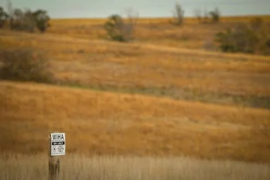
The WIHA program is the defining feature of kansas public hunting areas. Over a million acres of private land enrolled for free public walk-in access is unlike anything most states offer. The tracts change annually, which means fresh ground opens every season and familiar spots sometimes disappear. KDWP publishes an updated WIHA atlas each August, and the tracts are mapped on the iSportsman Kansas app and on onX Hunt. Checking the current map before every season is mandatory.
For licensing, Kansas residents pay about $27.50 for a hunting license and $32.50 for a deer permit. Non-residents pay $97.50 for a hunting license and $442.50 for a non-resident deer permit. Non-resident archery deer permits are available over the counter at about $342.50. Non-resident firearms deer permits require a draw, and the odds tighten each year as demand increases. Turkey permits run about $27.50 resident and $67.50 non-resident for spring, available over the counter. The archery tag availability is the key takeaway for out-of-state hunters. You can decide in August and hunt in November without a multi-year preference point wait.
Top 12 Kansas Public Hunting Areas
Milford Wildlife Area
Managing agency: KDWP / Army Corps of Engineers
Acreage: 18,500
Region: Geary and Clay counties, north-central Kansas
Primary species: Whitetail, turkey, waterfowl, pheasant, quail, dove
Terrain: Republican River bottom hardwood, lake shoreline, agricultural borders, grassland, managed wetlands
Access: Good road access with multiple parking areas. Some seasonal closures for waterfowl management.
Insider tip: Milford is one of the largest contiguous public hunting areas in Kansas, and the Republican River bottom timber holds excellent whitetails. The timber corridors along the river create natural travel funnels between bedding in the dense river cover and feeding on the surrounding ag fields. Hunt the inside corners where timber meets crop field during the rut. Most hunters gravitate to the lake-side units for waterfowl. The river bottom timber south of the dam sees far less deer hunting pressure. [TODO LINK: how to read a topo map for deer hunting -> /field-notes/how-to-read-a-topo-map-for-deer-hunting]
Tuttle Creek Wildlife Area
Managing agency: KDWP / Army Corps of Engineers
Acreage: 12,500
Region: Riley, Pottawatomie, and Marshall counties, northeast Kansas
Primary species: Whitetail, turkey, waterfowl, pheasant, dove
Terrain: Big Blue River corridor, lake shoreline, timbered draws, crop field borders, tallgrass prairie remnants
Access: Road access to multiple units around the reservoir. Boat access for some shoreline hunting.
Insider tip: The timbered draws running perpendicular to the Big Blue River corridor are where mature bucks bed during the day and travel to feed at dusk. These draws are narrow, steep-sided, and full of thick brush, which keeps pressure low. Drop into a draw from the upper end, set up where the draw opens into the river bottom, and hunt the transition during the last two hours of light.
Perry Wildlife Area
Managing agency: KDWP / Army Corps of Engineers
Acreage: 11,000
Region: Jefferson County, northeast Kansas
Primary species: Whitetail, turkey, waterfowl, dove
Terrain: Delaware River corridor, hardwood bottoms, lake shoreline, crop field edges, CRP grass
Access: Good road access. Multiple parking areas. Close to Topeka and Lawrence.
Insider tip: Perry's proximity to Topeka and Lawrence means weekend pressure is real, especially during firearms season. The weekday archery hunting in October and November is a different experience. The Delaware River bottom timber on the south side of the lake holds deer that pattern predictably on the surrounding soybean fields. Glass the field edges at last light with Vortex Diamondback HD 10x42 binoculars to find where deer enter the fields, then set up on the timber-side approach the next morning.
Glen Elder Wildlife Area
Managing agency: KDWP
Acreage: 12,600
Region: Mitchell County, north-central Kansas
Primary species: Whitetail, mule deer, turkey, pheasant, waterfowl, dove
Terrain: Solomon River corridor, chalk bluffs, cedar draws, agricultural borders, lake shoreline
Access: Road access with multiple parking areas around the reservoir.
Insider tip: Glen Elder sits in the transition zone where whitetail range overlaps with mule deer. The cedar draws along the chalk bluffs north of the reservoir hold whitetails, while the open grassland and crop borders produce mule deer sightings. During the rut, whitetail bucks cruise the cedar draws between doe groups. The terrain is gentler than the eastern river bottoms but still creates natural funnels where the draws pinch between the bluffs and the lake.
Cimarron National Grassland
Managing agency: U.S. Forest Service
Acreage: 108,000
Region: Morton County, far southwest Kansas
Primary species: Mule deer, pronghorn, quail, pheasant, dove, lesser prairie chicken
Terrain: Shortgrass prairie, Cimarron River corridor, sand hills, cottonwood bottoms
Access: Open with a valid Kansas hunting license. Dispersed camping allowed. Extensive road network.
Insider tip: Cimarron is the only national grassland in Kansas and the largest contiguous federal land in the state. The Cimarron River corridor holds mule deer and some whitetails in the cottonwood bottoms. For pronghorn, glass the open grassland north of the river at first light. This is big-sky, long-range hunting that feels more like eastern Colorado than typical Kansas. Bring a spotting scope and plan for wind. The wind never stops on the Cimarron.
Clinton Wildlife Area
Managing agency: KDWP / Army Corps of Engineers
Acreage: 9,600
Region: Douglas County, northeast Kansas
Primary species: Whitetail, turkey, dove, waterfowl
Terrain: Wakarusa River corridor, hardwood bottoms, lake shoreline, crop borders, CRP grass
Access: Good road access. Close to Lawrence and Kansas City.
Insider tip: Clinton is the closest quality public deer hunting to Kansas City, and the pressure shows it. But the deer here are very good because the surrounding agricultural land grows them well. Beat the pressure by hunting deep into the Wakarusa River bottom timber during midweek archery. The river creates pinch points where timber narrows between the water and the surrounding crop fields. A Tethrd Phantom saddle platform lets you set up in the narrow bottleneck corridors where hanging a traditional stand isn't practical.
Flint Hills NWR and Vicinity
Managing agency: U.S. Fish and Wildlife Service / KDWP
Acreage: 18,500 (refuge plus adjacent state lands)
Region: Lyon and Coffey counties, east-central Kansas
Primary species: Whitetail, turkey, waterfowl, dove
Terrain: Neosho River bottomland, managed wetlands, tallgrass prairie, hardwood edges
Access: Refuge-specific hunting rules apply. Some units closed to hunting or restricted seasonally. Check the annual refuge hunt plan.
Insider tip: The Flint Hills NWR borders John Redmond Reservoir and the Neosho River corridor. The river bottom hardwood holds excellent deer, and the refuge boundaries confuse most hunters enough that the adjacent KDWP land and Corps tracts get hunted while the refuge itself sees less pressure during the deer seasons it's open. Read the refuge hunt plan carefully. The units that allow archery deer hunting are some of the best public ground in east-central Kansas.
Quivira NWR
Managing agency: U.S. Fish and Wildlife Service
Acreage: 22,000
Region: Stafford County, south-central Kansas
Primary species: Waterfowl, whitetail, dove, pheasant, quail
Terrain: Saltwater marshes, sand prairie, cropland, Big and Little Salt marshes
Access: Refuge-specific rules. Designated hunting units. Some areas closed for wildlife management.
Insider tip: Quivira is a world-class stopover for migrating waterfowl, and the managed salt marshes pull species you won't find on most Kansas public land. The deer hunting here gets overlooked because the property is known for birds. The sand prairie and crop borders around the marsh units hold whitetails that feed on the surrounding agricultural ground and bed in the dense vegetation near the marshes. If you're making a waterfowl trip, bring your deer tag.
Fall River Wildlife Area
Managing agency: KDWP / Army Corps of Engineers
Acreage: 13,200
Region: Greenwood County, southeast Kansas
Primary species: Whitetail, turkey, waterfowl, quail, dove
Terrain: Fall River and Verdigris River corridors, hardwood bottoms, cross-timber uplands, lake shoreline
Access: Road access with multiple units around the reservoir.
Insider tip: Southeast Kansas is the state's most heavily timbered region, and Fall River sits in the cross-timbers where post oak and blackjack oak create thick cover that holds deer differently than the open river bottoms further west and north. The terrain here is more similar to the Ozarks than to the wide-open Kansas most people picture. Hunt the saddles and benches on the timbered ridges during the rut. The deer here use terrain features the way hill-country deer in Ohio and Missouri do. [TODO LINK: how to scout public land -> /field-notes/how-to-scout-public-land]
Benedictine Bottoms Wildlife Area
Managing agency: KDWP
Acreage: 2,300
Region: Atchison County, far northeast Kansas along the Missouri River
Primary species: Whitetail, turkey, waterfowl
Terrain: Missouri River bottomland, dense cottonwood and hardwood, crop field borders, oxbow lakes
Access: Walk-in from parking area. Interior is thick and difficult to access.
Insider tip: Benedictine Bottoms is small, thick, and hard to hunt, which is exactly why the deer here grow old. The Missouri River bottom timber is dense cottonwood and silver maple with an understory so thick you can't see 30 yards in most places. Deer bed in the middle of the cover and travel the edges where the timber meets the surrounding crop fields. Set up on a field-edge entry trail during the last 90 minutes of light and let the deer come to you. Don't try to push through the interior. You'll blow out every deer on the property.
Kanopolis Wildlife Area
Managing agency: KDWP
Acreage: 6,200
Region: Ellsworth County, central Kansas
Primary species: Whitetail, mule deer, turkey, pheasant, dove
Terrain: Smoky Hill River corridor, sandstone bluffs, cedar canyons, crop borders, lake shoreline
Access: Road access with camping available at adjacent Kanopolis State Park.
Insider tip: The sandstone bluffs and cedar canyons around Kanopolis Reservoir create terrain features you won't find on the flat farm-country wildlife areas further east. The cedar canyons hold whitetails that bed in the thick cedar and travel to the agricultural fields along predictable routes through the canyon corridors. This is one of the few Kansas public areas where you can read terrain the way you'd read topo features in the Ozarks. Hunt the canyon mouths where they open onto crop fields during the evening.
WIHA Tracts (Statewide)
Managing agency: KDWP (administered program on private land)
Acreage: 1 million+ enrolled acres statewide, changing annually
Region: Concentrated in western and central Kansas, with tracts across the entire state
Primary species: Whitetail, mule deer, pheasant, quail, dove, waterfowl (varies by tract)
Terrain: CRP grass, crop stubble, shelter belts, river corridor timber, playa wetlands
Access: Walk-in only. No vehicles on enrolled land. Tracts marked with WIHA signs.
Insider tip: The best deer-hunting WIHA tracts are not the big CRP grass blocks. They're the tracts with timber along a creek or river corridor. Use the WIHA atlas and satellite imagery to find tracts where a timbered creek cuts through enrolled ground, especially where the creek timber connects to larger blocks of private timber nearby. Those creek corridors funnel deer movement into predictable travel lanes, and on WIHA ground that just enrolled this year, the deer haven't been pressured on that specific tract before. Fresh ground with no hunting history is the best advantage WIHA kansas gives you. [TODO LINK: e-scouting for deer hunting -> /field-notes/e-scouting-for-deer-hunting]
Species You Can Hunt on Kansas Public Land
Whitetail is the main draw for DIY hunters, and Kansas delivers on its reputation. The state consistently ranks in the top five nationally for Boone and Crockett entries, and the northern and eastern river corridor counties (Riley, Pottawatomie, Marshall, Nemaha, Brown, Doniphan, Atchison, Leavenworth) produce the biggest deer. The agricultural food base, predominantly corn, soybeans, wheat, and milo, drives body weights and antler growth that compete with Iowa at their best.
Mule deer hold the western third of the state, roughly west of Highway 283. The Cimarron National Grassland, the western WIHA tracts, and select wildlife areas in the High Plains counties offer mule deer hunting on public access. Some areas hold both species in the transition zone.
Pronghorn hunting is available through a drawn tag system in western Kansas. The Cimarron National Grassland and surrounding WIHA tracts provide public access. Draw odds vary by unit, and preference points apply.
Turkey hunting is excellent across the eastern two thirds of Kansas. Rio Grande and Eastern turkey populations overlap, and spring gobbler season runs from mid-April through the end of May. Tags are over the counter. The Flint Hills and eastern timber corridors hold strong bird numbers. [TODO LINK: spring turkey public land tactics -> /field-notes/spring-turkey-public-land-tactics]
Pheasant hunting is a Kansas tradition, concentrated in the western and central counties where CRP grass, stubble fields, and shelter belts support wild bird populations. The WIHA program is the primary public access tool for pheasant, and the October opener draws hunters from across the Midwest.
Quail (bobwhite and scaled), dove, waterfowl, and rabbit round out the small-game menu. Kansas sits in the Central Flyway, and the managed wetlands at Quivira NWR, Cheyenne Bottoms, and the reservoir wildlife areas provide strong public waterfowl access.
Season Structure for Public Land Hunting in Kansas
Archery deer: Mid-September through December 31. The entire rut, pre-rut, and late season falls within archery.
Muzzleloader deer: Mid-September through the end of September in most units.
Firearms deer: Approximately 12 days starting the Wednesday after Thanksgiving. This is the one window where the woods (and river bottoms) get crowded.
Extended firearms: Early January in select units for antlerless deer.
Spring turkey: Mid-April through May 31. Youth weekend precedes the general opener.
Fall turkey: October through November and again in January. Over the counter.
Pheasant: Second Saturday in November through January 31.
Quail: Second Saturday in November through January 31.
The archery season is the centerpiece for DIY deer hunting. Mid-September through December 31 gives you three and a half months of bow season, and the rut peaks in mid-November. A two-week trip timed to November 1 through November 14 puts you in the stand during the rut's most active phase with a fraction of the pressure that the late-November firearms season brings.
Non-resident archery tags are over the counter. Non-resident firearms tags require a draw. If you're a bowhunter, Kansas is one of the most accessible premium whitetail states in the country. If you want to hunt with a rifle, start applying and building preference points now.
Access Tips for Kansas Public Hunting Areas and WIHA
WIHA tracts change every year. The atlas updates each August. Download the current year's map from the KDWP website or iSportsman Kansas app before the season. A tract you hunted last November may not be enrolled this year.
WIHA is walk-in only. No vehicles on enrolled land. No camping. No permanent stands. Park on the county road and walk in. Respect the landowner's property. Bad behavior costs landowner participation, and landowner participation is what makes the whole program work.
iSportsman check-in. Several Kansas wildlife areas now use the iSportsman system for electronic check-in and check-out. Download the app and create an account before your trip. Check-in is required before hunting and check-out is required when you leave. The system also tracks harvest.
Camping. Most KDWP wildlife areas don't allow camping on the wildlife area itself. Corps of Engineers campgrounds exist around the major reservoirs (Milford, Tuttle Creek, Perry, Clinton, Kanopolis). The Cimarron National Grassland allows dispersed camping. State parks adjacent to wildlife areas offer campgrounds. Plan lodging before your trip.
Rifles are legal. Kansas allows centerfire rifles for deer during firearms season statewide. On public land, be aware that other hunters can reach further than in shotgun-only states.
Orange requirements. During firearms deer season and the spring turkey youth weekend, Kansas requires a minimum of 200 square inches of blaze orange visible from all directions. That's less than most states require, but enforcement is strict. Wear the orange.
HIP registration. If you hunt migratory birds (dove, waterfowl) on any Kansas public land, you need a Harvest Information Program registration in addition to your state and federal stamps. It's free and takes two minutes online.

Gear Considerations for Public Land Hunting in Kansas
Kansas hunting demands gear that handles two things: wind and temperature extremes. November in Kansas swings from 60-degree afternoons to 15-degree mornings within the same week, and the wind blows hard across the open ground that dominates most of the state.
Wind-blocking outer layer. The KUIU Axis Hybris jacket blocks wind without being loud, which is the exact combination Kansas whitetail hunting demands. The open timber and field-edge setups mean wind hits you from every direction, and a shell that doesn't stop wind makes 30 degrees feel like 15.
Boots for river bottoms. The best Kansas deer hunting happens in the river corridor timber, and that means creek crossings, standing water in the bottoms, and mud. LaCrosse Alphaburly Pro in 800g or 1600g handles the water and the cold. For the drier upland WIHA tracts and the Cimarron Grassland, Danner Pronghorn gives you tread and support on the harder ground.
Binoculars are mandatory. Kansas hunting involves more glassing than almost any other whitetail state. The open timber, agricultural field edges, and long sight lines on the WIHA tracts make binoculars the single most important piece of gear after your weapon. Vortex Diamondback HD 10x42 covers the field-edge glassing at 200 to 500 yards and the low-light timber work for under $230.
Mobile setup. WIHA tracts don't allow permanent stands. Corps lands have varying stand rules. A Tethrd Phantom saddle platform with climbing sticks gives you complete mobility on ground you've never hunted before. Kansas deer hunting is very often a cold-call situation where you e-scout a WIHA tract the night before, drive there at dawn, and set up on the best tree you can find near a terrain feature. A mobile setup makes that process work.
Cellular trail camera. On the small Kansas public tracts where every visit increases your scent footprint, a Muddy Matrix 2.0 cellular camera eliminates the walk-in visits. Hang it at a river crossing or field-edge entry trail in August and don't come back until you hunt. [TODO LINK: how to set up trail cameras on public land -> /field-notes/how-to-set-up-trail-cameras-on-public-land]
Layering for 40-degree swings. A morning that starts at 20 degrees and ends at 55 by noon destroys a single-outfit hunter. Layer with a wicking base, a modular mid layer you can remove, and a wind-blocking outer shell. The base layer review on LandsToHunt covers the full range by temperature and material.
Finding Unpressured Ground on Kansas Public Hunting Areas
Kansas sells roughly 80,000 to 100,000 deer permits a year. That's less than Iowa, Missouri, or Wisconsin, but the public acreage is smaller and more concentrated. Pressure on the well-known wildlife areas near Topeka, Lawrence, and Manhattan is real, especially during firearms season and on weekends during archery. Here's how to find the ground other hunters skip.
Hunt the WIHA tracts nobody else finds. The WIHA atlas contains thousands of tracts. Most out-of-state hunters pick the biggest ones near the towns they're staying in. The 160-acre WIHA tract with a timbered creek corridor 20 miles from the nearest town draws almost zero pressure and holds deer that feed on the surrounding private corn and beans. Use the atlas and satellite imagery to find tracts with timber, not just grass. A 160-acre WIHA with 40 acres of creek-bottom timber is worth more for deer than a 640-acre WIHA that's all CRP grass.
Hunt the river bottoms, not the uplands. Kansas pheasant hunting drives most of the public-land foot traffic to the upland CRP grass and stubble fields. The river bottom timber corridors on the wildlife areas and WIHA tracts hold deer that see minimal pressure because pheasant hunters don't go there and most deer hunters glass from the road rather than walking into the thick bottoms.
Hunt weekday archery in November. The first two weeks of November are the rut's peak in Kansas, and firearms season doesn't start until late November. A weekday archery sit during the first week of November on any wildlife area or WIHA tract puts you on rutting bucks with minimal competition. This is the window that out-of-state archery hunters should build their entire trip around.
For property-level terrain analysis before your trip, Hunting Scout builds interactive scouting reports from real USGS and NOAA data for any wildlife area or WIHA tract. The funnel detection works on Kansas's subtle river-bottom terrain, flagging creek crossings, timber pinch points, and field-edge funnels that satellite imagery alone won't show you. Three free reports per month, no credit card required.
For properties adjacent to public ground that you're evaluating for a lease or purchase, ScoutFlight Hunting Assessments delivers drone-based property reports with terrain, cover, and habitat analysis.
Frequently Asked Questions About Public Land Hunting in Kansas
How much public hunting land is in Kansas?
Kansas has roughly 350,000 acres of state wildlife areas, about 108,000 acres of Cimarron National Grassland, significant Corps of Engineers land around the major reservoirs, and over 1 million acres of WIHA walk-in access on private land. Combined, the state offers well over 1.5 million acres of public hunting access, with the WIHA program providing the majority.
What is WIHA in Kansas?
WIHA (Walk-In Hunting Access) is a Kansas program where private landowners voluntarily enroll their property for public walk-in hunting. Enrolled tracts are marked with WIHA signs and mapped on the KDWP atlas and iSportsman Kansas app. You can hunt these tracts on foot without permission from the landowner. No vehicles, no camping, no permanent stands. Over a million acres are enrolled annually, but tracts change year to year. Check the updated atlas every August.
Can non-residents buy an archery deer tag in Kansas over the counter?
Yes. Non-resident archery deer permits are available over the counter at about $342.50 (plus the $97.50 hunting license). No draw, no preference points, no waiting. You can decide in September and hunt that November. Non-resident firearms deer permits require a draw, and odds tighten each year. For bowhunters, Kansas is one of the most accessible premium whitetail states in the country.
When is the rut in Kansas?
Peak breeding in Kansas falls in mid-November, roughly November 10 through November 20 in most of the state. Pre-rut chasing activity starts in late October and builds through the first week of November. Post-rut activity carries into early December. The entire rut falls within the archery season, which is why a two-week archery trip in early to mid-November is the highest-value DIY whitetail hunt Kansas offers.
Is Kansas a rifle state for deer?
Yes. Kansas allows centerfire rifles for deer during the firearms season statewide. There are no caliber restrictions. The firearms season runs approximately 12 days starting the Wednesday after Thanksgiving. During archery season (mid-September through December 31), only archery equipment is legal for deer.
Can you camp on Kansas wildlife areas?
Most KDWP wildlife areas don't allow camping on the wildlife area itself. Corps of Engineers campgrounds exist around the major reservoirs, and state parks adjacent to many wildlife areas offer campgrounds. The Cimarron National Grassland allows dispersed camping. For multi-day trips, reserve a campsite or lodging before your trip, especially during firearms season and pheasant opener.
What are the best counties for public land deer hunting in Kansas?
For trophy whitetail: Riley, Pottawatomie, Marshall, Nemaha, Brown, Doniphan, and Atchison counties in the northeast, where river bottom habitat and rich agricultural soils produce the state's biggest deer. For the best combination of access and deer quality: Geary (Milford WA), Jefferson (Perry WA), and Greenwood (Fall River WA). For mule deer: Morton (Cimarron National Grassland), Rawlins, Decatur, and Thomas counties in the far west.

How do WIHA tracts compare to state wildlife areas for deer hunting?
State wildlife areas are permanent public properties managed by KDWP with consistent boundaries, road access, and management history. Deer in wildlife areas have been hunted year after year and have adjusted their behavior accordingly. WIHA tracts are private land that enroll annually, meaning fresh ground with deer that may not have been hunted on that specific tract before. The trade-off is that WIHA tracts are often smaller, lack parking infrastructure, and disappear from the program without notice. For deer hunting, newly enrolled WIHA tracts with creek-bottom timber are often better value than heavily pressured wildlife areas.
Want the full breakdown of every Kansas wildlife area and WIHA program details plus the same for all 50 states? Subscribe to the LandsToHunt newsletter and get our free state-by-state public land hunting guides delivered to your inbox.
Want the full breakdown of every Kansas wildlife area and WIHA program details plus the same for all 50 states? Subscribe to the LandsToHunt newsletter below and get our free state-by-state public land hunting guides delivered to your inbox.
This guide includes affiliate links to tools and gear we recommend for hunting Kansas public land. LandsToHunt.com earns a commission on qualifying purchases.

Public Land Deer Hunting Iowa: How to Hunt the Best Whitetail State on the Ground Everyone Thinks Is Private
Iowa produces more Boone and Crockett whitetails per square mile than any other state. The second fact most hunters learn is that Iowa is 97 percent private. The third fact, the one that matters: public land deer hunting Iowa is not only possible, it's very good if you know how the access works. WMAs, state forests, IHAP walk-in lands, and Corps tracts give you 500,000-plus acres of ground where the deer carry genetics no other state can match. Here's how to hunt them.

Iowa produces more Boone and Crockett whitetails per square mile than any other state in the country. That fact drives more out-of-state tag applications than any amount of marketing ever will. But the second fact most hunters learn about Iowa stops them cold: the state is roughly 97 percent privately owned, and the public hunting acreage is a fraction of what you'll find in Wisconsin, Pennsylvania, or Missouri.
Here's the third fact, the one that matters: public-land deer hunting in Iowa is not only possible but also very good if you know how access works. The state manages more than 500,000 acres of public hunting land across Wildlife Management Areas, state forests, county conservation areas, and the IHAP (Iowa Habitat and Access Program) walk-in lands that open private ground to public hunting. The tracts are smaller than the national forests you'd hunt in the Ozarks or the Alleghenies, but the deer that live on and around them carry genetics that no other state can match.
The catch is that Iowa's tag system requires planning. Non-resident firearm tags are drawn through a preference point system that takes multiple years. Non-resident archery tags are drawn through a separate allocation with better odds. And the archery season, which runs from early October through early December, covers the entire rut with a fraction of the pressure that the short firearms season brings. If you're a bowhunter willing to work small tracts on public ground in the best whitetail state in America, Iowa delivers. [TODO LINK: best states for whitetail hunting -> /field-notes/best-states-for-whitetail-hunting]
How Much Public Hunting Land Iowa Has
Iowa's public hunting access breaks down across several systems:
Wildlife Management Areas (WMAs): Roughly 380,000 acres across more than 350 WMAs, managed by the Iowa DNR. These range from 40-acre parcels to properties over 10,000 acres.
State forests: Several state forests, including Yellow River, Shimek, and Stephens, totaling about 44,000 acres
IHAP (Iowa Habitat and Access Program) walk-in lands: Private land enrolled in a voluntary program that allows public hunting. Adds tens of thousands of acres annually, concentrated in the farm-country regions. Tracts rotate year to year as landowners enroll and withdraw.
County conservation areas: Hundreds of small county-managed tracts scattered across every county, totaling thousands of additional acres
Army Corps of Engineers lands: Tracts around reservoirs, including Coralville, Red Rock, Rathbun, and Saylorville
National Wildlife Refuges: Upper Mississippi River NWR, DeSoto NWR, and Union Slough NWR offer seasonal hunting
Mississippi and Missouri River corridors: Federal and state-managed bottomland parcels along both river systems
The total is smaller than what neighboring states offer, and the parcels are generally smaller and more scattered. That's the reality. But the quality of the deer that live on and around these parcels is unmatched. A 300-acre Iowa public hunting area surrounded by 10,000 acres of corn and beans holds deer that feed on the richest agricultural food base in the whitetail range. The public ground is the bedding. The private ground is the kitchen. Your job is to intercept them moving between the two.
For licensing, Iowa residents pay about $30 for a deer hunting license (covers one antlered or antlerless deer). Non-residents pay $551 for a non-resident deer license. Non-resident archery-only licenses run about $351. All non-resident deer tags are drawn through a lottery. Archery tags are easier to draw than firearms tags, and the preference point system means first-time applicants for firearms may wait 3 to 5 years. Start applying and stacking points now if you haven't already.

Top 12 Iowa Public Hunting Areas for Deer
Yellow River State Forest
Managing agency: Iowa DNR
Acreage: ~8,500
Region: Allamakee County, far northeast Iowa driftless region
Primary species: Whitetail, turkey, grouse (limited), squirrel
Terrain: Steep limestone bluffs, deep hollows, hardwood ridges, cold-water trout streams, the most rugged terrain in Iowa
Access: Forest roads with some gated interior. Primitive camping at designated sites.
Insider tip: The Yellow River is Iowa's version of the driftless bluff country that makes southeast Minnesota and southwest Wisconsin famous for big bucks. The terrain is steep enough to discourage casual hunters, and the deer that bed on the upper bluffs grow old because nobody climbs to them. Hunt the saddles connecting parallel ridge systems during the rut. The topo makes them obvious. A Tethrd Phantom saddle platform is the right setup here because the hardwoods on the bluff edges are big enough to support a saddle but too remote for pre-hung stands.
Shimek State Forest
Managing agency: Iowa DNR
Acreage: 9,100
Region: Lee and Van Buren counties, far southeast Iowa
Primary species: Whitetail, turkey, squirrel
Terrain: Rolling hardwood hills, oak-hickory ridges, creek bottoms, gentler than the driftless but still hilly
Access: Good road access to parking areas. Primitive camping available.
Insider tip: Shimek sits in one of the best deer-density zones in Iowa, and the surrounding agricultural ground drives body weights and antler growth that reward the time it takes to draw a tag. The creek bottoms that wind through the forest create natural travel corridors with pinch points at every confluence. Place a Muddy Matrix 2.0 cellular camera at a creek crossing in August and you'll have a clear picture of buck movement by October without ever walking to the camera.
Stephens State Forest
Managing agency: Iowa DNR
Acreage: 15,500 (across multiple units)
Region: Lucas, Monroe, and Appanoose counties, south-central Iowa
Primary species: Whitetail, turkey, squirrel
Terrain: Rolling hardwood hills, thick understory, scattered pine plantations, crop field borders
Access: Multiple units spread across three counties. Road access to parking areas. Primitive camping at designated sites.
Insider tip: Stephens is the largest state forest in Iowa and one of the most overlooked public deer hunting properties in the state. The scattered-unit structure means each unit is a self-contained hunting property surrounded by private agricultural land. The smaller, more remote units (Whitebreast Unit, Unionville Unit) get a fraction of the pressure that the main Woodburn Unit draws. Hunt the small units, and you're functionally on private ground.
Hawkeye WMA
Managing agency: Iowa DNR
Acreage: 10,200
Region: Johnson County, east-central Iowa
Primary species: Whitetail, waterfowl, pheasant, dove
Terrain: Iowa River bottomland, managed wetlands, agricultural fields, timber blocks, prairie grass
Access: Good road access with multiple parking areas. Some seasonal closures on waterfowl management areas.
Insider tip: Hawkeye draws most of its attention for waterfowl, and that works in your favor during archery deer season. The timber blocks between the managed wetlands hold whitetails that feed on the surrounding agricultural ground. While the duck hunters focus on the water, the timber corridors between the wetland units see almost no deer-hunting pressure during the October and November archery seasons.
Loess Hills State Forest
Managing agency: Iowa DNR
Acreage: 11,500 (across multiple units)
Region: Harrison and Monona counties, western Iowa, along the Missouri River
Primary species: Whitetail, turkey
Terrain: Unique loess (wind-deposited silt) bluffs, steep, narrow ridges, deep-cut ravines, oak-dominated timber, prairie remnants on south-facing slopes
Access: Multiple units along the Loess Hills ridge. Road access to parking areas. Some steep walk-ins.
Insider tip: The Loess Hills are some of the most dramatic terrain in the Midwest, and the deer that live in them use the steep, narrow ridges and ravines the way Appalachian deer use mountain terrain. The ridgetop saddles are the high-value features. Deer cross at the low points rather than climbing over the tops, and the narrow ridge structure compresses these crossings into very tight funnels. One saddle in the Loess Hills can produce the way three saddles in gentler terrain would, because the deer have fewer options.
Red Rock WMA (Elk Rock and Howell Station Units)
Managing agency: Iowa DNR / Army Corps of Engineers
Acreage: 30,000+ across multiple units around Red Rock Reservoir
Region: Marion County, south-central Iowa
Primary species: Whitetail, turkey, waterfowl, dove, pheasant
Terrain: Lake shoreline, timber blocks, brushy draws, agricultural borders, river bottom hardwood
Access: Road access to many units. Some areas are restricted during waterfowl season. Boat access for shoreline hunting.
Insider tip: Red Rock is the largest reservoir in Iowa, and the Corps land surrounding it creates one of the biggest contiguous public hunting areas in the state. The Elk Rock unit on the east side holds excellent deer in the hardwood blocks between the lake and the surrounding farmland. Most hunters gravitate to the waterfowl areas near the dam. Push south and east into the timber blocks beyond the duck-hunting zones, where deer see a fraction of the pressure.
Sweet Marsh WMA
Managing agency: Iowa DNR
Acreage: 3,200
Region: Bremer County, northeast Iowa
Primary species: Whitetail, waterfowl, pheasant
Terrain: Managed wetlands, cattail marshes, hardwood timber edges, crop field borders
Access: Road access to parking areas. Waterfowl blind assignments on some units.
Insider tip: Sweet Marsh is a wetland property that most hunters visit for ducks, but the hardwood timber strips bordering the marsh hold very good deer. The narrow timber corridors between the open marsh and the adjacent agricultural fields create natural travel funnels that deer use daily. The duck-hunting crowd ignores the timber completely. Hunt the edges where cattail marsh meets hardwood in October, and you'll have the deer woods to yourself.
Volga River State Recreation Area
Managing agency: Iowa DNR
Acreage: 5,400
Region: Fayette County, northeast Iowa
Primary species: Whitetail, turkey, squirrel
Terrain: Wooded bluffs along the Volga River, rolling hardwood ridges, some prairie, and the Frog Hollow Lake shoreline
Access: Good road access. Campground on site. Some areas are shared with recreational users.
Insider tip: Volga River SRA sits in one of the best whitetail counties in Iowa, and the timber along the Volga River bluffs holds mature bucks that pattern predictably in October. The recreational campers and day-users leave before dark, and the deer know the schedule. Evening sits on the timber edges overlooking the river bottom, produce well because the deer wait for the people to leave before moving to feed. Plan your entry so you're in the stand before the last park visitors drive out.
Rathbun WMA
Managing agency: Iowa DNR / Army Corps of Engineers
Acreage: 16,000+ across multiple units around Rathbun Reservoir
Region: Appanoose County, south-central Iowa
Primary species: Whitetail, turkey, waterfowl, quail
Terrain: Lake shoreline, brushy draws, timber blocks, agricultural borders, mixed grass and hardwood
Access: Multiple units with road access. Some shoreline units accessible by boat.
Insider tip: Rathbun's scattered units create the same dynamic as Stephens State Forest. Each unit is a self-contained property surrounded by private agricultural land. The deer use the public timber for bedding and the private fields for food. The smaller, harder-to-find units north and east of the reservoir get the least pressure. Use onX Hunt to find the 200 to 500-acre units that don't show up on the basic Iowa DNR map, and hunt the timber edges bordering crop fields during archery season.
Riverton WMA
Managing agency: Iowa DNR
Acreage: 2,600
Region: Fremont County, far southwest Iowa, along the Missouri River
Primary species: Whitetail, waterfowl, dove, pheasant
Terrain: Missouri River bottomland, cottonwood and willow flats, managed wetlands, crop stubble
Access: Road access with some seasonal flooding on low-lying roads.
Insider tip: Riverton is small and gets hammered for waterfowl, but the cottonwood bottoms along the Missouri River hold bucks that feed on the surrounding corn and bean fields. The narrow river-bottom timber creates pinch points where deer cross between bedding in the dense river cover and feeding on the ag fields. During archery season, the duck hunters haven't arrived yet, and the entire property is a deer hunting opportunity disguised as a duck marsh.
Lake of Three Fires State Park (and adjacent WMA)
Managing agency: Iowa DNR
Acreage: 700 (park) plus adjacent WMA acreage
Region: Taylor County, southwest Iowa
Primary species: Whitetail, turkey, squirrel
Terrain: Wooded ridges around a small lake, hardwood timber, brushy edges
Access: Park roads with designated hunting areas. Campground available.
Insider tip: Taylor County is one of the top trophy-deer counties in Iowa, and Lake of Three Fires is one of the few accessible public tracts in the area. The property is small, so pressure concentrates quickly during firearms season. But archery hunters who walk past the popular shoreline areas and hunt the ridges on the south end find deer that have very little competition. The surrounding ag country is home to deer that make the effort of drawing a tag and driving to southwest Iowa worthwhile.
IHAP Walk-In Hunting Areas (Statewide)
Managing agency: Iowa DNR (administered program on private land)
Acreage: Varies year to year, typically 20,000 to 30,000+ acres enrolled statewide
Region: Concentrated in western, central, and northern Iowa farm country
Primary species: Whitetail, pheasant, quail, waterfowl (varies by tract)
Terrain: CRP grass, crop stubble, small timber blocks, shelterbelts, waterways
Access: Walk-in only. No vehicles on enrolled land. Tracts marked with IHAP signs.
Insider tip: Iowa walk-in hunting areas are the state's secret weapon for pheasant and deer access in the farm-country regions where traditional public land is scarce. IHAP tracts change year to year as landowners enroll and withdraw, so check the Iowa DNR's online IHAP map every August before the season. The best deer-hunting IHAP tracts are the ones with timber blocks adjacent to crop fields. CRP grass tracts are better for pheasants but hold fewer deer. Filter for tracts with timber on satellite imagery, and you'll find bedding habitat that feeds directly onto private ag ground.

What You Can Hunt on Iowa Public Land
Whitetail is why most hunters think of Iowa, and the deer deliver. The state produces more Boone and Crockett entries per capita than any other state in the country, driven by a combination of abundant agricultural resources, a one-buck limit that preserves age structure, and moderate hunter density. The southern tier of counties (Lucas, Wayne, Appanoose, Davis, Van Buren, Lee) and the driftless northeast (Allamakee, Clayton, Winneshiek) produce the best trophy potential. But Iowa grows good deer statewide. Even the central counties that don't make the magazine covers hold 140-class bucks on public ground.
Turkey hunting in Iowa is strong and growing. The spring gobbler season runs through April and May, with multiple periods and available tags over the counter. Nearly every WMA and state forest holds turkeys, and the farm-country timber blocks produce vocal, responsive birds in the spring.
Pheasant hunting drives a significant portion of Iowa's small-game hunting tradition, especially in the northwest and north-central counties where CRP acreage and grassland habitat support wild birds. The IHAP walk-in program is the primary public access tool for pheasants. Iowa's pheasant opener in late October draws hunters from across the Midwest.
Waterfowl hunting is excellent along both the Mississippi and Missouri River corridors, at DeSoto NWR, on the managed wetlands at Hawkeye and Sweet Marsh, and on dozens of smaller WMAs with potholes and marshes. The Central and Mississippi Flyways overlap in Iowa, which means the state catches migration from both corridors.
Season Structure for Public Land Deer Hunting Iowa
Iowa's deer season structure heavily favors the archery hunter:
Archery: Early October through early December, then reopens from late December through mid-January. The full rut falls within the archery season.
Early muzzleloader: A short window in mid-October.
Youth/disabled: A weekend in late September.
Firearms (shotgun/muzzleloader): Approximately 5 to 7 days in early December. Iowa restricts deer firearms to shotguns (slugs) and muzzleloaders in the shotgun zone (most of the state). Select southern counties allow centerfire rifles.
Late muzzleloader: Late December through early January.
January antlerless: An extended antlerless-only season in January on select areas.
The firearms season is short and intense. Five to seven days of shotgun season concentrate pressure in a way that gun seasons in Wisconsin, Pennsylvania, and Alabama don't. The upside is that the pressure wave passes quickly, and the late archery window from late December into January gives bowhunters another shot at bucks that survived firearms week.
The non-resident tag draw is the biggest barrier to entry. Non-resident archery tags draw through a lottery with decent odds if you apply early (odds have tightened in recent years, but remain far better than firearms). Non-resident firearms tags use a preference point system, with wait times of 3 to 5 years, depending on the zone. Apply every year and stack points while you wait. The tag is worth the patience.
Access Tips for Iowa Public Hunting Areas
The IHAP map updates annually. Iowa walk-in hunting tracts change every year. New landowners enroll, others withdraw. Download the current IHAP map from the Iowa DNR website every August before the season. Don't rely on last year's map. A tract you hunted in November might not be enrolled this season.
Camping is limited. Most Iowa WMAs do not allow camping. State forests (Yellow River, Shimek, Stephens) have designated primitive camping areas. Corps of Engineers lands around the reservoirs have campgrounds. Plan lodging before your trip, especially during firearms week and pheasant opener, when nearby towns fill up fast.
No check-in system in most areas. Iowa WMAs don't require sign-in before hunting. You park, walk in, and hunt. Harvest reporting is done through the Iowa DNR electronic reporting system.
Vehicle restrictions. On WMAs, vehicles are restricted to designated parking areas and roads. Don't drive on field edges, gated roads, or two-tracks. Violations on Iowa public land carry meaningful fines.
Shotgun zone restrictions. Most of Iowa falls in the shotgun zone, where centerfire rifles are not legal for deer. You'll hunt with shotgun slugs, muzzleloader, or archery equipment. A handful of southern counties allow rifles. Check the current zone map on the Iowa DNR website before buying ammunition.
Blaze orange. Iowa requires blaze orange on the head and at least 400 square inches on the upper body during all firearms deer seasons. This applies to all hunters in the field during those dates, including bowhunters.
IHAP walk-in rules. You can hunt IHAP tracts on foot only. No vehicles on enrolled land. No camping. No permanent stands. Park on the public road and walk in. Treat the landowner's property with respect. The program depends on willing landowners, and bad behavior from hunters causes landowners to withdraw.
Gear Considerations for Public Land Deer Hunting Iowa
Iowa's terrain is gentler than Ohio's hill country or Pennsylvania's mountains, but the weather is brutal. November in Iowa means cold, wind, and the kind of raw conditions that test every layer in your system.
A serious cold-weather system. Iowa archery through firearms season runs from October through January, with temperatures dropping from the 50s in early October to well below zero in January. The KUIU Axis Hybris jacket covers the October and November window. For late-season sits below 15 degrees, layer an insulated puffy mid-layer under a windproof shell. The base layer review on LandsToHunt covers the full temperature range.
Boots for cold and mud. Iowa's farm-country WMAs are flat, muddy, and cold in November. LaCrosse Alphaburly Pro in 1600g handles the combination of standing water, crop-stubble mud, and cold-weather sits. For the hillier state forest terrain in the northeast and southeast, Danner Pronghorn in 800g or 1200g gives you the tread and ankle support the bluffs demand.
Mobile setup. Iowa's small public tracts and high deer quality demand mobility. A Tethrd Phantom saddle platform with climbing sticks lets you set up on any tree at any location without pre-hanging anything. On IHAP walk-in lands where no permanent stands are allowed, a mobile saddle or hang-on is the only option.
Binoculars. Iowa hunting involves a lot of field-edge glassing. Bean fields, corn stubble, CRP grass, and timber-field transitions are where deer feed, and a quality binocular lets you pattern deer from 300 yards without walking through the spot. Vortex Diamondback HD 10x42 is the standard recommendation at under $230.
Cellular trail camera. On small Iowa public tracts, every walk to a camera increases your scent footprint on a property where the margin for error is thin. A Muddy Matrix 2.0 sends photos to your phone without a visit. Hang it in August and don't go back until you hunt.
Mapping app. onX Hunt is critical in Iowa because the small, scattered public tracts mixed with private land make boundary awareness essential. IHAP tracts are shown on the Iowa DNR map and on onX. Without a digital boundary line, you're guessing where public ends and private starts on tracts as small as 40 acres.
Finding Unpressured Ground for Public Land Deer Hunting Iowa
Iowa's public land challenge isn't total acreage. It's per-tract pressure on small properties. A 500-acre WMA that draws 20 hunters on firearms opener doesn't absorb that pressure the way a 20,000-acre national forest does. Your edge on Iowa public ground comes from three things.
Hunt the small tracts nobody else finds. Iowa has hundreds of county conservation areas, small WMAs, and IHAP tracts under 500 acres that don't show up on any list and don't draw out-of-state attention. Use onX Hunt and the Iowa DNR hunting atlas to find every tract in your target county, then cross-reference against satellite imagery. The 80-acre WMA with a timber block surrounded by beans that nobody's talking about is better than the 10,000-acre property everyone drives to.
Hunt archery, not firearms. Iowa's 5 to 7-day firearms season concentrates the state's hunting pressure into one intense week. The archery season stretches from early October through early December and draws a fraction of the crowd. A weekday archery sit on any Iowa WMA in the first two weeks of November is a fundamentally different experience than the firearms opener on the same property. The rut is in full swing, the competition is minimal, and the deer are still moving during daylight.
Hunt the IHAP walk-in lands nobody walks to. IHAP tracts turn over annually, which means many of them are fresh ground that no hunter has walked before. The tracts that enrolled this year have deer that haven't been pressured on that specific piece of ground, and the hunters who check the updated IHAP map first have the first-mover advantage. Treat IHAP tracts like a rotating menu of fresh public ground.
For property-level terrain analysis before your Iowa trip, Hunting Scout builds interactive scouting reports from real USGS and NOAA data for any WMA, state forest, or IHAP tract. The automated funnel detection works on Iowa's gentle farm-country terrain as well as the steep driftless bluffs in the northeast. Three free reports per month, no credit card required.
For properties adjacent to public ground that you're evaluating for a lease or purchase, ScoutFlight Hunting Assessments delivers drone-based property reports with terrain, cover, and habitat analysis.
Frequently Asked Questions About Public Land Deer Hunting Iowa
How much public hunting land is in Iowa?
Iowa has roughly 500,000 acres of public hunting land, combining WMAs (380,000 acres), state forests (44,000 acres), Corps of Engineers land, county conservation areas, and National Wildlife Refuges. The IHAP walk-in program adds tens of thousands of additional acres annually on enrolled private land. The total is smaller than neighboring states, but the deer quality on and around these tracts is the highest in the country.
How long does it take to draw an Iowa non-resident deer tag?
Non-resident archery tags draw through a lottery with decent odds in most years, though the odds have tightened recently. Many first-time applicants draw within 1 to 2 years. Non-resident firearms tags use a preference point system with waits of 3 to 5 years, depending on the zone. Start applying and stacking preference points now. The tag is worth the wait.
Can you use a rifle for deer in Iowa?
In most of the state, no. The majority of Iowa falls in the shotgun zone where deer firearms are restricted to shotguns (slugs) and muzzleloaders. A handful of southern counties allow centerfire rifles. Check the current zone map on the Iowa DNR website. Archery equipment (compound, crossbow, longbow) is legal statewide during archery season.

What is IHAP walk-in hunting in Iowa?
IHAP (Iowa Habitat and Access Program) is a voluntary program where private landowners enroll their property to allow public hunting access. Enrolled tracts are marked with IHAP signs and mapped on the Iowa DNR website. You hunt on foot without permission from the landowner. No vehicles, no camping, no permanent stands on enrolled land. Tracts rotate year to year as landowners enroll and withdraw, so check the updated map every August.
When is the best time to hunt public land deer in Iowa?
The first two weeks of November are during archery season. The rut is peaking, firearms season hasn't started, and midweek pressure on any WMA or state forest is minimal. This is the window when Iowa's public-land deer hunting justifies the effort to draw a tag. If you can only hunt one week a year in Iowa, pick November 1 through November 14 and hunt with archery equipment.
Is Iowa public land deer hunting worth it for non-residents?
Yes, with the right expectations. Iowa public land tracts are smaller and more scattered than those you'll find in Wisconsin, Pennsylvania, or Missouri. You're working harder per acre. But the deer that live on and around these tracts carry genetics and body conditions that no other state matches. If you're a bowhunter who excels at hunting small tracts, reading terrain, and adapting to limited access, Iowa's public ground delivers deer that justify the tag cost and the wait. If you need 10,000 acres of unbroken public forest to feel comfortable, look at Wisconsin or Pennsylvania first.
What are the best counties for public land deer hunting in Iowa?
For trophy antler potential: Lucas, Wayne, Appanoose, Davis, and Van Buren counties in the south, and Allamakee, Clayton, and Winneshiek counties in the driftless northeast. For the best combination of deer quality and accessible public acreage: Appanoose (Rathbun WMA and Stephens State Forest), Lee (Shimek State Forest), and Allamakee (Yellow River State Forest). The southern tier and the driftless northeast produce the biggest deer, and the state forests and Corps lands in those regions provide the most contiguous public access.
Can you camp on Iowa public hunting land?
Most Iowa WMAs do not allow camping. State forests (Yellow River, Shimek, Stephens) have designated primitive camping areas. Corps of Engineers campgrounds are located around the major reservoirs (Red Rock, Rathbun, and Coralville). For out-of-state hunters, plan lodging early, especially during firearms week and pheasant opener, when small-town hotels and campgrounds fill up fast.
Want the full breakdown of every Iowa WMA and state forest with species data and maps, plus the same for all 50 states? Subscribe to the LandsToHunt newsletter below and get our free state-by-state public land hunting guides delivered to your inbox.
This guide includes affiliate links to tools and gear we recommend for hunting Iowa's public land. LandsToHunt.com earns a commission on qualifying purchases.

Public Land Hunting in Alabama: WMAs, National Forests, and the Southeast's Best-Kept Secret
Alabama holds roughly 1.2 million acres of public hunting land across more than 30 Wildlife Management Areas and four national forests. The deer season stretches from mid-October through late January. The Black Belt grows whitetails with Midwest-caliber antlers. And the dog-hunting tradition on WMAs creates a pressure dynamic that out-of-state hunters need to understand. Here's your complete guide to the best properties, season structure, gear considerations, and how to find unpressured ground across every region of the state.
Alabama doesn't show up on most out-of-state hunters' radar, and the hunters who know the state like it that way. The state holds roughly 1.2 million acres of public hunting land across more than 30 Wildlife Management Areas and four national forests. The deer season stretches from mid-October archery through late January firearms, one of the longest in the country. The turkey hunting is elite. Feral hogs are year-round on most WMAs with no bag limit. And the Black Belt region of west-central Alabama grows whitetails with the body mass and antler genetics to compete with anything in the Midwest.
Public land hunting in Alabama rewards hunters who learn the state's WMA system and understand the regional differences between the Appalachian foothills in the north, the Piedmont and Black Belt in the center, and the coastal plain and river delta in the south. Each region hunts differently, holds different deer densities, and demands different gear and tactics. But across all of them, the access is strong, the tags are available, and the competition on public ground is lighter than most hunters expect.
If you're looking for a southern state where you can buy a tag over the counter, hunt whitetails from October through January, chase spring gobblers on public ground that rivals the best in the Southeast, and stick a hog any month of the year while you're at it, Alabama deserves a serious look.
How Much Public Hunting Land Does Alabama Have
The access breaks down like this:
Wildlife Management Areas (WMAs): More than 30 WMAs totaling roughly 700,000 acres, managed by the Alabama Department of Conservation and Natural Resources (ADCNR), Division of Wildlife and Freshwater Fisheries
Talladega National Forest: 392,000 acres in two divisions (Shoal Creek in the northeast and Oakmulgee in the west-central), managed by the U.S. Forest Service
William B. Bankhead National Forest: 181,000 acres in the northwest, managed by the U.S. Forest Service
Conecuh National Forest: 84,000 acres in the far south, managed by the U.S. Forest Service
Tuskegee National Forest: 11,000 acres in east-central Alabama
Army Corps of Engineers lands: Scattered tracts around reservoirs, including Wheeler, Guntersville, and Walter F. George
National Wildlife Refuges: Wheeler NWR, Bon Secour NWR, and others with seasonal hunting
Special Opportunity Areas: Select ADCNR-managed tracts with controlled hunts, often on prime habitat
The Talladega National Forest is the largest single block of public hunting ground in the state, and most out-of-state hunters don't realize it exists. Between the two Talladega divisions, Bankhead and Conecuh, Alabama holds about 670,000 acres of national forest land open to hunting. Add the WMA system and the Corps lands, and you're past a million acres without counting any state-managed timber or Special Opportunity Areas.
For licensing, Alabama residents pay about $24 for an all-game hunting license. Non-residents pay $311 for an all-game license or $51 for a 7-day trip license that covers small game and deer (an additional $51 for turkey). A WMA license is required for hunting any WMA and runs $16 for residents, $51 for non-residents. The WMA license is mandatory. Don't show up without it. National forest hunting requires only the standard hunting license; no separate WMA stamp is required.
Top 12 Alabama WMA Hunting Areas and National Forests
Talladega National Forest (Oakmulgee Division)
Managing agency: U.S. Forest Service
Acreage: 186,000
Region: Bibb, Hale, Perry, and Tuscaloosa counties, west-central Alabama Black Belt edge
Primary species: Whitetail, turkey, feral hogs, squirrel, dove
Terrain: Rolling hills, mixed longleaf pine and hardwood, creek bottom hardwood, some Black Belt prairie edges
Access: Standard Alabama hunting license (no WMA license required on national forest). Extensive forest road network. Dispersed camping allowed.
Insider tip: The Oakmulgee Division sits right on the edge of the Black Belt, and the deer here carry better antler genetics than most Alabama public land because of the rich soil and the agricultural influence from the surrounding farmland. Focus your scouting on the hardwood creek bottoms that feed into the Cahaba River drainage. The creek crossings and confluences are natural terrain funnels, and the mature hardwood along the creek corridors produces white oak acorns that pull deer off the surrounding pine for fall feeding.
William B. Bankhead National Forest
Managing agency: U.S. Forest Service
Acreage: 181,000
Region: Winston, Lawrence, and Franklin counties, northwest Alabama
Primary species: Whitetail, turkey, feral hogs, squirrel, grouse (limited)
Terrain: Deep sandstone canyons, hardwood-covered bluffs, Sipsey Wilderness, mixed pine-hardwood uplands
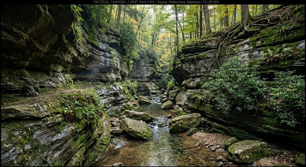
Access: Standard hunting license. The Sipsey Wilderness (~25,000 acres) is walk-in only with no motorized access. Dispersed camping throughout.
Insider tip: The Sipsey Wilderness inside Bankhead is one of the most underrated public land deer hunting experiences in the Southeast. The sandstone canyons are steep and the access is tough, which means pressure drops off within the first half mile of any trailhead. Deer bed on the benches above the canyon walls and travel the rim trails between feeding areas. A Tethrd Phantom saddle platform lets you set up on the small-diameter hardwoods along these rim trails without pre-hanging anything.
Barbour WMA
Managing agency: ADCNR
Acreage: 28,000
Region: Barbour and Bullock counties, southeast Alabama
Primary species: Whitetail, turkey, dove, quail, feral hogs
Terrain: Coastal plain longleaf pine, mixed hardwood bottoms, managed dove fields, agricultural borders
Access: WMA license required. Good road network with multiple parking areas.
Insider tip: Barbour is one of the best public land turkey properties in Alabama. The managed longleaf pine with open understory creates ideal strutting habitat, and the birds here gobble well into mid-morning on days when other properties have gone quiet. For deer, focus on the hardwood bottom corridors between the pine uplands. The transition from pine to hardwood concentrates deer movement into narrow lanes you can set up on.
Lauderdale WMA
Managing agency: ADCNR
Acreage: 27,000
Region: Lauderdale County, far northwest Alabama along the Tennessee River
Primary species: Whitetail, turkey, waterfowl, dove, small game
Terrain: Tennessee River bottomland, hardwood flats, managed impoundments, agricultural fields, cottonwood and sycamore bottoms
Access: WMA license required. Boat access for some areas. Road access to most parking areas.
Insider tip: Lauderdale WMA's river bottom hardwood holds excellent deer that feed on the surrounding ag fields. The bottleneck points where timber corridors narrow between open fields and the river are the high-percentage setups during the rut. The waterfowl hunting on the managed impoundments draws most of the attention, which means the deer hunters who push into the timber blocks between the wetland units have the woods to themselves. Glass the field edges at last light with Vortex Diamondback HD 10x42 binoculars to pattern deer movement before committing to a stand location.
Skyline WMA
Managing agency: ADCNR
Acreage: 33,000
Region: Jackson County, far northeast Alabama on the Cumberland Plateau
Primary species: Whitetail, turkey, bear (limited), squirrel
Terrain: Cumberland Plateau sandstone bluffs, deep hollows, mature hardwood, laurel thickets, the most Appalachian-feeling terrain in Alabama
Access: WMA license required. Rugged interior with gated roads. Walk-in to the best hunting.
Insider tip: Skyline is the closest thing Alabama has to Pennsylvania's big-woods hunting experience. The terrain is steep and the hollows are deep, which keeps the casual hunters on the plateau top. Drop off the rim into the hollow and hunt the benches below the bluff lines. Deer bed in the laurel thickets on the north-facing slopes and travel the benches between bedding and the oak flats on the ridgetop. Alabama has a growing black bear population in this part of the state, and Skyline is in the bear zone. You won't get a bear tag easily, but seeing sign keeps the big-woods experience interesting.
Conecuh National Forest
Managing agency: U.S. Forest Service
Acreage: 84,000
Region: Covington and Escambia counties, far south Alabama near the Florida line
Primary species: Whitetail, turkey, feral hogs, quail (limited wild birds)
Terrain: Longleaf pine flatwoods, pitcher plant bogs, hardwood creek bottoms, sandy soils
Access: Standard hunting license. Good forest road network. Dispersed camping allowed.
Insider tip: Conecuh's longleaf pine ecosystem is managed with prescribed fire, which creates the open, park-like understory that deer, turkeys, and quail all thrive in. The best deer hunting is along the hardwood creek bottoms that wind through the pine. These creek corridors are the only dense cover in an otherwise open forest, and deer concentrate along them during daylight for security. During the rut, bucks cruise from one creek corridor to the next checking doe groups. Set up at a creek crossing between two hardwood drains.
Lowndes WMA
Managing agency: ADCNR
Acreage: 17,000
Region: Lowndes County, central Alabama Black Belt
Primary species: Whitetail, turkey, dove, quail
Terrain: Black Belt prairie, managed fields, mixed hardwood and pine, limestone-based soils
Access: WMA license required. Special Opportunity Area hunts for quota-managed deer.
Insider tip: Lowndes WMA sits on Black Belt soils, which are the richest in the state for growing big-bodied, big-antlered whitetails. The calcium-rich limestone soils translate directly to antler mass. Drawn hunts here are worth applying for every year. The odds are better than most hunters think, and the quality of the deer rivals that of private-land hunting in the region. If you don't draw a quota hunt, the non-quota archery periods still put you on Black Belt deer.
Mobile-Tensaw Delta
Managing agency: ADCNR (multiple WMAs within the delta)
Acreage: 50,000+ across multiple managed areas including Upper Delta, Lower Delta, and Tensaw River
Region: Baldwin and Mobile counties, coastal southwest Alabama
Primary species: Whitetail, waterfowl, feral hogs, alligator (drawn)
Terrain: River delta swamp, cypress-tupelo bottomland, tidal marsh, hardwood hammocks, coastal flatwoods
Access: WMA license required. Boat access essential for the best hunting. Some road access on the margins.
Insider tip: The Mobile-Tensaw Delta is the second-largest river delta in the country, and the deer hunting inside the swamp is unlike anything else in Alabama. Bucks bed on high-ground hardwood hammocks surrounded by standing water, and the only way to reach them is by boat. Bring a shallow-draft boat or kayak, find the hammocks on satellite imagery, and hunt the transitions where dry ground meets the swamp. Deer densities are moderate, but the bucks see very few hunters and grow old. Hog hunting here is excellent year-round, and alligator tags are available through an annual draw.
Choccolocco WMA
Managing agency: ADCNR (on Fort McClellan former military land)
Acreage:19,000
Region: Calhoun County, northeast Alabama Piedmont
Primary species: Whitetail, turkey, feral hogs
Terrain: Rolling Piedmont hills, mixed pine-hardwood, old military roads and clearings, creek bottoms
Access: WMA license required. Special regulations apply (former military installation). Check for unexploded ordnance warnings and stay on designated trails in restricted zones.
Insider tip: The former military clearings and road network at Choccolocco create edge habitat that concentrates deer movement. The old clearings function like food plots, growing native browse that draws deer from the surrounding timber. Hunt the edges where these clearings meet the hardwood blocks, especially during the early archery window when deer are still on predictable feeding patterns. The ordnance warnings keep timid hunters away, which keeps the pressure lower than it should be for a WMA this close to Anniston and Jacksonville.
Coosa WMA
Managing agency: ADCNR
Acreage: 26,000
Region: Coosa County, central Alabama Piedmont
Primary species: Whitetail, turkey, feral hogs, small game
Terrain: Piedmont mixed pine-hardwood, creek bottoms, rolling hills with moderate slopes
Access: WMA license required. Good road access with multiple parking areas.
Insider tip: Coosa WMA sits in one of the better deer-density zones in the Alabama Piedmont, and the terrain is gentle enough that it draws more pressure than the steep northern WMAs. Beat the pressure by hunting midweek during archery and pushing past the first mile from any parking lot. The creek bottoms that run between the pine ridges are the money features here. Where two creeks merge, the terrain pinches deer movement into a funnel that concentrates both travel and sign.
Mud Creek WMA
Managing agency: ADCNR
Acreage: 7,000
Region: Lawrence County, northwest Alabama
Primary species: Whitetail, turkey, squirrel
Terrain: Tennessee Valley hardwood bottoms, limestone cedar glades, crop field edges
Access: WMA license required. Road access to parking areas.
Insider tip: Mud Creek is small enough that most hunters scan past it, and that's your advantage. The Tennessee Valley's agricultural influence supports strong deer nutrition, and the limestone soils support good antler growth in the region. The cedar glade openings scattered through the hardwood create natural browse areas that function like small food plots. Hunt the edges where cedar glade meets hardwood, especially when acorns are dropping.
Talladega National Forest (Shoal Creek Division)
Managing agency: U.S. Forest Service
Acreage: 206,000
Region: Calhoun, Cleburne, Clay, and Talladega counties, northeast Alabama Piedmont/Appalachian transition
Primary species: Whitetail, turkey, feral hogs, squirrel, bear (limited zone)
Terrain: Appalachian foothills, Cheaha Mountain (the highest point in Alabama), mixed hardwood with some pine, rocky ridges, mountain streams
Access: Standard hunting license. Forest road network with some gated seasonal roads. Dispersed camping.
Insider tip: The Shoal Creek Division holds Cheaha Mountain and the steepest terrain in Alabama. Most hunters stick to the lower road-accessible areas. The rocky ridgelines above 1,500 feet in elevation hold deer that see almost no hunting pressure, and the white oak acorn crop on these upper ridges draws deer from lower elevations in October and November. The terrain is steep enough that the walk up deters most people, but the benches below the ridgetop are classic big-woods bedding features that work exactly as they do in Pennsylvania and West Virginia.
Species You Can Hunt on Public Land in Alabama
Whitetail is the main draw. Alabama's deer herd is about 1.8 million animals statewide, and the public-land harvest is strong across all regions. The Black Belt counties (Dallas, Lowndes, Perry, Marengo, Hale) produce the state's best trophy potential, driven by rich limestone soils that support heavy body weights and above-average antler growth. The northern Appalachian counties produce smaller-bodied deer but offer steep terrain and low pressure. The coastal plain deer in the south are moderate in both size and density.
Turkey hunting in Alabama is among the best in the country. The state holds one of the largest Eastern turkey populations in the Southeast, and the spring gobbler season runs from mid-March through April. Nearly every WMA and national forest tract holds turkeys, and the longleaf pine WMAs in the central and southern parts of the state produce some of the most vocal, responsive birds you'll hunt anywhere.
Feral hogs are year-round on most WMAs during any legal hunting season, with no bag limit. Hog populations are heavy on the coastal plain WMAs, the river bottom properties, and throughout the Talladega and Bankhead national forests. Hogs are the best excuse to learn a new piece of public ground during the off-season.
Waterfowl hunters find the best access on the Tennessee River WMAs in the north (Lauderdale, Wheeler NWR), the Mobile-Tensaw Delta in the south, and several managed impoundments on interior WMAs. The delta produces excellent wood duck and teal hunting.
Alabama also offers drawn alligator hunts on select WMAs (primarily in the south and Mobile Delta), dove on managed fields across multiple WMAs, and small game, including squirrel, rabbit, and quail (limited wild populations).
Season Structure for Alabama WMA Hunting
Alabama's deer season is one of the longest in the country:
Archery: Mid-October through late January in most zones. Some zones open as early as October 1.
Gun season: Mid-November through late January. Rifles, shotguns, muzzleloaders, and handguns are all legal during gun season, depending on the zone.
Muzzleloader-only: Varies by zone, typically a window in late October or January.
Dog hunting season: Varies by zone and WMA. Dog-drive deer hunting is a legal and deeply rooted tradition in Alabama, especially on the coastal plain WMAs. If you're a still-hunter or stand-hunter, check whether your target WMA allows dog hunting during your planned dates, and plan around it.
The dog hunting element is something out-of-state hunters need to understand. On WMAs that allow dog-driven deer hunting, the dogs push deer through large areas, and the hunting style is very different from stand hunting or still-hunting. If dogs are running on the property you're hunting, the deer movement patterns change completely. Some hunters use this to their advantage by setting up escape routes and pinch points that deer funnel through when driven. Others avoid dog-hunt dates entirely. Check the WMA-specific season dates and regulations on the ADCNR website.
Spring turkey runs from mid-March through late April. Tags are available over the counter. The season typically opens a week earlier for youth hunters.
Access Tips Specific to Alabama WMA Hunting
WMA license is mandatory. You need the WMA license ($16 resident, $51 non-resident) in addition to your standard hunting license to hunt any ADCNR Wildlife Management Area. National forests don't require the WMA license unless you're hunting an overlapping WMA unit within the forest boundary.
Check-in and check-out. Many Alabama WMAs require self-registration at parking lot kiosks. Sign in before you hunt and sign out when you leave. Some WMAs track harvest through mandatory check stations during specific seasons. Read the WMA-specific regulations before your trip.
Dog hunting dates. If you're a stand hunter planning a trip to an Alabama WMA, check whether dog-drive deer hunting is scheduled during your dates. The ADCNR publishes dog-hunt dates by WMA on their website and in the annual regulation booklet. Planning around these dates can make or break your trip.
Camping. Some WMAs allow primitive camping in designated areas. Many don't. National forests allow dispersed camping up to 14 days. Check the specific property before you plan an overnight trip. The Bankhead, Talladega, and Conecuh national forests are the most camping-friendly public hunting options in the state.
Vehicle access. On WMAs, vehicles are restricted to designated roads and parking areas. Don't drive past locked gates or on two-tracks that aren't signed as open. In national forests, the road network is more open, but seasonal gates close some interior roads.
Snake awareness. Alabama has rattlesnakes, copperheads, and cottonmouths on every public tract in the state. Archery season in October and November overlaps with warm temperatures in the southern half of the state, and snakes are still active. Snake boots or gaiters are worth the investment.
Gear Considerations for Best Public Hunting in Alabama
Alabama's climate and terrain demand gear that handles heat, humidity, and a long temperature range from 80-degree October archery to 25-degree late-January mornings.
Heat management for early season. October archery in Alabama is hot. Lightweight, breathable camo is mandatory. Bring more water than you think you need. Early-season sits in the southern half of the state feel more like a summer hunt than a fall one. Your base layer should be the lightest thing you own.
Snake boots. Non-negotiable on Alabama public land from October through November south of Birmingham, and through mid-October in the north. Rattlesnakes, copperheads, and cottonmouths are real and present. The LaCrosse Alphaburly Pro covers both the snake protection and the wet-ground performance you need on the coastal plain and river bottom properties.
Rubber boots for swamp WMAs. The Mobile-Tensaw Delta, the river bottom WMAs, and several southern coastal plain properties involve standing water. Knee-high rubber boots with good tread are standard equipment.
A quiet outer layer. Alabama's long archery season means most of your deer hunting happens with a bow, and noise discipline matters on close-range encounters. The KUIU Axis Hybris jacket handles the mild-to-cool November and December conditions that make up the heart of Alabama deer season. For late-January cold snaps, layer a fleece underneath.
Binoculars. The Piedmont and coastal plain have more open timber than the northern mountains, and many WMAs border agricultural fields where glassing at 200-plus yards is standard practice. The Vortex Diamondback HD 10x42 covers both the open-field glassing and the low-light timber work for under $230.
Mobile stand. A Tethrd Phantom saddle platform with climbing sticks gives you the mobility to adapt to pressure shifts, wind changes, and the varying timber sizes across Alabama's different regions. Public land in Alabama is best hunted on foot because the dog-hunt pressure on some WMAs dramatically shifts deer patterns from week to week.
Cellular trail camera. The Muddy Matrix 2.0 sends photos to your phone without requiring a walk-in visit. On Alabama WMAs where sign-in requirements mean other hunters know you're on the property, keeping your camera locations secret depends on never visiting them. Hang it in August and don't go back until you hunt. [
Mapping app. onX Hunt with the Alabama layer shows WMA boundaries, national forest tracts, and property lines. On scattered national forest parcels mixed with private land (common in the Talladega), the digital boundary line is what keeps you legal.
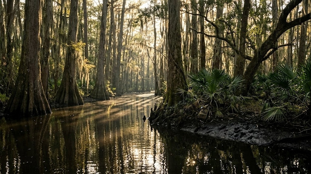
Finding Unpressured Ground on Alabama Public Hunting Land
Alabama sells about 300,000 hunting licenses a year, and the pressure on public land concentrates predictably: gun-season opener on the well-known WMAs within an hour of Birmingham, Huntsville, and Mobile, and on any WMA during dog-hunt dates when organized drives push through the property.
Avoid dog-hunt dates if you're a stand hunter. This is the single most important pressure-management decision on Alabama WMAs. Dog drives push deer movement into chaos for stand hunters. Either use it to your advantage by sitting escape funnels (creek crossings, pinch points, thick-cover transitions), or hunt on dates when dogs aren't allowed. The ADCNR schedule is published well before the season.
Hunt the national forests. The Bankhead, Talladega, and Conecuh national forests don't run dog hunts, don't require the WMA license, and hold far less per-acre pressure than the WMAs during gun season. The Sipsey Wilderness within Bankhead is walk-in-only and feels like a different state by the second mile. The Oakmulgee Division of Talladega sits on the Black Belt edge and grows better deer than most of the WMAs. These national forest tracts offer the best value in Alabama public-land hunting.
Hunt early archery. Alabama's archery season opens in mid-October, a full month before gun season brings the crowds. Midweek archery sits on any WMA in October draw minimal competition, and the deer are still on predictable pre-rut patterns.
Go deep on the coastal plain. The flat, featureless pine flatwoods of southern Alabama discourage most hunters because there are no obvious terrain features to hunt. But the creek bottoms that wind through the pine are the only dense cover in those forests, and deer stack along them. The hunters who learn to read those creek corridors on satellite imagery before the trip find deer that the rest of the property ignores.
For property-level terrain analysis before your trip, Hunting Scout builds interactive scouting reports from real USGS and NOAA data for any WMA or national forest tract. The funnel detection works on Alabama's subtle coastal-plain terrain as well as the steep Appalachian features in the north. Three free reports per month, no credit card required.
For properties adjacent to public ground that you're evaluating for a lease or purchase, ScoutFlight Hunting Assessments delivers drone-based property reports with terrain, cover, and habitat analysis.
Frequently Asked Questions About Public Land Hunting in Alabama
How much public hunting land is in Alabama?
Alabama has roughly 1.2 million acres of public hunting land, combining WMAs (700,000 acres), four national forests (670,000 acres), Corps of Engineers land, and National Wildlife Refuges. The Talladega National Forest alone accounts for nearly 400,000 acres across two divisions.
Do I need a WMA license to hunt in Alabama?
Yes, for any ADCNR Wildlife Management Area. The WMA license runs $16 for residents and $51 for non-residents and is required in addition to your standard hunting license. You don't need the WMA license to hunt national forest land unless you're in an area that overlaps with a designated WMA unit.
Can non-residents hunt Alabama public land?
Yes. Non-residents buy an all-game license ($311) or a 7-day trip license ($51 for small game and deer, an additional $51 for turkey), plus the WMA license ($51) for WMA access. Tags are over the counter. No draws or preference points required for deer or turkey. Alabama is non-resident-friendly with no separate quotas on public land access.
What is dog hunting in Alabama, and how does it affect me?
Dog-drive deer hunting is a legal, traditional practice on many Alabama WMAs where organized groups release hounds to drive deer past posted standers. It's a deeply rooted part of the state's hunting culture. If you're a still-hunter or stand hunter, dog-hunt dates will change deer movement patterns dramatically on your WMA. Check the ADCNR's WMA-specific season schedule for dog-hunt dates and either plan around them or use the driven deer to your advantage by sitting escape routes and terrain funnels.
What are the best WMAs in Alabama for big bucks?
The Black Belt WMAs (Lowndes, parts of Oakmulgee Talladega NF, and surrounding areas) produce the state's best antler growth due to rich limestone soils. In the north, Skyline WMA on the Cumberland Plateau grows mature bucks in steep terrain that keeps pressure low. The Mobile-Tensaw Delta holds bucks that grow old in a swamp habitat nobody wants to wade into. Each region trades off antler size, deer density, and hunter pressure differently.
When is the rut in Alabama?
The timing of the Alabama rut varies significantly by region, which is unusual. In the northern third of the state, peak breeding falls in mid to late January. In the central Piedmont and Black Belt, peak breeding hits in late December through mid-January. In the southern coastal plain, the rut peaks in January through early February. This means Alabama's gun season (mid-November through late January) covers the pre-rut and rut in most of the state. Time your trip to your target region's rut peak for the best chance at a mature buck on the move.
Are there bears in Alabama?
Yes, and the population is growing. Alabama's black bear population is centered in the northeast corner of the state (Jackson, DeKalb, and Marshall counties), with bears expanding into surrounding areas. There is no open bear season in Alabama at this time, but bear presence on properties such as Skyline WMA and in the Bankhead National Forest is increasing. ADCNR is monitoring the population and may establish a limited season in the future.
Can you camp on Alabama WMAs?
It depends on the WMA. Some allow primitive camping in designated areas, and a few have established campgrounds nearby. Many WMAs don't allow camping at all. The four national forests (Bankhead, Talladega, Conecuh, Tuskegee) all allow dispersed camping up to 14 days, making them the best options for multi-day hunt-camp trips. Always check the specific property regulations on the ADCNR website before planning an overnight stay.
Want the full breakdown of every Alabama WMA with regulations and species data, plus the same for all 50 states? Subscribe to the LandsToHunt newsletter below and get our free state-by-state public land hunting guides delivered to your inbox.
This guide includes affiliate links to tools and gear we recommend for hunting Alabama's public land. LandsToHunt.com earns a commission on qualifying purchases.

Public Land Hunting in Minnesota: 12 Million Acres from the Prairie to the Big Woods
Minnesota holds more public hunting land than any state in the Midwest. More than 12 million acres across 1,400 WMAs, two national forests, 58 state forests, and Walk-In Access private land. From the driftless bluff country in the southeast to the boreal big woods on the Canadian border, here's your guide to the best tracts, season structure, gear considerations, and how to find unpressured ground in a state where the opportunities outstrip what most hunters imagine.

Minnesota holds more public hunting land than any state in the Midwest and most states in the entire country. When you add up Wildlife Management Areas, state forests, two national forests, county forests, Walk-In Access lands, and the Boundary Waters, the total pushes past 12 million huntable acres. That's not a typo. Twelve million acres of public ground spread from the prairie pothole country in the west through the farm belt in the south to the boreal big woods running all the way to the Canadian border.
Public land hunting in Minnesota gives you options that no neighboring state can match. Whitetail in the farm-country WMAs that rival Iowa genetics. Big-woods bucks in the northern forests, where you can walk all day without seeing another hunter. One of the best ruffed grouse traditions in the country. Waterfowl hunting across the Mississippi Flyway that draws birds from the entire continent. Black bear draws in the northern third of the state. And a landscape that shifts from 1,000-acre prairie WMAs to 4-million-acre national forests within a three-hour drive.
The state's system is deep enough that most hunters, even lifelong residents, don't know the full scope of what's available. Here's the guide to working it.
How Much Public Hunting Land Minnesota Has
The total public hunting access in Minnesota is staggering:
Wildlife Management Areas (WMAs): More than 1,400 WMAs totaling roughly 1.3 million acres, managed by the Minnesota DNR
Superior National Forest: 3.9 million acres, including the Boundary Waters Canoe Area Wilderness (BWCAW), managed by the U.S. Forest Service
Chippewa National Forest: 666,000 acres in north-central Minnesota, managed by the U.S. Forest Service
State forests: 58 state forests totaling roughly 4 million acres, managed by the Minnesota DNR
County and municipal forests: Additional millions of acres, especially in the northern counties (St. Louis, Itasca, Beltrami, Koochiching)
Walk-In Access (WIA): Private land enrolled in a voluntary program that allows public hunting access, adding tens of thousands of acres primarily in the farm-country western and southern regions
National Wildlife Refuges: Including Tamarac, Sherburne, Big Stone, and others, offering seasonal hunting
The sheer volume of public ground in northern Minnesota is hard to overstate. St. Louis County alone holds more public hunting land than many entire states. When you combine state forest, county forest, and national forest in the northern third of the state, there are blocks of huntable public ground that run 50-plus miles without interruption.
For licensing, Minnesota residents pay about $26 for a firearms deer license and $26 for an archery license, with various combination options. Non-residents pay $166 for a firearms deer license and $88 for archery. Small game runs $19 for residents, $80 for non-residents. Turkey is $26 for residents, $80 for non-residents. Deer tag availability varies by zone. Some zones are over-the-counter for residents but drawn for non-residents. Some are drawn for everyone. Check the specific Deer Permit Area (DPA) regulations on the Minnesota DNR website before planning a trip.
Top 12 Public Hunting Areas for Minnesota WMA Hunting and Beyond
Superior National Forest (including Boundary Waters)
Managing agency: U.S. Forest Service
Acreage: 3.9 million
Region: Northeast Minnesota, Cook, Lake, and St. Louis counties
Primary species: Whitetail, black bear, moose (very limited tags), ruffed grouse, snowshoe hare, waterfowl
Terrain: Boreal forest, spruce and birch-aspen, thousands of lakes, rocky ridges, dense understory, vast unbroken wilderness
Access: Open with a valid Minnesota hunting license. Dispersed camping throughout. The BWCAW requires a separate entry permit and restricts motorized access.
Insider tip: The areas of the Superior outside the BWCAW boundary get far less attention than the wilderness itself but hold excellent deer and grouse hunting with road access. The young aspen regrowth from timber cuts along forest roads between Ely and Isabella concentrates both grouse and deer. Use the Forest Service's timber sale maps to find cuts that are 5 to 15 years old, then hunt the edges where young aspen meets mature spruce.
Chippewa National Forest
Managing agency: U.S. Forest Service
Acreage: 666,000
Region: Itasca, Cass, and Beltrami counties, north-central Minnesota
Primary species: Whitetail, black bear, ruffed grouse, waterfowl, turkey
Terrain: Mixed hardwood and pine, aspen stands, lake-studded terrain, wild rice marshes, rolling glacial topography
Access: Extensive forest road network. Dispersed camping. Multiple boat landings for lake access.
Insider tip: The Chippewa holds the highest density of nesting bald eagles in the lower 48, and the same habitat that supports eagles supports a strong deer and grouse population. Focus your deer scouting on the aspen-dominated areas between the larger lakes. Deer in this part of Minnesota key on the thick aspen regen for both browse and thermal cover, especially after the first snow. The Chippewa gets less out-of-state attention than the Superior because it lacks the wilderness-area cachet, and that's your advantage.
Whitewater WMA
Managing agency: Minnesota DNR
Acreage: 29,000
Region: Winona and Wabasha counties, southeast Minnesota bluff country
Primary species: Whitetail, turkey, pheasant, waterfowl
Terrain: Mississippi River bluff country with steep limestone bluffs, hardwood ravines, trout streams, and crop field valleys
Access: Good road access to multiple parking areas. Walk into the interior bluff terrain.
Insider tip: Southeast Minnesota's driftless region grows the biggest whitetails in the state, and Whitewater WMA sits in the middle of it. The steep bluffs create natural terrain funnels that topo maps make obvious. Hunt the saddles connecting parallel bluff ridges during the rut when bucks cruise between doe groups in the valleys. The terrain keeps casual hunters in the valleys, and the deer on the upper bluffs see very little pressure past opening weekend.
Richard J. Dorer Memorial Hardwood State Forest
Managing agency: Minnesota DNR
Acreage: 800,000 (scattered tracts across the driftless region)
Region: Southeast Minnesota, Houston, Fillmore, Winona, Goodhue, and surrounding counties
Primary species: Whitetail, turkey, ruffed grouse, squirrel
Terrain: Limestone bluffs, deep coulees, hardwood ridges, trout stream valleys
Access: Scattered tracts with varying access. Primitive camping is allowed at designated sites.
Insider tip: The Dorer is not one contiguous block. It's hundreds of scattered parcels throughout the bluff country, and many of them are small enough that other hunters don't notice them on the map. Use onX Hunt to find the 200 to 500-acre Dorer parcels surrounded by private agricultural land. These small tracts hold deer that feed on the surrounding farms and bed on the public timber. A mapping app is mandatory because boundary signage is inconsistent on the smaller parcels.
Carlos Avery WMA
Managing agency: Minnesota DNR
Acreage: 23,000
Region: Anoka and Chisago counties, just north of the Twin Cities metro
Primary species: Whitetail, waterfowl, pheasant (stocked), turkey, small game
Terrain: Marshes, grassland, oak savanna, young hardwood, agricultural edges
Access: Good road access. Multiple designated parking areas. Some restricted zones for waterfowl management.
Insider tip: Carlos Avery is close to the metro and gets pressure that reflects it, especially during firearms opener. But the weekday archery hunting on this property is surprisingly good. The suburban deer population in the surrounding developments pushes animals onto the WMA, and deer density here is higher than in most northern forest zones. Hunt October archery on a weekday, target the oak savanna edges where the prairie meets the timber, and you'll see deer that the Saturday gun-season crowd never encounters.
Lac qui Parle WMA
Managing agency: Minnesota DNR
Acreage: 32,000
Region: Lac qui Parle, Chippewa, and Swift counties, west-central Minnesota
Primary species: Waterfowl (geese and ducks, major migration staging area), whitetail, pheasant, dove
Terrain: Prairie, managed wetlands, Minnesota River bottomland, crop field edges, shelter belts
Access: Road access throughout. Designated waterfowl zones with specific hunting rules.
Insider tip: Lac qui Parle is one of the top goose staging areas in the Central Flyway. During the October and November migration, hundreds of thousands of Canada geese and snow geese funnel through the Minnesota River corridor. The goose hunting gets the attention, but the deer hunting along the river timber corridor is very good and very overlooked. The narrow strips of hardwood bottomland along the river create natural travel corridors that squeeze buck movement into predictable lanes during the rut.
Nemadji State Forest
Managing agency: Minnesota DNR
Acreage: ~42,000
Region: Carlton and Pine counties, east-central Minnesota
Primary species: Whitetail, ruffed grouse, black bear, snowshoe hare
Terrain: Mixed aspen-birch-spruce, alder swamps, beaver ponds, rolling glacial hills
Access: Forest roads with some gated seasonal roads. Dispersed camping allowed.
Insider tip: Nemadji is close enough to Duluth and the Twin Cities that you'd expect heavy pressure, but the terrain and cover are thick enough that most hunters don't push past the road edges. The alder swamps that run between the upland ridges are where pressured deer retreat after opening weekend. If you're willing to wade through alder tag-along (bring the LaCrosse Alphaburly Pro boots), you'll find bedding deer that haven't seen a hunter in days. Grouse hunting along the forest roads between the swamps is some of the best within two hours of the metro.
Mille Lacs WMA
Managing agency: Minnesota DNR
Acreage: ~39,000
Region: Mille Lacs County, central Minnesota
Primary species: Whitetail, ruffed grouse, waterfowl, turkey
Terrain: Mixed hardwood and aspen, tamarack bogs, Rum River corridor, agricultural edges
Access: Multiple parking areas along county roads. Walk into the interior.
Insider tip: Mille Lacs WMA sits in the transition zone between the northern big woods and the central farm belt. The deer here are bigger-bodied and carry more antlers than the deep-woods deer further north because the adjacent agricultural food base supports better nutrition. Hunt the hardwood ridges that border the tamarack bogs. Deer bed in the bog edges for thermal cover and security, and travel to the agricultural fields through predictable corridors that the topo makes obvious.
Roseau River WMA
Managing agency: Minnesota DNR
Acreage: 62,000
Region: Roseau County, far northwest Minnesota, along the Canadian border
Primary species: Whitetail, moose (very limited), waterfowl, upland birds
Terrain: Prairie, marshland, aspen-willow belts, river bottomland
Access: Road access along the perimeter. Interior access varies by season and water levels.
Insider tip: Roseau River is remote enough that it gets minimal pressure from anyone outside the local community. The aspen belts along the river hold deer that feed on the surrounding agricultural ground and bed in the dense willow and aspen thickets. The rut peaks slightly later this far north (mid to late November), and a Thanksgiving-week hunt timed to cold weather and late-rut activity puts you on bucks that see almost no competition. Bring everything you need. Services are limited.
Beltrami Island State Forest
Managing agency: Minnesota DNR
Acreage: 676,000
Region: Lake of the Woods, Roseau, and Beltrami counties, far northern Minnesota
Primary species: Whitetail, black bear, ruffed grouse, snowshoe hare, timber wolf
Terrain: Boreal forest, spruce bogs, aspen uplands, muskeg, vast and roadless in the interior
Access: Forest roads on the perimeter. The interior is very remote with limited access. Dispersed camping allowed.
Insider tip: Beltrami Island is true wilderness hunting. The interior of this forest sees almost zero hunting pressure outside of firearms opener week. Deer densities are lower than in the farm country zones, but the bucks that live here grow old because nobody walks far enough to find them. This is a bring-your-own-everything, pack-in-for-days kind of place. If you want a big-woods experience that feels like northern Canada without crossing the border, this is it.
Crow Wing State Forest
Managing agency: Minnesota DNR
Acreage: 103,000
Region: Cass and Crow Wing counties, central Minnesota
Primary species: Whitetail, ruffed grouse, black bear, turkey
Terrain: Jack pine, red pine, aspen cuts, rolling glacial terrain, scattered lakes, and wetlands
Access: Extensive forest road network. State forest campgrounds available. ATV trails in designated areas.
Insider tip: Crow Wing sits in the heart of Minnesota's best grouse and woodcock range. The jack pine and young aspen habitat produces consistent bird numbers, and the logging roads through the forest give you miles of walkable cover to work with a dog. Deer hunting is secondary to bird hunting for most people who come here, which means deer pressure is lower than you'd expect in a state forest this size and this close to the Brainerd Lakes area.
Talcot Lake WMA
Managing agency: Minnesota DNR
Acreage: 4,200
Region: Cottonwood County, southwest Minnesota prairie
Primary species: Pheasant, waterfowl, whitetail, dove
Terrain: Prairie grassland, managed wetlands, shelter belt timber strips, crop field borders
Access: Road access with parking pull-offs.
Insider tip: Southwest Minnesota prairie WMAs are the state's best bet for pheasant hunting on public ground. Talcot Lake holds wild roosters in the native grass and shelter belt edges, especially in years with good nesting cover. Walk the grass strips between the wetlands and the crop borders with a dog working 40 yards ahead. Deer hunting in the shelter belts is a bonus during firearms season. Bucks bed in the 100-yard-wide tree rows between open fields, and you can see both ends of the shelter belt with a good pair of binoculars. Glass first from the truck, then set up on the downwind end.
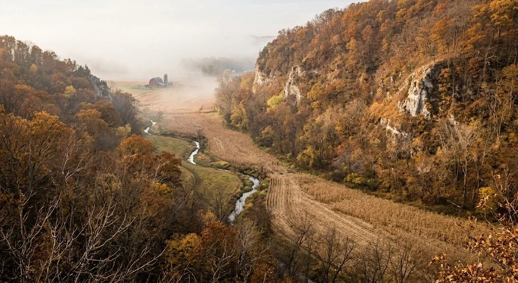
What You Can Hunt on Minnesota Public Land
Whitetail is the primary draw for most out-of-state hunters, and Minnesota delivers two very different deer hunting experiences depending on where you go. The farm-country zones in the southeast (driftless bluff country) and south-central regions produce the state's best body weights and antler growth, driven by rich agricultural food sources. The northern big-woods zones produce lower deer densities but offer a wilderness hunting experience with almost zero competition for mature bucks that grow old simply because nobody walks deep enough to find them.
Ruffed grouse hunting is a Minnesota tradition, and the northern forests from the Chippewa east through the Superior hold some of the best public land grouse hunting in the country. The 10-year grouse population cycle means some years are better than others, and the DNR publishes annual drumming survey data that tells you where in the cycle your target area falls. Woodcock migrate through the same aspen cover in September and October.
Waterfowl hunting is exceptional. Minnesota sits in the Mississippi Flyway, and the prairie pothole country in the west, and the large lakes and river corridors throughout the state draw ducks and geese from breeding grounds across the northern plains and Canada. Public access is strong on WMAs, state forest lakes, and national forest water bodies.
Black bear hunting is available through a drawn tag system with preference points. The primary bear range runs across the northern third of the state. The wait for a tag varies by zone from 1 to 5-plus years.
Turkey hunting has expanded significantly across the southern two-thirds of the state, with spring and fall seasons available. Spring turkey hunting in the southeast bluff country is outstanding and continues to build momentum as the population expands.
Minnesota also offers limited moose hunting through a once-in-a-lifetime lottery in the northeast, pheasant hunting on prairie WMAs, rabbit and squirrel hunting, and excellent trapping opportunities across the state.
Season Structure for Public Land Hunting in Minnesota
Archery deer: Mid-September through December 31. A long season that covers the entire pre-rut, rut, and late season.
Firearms deer: Opens the first Saturday after November 4 and runs 16 days. This is when Minnesota's woods get crowded. The tradition runs deep, and the firearm opener is a cultural event across the state.
Muzzleloader deer: Late November through mid-December in designated zones.
Ruffed grouse: Mid-September through January. One of the longest grouse seasons in the country.
Waterfowl: Follows federal frameworks, with early teal in September and the regular season running October through November/December, depending on the zone.
Pheasant: Mid-October through January in designated zones.
Spring turkey: Mid-April through May, with multiple time periods drawn by zone.
Black bear: September season drawn by zone with preference points.
Deer Permit Areas (DPAs) determine your tag availability and antlerless quota. Some DPAs are over the counter for residents. Some require a lottery draw. Non-residents draw tags through a separate allocation. Research your target DPA on the Minnesota DNR website well before the application deadline.
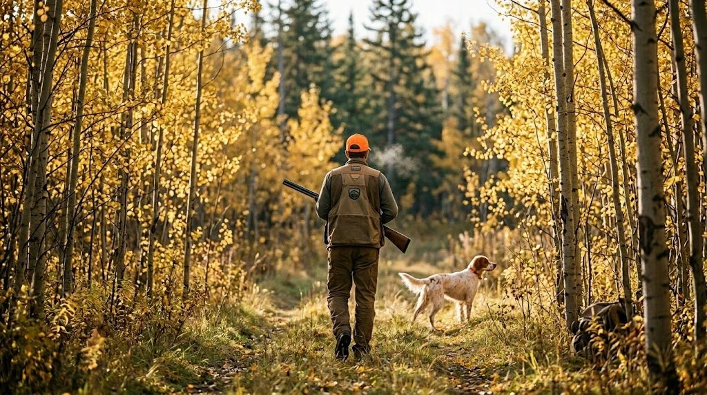
Access Tips for Minnesota Public Hunting
Registration requirement on WMAs. Some Minnesota WMA hunting areas require self-registration at a parking lot kiosk before hunting. Sign in, note your vehicle, and sign out when you leave. Not all WMAs have this, but check for the kiosk at every parking area.
Walk-In Access (WIA) lands. The WIA program enrolls private land for public hunting access. These tracts are marked with yellow WIA signs and shown on the DNR Hunting Atlas. Walk-in only, no vehicles on the enrolled land, and respect the landowner's posted boundaries. WIA lands are concentrated in the farm-country western and southern regions and are excellent for pheasant and deer.
Vehicle restrictions. On WMAs, vehicles are restricted to designated roads and parking areas. State forests have more open road networks, but many roads are seasonal and gated after freeze-up. The national forests have extensive road systems with some gated seasonal roads.
Camping. Camping is not allowed on WMAs. State forests allow dispersed camping with some restrictions by forest. National forests allow dispersed camping up to 14 days. For multi-day hunts on WMAs, camp at a nearby state forest, state park campground, or private campground.
Blaze orange. Minnesota requires blaze-orange on the upper body and a blaze-orange cap during the firearm deer season. At least one blaze orange article is visible from all directions. This applies to all hunters in the field during the firearms window.
ATV use. ATV regulations vary significantly by property. Some state forests allow ATVs on designated trails. WMAs restrict ATVs to designated roads and parking areas. Check the specific property rules before you bring a machine.
The DNR Hunting Atlas is essential. The Minnesota DNR's online Hunting Atlas shows every WMA, state forest, national forest tract, and WIA parcel with boundary layers. Download the GPS layers to your mapping app or phone before you head to the field.
Gear Considerations for Public Land Hunting in Minnesota
Minnesota hunting means cold. The kind of cold that ends hunts, breaks gear, and tests everything in your clothing system. Here's what the terrain and climate demand.
Boots for extreme cold. Northern Minnesota in November regularly drops below zero at dawn. The LaCrosse Hunt Pac Extreme with 2000g Thinsulate is built for all-day sits in these conditions. For the southern bluff country where you're climbing steep terrain, the Danner Pronghorn in 800g or 1200g covers the milder cold and the ankle support you need on the limestone bluffs. For wet terrain (alder swamps, beaver ponds, creek crossings), the LaCrosse Alphaburly Pro in 1600g handles water and cold.
A serious layering system. Minnesota archery starts in 60-degree September weather and firearms season bottoms out below zero. You need the full spectrum. The KUIU Axis Hybrid jacket works as the outer layer from October through November in most conditions. For late-season sits below 30 degrees, add an insulated puffy mid-layer and step up to a heavier outer shell. The base layer review on LandsToHunt covers the full range of merino and synthetic picks by temperature.
Mobile setup. A Tethrd Phantom saddle platform works in the hardwood bluff country and mixed timber of the central zones. In the northern boreal forest, where trees are small (6- to 10-inch-diameter aspens and birches), make sure your climbing sticks and platform work on smaller-diameter trees. Some saddle hunters in the far north switch to ladder sticks or ground setups because the available trees won't support a standard stick-and-platform setup.
Optics. The Vortex Diamondback HD 10x42 handles everything from glassing open farm-country fields in the south to picking apart timber in the northern forests. In the prairie zones, binoculars are the single most important piece of gear for spotting deer in shelter belts and pheasants in grass strips from a distance.
Grouse and upland gear. If you're hunting grouse and woodcock in the northern forests, add a quality upland vest with a bird pouch, a 20-gauge shotgun, and brush-resistant pants. The aspen and alder cover in Minnesota's grouse range will shred lightweight fabrics in a day.
A cellular trail camera. The Muddy Matrix 2.0 sends photos to your phone so you don't have to walk to the camera on WMAs and state forests where every visit leaves scent. Mount high, face north, place at terrain funnels.
Finding Unpressured Spots on Public Land in Minnesota
Minnesota sells about 500,000 deer licenses a year. The good news is that 12 million acres of public ground absorb that pressure better than any other Midwest state. The pressure concentrates predictably: firearms opener week on the well-known WMAs and accessible state forest tracts within two hours of the Twin Cities, Duluth, and Rochester.
Go north. The simplest pressure-avoidance strategy in Minnesota is to drive farther north than most hunters bother to. The state forests and county forests in Koochiching, Lake of the Woods, Roseau, and northern St. Louis counties hold deer that see minimal hunting pressure outside of firearms opener weekend. Deer densities are lower than in the farm country, but the bucks that survive here are mature because nobody hunts them. Pack for cold, plan for remote, and hunt the aspen cuts between the spruce bogs.
Use the small WMAs. Everyone targets the big-name WMAs. The 200 to 2,000-acre WMAs scattered across the farm country don't show up on most hunters' radar. Use the DNR Hunting Atlas to filter by acreage and find small tracts surrounded by agricultural land. These little WMAs hold deer that feed on the surrounding corn and beans and bed on the public timber. A weekday archery sit on a 500-acre WMA in prime farm country is one of the best-kept secrets in Minnesota hunting.
Hunt weekday archery. Minnesota's archery season runs mid-September through December 31. That's three and a half months of bow season with a fraction of the firearms-week crowd. Midweek sits on any WMA or state forest during October and November draws minimal competition.
For property-level terrain analysis, Hunting Scout builds interactive scouting reports from real USGS and NOAA data for any WMA, state forest, or national forest tract in Minnesota. The automated funnel detection works on bluff-country topo features in the southeast and on subtle terrain changes in the northern forests alike. Three free reports per month, no credit card required.
For properties adjacent to public ground that you're evaluating for a lease or purchase, ScoutFlight Hunting Assessments delivers drone-based property reports with terrain, cover, and habitat analysis that would take seasons of on-the-ground work to develop.
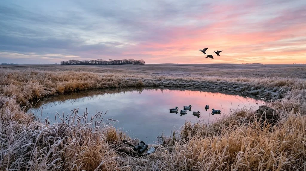
Frequently Asked Questions About Public Land Hunting in Minnesota
How much public hunting land is in Minnesota?
Minnesota has roughly 12 million acres of public hunting land when you combine WMAs (1.3 million), state forests (4 million), the Superior National Forest (3.9 million), the Chippewa National Forest (666,000), county and municipal forests (millions more), Walk-In Access private land, and National Wildlife Refuges. The northern third of the state has the largest contiguous concentration of public ground.
Can non-residents hunt deer in Minnesota?
Yes, but tag availability depends on the Deer Permit Area. Some DPAs allow non-resident tags to be issued over the counter. Many require a lottery draw with a separate allocation for non-residents. Non-resident firearms deer licenses run about $166, archery $88. Research your target DPA and apply during the correct window. Archery tags are generally easier to obtain than firearms tags for non-residents.
What is Walk-In Access in Minnesota?
Walk-In Access (WIA) is a voluntary program where private landowners enroll their property to allow public hunting access. Enrolled tracts are marked with yellow WIA signs and shown on the DNR Hunting Atlas. You can hunt these tracts on foot without permission from the landowner, but you can't drive on the enrolled land or camp. WIA lands are concentrated in farm-country regions and are excellent for pheasant, waterfowl, and deer hunting.
When is the best time to hunt public land deer in Minnesota?
Weekday archery between October 25 and November 10 gives you the best combination of rut activity and low pressure. The firearms opener (the first Saturday after November 4) is the highest-pressure day of the year on every public tract in the state. If you hunt during firearm season, days three through five produce well because the initial pressure wave pushes deer into predictable refuge areas that you can scout in advance.
Is Minnesota good for grouse hunting?
Minnesota is one of the best ruffed grouse states in the country. The northern forests from the Chippewa east through the Superior and the state forests in between hold strong grouse populations, especially in 5 to 15-year-old aspen cuts. The season runs from mid-September through January, and the best hunting coincides with the peaks of the 10-year population cycle. Check the DNR's annual drumming count survey for current population trends by region.
Can you camp on Minnesota WMAs?
No. Camping is not allowed on WMAs. For multi-day hunts, camp in nearby state forests (dispersed camping allowed), state park campgrounds, or private campgrounds. The national forests (Superior and Chippewa) allow dispersed camping up to 14 days. Plan your lodging before your trip, especially during firearms opener week when campgrounds fill up fast.
What are the best areas in Minnesota for big bucks?
The southeast bluff country (Winona, Houston, Fillmore, and Wabasha counties) produces the state's best antler growth and body weights. The Whitewater WMA, the Dorer Memorial Hardwood State Forest, and the surrounding WMAs and state forest tracts hold whitetails that compete with Iowa genetics. For a big-woods experience with mature bucks that grow old from lack of pressure, the northern state forests (Beltrami Island, Nemadji, and the Chippewa NF) reward hunters willing to go deep and hunt hard in low-density cover.
Does Minnesota have a moose season?
Yes, but it's extremely limited. Moose tags are issued through a once-in-a-lifetime lottery in the northeast corner of the state. The number of tags issued varies year to year based on population surveys and can be zero in some years. If tags are issued, the odds are very long. Apply if you want to, but don't plan a trip to Minnesota around moose. Plan around whitetail, grouse, and waterfowl, and apply for moose as a lifelong lottery ticket.
Want the full breakdown of Minnesota's WMAs and state forests with maps and species data, plus the same for all 50 states? Subscribe to the LandsToHunt newsletter below and get our free state-by-state public land hunting guides delivered to your inbox.
This guide includes affiliate links to tools and gear we recommend for hunting Minnesota's public land. LandsToHunt.com earns a commission on qualifying purchases.

Public Land Hunting in Missouri: Conservation Areas, the Ozarks, and 2.5 Million Acres of Opportunity
Missouri runs one of the best-funded public hunting programs in the country. More than 1,000 MDC conservation areas and 1.5 million acres of Mark Twain National Forest give DIY hunters 2.5 million acres of accessible ground. Here's your complete guide to the best properties, season structure, gear considerations, and how to find unpressured spots from the farm country north to the Ozark ridge country south.

Missouri runs one of the best-funded, best-managed public hunting programs in the country, and most out-of-state hunters have no idea how deep the access goes. The Missouri Department of Conservation (MDC) manages more than 1,000 conservation areas totaling roughly 1 million acres. Add the Mark Twain National Forest at 1.5 million acres across southern Missouri, and the state's total public hunting acreage pushes past 2.5 million. That's more accessible ground than most western states, sitting right in the heart of the best whitetail and turkey range in America.
Public land hunting in Missouri rewards the DIY hunter who shows up ready to work. The deer herd consistently ranks in the top ten nationally for Boone and Crockett entries. The spring turkey hunting is among the best in the country. Non-resident tags are over the counter. The archery season stretches from mid-September into mid-January. And the Missouri conservation areas hunting system gives you a network of properties spread across every county in the state, from the farm-country flats of the north to the Ozark ridge country in the south.
If you're looking for a state where you can buy a tag today and hunt quality whitetails on accessible public ground through a season that covers five months, Missouri belongs at the top of your list.
How Much Public Land Does Missouri Have for Hunting
The numbers break down better than most hunters expect:
MDC Conservation Areas: More than 1,000 areas totaling roughly 1 million acres, managed by the Missouri Department of Conservation. These range from 40-acre tracts to massive properties over 20,000 acres.
Mark Twain National Forest: ~1.5 million acres across nine ranger districts in southern and central Missouri, managed by the U.S. Forest Service
Army Corps of Engineers lands: Significant acreage around reservoirs like Truman, Stockton, Pomme de Terre, and Table Rock
National Wildlife Refuges: Mingo, Squaw Creek, and several smaller refuges offering seasonal hunting access
State parks with hunting: Select MDC-managed areas within or adjacent to state parks
The MDC conservation area system is the backbone of public land hunting in Missouri. The department funds itself primarily through a dedicated conservation sales tax that Missouri voters have renewed multiple times since 1976. That funding model means MDC conservation areas are actively managed for wildlife, not just left alone. Timber cuts, prescribed burns, food plots, and habitat work happen on a schedule across the system. The result is a healthier habitat and better hunting than you'll find on most state-managed public land in the country.
For licensing, Missouri residents pay about $12 for a small game hunting permit and $11 for a deer or turkey permit (plus $7 for additional antlerless tags). Non-residents pay $125 for a small game permit, $200 for a firearms deer permit, and $100 for an archery-only deer permit. All tags are over the counter. No draws, no preference points, no waiting for whitetail. Turkey permits run $25 resident and $125 non-resident for spring, with tags available over the counter.
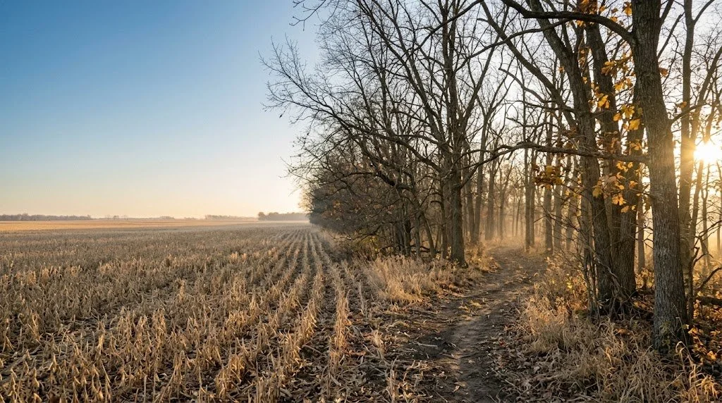
Top 12 Public Hunting Areas: The Best Missouri Conservation Areas and Beyond
Mark Twain National Forest (Eleven Point District)
Managing agency: U.S. Forest Service
Acreage: 200,000 (Eleven Point District)
Region: Oregon, Shannon, and Carter counties, south-central Missouri
Primary species: Whitetail, turkey, squirrel, grouse
Terrain: Ozark ridges, steep hollows, oak-hickory-pine mix, spring-fed creek drainages, karst topography with sinkholes and bluffs
Access: Open with a valid Missouri hunting permit. Dispersed camping allowed. Extensive forest road network.
Insider tip: The sinkholes and karst features scattered across the Eleven Point District create natural terrain funnels that topo maps make obvious. Deer travel the edges of sinkholes the way they travel creek bottoms elsewhere, following the rim where the ground transitions from flat to steep. Find a sinkhole with an oak-dominated overstory on the south side, and you've found a spot that holds both food and a travel corridor.
Peck Ranch Conservation Area
Managing agency: MDC
Acreage: 23,600
Region: Carter and Shannon counties, Ozarks
Primary species: Whitetail, turkey, elk (drawn only), black bear (limited)
Terrain: Rugged Ozark ridges, Current River watershed, mixed hardwood and cedar glades, pine plantations
Access: Standard MDC access. Some areas are restricted during elk season.
Insider tip: Peck Ranch is the epicenter of Missouri's restored elk herd, and elk tags are drawn through a lottery with very long odds. But the whitetail hunting on the property is excellent, yet it gets overlooked because everyone talks about the elk. The rugged terrain keeps casual hunters close to the roads, and the deer in the interior hollows see very little pressure after the first weekend of firearms season.
Deer Ridge Conservation Area
Managing agency: MDC
Acreage: 7,000
Region: Lewis County, northeast Missouri
Primary species: Whitetail, turkey, waterfowl, dove
Terrain: Rolling farm country, hardwood timber blocks, crop field edges, managed wetlands
Access: Good road access to multiple parking areas. Managed wetland units for waterfowl.
Insider tip: Northeast Missouri is the state's best farm-country deer region, and Deer Ridge sits in the middle of it. The timber blocks between agricultural fields create the kind of edge habitat that grows big deer. Hunt the funnels where narrow strips of timber connect larger hardwood blocks. During the rut, bucks cruise those corridors between doe groups bedded in separate timber pockets.
Rocky Creek Conservation Area
Managing agency: MDC
Acreage: 3,400
Region: Shannon County, Ozarks
Primary species: Whitetail, turkey, squirrel
Terrain: Steep Ozark ridges, rocky creek drainages, old-growth hardwood pockets, cedar glades
Access: Walk-in from perimeter parking. The interior is rugged and remote.
Insider tip: Rocky Creek is small enough that most hunters scan past it on the MDC map, and that's your advantage. The terrain is brutally steep, which keeps pressure low despite the relatively small acreage. Hunt the benches on the upper slopes where deer bed with a view downhill and escape routes along the contour. The old-growth oak pockets along the upper drainages produce mast that draws deer from the surrounding private ground.
Bob Brown Conservation Area
Managing agency: MDC
Acreage: 6,600
Region: Holt County, far northwest Missouri, along the Missouri River
Primary species: Waterfowl, whitetail, dove, turkey
Terrain: Missouri River bottomland, managed wetland impoundments, agricultural fields, cottonwood and willow flats
Access: Road access to levee roads and parking areas. Boat access for some wetland units.
Insider tip: Bob Brown is one of the best public land waterfowl destinations in the Central Flyway. The managed impoundments pull serious numbers of ducks and geese during migration. Midweek hunts in late November give you blinds that are standing-room-only on Saturdays. The deer hunting along the river timber gets overlooked because the property is known for ducks, and the bottleneck whitetail bucks that live in the narrow timber strips between the ag fields and the river see almost no hunting pressure.
Caney Mountain Conservation Area
Managing agency: MDC
Acreage: 8,100
Region: Ozark County, south-central Missouri
Primary species: Whitetail, turkey, black bear (limited), squirrel
Terrain: Some of the steepest terrain in Missouri. Deep hollows, sandstone bluffs, mature oak-hickory, shortleaf pine
Access: Gated interior roads. Walk into most of the properties.
Insider tip: Caney Mountain holds bears and big bucks for the same reason: the terrain is nasty enough to keep most hunters in their trucks. The interior hollows are 300-plus feet deep with slopes that test your legs and your will. If you're willing to drop into a hollow and hunt the benches and saddles on the far side, you'll find deer that haven't seen a human since last November. Bring the Danner Pronghorn boots. You'll need the ankle support and tread.
Schell-Osage Conservation Area
Managing agency: MDC
Acreage: 8,600
Region: Vernon and St. Clair counties, west-central Missouri
Primary species: Waterfowl, whitetail, turkey, quail, dove
Terrain: Managed wetlands, prairie, crop fields, scattered hardwood timber
Access: Good road access. Designated waterfowl blinds on managed pools.
Insider tip: Schell-Osage is a premier duck property, but the prairie edges between the managed pools hold coveys of wild bobwhite quail that get almost no hunting pressure. If you're a bird dog person, spend a January afternoon on the brushy prairie margins after the waterfowl crowd goes home. The quail hunting here is as good as public land quail gets in Missouri.
Indian Trail Conservation Area
Managing agency: MDC
Acreage: 4,400
Region: Callaway County, central Missouri
Primary species: Whitetail, turkey
Terrain: Mixed hardwood ridges, creek bottoms, brushy edges, agricultural borders
Access: Standard MDC access with several parking pull-offs.
Insider tip: Indian Trail sits in the transition zone between the Ozarks and the northern farm country, and deer densities here reflect the richer soils and better food base. The creek bottom that runs through the property creates a natural travel corridor with pinch points where the timber narrows between the creek and the adjacent ag fields. Set up at those pinch points during the rut.
Rudolf Bennitt Conservation Area
Managing agency: MDC
Acreage: 3,600
Region: Randolph County, north-central Missouri
Primary species: Whitetail, turkey, dove, quail
Terrain: Open grassland, brushy draws, timber blocks, agricultural edges
Access: Multiple access roads with pull-off parking.
Insider tip: Bennitt is smaller and less well-known than the big northern Missouri conservation areas, and the deer here benefit from lower pressure and proximity to surrounding agricultural ground. The brushy draws that cut through the grassland create natural travel corridors. Glass these draws from the high ground at first and last light with a pair of Vortex Diamondback HD 10x42 binoculars, and you'll find deer moving between bedding in the thick brush and feeding on the ag edges.
Mark Twain National Forest (Ava-Cassville-Willow Springs District)
Managing agency: U.S. Forest Service
Acreage: 400,000 combined across the three districts in southwest/south-central Missouri
Region: Taney, Christian, Douglas, Ozark, and surrounding counties
Primary species: Whitetail, turkey, squirrel, occasional bear
Terrain: Ozark plateau, white oak and red oak ridges, shortleaf pine, rocky creek bottoms, glade openings
Access: Extensive forest road network. Dispersed camping allowed throughout.
Insider tip: The glade openings on south-facing slopes throughout this part of the Mark Twain are natural food sources that deer use the way they use ag fields in the north. Glades grow native grasses, forbs, and browse that peak in nutritional value during early fall. Hunt the timber edges around these glades during September and October archery and you'll find deer still on predictable summer-pattern food sources while other hunters are sitting over acorns that haven't dropped yet.
Little Lost Creek Conservation Area
Managing agency: MDC
Acreage: 3,000
Region: Warren County, east-central Missouri
Primary species: Whitetail, turkey
Terrain: Mixed hardwood ridges, creek bottom, bluff faces, agricultural borders
Access: Walk-in from parking areas along the perimeter.
Insider tip: Little Lost Creek is close enough to the St. Louis metro that it gets attention during gun season, but the archery pressure is very manageable on weekdays. The creek corridor funnels deer movement through the property, and the bluff faces along the east side create natural pinch points that deer can't avoid. Set up below the bluff on a creek bend where a trail drops off the ridge and you've got a natural ambush that works with a west wind.
Settle's Ford Conservation Area
Managing agency: MDC
Acreage: 4,400
Region: Texas County, Ozarks
Primary species: Whitetail, turkey, squirrel
Terrain: Big Spring country. Deep hollows, spring-fed creek bottoms, mature oak forest, cedar breaks
Access: Walk-in to the interior. Gated roads limit vehicle access.
Insider tip: The spring-fed creek at the bottom of this property runs clear and cold year-round, and deer water there through every season. During dry years, when seasonal creeks on surrounding properties dry up, this permanent water source concentrates deer movement. Hunt the trails leading to water during September and October archery when water is still a daily need, and the summer pattern holds. A Muddy Matrix 2.0 cellular camera at the creek crossing tells you exactly when deer arrive.
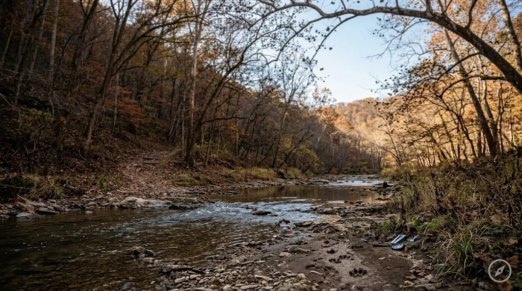
What You Can Hunt on Public Land in Missouri
Whitetail is the headliner. Missouri consistently ranks in the top ten nationally for total deer harvest and Boone and Crockett entries. The northern third of the state, roughly north of the Missouri River corridor, produces the largest antlers, driven by rich agricultural soils and diverse forage. The Ozarks produce slightly smaller deer on average, but offer a big-woods hunting experience with lower pressure and more solitude.
Turkey hunting in Missouri is elite. The state holds one of the largest Eastern wild turkey populations in the country, and the spring gobbler season draws hunters from across the Midwest. Nearly every MDC conservation area holds turkeys, and the Ozark ridges produce some of the most vocal, responsive birds you'll hunt anywhere.
Waterfowl hunters find strong public access on the Missouri River corridor, the managed wetlands at Bob Brown, Schell-Osage, Four Rivers, and Ted Shanks conservation areas, and around the major reservoirs. The Central Flyway pushes millions of ducks and geese through Missouri from October through January.
Small game includes squirrel (strong across the Ozark timber), rabbit, quail (recovering in the prairie regions), and dove. Feral hogs are present in parts of the Ozarks. MDC treats them as an invasive species and encourages harvest. You can take them year-round on MDC conservation areas during any open hunting season with no bag limit.
Missouri also offers a limited elk season at Peck Ranch (drawn tags), a growing black bear season in the southern Ozarks (drawn tags with preference points), and excellent trapping opportunities across the state.
Season Structure for Public Land Hunting in Missouri
Missouri's deer season structure favors the archery hunter:
Archery: Mid-September through mid-November, then reopens late November through mid-January. This covers the entire pre-rut, rut, and late season with a bow.
Firearms (November portion): 11 days starting the Saturday after Thanksgiving. Rifles are legal statewide. This is the one window where the woods get crowded.
Antlerless firearms: A short antlerless-only season early in November and again in late December.
Muzzleloader: One week immediately after the November firearms season.
Youth firearms: Two weekends, one before and one during the regular firearms season.
The 11-day firearms season is when Missouri conservation areas hunting gets the heaviest pressure. The archery season before and after firearms week draws a fraction of the crowd. If you can hunt weekday archery between October 15 and November 15, you'll have mature buck rut activity and minimal competition on most conservation areas.
Spring turkey runs from mid-April through early May, with separate youth and disabled hunter weekends preceding the general opener. Tags are available over the counter for residents and non-residents.
Bear season runs in October for a 10-day window with specific zone boundaries. Tags are drawn through a preference point system. Elk season at Peck Ranch issues a handful of tags annually through a separate lottery.
Access Tips for MDC Conservation Areas and Mark Twain National Forest
Telecheck is mandatory. Missouri requires electronic harvest reporting (Telecheck) for deer, turkey, and bear. Call or go online within 24 hours of harvest and before processing the animal. You'll get a confirmation number. Write it down and keep it with the animal. Wardens check.
No check-in system on most areas. Most MDC conservation areas don't require you to sign in before hunting. You park, walk in, and hunt. A few managed waterfowl areas require sign-in at the blind or marsh. Read the area-specific regulations page on the MDC website before your first trip.
Camping. Camping is allowed in designated areas of some MDC conservation areas, but many don't allow it at all. Check the specific area regulations. Mark Twain National Forest allows dispersed camping for up to 14 days, making it the best option for multi-day hunt-camp trips.
Rifles are legal for deer. Missouri allows centerfire rifles for deer hunting during the statewide firearms season. This is a big difference from neighboring Ohio, Indiana, and Illinois, which restrict firearms to shotguns or straight-wall cartridges. On public land, this means other hunters can reach out further, which affects deer behavior and your safety-zone planning.
Orange requirements. During firearms deer season, hunters must wear at least 400 square inches of blaze orange visible from all directions, including a hat. This applies to all hunters in the field during that window, even archery hunters.
Vehicle restrictions. In conservation areas, vehicles are restricted to designated roads and parking areas. Don't drive on gated roads, field edges, or two-tracks. Mark Twain has a more open road network, but many interior roads are seasonal or gated.
MDC Area Finder is your friend. The MDC website and app include a searchable database of all conservation areas with maps, acreage, species, regulations, and access points. Use it to filter by county, acreage, or species before your trip.
Gear Considerations for Public Land Hunting in Missouri
Missouri's terrain divides into two distinct environments, and your gear needs to handle both.
Ozark terrain boots. The southern half of Missouri is steep, rocky, and unforgiving on the ankles. Loose chert rock, cedar roots, and slippery creek crossings demand a boot with ankle support and aggressive tread. Danner Pronghorn in 400g or 800g handles the dry ridges. LaCrosse Alphaburly Pro handles the creek crossings and wet bottomland.
Farm country boots. Northern Missouri is flat, muddy, and wet in November. Rubber boots are the default for the farm-country conservation areas where you're walking through crop stubble and creek bottoms. The LaCrosse Alphaburly Pro covers this, too.
A mobile setup. MDC conservation areas don't require daily stand removal (unlike in Ohio), but most serious public-land hunters in Missouri run mobile anyway because the pressure shifts deer patterns week to week. A Tethrd Phantom saddle platform with sticks lets you adapt to where the deer are right now, not where they were opening weekend.
Binoculars. The Ozarks are tight timber where most shots happen under 40 yards, but the northern conservation areas sit in open farm country where glassing at 200 to 500 yards is standard practice. Vortex Diamondback HD 10x42 covers both situations and runs under $230.
A quiet outer layer. Whether you're brushing past cedar in the Ozarks or sitting at a timber edge in the north, a quiet outer shell matters. The KUIU Axis Hybrid jacket stays quiet against branches and sheds enough weather for Missouri's typically mild-to-cold November conditions.
Mapping app. onX Hunt with Missouri's conservation area boundaries loaded is essential. The MDC areas range from tiny 40-acre patches to 20,000-acre properties, and the boundaries on the small tracts are easy to miss on the ground. The digital line keeps you legal.
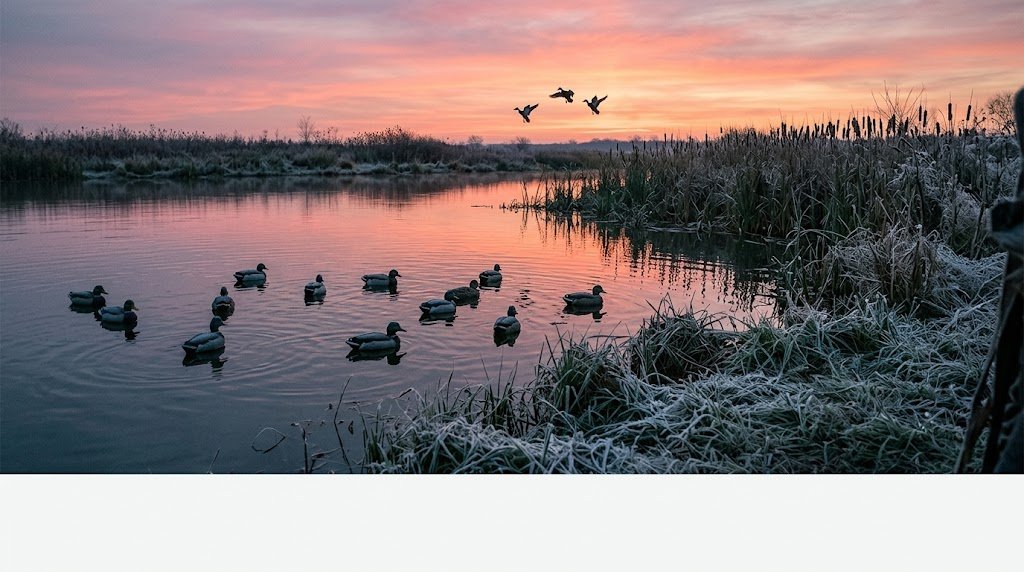
Finding Unpressured Ground on Missouri Conservation Areas
Missouri sells about 500,000 deer permits a year across a million acres of MDC land and 1.5 million acres of national forest. Pressure is real, especially during the November firearms season. Here's how to beat it.
Hunt the small areas. Everyone knows about the big conservation areas. The 10,000 and 20,000 acre properties show up on every list and draw the most hunters per acre. The 500 to 3,000-acre MDC areas scattered across every county get a fraction of the attention. Some of these small tracts sit in the best deer country in the state and see almost no hunting pressure during archery season. Use the MDC Area Finder to filter by acreage under 5,000 and look for tracts surrounded by agricultural land. Those are the ones that hold deer that feed on farms and bed on public ground.
Hunt the Ozark interior. On the Mark Twain National Forest and the big Ozark conservation areas, pressure drops off sharply past the first half mile from any road or parking area. The steep hollows, rocky creek crossings, and dense cedar breaks that most hunters avoid are exactly where mature deer retreat after opening weekend. Cross the creek, climb the far ridge, and hunt the terrain features the parking-lot crowd can't be bothered to reach.
Hunt weekday archery. Missouri's archery season runs from mid-September into mid-January with a break during firearms week. That's four-plus months of bow season. Midweek sits in any conservation area during October and November draws a fraction of the weekend pressure, and the deer respond to the lower disturbance by moving more freely during daylight.
For property-level terrain analysis before your trip, Hunting Scout builds interactive scouting reports from real USGS and NOAA data for any conservation area or national forest tract. The automated funnel detection and wind-scored stand picks give you a head start that takes locals years to build through boot scouting. Three free reports per month, no credit card required. [TODO LINK: e-scouting for deer hunting -> /field-notes/e-scouting-for-deer-hunting]
For properties you're considering for a lease or purchase adjacent to public ground, a drone-based assessment from ScoutFlight Hunting Assessments provides terrain, cover, and habitat analysis that boots-on-the-ground scouting alone takes multiple seasons to develop.
Frequently Asked Questions About Public Land Hunting in Missouri
How much public hunting land is in Missouri?
Missouri has roughly 2.5 million acres of public hunting land, combining MDC conservation areas (~1 million acres), the Mark Twain National Forest (~1.5 million acres), Corps of Engineers land, and National Wildlife Refuges. The MDC alone manages more than 1,000 individual conservation areas spread across every county in the state.
Do I need a special permit to hunt MDC conservation areas?
No. A valid Missouri hunting permit and the appropriate deer, turkey, or small game permit is all you need. There's no separate public land stamp or conservation area access fee. Some managed waterfowl areas have specific rules and blind assignments, but for deer, turkey, and small game, you park and hunt.
Can non-residents hunt Missouri public land?
Yes. Non-residents buy their permits over the counter with no draw or preference point requirements for deer and turkey. Non-resident firearms deer permits run $200, archery-only $100, turkey $125. You hunt the same conservation areas and national forest as residents with identical access. Missouri is one of the most non-resident-friendly states in the Midwest.
Can you use rifles for deer in Missouri?
Yes. Missouri allows centerfire rifles for deer hunting during the statewide November firearms season. There are no caliber restrictions. This sets Missouri apart from neighboring states like Ohio, Indiana, and Illinois, which restrict deer hunters to shotgun or straight-wall cartridge. On public land, be aware that rifle-equipped hunters nearby can shoot farther, which affects your safety planning and how deer respond to pressure.
Can you camp on MDC conservation areas?
It depends on the area. Some MDC conservation areas allow camping in designated spots, but many don't allow camping at all. Always check the specific area regulations on the MDC website before planning an overnight trip. The Mark Twain National Forest allows dispersed camping up to 14 days throughout the forest, making it the most flexible option for multi-day hunt-camp trips in Missouri.
When is the best time to hunt public land deer in Missouri?
The last week of October through the second week of November, during archery season. The rut is building and peaking, the archery crowd is a fraction of the firearms pressure, and mature bucks are moving during daylight. Weekday sits during this window on any MDC conservation area feels like private land compared to the Saturday after Thanksgiving.
What are the best counties for public land deer hunting in Missouri?
For trophy antlers on farm-country ground: Pike, Lincoln, Monroe, Shelby, and Macon counties in the northeast. For big-woods, lower-density mature bucks: Shannon, Carter, Oregon, and Texas counties in the Ozarks. For the best balance of deer quality and public access: Callaway, Gasconade, and Franklin counties in the central transition zone, where Ozark terrain meets farm country.
Does Missouri have elk or bear hunting on public land?
Yes to both, through limited-draw tags. Elk hunting takes place at Peck Ranch Conservation Area in Carter County, with a handful of tags issued annually through a lottery. Bear season runs 10 days in October in designated zones in the southern Ozarks, with tags drawn through a preference point system. Both require separate applications through the MDC. Start building bear preference points now if you're interested. The elk draw is a straight lottery with no preference.
Want the full breakdown of every MDC conservation area with maps and species data, plus the same for all 50 states? Subscribe to the LandsToHunt newsletter and get our free state-by-state public land hunting guides delivered to your inbox.
This guide includes affiliate links to tools and gear we recommend for hunting this state's public land. LandsToHunt.com earns a commission on qualifying purchases.
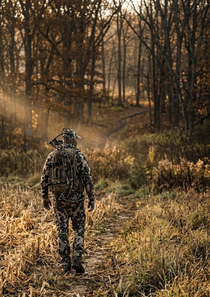
Public Land Hunting in Ohio: Big Deer, Big Opportunity, and How to Hunt the Buckeye State
Ohio holds 400,000 acres of public hunting land and grows whitetails that compete with anything in the Midwest. The state's no-rifle regulation and statewide antler restrictions produce bucks in the 140 to 160 class on public ground, and the archery season runs from late September into early February. Here's your complete guide to the Wayne National Forest, top wildlife areas, season structure, and how to find mature deer on the Buckeye State's most productive public tracts.
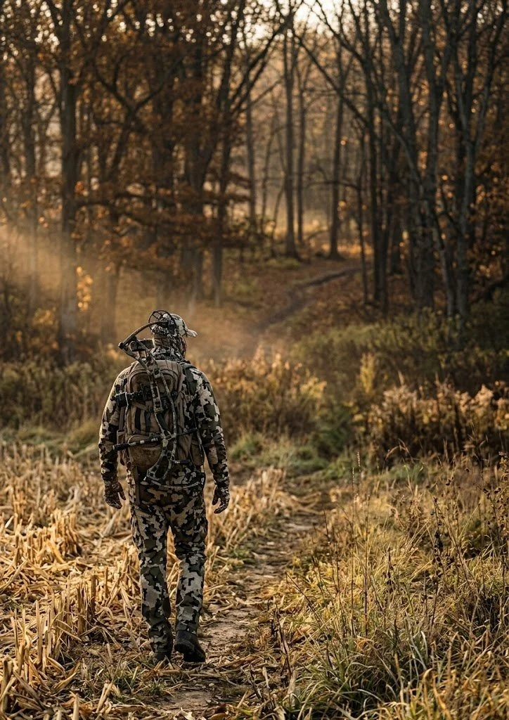
Ohio grows whitetails that compete with anything in the Midwest, and most of the country doesn't realize how much of that hunting happens on public ground. The state holds roughly 400,000 acres of public hunting land across wildlife areas, state forests, and the Wayne National Forest. The deer herd is managed with statewide antler restrictions and a firearms season limited to shotguns and straight-walled cartridges, which keeps the age structure healthier than in most neighboring states. Bucks in the 140 to 160 class come off public land in Ohio every year, and the archery season runs from late September into early February, one of the longest in the country.
Public land hunting in Ohio rewards the archer who's willing to learn the terrain. The southeast hill country, centered on the Wayne National Forest and surrounding wildlife areas, produces the state's best combination of mature bucks and low hunter density. The farm-country wildlife areas in the western and central regions have higher deer densities but face greater pressure. And the Lake Erie marshes give waterfowl hunters some of the best public access in the Great Lakes region.
If you're a DIY hunter looking for a state where you can buy a tag over the counter and hunt quality whitetails on accessible public ground through a season that stretches five months, Ohio belongs on your short list.
How Much Public Hunting Land Ohio Has
The breakdown of Ohio public hunting areas looks like this:
Wildlife Areas: More than 100 wildlife areas totaling roughly 200,000 acres, managed by the Ohio DNR Division of Wildlife
Wayne National Forest: 240,000 acres across three units in southeast Ohio, managed by the U.S. Forest Service
State Forests: Several state forests open to hunting, managed by the Ohio DNR Division of Forestry
Army Corps of Engineers lands: Tracts around reservoirs, including Deer Creek, Salt Fork, and Seneca
Metro parks and select nature preserves: Some allow controlled hunts through special permit programs
The Wayne National Forest is the centerpiece for DIY public land hunters. It's the only national forest in Ohio, and it sprawls across the unglaciated hill country of the southeast in three separate units: the Athens, Ironton, and Marietta. The terrain down there is steep, wooded, and very different from the flat farm country most people picture when they think about Ohio.
Licensing is straightforward. Ohio residents pay about $19 for a hunting license and $24 for a deer permit (one antlered, one antlerless per permit). Non-residents pay $149 for a hunting license and $40 for a deer permit. Tags are over the counter for both residents and non-residents. No draws, no preference points, no waiting. Turkey requires a separate permit ($28 for residents, $40 for non-residents). Waterfowl needs the federal duck stamp plus a state wetland habitat stamp.

Top 12 Ohio Public Hunting Areas for Deer and More
These are the properties that consistently produce for public land hunters across the state.
Wayne National Forest (Athens Unit)
Managing agency: U.S. Forest Service
Acreage: 74,000 (Athens Unit)
Region: Athens, Hocking, and Perry counties, southeast Ohio
Primary species: Whitetail, turkey, grouse, squirrel
Terrain: Steep wooded ridges, narrow hollows, oak-hickory forest, reclaimed mine land, small creek bottoms
Access: Open with a valid Ohio hunting license. Dispersed camping allowed. Extensive forest road and trail network.
Insider tip: The reclaimed mine land sections create open grassy areas surrounded by mature timber, and deer use these openings the way they use ag fields in farm country. Hunt the edges where reclaimed grassland meets standing hardwood, especially during early archery when deer are still on summer feed patterns. Most hunters walk the ridgetops and miss these openings entirely.
Wayne National Forest (Ironton Unit)
Managing agency: U.S. Forest Service
Acreage: 66,000
Region: Lawrence, Gallia, and Jackson counties
Primary species: Whitetail, turkey, squirrel
Terrain: Steep ridges, narrow bottoms, mature oak forest, laurel thickets on north-facing slopes
Access: Standard national forest access. Some interior roads are gated and seasonal.
Insider tip: The Ironton Unit is the least visited of the three Wayne units and holds bucks that see very little pressure outside of gun week. The terrain is steeper and the access is harder than the Athens Unit, which keeps the casual hunters out. Hunt the benches on the upper third of the ridges where deer bed with a view downhill.
Wayne National Forest (Marietta Unit)
Managing agency: U.S. Forest Service
Acreage: 98,000
Region: Washington, Noble, and Monroe counties
Primary species: Whitetail, turkey, grouse, squirrel
Terrain: Rolling hills, oak-hickory ridges, gas well roads, small stream valleys
Access: Good road network, including access roads to gas wells. Dispersed camping.
Insider tip: The gas well roads that crisscross the Marietta Unit give you access to interior terrain that would otherwise require long walks. Park at a locked gate and walk in on a gas road. The deer use these openings as travel corridors, and the two-track road edges hold browse that attracts feeding deer at first and last light.
Salt Fork Wildlife Area
Managing agency: Ohio DNR Division of Wildlife
Acreage: 19,000
Region: Guernsey County, east-central Ohio
Primary species: Whitetail, turkey, waterfowl, small game
Terrain: Rolling hills, mixed hardwood, pine plantations, Salt Fork Reservoir shoreline
Access: Multiple parking areas and road access. Adjacent to Salt Fork State Park.
Insider tip: Salt Fork is one of the most well-known Ohio WMA deer hunting destinations, and opening weekend pressure reflects it. The deer here are educated. Hunt weekdays during archery season and focus on the steep terrain between the reservoir fingers where the ground drops off sharply. Other hunters stick to the ridgetops and easy-walking pine plantations. The deer know that and bed in the steep stuff by day two of gun season.
Woodbury Wildlife Area
Managing agency: Ohio DNR Division of Wildlife
Acreage: 20,000
Region: Coshocton County
Primary species: Whitetail, turkey, grouse, waterfowl
Terrain: Steep wooded hollows, mature hardwood, creek bottoms, old strip mine reclamation areas
Access: Walk-in for most of the interior. Road access to perimeter parking areas.
Insider tip: Woodbury consistently produces mature bucks because the terrain discourages lazy hunting. The hollows are deep, and the climbs are real. Hunt the saddles connecting parallel ridges during the rut when bucks cruise between doe groups bedded on different drainages. A topo map makes these saddles obvious.
Shawnee State Forest
Managing agency: Ohio DNR Division of Forestry
Acreage: 63,000
Region: Scioto and Adams counties, far southern Ohio
Primary species: Whitetail, turkey, grouse, squirrel
Terrain: The most rugged terrain in Ohio. Deep ravines, sandstone cliffs, dense hardwood, rhododendron thickets
Access: Forest roads and hiking trails. Primitive camping available at designated sites.
Insider tip: Shawnee gets called "The Little Smokies" for a reason. The terrain is brutal, and the cover is thick. That combination produces deer that rarely see hunters past the first Saturday of gun season. If you can handle the hills and don't mind dragging a deer up a 400-foot elevation change, Shawnee rewards effort like few other public tracts in the Midwest.
Zaleski State Forest
Managing agency: Ohio DNR Division of Forestry
Acreage: 28,000
Region: Vinton County
Primary species: Whitetail, turkey, grouse, squirrel
Terrain: Deep hollows, oak-hickory ridges, hemlock ravines
Access: Backpack trail loops provide access to the remote interior. Horse camp and primitive camping are available.
Insider tip: The backpack trail system at Zaleski puts you deep into terrain that day-trippers from Columbus and Cincinnati never reach. Pack in for a two-day archery hunt during the first week of November and hunt the ridgetop saddles along the trail system. The deer in the interior of Zaleski see almost no hunting pressure during archery season.
Killdeer Plains Wildlife Area
Managing agency: Ohio DNR Division of Wildlife
Acreage: 8,600
Region: Wyandot County, northwest Ohio
Primary species: Waterfowl, pheasant (stocked), whitetail, dove
Terrain: Flat marshland, managed impoundments, agricultural fields, prairie grass
Access: Good road access. Designated parking areas. Waterfowl blinds on some units.
Insider tip: Killdeer Plains is the premier public land waterfowl spot in Ohio. The managed impoundments draw large numbers of ducks and geese during migration. Get there mid-week, and you'll have blinds to yourself that are standing room only on Saturday mornings. The pheasant stocking program also makes this one of the few places in Ohio where you can hunt roosters on public ground.
Grand River Wildlife Area
Managing agency: Ohio DNR Division of Wildlife
Acreage: 5,000
Region: Trumbull and Ashtabula counties, northeast Ohio
Primary species: Whitetail, turkey, waterfowl, pheasant (stocked), rabbit
Terrain: River bottomland, marshy wetlands, hardwood timber, brushy edges
Access: Multiple access points along the Grand River corridor.
Insider tip: The river bottom hardwood along the Grand River holds deer that feed on the ag fields bordering the wildlife area. Hunt the timber funnels between the river and the field edges during the rut. The narrow strips of cover squeeze buck movement into predictable travel lanes.
Crown City Wildlife Area
Managing agency: Ohio DNR Division of Wildlife
Acreage: ~22,000
Region: Gallia and Lawrence counties, far southeast Ohio
Primary species: Whitetail, turkey, grouse
Terrain: Reclaimed strip mine land, young hardwood regrowth, scrubby cover, steep grades
Access: Walk-in from designated parking. Interior is rugged and remote.
Insider tip: Crown City is reclaimed mine land that's growing back into excellent early successional habitat. The thick young cover holds deer and turkeys that rarely see pressure because the terrain is ugly and the walking is hard. Don't let the "reclaimed mine" label turn you away. The habitat quality here is better than a lot of mature timber tracts in the region.
Mosquito Creek Wildlife Area
Managing agency: Ohio DNR Division of Wildlife
Acreage: ~10,000
Region: Trumbull County, northeast Ohio
Primary species: Waterfowl, whitetail, turkey, rabbit, pheasant (stocked)
Terrain: Reservoir shoreline, managed wetlands, mixed hardwood and brush, ag field edges
Access: Road access around the reservoir. Boat access for waterfowl.
Insider tip: Mosquito Creek is primarily known for waterfowl, but the deer hunting on the wooded ridges above the reservoir gets overlooked. During archery season, the waterfowl hunters haven't shown up yet and the deer have the timber mostly to themselves. Hunt the transition between the hardwood ridges and the marshy reservoir edge where deer move to water in the evenings.
Tar Hollow State Forest
Managing agency: Ohio DNR Division of Forestry
Acreage: 16,000
Region: Ross and Vinton counties
Primary species: Whitetail, turkey, squirrel, grouse
Terrain: Deep hollows, sandstone outcrops, oak-hickory ridges, pine plantations
Access: Forest roads and hiking trails. Primitive camping at designated areas.
Insider tip: The pine plantations at Tar Hollow create thermal bedding cover that deer use heavily in late season when temperatures drop. Hunt the transition between the pine and the surrounding hardwood during the late muzzleloader and archery seasons. Deer bed in the warm pines and feed on the acorns in the adjacent hardwood.
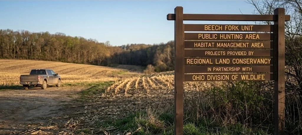
What You Can Hunt on Public Land in Ohio
Whitetail is the main draw, and Ohio delivers. The state consistently ranks in the top ten nationally for Boone and Crockett entries, and the statewide antler point restriction (at least four points on one side in most counties) pushes bucks past the 2.5-year-old mark before they become legal. That single regulation is why Ohio's public land buck quality outperforms neighboring states with more liberal harvest rules.
The state harvests between 180,000 and 200,000 deer in a typical season. The southeast hill country (Vinton, Athens, Hocking, Gallia, Lawrence counties) produces the best trophy potential on public ground, while the farm-country wildlife areas in the west and north hold higher deer densities with slightly younger age structure.
Turkey hunting is strong throughout the state, with a spring gobbler season running from late April through late May. Ohio's turkey population has expanded significantly over the past two decades, and nearly every wildlife area and state forest in the southeast holds huntable numbers. Fall turkey is also available in select counties.
Waterfowl hunters find the best public access on the Lake Erie marshes, the managed impoundments at Killdeer Plains and Mosquito Creek, and along the major river corridors. The western Lake Erie marshes are a migration corridor for ducks and geese that rivals anything in the Mississippi Flyway.
Small-game options include squirrel (common throughout the southeastern forests), rabbit, pheasant (stocked in select wildlife areas), grouse (limited but present in the hill country), and dove. Ohio also offers limited opportunities for bobcat (draw only) and river otter trapping.
Season Structure: Why Ohio Is an Archery State
Ohio's season structure is built around archery, which is the biggest advantage for DIY public-land hunters.
Archery: Late September through early February. That's roughly five months of bow season. The rut peaks in early to mid-November, which means you get the entire rut window during archery season with a fraction of the pressure that gun season brings.
Gun season: One week in late November/early December. Shotgun and straight-wall cartridge only (no centerfire rifles for deer). This short window concentrates pressure, and then it's over.
Muzzleloader: A short season in early January.
Youth gun: One weekend before the regular gun opener.
The gun-only restriction (no rifles) means the effective range of most deer hunters during firearms season is under 150 yards. That's important because it means deer don't get educated at long distances the way they do in rifle states. A mature buck that survives gun week in Ohio can still be killed at 25 yards with a bow in January because he hasn't been shot at from 300 yards across a field.
Turkey’s spring season runs from Saturday closest to the last Monday in April through late May. Tags come with a $28 resident or $40 non-resident permit. No draw required.
Ohio runs controlled hunts on select wildlife areas and metro parks for deer and other species. These require separate applications and are managed through the Ohio DNR website. The controlled hunts on metro park properties near Columbus, Cleveland, and Cincinnati often produce very good deer because the herds build up in suburban habitats with limited hunting pressure.
Access Tips for Public Land Hunting in Ohio
No check-in system in most areas. Ohio wildlife areas and state forests don't require hunter check-in. You park, walk in, and hunt. Harvest reporting is done online through the Ohio DNR Game Check system within 24 hours of the kill.
Vehicle access. In wildlife areas, vehicles are restricted to designated roads and parking lots. Don't drive on gated roads or field edges. The Wayne National Forest has a more open road network, but many interior roads are seasonal or gated.
Camping. Camping is not allowed on most Ohio wildlife areas. The Wayne National Forest allows dispersed camping (up to 14 days). State forests have designated primitive camping areas. If you're planning an out-of-state trip, book a nearby campground or plan around the Wayne for camping flexibility.
Blaze orange. Ohio requires a minimum of 400 square inches of blaze orange on the head, chest, and back during gun season. This also applies to anyone in the field during gun season, even if you're carrying a bow. Don't get caught without it.
Tree stand rules. You can use portable tree stands on public land in Ohio, but they must be removed at the end of each day in wildlife areas. The Wayne National Forest allows stands to remain up during the season,, but requires your name and address on each stand. Know the rules for the specific property you're hunting.
No baiting. Baiting for deer and turkey is illegal statewide. No corn piles, no mineral licks, no food-based attractants on public or private land.
Gear Considerations for Ohio
Ohio's terrain and climate vary enough between the hill country and the farm-country flatlands that your gear needs to flex. Here's what matters most.
Boots for steep terrain. The southeast hill country is the real deal. Steep ridges, loose shale, and slippery creek crossings demand boots with ankle support and aggressive tread. Danner Pronghorn handles the dry-ground ridge hunting well. For the creek bottoms and wet weather, the LaCrosse Alphaburly Pro with 800-gram insulation covers late-season cold and standing water.
A mobile stand setup. Ohio's daily-removal rule on wildlife areas means you're either carrying your stand in and out every sit or you're hunting saddle-style. Tethrd Phantom saddle platform is the go-to for mobile public land setups where you need to move light and fast. If you prefer a hang-on, keep it packable enough to carry in a stand bag with sticks every trip.
Mid-weight layering. Ohio archery runs from 70-degree September afternoons to single-digit January mornings. You need a system that covers all of it. First Lite’s Kiln Zip Off Long John serves as a foundation from October through January. Add the KUIU Axis Hybrid jacket as a quiet, weather-shedding outer layer for the November rut sits. For late-season cold, the First Lite Thermic insulated jacket handles long sits in the 10- to 20-degree range.
Good low-light optics. Ohio's thick hardwood timber means most shots happen under 30 yards, but a quality binocular helps you pick apart dark timber at first and last light when deer move. Vortex Diamondback HD 10x42 is the standard recommendation. Budget pick: Vortex Crossfire HD 10x42 at around $150.
Mapping app. onX Hunt with the Ohio layer shows you wildlife area boundaries, Wayne National Forest tracts, and the private-public lines that are critical in southeast Ohio,, where the national forest is broken into scattered parcels mixed with private land. Knowing exactly where you stand keeps you legal in a region where boundary signage is inconsistent.
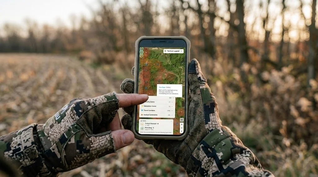
Finding Unpressured Spots on Public Land in Ohio
Ohio sells about 400,000 deer permits a year. That's a lot of hunters on 400,000 acres of public ground. Pressure management is the defining skill for public land hunting in Ohio.
The good news is that Ohio's pressure concentrates predictably. Gun week is the worst of it, a short, intense burst that pushes every casual hunter into the woods for seven days and then it's over. Archery season, by contrast, draws a fraction of the crowd spread over five months. If you hunt archery during the week, you're on functionally different ground than the weekend gun-season hunter.
In the Wayne National Forest, the scattered-parcel structure is your friend. The forest is broken into dozens of disconnected tracts mixed with private land. The big, easy-to-find tracts near the main ranger station and popular trailheads get the most pressure. The small, isolated parcels that require a mapping app to even locate, and a longer drive on township roads to access, hold deer that see very few hunters all season.
In wildlife management areas, push past the half-mile mark from any parking lot. Ohio's hill country is steep enough that most hunters don't walk far. Drop into a hollow, cross a creek, and climb to a bench or saddle on the far ridge. The deer you find there are on a different schedule than those within earshot of the parking area.
For property-level terrain analysis, Hunting Scout builds interactive scouting reports from real USGS and NOAA data for any public or private tract. Run a report on your target wildlife area before your trip and you'll find funnels and terrain features the topo alone won't show you. If you're evaluating a property adjacent to public ground for a lease or purchase, ScoutFlight Hunting Assessments gives you the aerial perspective and habitat analysis that walking the ground can take months to provide.
Frequently Asked Questions About Public Land Hunting in Ohio
How much public hunting land is in Ohio?
Ohio has roughly 400,000 acres of public hunting land, combining wildlife management areas (200,000 acres), the Wayne National Forest (240,000 acres), state forests, and Army Corps lands. The southeast hill country holds the largest concentrations of contiguous public ground.
Can you use a rifle for deer in Ohio?
No. Ohio does not allow centerfire rifles for deer hunting. The legal firearms are shotguns (slugs), straight-wall cartridges (.357 minimum through .50 caliber), muzzleloaders, bows, and crossbows. This regulation keeps the effective range short and is a major reason Ohio's buck age structure is so strong. Deer don't get shot at from 300 yards across a bean field.
Can non-residents hunt Ohio public land?
Yes. Non-residents buy a hunting license ($149) and a deer permit ($40) over the counter. No draws, no preference points, no non-resident quotas. You have access to the same wildlife areas, state forests, and national forests as residents. Ohio is one of the most non-resident-friendly states in the Midwest for public land deer hunting.
Can you camp in Ohio wildlife areas?
No. Camping is not allowed on most Ohio DNR wildlife areas. The Wayne National Forest allows dispersed camping up to 14 days. State forests have designated primitive camping areas. If you're planning a multi-day hunt in a wildlife management area, you'll need to find a nearby campground, state park campground, or private lodging.
Do you have to remove your tree stand daily on Ohio public land?
In wildlife management areas, yes. Portable stands must be removed at the end of each day. In the Wayne National Forest, stands can remain in place during the hunting season, but must have your name and address attached. On state forests, check the specific property rules. The daily-removal rule for wildlife areas makes saddle hunting and lightweight, mobile setups the standard approach for serious Ohio public-land hunters.
When is the best time to hunt public land deer in Ohio?
The first two weeks of November are during archery season. The rut is peaking, gun season hasn't started yet, and the midweek pressure is minimal. This is the window where mature bucks move during daylight on public ground in Ohio. If you can only hunt one week a year, pick the first week of November and hunt mornings and evenings from a mobile setup near a saddle or terrain funnel in the southeast hill country.
What are the best counties in Ohio for public land deer hunting?
For trophy potential: Vinton, Athens, Hocking, Gallia, and Lawrence counties in the southeast hill country, all of which have significant Wayne National Forest or state forest acreage. For higher deer density with more sightings: Coshocton (Woodbury, WA), Guernsey (Salt Fork, WA), and the farm-country wildlife areas in Wyandot, Crawford, and Marion counties. Your choice depends on whether you're optimizing for a mature buck or for more deer encounters.
Is Ohio WMA deer hunting worth it for out-of-state hunters?
Absolutely. Ohio's combination of over-the-counter non-resident tags, a five-month archery season, no-rifle regulations that protect buck age structure, and 400,000 acres of public hunting land makes it one of the best values in the Midwest for a DIY whitetail trip. The southeast hill country produces bucks that compete with those in Iowa and Kansas on accessible public ground, without a multi-year preference-point wait.
Want the full breakdown of every Ohio wildlife area and Wayne National Forest unit, plus the same for all 50 states? Subscribe to the LandsToHunt newsletter below and get our free state-by-state public land hunting guides delivered to your inbox.

How to Scout Public Land: Lessons from Hunters Who Live on Pennsylvania's State Game Areas
Most public land hunters skip scouting or treat it as a single walk-through the week before opener. The system that works breaks scouting into three phases: e-scouting from home to eliminate 90 percent of the property, targeted boots-on-the-ground trips to verify sign and access, and a light hunt-week check to confirm fresh activity and match spots to the forecast wind. Lessons from hunters who do this on Pennsylvania's most pressured State Game Land.
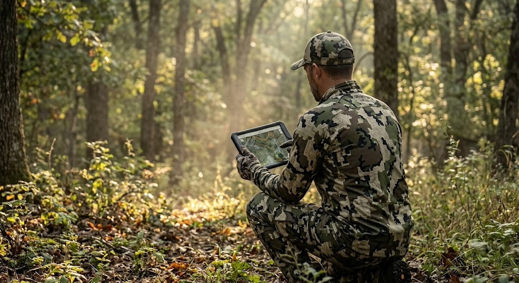
I've got a group of guys from Pennsylvania who treat scouting like a second job. They don't have leases. They don't have family farms. They hunt State Game Land and state forests alongside 900,000 other licensed hunters in a state where rifle opener shuts down school districts. And they consistently put deer on the ground, which makes people ask how they do it on public land.
The answer isn't luck. It's a scouting system they've refined over years of hunting some of the most pressured public ground in the eastern U.S. I've watched them work, hunted with them, and picked their process apart enough to know it translates to any public land in any state. But the examples here come straight from the ridges, laurel thickets, and hollows of Pennsylvania's game lands, because that's where these guys prove it works every fall.
The Core Concept: Scout in Layers, Not All at Once
The system breaks scouting into three phases, each one narrowing the focus so you're not wasting time walking ground that won't produce.
Phase 1: E-scouting. Done from home using mapping apps, satellite imagery, and topo data. The goal is to eliminate 90 percent of a property and zero in on 8 to 10 spots worth walking to.
Phase 2: Boots on the ground. Walk those 8 to 10 spots during the off-season and verify what the map showed you. Sign, cover density, access difficulty, and the stuff satellite images can't tell you. Cut the list to 3 or 4.
Phase 3: Hunt-week verification. A quick, low-impact check 2 to 5 days before you hunt. Fresh sign, wind options, and entry routes. You're not scouting anymore. You're confirming.
One of the guys put it simply: "I want to walk 200 acres with purpose, not 10,000 acres hoping to get lucky." That's the whole idea. Each phase filters out bad spots before you invest real boot leather in them.
Phase 1: E-Scouting from Home
Start with a mapping app. onX Hunt is the standard for public land because the boundary layers show you exactly where State Game Lands and state forest boundaries run. In Pennsylvania, game lands butt up against private land with minimal signage in a lot of places, and the boundary lines on the app keep you legal. Load your target property and toggle between satellite and topo views. You're looking for five things:
Saddles and passes on ridgelines. Pennsylvania's parallel Appalachian ridges create natural saddles where deer cross from one drainage to another. These show up clearly on topo maps as contour lines pinching together along the ridge. On SGL 76 in Clinton County, the guys found three saddles along a two-mile stretch of ridge that all funneled deer movement between a bedding slope and a feeding flat below.
Laurel thickets on north-facing slopes. On satellite imagery, mountain laurel appears as dark, dense patches that retain their green into winter. In PA's big woods country, these thickets are where pressured bucks bed because no one wants to fight through them. Flag the ones that sit on north-facing slopes with hardwood feeding areas nearby.
Benches on steep terrain. A bench is a flat or gently sloped shelf partway up a mountain. Deer use benches as travel corridors and bedding areas because walking a bench burns less energy than climbing the full ridge. They show up on topo maps as a wider spacing between contour lines on an otherwise steep slope.
Thick cover far from parking areas. Pull up the game lands map and note every parking pull-off and gated road. Then look for terrain features more than a mile from any of those access points. On SGL 12 in Schuylkill County, the reclaimed strip mine land on the far side of a gated road held deer and bears that the roadside hunters never reached.
Creek confluences and drainage heads. Where two small drainages merge, the terrain often creates a natural pinch point. Water, cover, and topography all concentrate deer movement at these spots. The PA big woods are full of unnamed feeder creeks that create funnels the map makes obvious, but the ground makes it hard to see through the timber.
Drop pins on every spot that hits. Don't edit yourself yet. You want 8 to 10 candidate locations. For a deeper digital read on terrain features, tools like Hunting Scout pull real geospatial data from USGS and NOAA and build an interactive scouting report for any piece of ground, public or private. The guys started experimenting with for me, running reports on their game lands tracts last year, and found funnels they'd walked past for seasons without noticing. I spent years learning to read contour lines and predict thermals on different terrain. Hunting Scout does that work for you, faster and more accurately than I can do it from a paper map, and shows you exactly what it means for every stand you've tagged.
Phase 2: Boots on the Ground
In Pennsylvania, the best time for this is late February through April. Snow is melting, leaves are down, and you can see terrain features and last fall's sign that summer growth buries. You're also far enough from hunting season that any disturbance you cause is forgotten by October.
Walk each pinned location. At each one, check four things:
Sign density. Rubs, scrapes, trails, beds, droppings, tracks. In PA's big woods, rub lines along ridge benches are the clearest indicator that bucks use a travel corridor consistently. Old rubs from the previous November still tell you something valuable in March. They tell you deer used this spot when it mattered. One of the guys marks every rub line he finds on his mapping app and looks for patterns across multiple seasons. The rub lines that show up in the same spots year after year are the ones worth hunting.
Cover quality at eye level. Satellite imagery shows you what's green and dark, but it can't tell you how thick the understory is at eye level. Pennsylvania laurel thickets that look impenetrable from above sometimes have openings at ground level where deer bed, with good sightlines downhill. Walk into the cover and see for yourself. Park-like timber with no understory isn't going to hold bedding deer after the first day of rifle season, no matter how good the topo looks.
Access difficulty. This matters more in PA than almost any other state because of the sheer hunter density during rifle season. How do you get to the spot without walking through bedding, crossing an open ridge, or making noise on a creek crossing? Can you approach from downwind in the dark? One of the guys maps his approach routes as carefully as he maps the stand locations. A great spot with a terrible entry is one you'll blow out on the first morning.
Pressure evidence. Look for other hunters' sign. Old stand straps on trees. Climbing stick scars. Flagging tape. Boot prints. In PA, every serious whitetail hunter on a State Game Lands tract gravitates toward the same obvious saddles and oak flats. If a spot has three sets of old sticks on trees within 100 yards of each other, it's been found. That doesn't mean you can't hunt it, but the deer there are educated.
After walking all your pins, you should have 3 to 4 spots you trust. For each one, note the best wind direction, the entry route you'd use in the dark, and exactly where you'd set up.
Phase 3: Hunt-Week Verification
Two to five days before your hunt, make a quick trip. Don't go deep. Don't walk through bedding. Stay on the edges.
You're looking for fresh scrapes opened up along trails, new rubs on trees that were clean two months ago, fresh tracks in soft dirt at creek crossings, and any change in cover since your last visit. In PA, this is also when you check whether a logging operation has started on or near your spot. State forests and game lands both run active timber harvests, and a fresh cut can completely change deer patterns overnight, sometimes for the better if the cut is recent enough that browse is already coming in.
Check the forecast. Match each spot to the wind. If you've got a northwest wind and your best saddle plays a south wind, hunt a different location. Never force a spot on a bad wind just because you found the most sign there.
A Concrete Scenario: How This Played Out on a State Game Lands Tract
One of the guys hunts a game lands tract in the north-central mountains, Potter County, deep, big woods. The property is about 8,000 acres of mixed hardwood ridges, hemlock ravines, and laurel-choked north-facing slopes. Access comes from two parking areas on a township road along the south boundary, and most hunters walk straight up the ridge from those lots and sit within a half mile of the road.
Hunt Scout showed a bench running east to west along the north face of the main ridge, about two-thirds of the way up. Below the bench, a laurel thicket covered the slope down to a small creek. Above the bench, open hardwood climbed to the ridgetop. A saddle crossed the ridge about 1.4 miles from the nearest parking area. On the satellite, the laurel was dense and dark. The bench showed as a band of slightly thinner canopy between the laurel below and the hardwood above.
March scouting confirmed everything. A heavy trail ran the length of the bench with rubs on both sides. Three beds in the laurel just below the bench, all on the downhill edge where deer could see below them and bail into the thicket behind them. A scrape line at the east end of the bench where it narrowed toward the saddle. No hunter sign. The 1.4-mile walk, the creek crossing, and the steep climb to the bench were keeping everybody out.
On a late-October archery hunt with a southwest wind, he parked at the east lot, crossed the creek 400 yards east of the bedding (downwind), and climbed the ridge on the east face rather than coming up the south slope where the bedded deer would see or smell him. He set up in a tree at the east end of the bench, where the scrape line converged with the bench trail near the saddle. The southwest wind carried his scent off the ridge to the north, away from both the bedding below and the trail along the bench.
A nice buck walked the bench trail at 7:40 AM, hit the scrape line, and stopped broadside at 22 yards. That spot has produced for three seasons since, and the only reason it still works is that the access keeps everyone else from finding it.
When to Scout: Season, Weather, and Terrain
E-scouting works any time. Do it in January while you're dreaming about next season. Do it in August when you're itching to get back in the woods. The more time you spend reading PA topo maps, the faster you get at spotting benches, saddles, and funnels.
Boots-on-the-ground scouting is best from late February through April. Pennsylvania's snow melt reveals trails, beds, rub lines, and scrape craters that summer growth erases. Leaves are down, so you can see terrain features and sight lines that are invisible in October.
This system works on every type of PA terrain. The big woods ridges of north-central PA, the ag-edge woodlots of Greene County, the reclaimed strip mine land in the coal region, the Pocono plateau, the rolling hardwood of the Alleghenies. The terrain features you're targeting change (saddles on ridges in Potter County vs. timber fingers between crop fields in Washington County), but the three-phase process stays the same.
Tools and Gear You Need
Mapping app.onX Hunt for State Game Lands and state forest boundaries, satellite/topo toggle, and offline maps. In PA, game lands boundary paint blazes can be hard to spot in thick timber. The digital line keeps you legal.
Binoculars. Vortex Diamondback HD 10x42 for reading terrain and sign from a distance during scouting trips. You want to glass a bench or a scrape line without walking through the middle of everything.
Rubber boots. LaCrosse Alphaburly Pro to minimize your scent footprint. PA scouting means creek crossings and wet laurel thickets on almost every trip.
Notebook or phone notes. Record wind direction, sign type and quality, access notes, and GPS coordinates for every spot. You'll forget the details if you don't write them down. One of the guys keeps a running notes file per game, going back five years. That data compounds.
Trail cameras (optional and risky on PA public land). Trail cameras on Pennsylvania State Game Lands disappear. Theft is common enough that the guys only run cellular models like the Muddy Matrix 2.0, so they don't have to walk into them. And they accept the reality that a camera on public ground is a temporary asset, not a permanent one.
The Three Biggest Mistakes When Scouting Public Land
Scouting the same ground that everyone else scouts
In Pennsylvania, the obvious saddles and oak flats within a quarter mile of every parking area get found by every hunter who walks in from that lot. The sign you're reading near the road is from deer that have already adjusted to human traffic. Push past the mile mark. Cross the creek. Climb the steep side of the ridge. In PA's big woods, the best scouting starts where the easy walking ends.
Scouting too close to hunting season
Walking through a State Game Lands tract the weekend before rifle opener, crashing through laurel thickets and bumping deer out of bedding, is not scouting. It's teaching deer exactly where you'll be. The guys do their heavy walking in late February and March. By the time archery opens in October, they already know where they're going. The fall visits are surgical. Get in, check fresh sign on the periphery, get out. Five minutes, not five hours.
Ignoring how other hunters access the property
Most PA public land hunters park at the pull-off, walk the easiest path uphill, and sit within half a mile. If you don't map that pressure pattern, you're competing with every other hunter on the property for the same deer. The guys map parking areas and trails the way they map deer sign. Once you see where the pressure concentrates, you see where the gaps are. And the gaps are where public land hunting gets good.
Advanced Application: Turning Pressure Into an Advantage
After scouting a PA game lands tract for two or three seasons, you start to understand how hunter pressure moves deer. On rifle opener, the wave of orange coats pushes deer off the easy-access ridges and into the thick, steep, ugly terrain that nobody wants to hunt. By day three, every deer that survived the first push is bedded in laurel, cedar swamp, or a steep-sided ravine far from any road.
One of the guys deliberately scouts for these pressure refuges rather than the spots that hold deer in October. He's not looking for where deer live during archery season. He's looking for where they go after 500,000 hunters hit the woods on the Monday after Thanksgiving. He scouts the nastiest, steepest, most laurel-choked terrain on the property, the stuff other hunters look at and keep walking. Then he hunts those spots on day three, four, and five of rifle season, when the rest of the woods is empty and the deer are stacked in the only cover that hasn't been walked through.
That's advanced scouting. You're not just reading deer sign. You're reading hunter behavior and deer response to that behavior, then positioning yourself where the math works in your favor.
For property-level terrain analysis showing where bedding, travel corridors, and pressure refuges intersect, Hunting Scout builds interactive reports from real USGS and NOAA data. The guys run reports on their public-lands tracts before the off-season scouting trips and use funnel detection to find spots they'd otherwise miss in the dense PA timber. For larger properties or tracts adjacent to public ground, a drone-based assessment from ScoutFlight Hunting Assessments gives you terrain and cover data that takes years of boot scouting to build.
Frequently Asked Questions
How far in advance should you scout public land?
Start e-scouting as early as you want. The best time for boots-on-the-ground scouting in Pennsylvania is late February through April, when snow is melting, leaves are down, and deer sign from the previous fall is still visible. This gives you a six-month gap between your heaviest disturbance and archery opener, long enough for deer to forget you were there.
How do you scout public land without bumping deer?
Wear rubber boots to minimize scent. Scout during midday when deer are bedded and least active. Stay on the edges of bedding cover, especially PA laurel thickets, rather than walking through the middle. Use binoculars to read sign from a distance. And do your heaviest scouting during the off-season, not the week before your hunt.
What should you look for when scouting public land for deer in Pennsylvania?
Focus on terrain features that concentrate movement: saddles on ridgelines, benches on steep slopes, pinch points where drainages merge, and transitions between habitat types like laurel and hardwood. Then verify with sign on the ground. The best spots in PA combine strong terrain features with heavy sign AND access that's difficult enough to keep the rifle-season crowd away.
Can you scout PA State Game Lands during hunting season?
Yes, and you should, but keep it light. Don't walk through your hunting spots during the season. Use what you learn while hunting to adjust. If deer are consistently moving through a funnel 200 yards from your setup, make a mental note and shift for your next sit. Mid-season scouting in PA is observation from the stand, not exploration on foot. Save the walking for February.

Public Land Hunting in Georgia: Your Guide to the Best WMAs in the Southeast
Georgia manages more than 100 Wildlife Management Areas covering over a million acres, and the quota hunt system gives DIY hunters access to properties that rival private leases. Here's your complete guide to the best WMAs, season structure, the draw system, and how to find unpressured ground from the Blue Ridge Mountains to the coastal plain.
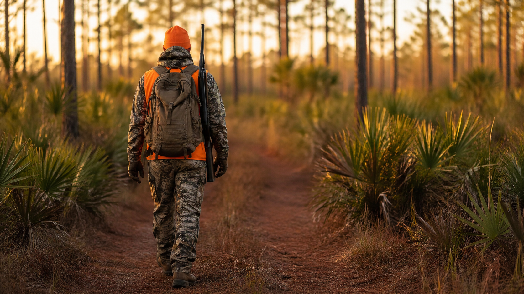
Georgia runs a public land hunting program that most hunters outside the Southeast don't take seriously, and that's their loss. The state manages more than 100 Wildlife Management Areas covering over a million acres, spread from the Blue Ridge Mountains in the north down through the Piedmont and into the coastal plain swamps along the Savannah and Altamaha rivers. The deer herd is strong, the turkey hunting is some of the best in the country, hog hunting is wide open, and the state offers public land access to species like alligator, quail on managed plantations, and coastal waterfowl that you won't find on public ground in most other states.
Public land hunting in Georgia rewards hunters who learn the state's quota hunt system. Georgia WMA hunting runs differently than the walk-in, hunt-anytime model you find in states like Pennsylvania or Wisconsin. Many of the best hunts are managed through a draw, with specific dates and limited tags. Once you understand how the system works and start applying strategically, Georgia gives you access to properties and deer herds that rival private land anywhere in the region.
How Much Public Land Does Georgia Have for Hunting
The numbers stack up better than most people expect:
Wildlife Management Areas: More than 100 WMAs totaling roughly 1 million acres, managed by the Georgia Department of Natural Resources, Wildlife Resources Division (GA DNR WRD)
Chattahoochee-Oconee National Forests: 866,000 acres across two national forests in north and central Georgia, managed by the U.S. Forest Service
National Wildlife Refuges: Several refuges, including Piedmont, Bond Swamp, Okefenokee, and Banks Lake, offer public hunting during specific seasons
Army Corps of Engineers lands: Scattered tracts around reservoirs like Hartwell, Clarks Hill, and Allatoona
State Parks with hunting: Select parks allow hunting in designated zones
Combined, you're looking at well over 1.5 million acres of public hunting land in Georgia. The WMA system is the centerpiece, but the national forests add massive acreage, especially in the mountain counties where the Chattahoochee stretches across some of the most rugged terrain in the eastern U.S.
Licensing is straightforward. Georgia residents pay $20 for a hunting license and $15 for a big game license (required for deer, bear, and turkey). Non-residents pay $150 for a hunting license and $75 for big game. Everyone hunting WMAs needs a free Georgia Outdoor Recreation Pass (GORP) and a WMA license ($19 for residents, $73 for non-residents). The WMA license is the key that opens the door to Georgia WMA hunting across every managed tract in the system. Quota hunt applications are submitted through the GA DNR GoOutdoorsGeorgia system, and most cost $5 to apply.

Top 12 Public Hunting Areas: The Best WMAs in Georgia and Beyond
These are the properties worth your time and application fees, covering every region of the state and a range of species.
Chattahoochee National Forest (Cohutta Wilderness and Rich Mountain Areas)
Managing agency: U.S. Forest Service
Acreage: 750,000 (entire forest), Cohutta Wilderness ~37,000
Region: Fannin, Gilmer, Murray, and surrounding mountain counties
Primary species: Whitetail, black bear, turkey, grouse, squirrel, hogs
Terrain: Steep mountain ridges, rhododendron-choked coves, hardwood slopes, laurel thickets, high-elevation creek drainages
Access: Open with a valid Georgia hunting license. No WMA license required for national forest land outside WMA boundaries. Dispersed camping allowed.
Insider tip: The Cohutta Wilderness is walk-in only with no motorized access, and most hunters don't go deeper than the first mile. Pack in two to three miles on Jacks River Trail and hunt the oak flats above the creek bends. Bear and mature bucks hold in the coves where nobody wants to drag an animal out.
Cedar Creek WMA
Managing agency: GA DNR WRD
Acreage: 30,900
Region: Putnam, Jones, and Jasper counties, central Georgia Piedmont
Primary species: Whitetail, turkey, feral hogs, small game
Terrain: Piedmont hardwood ridges, loblolly pine plantations, Lake Oconee shoreline, creek bottoms
Access: WMA license required. Mix of quota and non-quota hunts. Multiple boat ramps and road access points.
Insider tip: Cedar Creek holds some of the better bucks on public ground in central Georgia. The fingers of hardwood running between pine plantations create natural travel corridors during the rut. Hunt the transition zones between pine and hardwood, not the pine interior.
B.F. Grant WMA
Managing agency: GA DNR WRD
Acreage: 2,085
Region: Putnam County
Primary species: Whitetail (quality bucks), turkey
Terrain: Mixed Piedmont hardwood and pine, food plots, managed habitat
Access: Quota hunts only. Very limited tags.
Insider tip: B.F. Grant is a managed showcase property and one of the best WMAs in Georgia for quality bucks. The draw odds are tough, but the property produces deer in the 130-plus class regularly on public ground. Apply every year. When you draw, you're hunting a property managed like a private lease.
Chickasawhatchee WMA
Managing agency: GA DNR WRD
Acreage: 19,800
Region: Baker, Calhoun, and Dougherty counties, southwest Georgia
Primary species: Whitetail, turkey, feral hogs, quail
Terrain: Longleaf pine flatwoods, cypress swamp, hardwood hammocks, palmetto understory
Access: WMA license required. Non-quota archery and some quota gun hunts.
Insider tip: Southwest Georgia is quail country, and Chickasawhatchee's managed longleaf and wiregrass ecosystem holds wild birds that most public land in the state can't match. Bring a dog and spend a January morning on the pine flats. Deer hunting is good, but quail hunting is what makes this property special.
Altamaha WMA
Managing agency: GA DNR WRD
Acreage: 36,000
Region: Appling, Tattnall, Toombs, and Jeff Davis counties, southeast Georgia
Primary species: Whitetail, turkey, feral hogs, waterfowl
Terrain: River swamp, bottomland hardwood, pine uplands along the Altamaha River corridor
Access: WMA license required. Boat access opens up the best swamp hunting. Some areas flood seasonally.
Insider tip: Altamaha is big, wet, and intimidating, which is exactly why it holds good deer. The river swamp bucks bed on high-ground islands within the floodplain. Use a boat to access the river corridor and hunt the hardwood ridges that rise out of the swamp. A lot of hunters stick to the pine uplands and miss the best ground entirely.
Dawson Forest WMA
Managing agency: GA DNR WRD
Acreage: 10,200
Region: Dawson County, north Georgia foothills
Primary species: Whitetail, turkey, bear, hogs, squirrel
Terrain: Mountain foothills, hardwood coves, pine ridges, creek bottoms
Access: WMA license required. Heavily used by hikers and mountain bikers on the Amicalola tract, so scout hunting sections separately.
Insider tip: Dawson Forest is close to Atlanta and gets hammered on weekends. Weekday archery hunts in October are a different experience. The bike trail traffic pushes deer into the north-facing coves by mid-morning, and those coves hold animals that don't see hunters during archery season.
Di-Lane WMA
Managing agency: GA DNR WRD
Acreage: 8,700
Region: Burke County, east-central Georgia
Primary species: Whitetail, turkey, dove, quail, rabbit
Terrain: Managed pine plantation, agricultural fields, hardwood drains, dove fields
Access: WMA license required. Popular dove field draws and small game hunting.
Insider tip: Di-Lane's managed dove fields are some of the best public land dove hunting in the Southeast. The draws fill up fast, so apply early. Outside of dove season, the hardwood drains between the pine blocks hold deer that see almost no pressure once small game season winds down.
Cohutta WMA
Managing agency: GA DNR WRD
Acreage: 95,600
Region: Murray and Fannin counties, extreme north Georgia
Primary species: Whitetail, bear, turkey, hogs, grouse, squirrel
Terrain: Mountain ridges, cove hardwood, high-elevation oak forests, rhododendron thickets
Access: WMA license required. Overlaps with Cohutta Wilderness (national forest). Mix of quota and non-quota hunts.
Insider tip: Cohutta WMA is the best public land bear hunting in Georgia, and the acorn crop drives everything. Check the Forest Service oak mast survey in September and hunt the ridges where white oak is dropping. Bear season overlaps with deer, so you can sit in a stand with two tags in your pocket.
Sapelo Island WMA
Managing agency: GA DNR WRD
Acreage: 8,240
Region: McIntosh County, Georgia barrier island
Primary species: Whitetail, feral hogs
Terrain: Maritime forest, salt marsh, live oak hammocks, palmetto flats
Access: Quota hunts only. Ferry access from the mainland. Very limited tags.
Insider tip: Sapelo Island is a once-in-a-lifetime public land experience. The hunt is as much about the setting as it is about the deer. Bucks here are smaller-bodied than mainland Georgia deer, but you're hunting live oak hammocks on a barrier island with no vehicle traffic and no outside pressure. Apply every year. The experience alone is worth the trip.
Oconee National Forest (including Redlands WMA)
Managing agency: U.S. Forest Service / GA DNR WRD (Redlands)
Acreage: 116,000 (Oconee NF total)
Region: Greene, Morgan, Putnam, Jones, and Jasper counties, central Georgia
Primary species: Whitetail, turkey, hogs, small game
Terrain: Piedmont pine and hardwood, creek bottoms, old-growth pockets, lake edges
Access: National forest land open with a hunting license. Sections of the Redlands WMA require a WMA license and follow quota schedules.
Insider tip: The Oconee is broken into scattered tracts mixed with private land, which creates edge habitat that holds more deer per acre than the big contiguous mountain forests. The small, isolated tracts that are hard to find on a map are the ones that hold unpressured deer. A mapping app makes these scattered parcels findable.
Ossabaw Island WMA
Managing agency: GA DNR WRD
Acreage: 11,800
Region: Chatham County, coastal barrier island south of Savannah
Primary species: Whitetail, feral hogs
Terrain: Maritime forest, marsh edges, palmetto, live oak canopy
Access: Quota hunts only. Boat access from the mainland.
Insider tip: Ossabaw holds a very healthy hog population, and the hog hunts draw fewer applicants than the deer hunts. If you want to get on the island and experience coastal Georgia hunting, the hog hunt is your best bet. The island is also one of the few places in Georgia where you can hunt truly feral hogs in a wild barrier island setting.
Rum Creek WMA
Managing agency: GA DNR WRD
Acreage: 9,200
Region: Monroe County, central Georgia
Primary species: Whitetail, turkey, hogs
Terrain: Mixed Piedmont hardwood and pine, power line cuts, creek drains
Access: WMA license required. Quota and non-quota hunts.
Insider tip: Rum Creek sits in one of the better deer density zones in the Piedmont, and the power line rights-of-way cutting through the property create browse and travel corridors that funnel deer movement. Set up where a power line crosses a creek bottom, and you've got a natural pinch point.
What You Can Hunt on Public Land in Georgia
Whitetail is the primary draw, and Georgia's deer herd is healthy across all three physiographic regions. The Piedmont and coastal plain produce the best body weights and antler growth because the soils are richer and the food is more diverse. Mountain deer are smaller-bodied but offer a big-woods hunting experience that appeals to a different kind of hunter.
Turkey hunting in Georgia is excellent. The state holds a strong Eastern turkey population, and the spring gobbler season runs from late March through mid-May. Public land turkey hunting on Georgia WMAs is some of the best in the Southeast, especially on the Piedmont and coastal plain properties where mixed hardwood and open ground create ideal strut habitat.
Feral hogs are open year-round on most WMAs during any legal hunting season, and there's no bag limit. Hogs are thick on the coastal plain and river swamp WMAs, and they're a great reason to get on new ground during the off-season or during small game hunts.
Black bear hunting is available in the north Georgia mountains through a limited season in September and October. Cohutta WMA and the surrounding Chattahoochee National Forest are the primary bear zones.
Waterfowl hunting hits on the coastal WMAs and along the major river corridors. Altamaha, the Savannah River corridor, and a handful of managed duck impoundments on WMAs give you public access to wood ducks, teal, and migrating mallards.
Alligator hunting is drawn on select WMAs and is one of Georgia's most unique public land opportunities. Tags are limited, and the draw is competitive, but someone pulls a tag every year.
Small game, including squirrel, rabbit, dove, and quail (wild birds on managed properties like Chickasawhatchee and Di-Lane), round out a species list that's deeper than most states can offer.
Season Structure and the Quota Hunt System
Georgia's deer season runs roughly from early September (archery) through mid-January (firearms), with exact dates varying by region. The state is divided into three deer season zones, each with its own opener and closer. Firearms season generally runs from mid-October through mid-January, depending on the zone.
Turkey spring season opens in late March and runs through mid-May. Fall turkey is available in select counties during a limited season.
The quota-hunt system is the defining feature of hunting in Georgia WMAs. Many of the best WMAs allocate deer, turkey, dove, waterfowl, and bear hunts through a drawing. You apply through the GoOutdoorsGeorgia system, pick your preferred hunts, and wait for results. Application fees are small, usually $5 per application. Draw results post several weeks before the hunt dates.
Non-quota hunts run on many WMAs during general season dates and don't require a draw, just a WMA license and the appropriate game license. These hunts get more pressure but still produce for hunters willing to work away from the crowds.
Dove field draws on managed WMAs like Di-Lane, which are a Georgia tradition and fill up fast. Apply early in the summer when applications open.
Access Tips for Georgia WMA Hunting
Georgia's WMA system has some specific rules that trip up out-of-state hunters and even some locals who haven't read the fine print:
Check-in and check-out. Most Georgia WMAs require you to check in at a sign-in board before hunting and check out when you leave. Some use physical kiosks at entry points. Others use the GoOutdoorsGeorgia app. Missing a check-in is a finable offense. Don't skip it.
Vehicle restrictions. On many WMAs, vehicles are restricted to designated roads only. Gates are locked on interior roads during certain seasons. If a gate is closed, walk. Getting your truck stuck behind a locked gate on a WMA is a bad day.
Camping. Camping rules vary by WMA. Some allow primitive camping in designated areas, some don't allow camping at all. Check the specific WMA regulations page on the GA DNR website before you plan an overnight trip. The national forests in north Georgia allow dispersed camping without restriction.
Orange requirements. During firearms deer seasons on WMAs, Georgia requires at least 500 square inches of fluorescent orange above the waist, including a hat. That's more than most states require, so check your gear before you go.
Harvest reporting. Georgia requires same-day electronic harvest reporting for deer, turkey, and bear through the GoOutdoorsGeorgia system. Report before you move the animal from the WMA.
Dog hunting. Dog hunting for deer is allowed on some WMAs during specific quota hunts. If you're a still-hunter or stand hunter and don't want dogs running through your area, check the WMA schedule and avoid dog hunt dates.
Gear That Works for Georgia's Terrain and Climate
Georgia's hunting seasons span from 90-degree September archery opens to 25-degree January mornings in the north Georgia mountains. Your gear has to flex across a huge temperature range and handle everything from swamp water to mountain rock.
Early-season heat management. September and October archery in Georgia is hot. Lightweight, breathable camo is mandatory. A moisture-wicking base layer like Sitka’s Core Lightweight base layer keeps you functional when it's 85 degrees at first light. Bring more water than you think you need. Heat kills hunts faster than anything in the Georgia woods.
Snake protection. Rattlesnakes, copperheads, cottonmouths. Georgia has all of them, and they're active well into November in the southern half of the state. Snake boots or gaiters are non-negotiable on any WMA south of Atlanta. LaCrosse Alphaburly Pro handles both the snakes and the swamp water on coastal plain properties.
Rubber boots for swamp WMAs. The river, swamp, and coastal WMAs like Altamaha and Ossabaw require wading through standing water. A knee-high rubber boot that drains and dries is your best friend. The LaCrosse Alphaburly Pro works here too, or go with a cheaper rubber boot you don't mind sacrificing to the mud.
Quiet outer layers for Piedmont hardwoods. Piedmont WMA deer hunting often means close encounters in mixed hardwood where sound carries. The KUIU Axis Hybrid jacket is quiet against branches and sheds enough weather for Georgia's mild winters. For a budget-friendly alternative, the First Lite Catalyst breathes well for active hunting.
Optics. Georgia timber is tight in the mountains and the Piedmont, but the coastal plain and pine plantations offer longer sightlines. A mid-range binocular like the Vortex Diamondback HD 10x42 covers both situations. Budget pick: the Vortex Crossfire HD 10x42 at around $150 gets the job done without hurting your wallet.
Mapping app.onX Hunt is essential for Georgia WMA hunting. WMA boundaries, property lines, and the scattered Oconee National Forest tracts are all loaded in. Knowing exactly where WMA land ends and private land begins prevents trespassing in a state where boundaries aren't always well-marked on the ground.
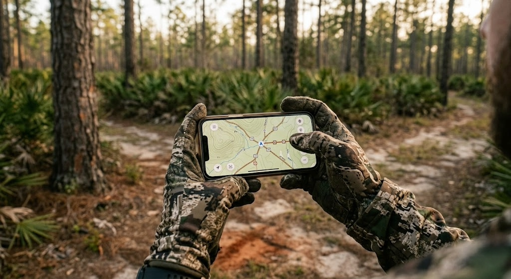
Finding Unpressured Ground on Georgia's Best WMAs
Georgia WMA hunting gets pressured, especially on the WMAs close to Atlanta, Macon, and Savannah. The opening weekend of firearms season on any accessible WMA will have trucks parked at every pull-off, and hunters spaced every 100 yards along the easy-walk ridges.
Your edge is distance and difficulty. On every Georgia WMA, pressure drops off dramatically past the first half mile from any road or parking area. Swampy creek bottoms that require a wade, steep north-facing coves in the mountains, and the far side of pine blocks away from any two-track all hold deer that see a fraction of the pressure.
E-scouting is the way to find these spots before you spend gas and boot leather. Pull up satellite imagery and look for three things: thick cover pockets surrounded by open pine (deer bed there), creek confluences with hardwood bottoms (deer feed and travel there), and any terrain feature that makes access difficult from the nearest road (deer survive there).
onX Hunt lets you layer WMA boundaries over topo and satellite imagery so you can plan approach routes that keep you on public ground while targeting spots other hunters won't reach. For a deeper analysis of bedding, travel, and food sources on a specific WMA or an adjacent tract you're considering, Hunting Scout uses AI to break down what a property is telling you about deer movement before you ever walk it.
Timing is the other lever. Non-quota hunts during the middle of the week see a fraction of the weekend pressure. If you can take a Tuesday or Wednesday off, you're hunting different ground than the Saturday crowd. Early archery season in September also draws far fewer hunters than the firearms opener, and deer patterns remain predictable around summer food sources.
Frequently Asked Questions About Public Land Hunting in Georgia
How much public hunting land is in Georgia?
Georgia has more than 1.5 million acres of public hunting land. When you combine WMAs (over 1 million acres), the Chattahoochee-Oconee National Forests (866,000 acres), National Wildlife Refuges, and Corps of Engineers land. The WMA system alone covers more than 100 managed properties across every region of the state.
What is a Georgia quota hunt?
A quota hunt is a drawn hunt on a specific WMA during specific dates with a limited number of hunters. You apply through the GoOutdoorsGeorgia system, pay a small application fee (usually $5), and wait for draw results. Quota hunts manage pressure and often produce better hunting quality than non-quota general season hunts. Some of the best WMAs in Georgia, like B.F. Grant and Sapelo Island are quota-only properties.
Do I need a WMA license to hunt Georgia's national forests?
No. If you're hunting Chattahoochee or Oconee National Forest land that is NOT also designated as a WMA, you only need a valid Georgia hunting license and the appropriate game license. If the national forest tract overlaps with a WMA (like Cohutta WMA inside the Chattahoochee), you need the WMA license for those areas.
Can non-residents hunt Georgia WMAs?
Yes. Non-residents buy a non-resident hunting license ($150), a big game license ($75), and a non-resident WMA license ($73). You're eligible for the same quota hunt draws and non-quota hunts as residents. There are no non-resident restrictions on which WMAs you can hunt.
What are the best WMAs in Georgia for big bucks?
B.F. Grant WMA (quota only, Putnam County) is the state's showcase quality-managed property. Cedar Creek WMA, Rum Creek WMA, and the Piedmont WMAs in general produce the best combination of antler growth and deer density. For the coastal plain, Chickasawhatchee and Altamaha hold good bucks in terrain that discourages casual hunters.
Is dog hunting allowed on Georgia WMAs?
Dog hunting for deer is permitted on select WMAs during specific quota hunt dates. The GA DNR WMA regulations booklet lists which properties and dates allow dog hunting. If you prefer to still-hunt or sit in a stand, check the schedule and plan your hunts around non-dog dates.
Can you camp on Georgia WMAs?
Camping rules vary by WMA. Some allow primitive camping in designated areas, and a few have established campgrounds nearby. Many WMAs don't allow camping at all. Always check the specific property regulations on the GA DNR website before planning an overnight stay. The Chattahoochee National Forest in north Georgia allows dispersed camping without a permit, which makes it the easiest option for hunt-camp trips.
When is the best time to hunt Georgia WMAs for deer?
The rut in Georgia generally peaks from late October through late November, with slight regional variation (earlier in north Georgia, later in the coastal plain). Early archery season in September offers low pressure and predictable deer on food sources. Mid-week non-quota hunts during November hit the sweet spot of rutting activity and low hunter density. For the least crowded experience, avoid the first week of firearms season on any accessible WMA.
Want the full breakdown of every Georgia WMA with quota hunt details, plus the same for all 50 states? Subscribe to the LandsToHunt newsletter below and get our free state-by-state public land hunting guides delivered to your inbox.
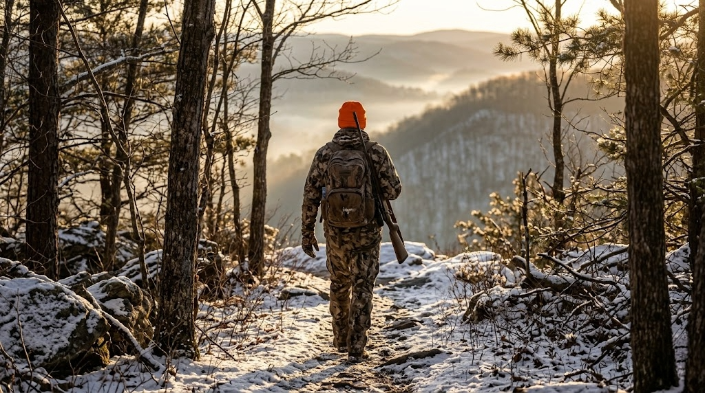
Public Hunting Land in Pennsylvania: Your Complete Guide to 4.7 Million Acres
Pennsylvania holds 4.7 million acres of public hunting land across State Game Lands, state forests, and the Allegheny National Forest. Here's your complete guide to the best tracts, season structure, access rules, and how to find unpressured ground in one of the most hunter-dense states in the country.

Pennsylvania doesn't get mentioned in the same breath as Iowa or Illinois when whitetail hunters start trading dream-state lists. That's a mistake. The state holds roughly 4.7 million acres of public hunting land, one of the highest totals east of the Mississippi, and the deer herd runs deep enough that hunters harvest around 300,000 whitetails in a typical year. Add a gobbler population pushing 300,000 birds, legit black bear hunting, elk draws, and a small game tradition that stretches back generations, and you're looking at one of the most well-rounded public land hunting states in the country.
The backbone of public hunting land in Pennsylvania is the State Game Lands system, which comprises 1.5 million acres across more than 300 tracts managed by the Pennsylvania Game Commission. But that's just one piece. National forests, state forests, Army Corps land, and state parks with hunting programs push the total well past what most hunters think is available. If you can read a map and don't mind walking past the parking lot crowd, Pennsylvania rewards effort in a way few eastern states can.
How Much Public Hunting Land Pennsylvania Holds
The numbers break down like this:
PA State Game Lands: 1.5 million acres across 300+ tracts, managed by the Pennsylvania Game Commission (PGC)
State forests: 2.2 million acres across 20 state forest districts, managed by the PA Department of Conservation and Natural Resources (DCNR)
Allegheny National Forest: 513,000 acres in the northwest, managed by the U.S. Forest Service
Army Corps of Engineers projects: Scattered tracts around reservoirs statewide
State parks allowing hunting: Select parks with designated hunting zones
The state forest acreage is the part most out-of-state hunters miss. PA's state forests are open to hunting with a valid license, and they're massive. Combined with game lands, you're looking at 3.7 million acres just between those two systems. The Allegheny National Forest pushes it past 4 million, and everything else fills in around the edges.
For licensing, Pennsylvania residents pay about $20.97 for a general hunting license. Non-residents pay $101.97. Archery and muzzleloader stamps run $16.97 each for residents, $36.97 each for non-residents. A bear license is an add-on for $16.97 for residents and $36.97 for non-residents. Turkey tags come with the general license (one spring, one fall). Migratory bird stamps and the federal duck stamp are required for waterfowl. You'll want a Pennsylvania hunting map from the PGC website or a digital version through a mapping app to see how game lands, state forests, and national forest tracts stitch together across the state.
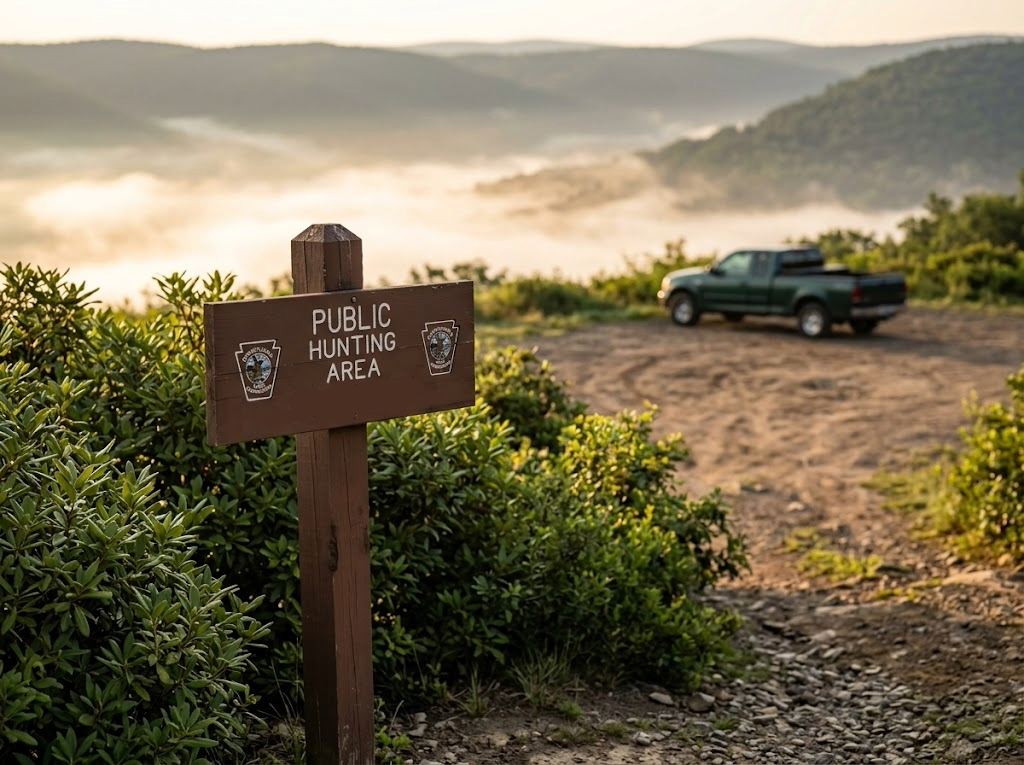
Top 12 Public Hunting Areas in Pennsylvania
These are the tracts worth building a strategy around, whether you're a Pennsylvania resident or an out-of-state hunter looking for serious public ground.
Allegheny National Forest
Managing agency: U.S. Forest Service
Acreage: 513,000
Region: Warren, McKean, Forest, and Elk counties (northwest PA)
Primary species: Whitetail, black bear, turkey, grouse, squirrel
Terrain: Northern hardwood plateau, deep stream gorges, cherry and beech forests, laurel thickets
Access: Open with a valid PA hunting license. Dispersed camping is allowed throughout. Extensive forest road network.
Insider tip: The eastern edge of the ANF around the Kinzua Creek watershed holds better deer densities than the interior plateau. Most pressure concentrates near the Allegheny Reservoir and along Route 59. Get east of there, drop into a stream drainage, and you'll find bucks that rarely see a hunter outside of rifle opener.
State Game Lands 76
Managing agency: PA Game Commission
Acreage: 43,000
Region: Clinton and Centre counties, north-central PA
Primary species: Whitetail, bear, turkey, grouse
Terrain: Steep mountain ridges, laurel-choked hollows, mixed oak and hardwood
Access: Multiple road access points, but the interior is rugged walk-in only
Insider tip: The laurel thickets on the north-facing slopes are brutal to hunt, and that's exactly why bears and pressured bucks bed there. If you can still-hunt through laurel without losing your mind, SGL 76 will reward you.
Sproul State Forest
Managing agency: DCNR
Acreage: 305,000
Region: Clinton and Centre counties
Primary species: Whitetail, bear, turkey, grouse, squirrel
Terrain: Remote mountain ridges, dense hemlock ravines, mixed hardwood slopes
Access: Gated roads limit vehicle access deep into the forest. Primitive camping allowed.
Insider tip: Sproul is one of the wildest chunks of public land east of the Mississippi. The Hammersley Wild Area within the forest is roadless and experiences very little hunting pressure after the first day of rifle season. Pack in, camp, and hunt areas that most people won't reach on a day trip from the parking lot.
State Game Lands 34
Managing agency: PA Game Commission
Acreage: 27,000
Region: Susquehanna County, northeast PA
Primary species: Whitetail, turkey, grouse, woodcock, rabbit
Terrain: Rolling farmland edges, hedgerows, hardwood woodlots, stream bottoms
Access: Road network provides good access across the tract
Insider tip: SGL 34 is surrounded by dairy farms, and deer densities here run higher than the big-woods tracts further west. The ag-edge habitat produces body weights and antler growth that surprise hunters who think PA public land is all mountain deer. Focus on funnels between woodlots and field edges during the rut.
Michaux State Forest
Managing agency: DCNR
Acreage: 85,000
Region: Adams and Franklin counties, south-central PA near Gettysburg
Primary species: Whitetail, turkey, squirrel
Terrain: South Mountain ridges, oak-hickory forest, mountain laurel understory
Access: Good road network with many pull-off parking spots. Popular with hikers and mountain bikers, so expect shared use on trails.
Insider tip: The shared-use traffic here works in your favor during archery season. Hikers push deer off the trail corridors into predictable staging areas by late afternoon. Set up 200 yards off a popular trail on the downwind side and let the foot traffic move deer to you.
State Game Lands 12
Managing agency: PA Game Commission
Acreage: 24,000
Region: Schuylkill County, eastern PA coal region
Primary species: Whitetail, bear, turkey, grouse, pheasant (stocked)
Terrain: Reclaimed strip mine land, scrubby regrowth, hardwood ridges, scattered wetlands
Access: Road access to multiple trailheads. Some interior roads are gated seasonally.
Insider tip: The reclaimed mine land creates a mosaic of thick early successional cover and open ground that's ideal for bears and turkeys. Don't let the coal country reputation turn you off. These reclaimed areas produce some of the densest cover on any PA game lands.
Elk State Forest
Managing agency: DCNR
Acreage: 200,000
Region: Elk and Cameron counties
Primary species: Whitetail, bear, turkey, grouse, elk (drawn only)
Terrain: Big mountain ridges, beech and black cherry forests, remote valleys
Access: Mix of forest roads and gated interior. Primitive camping allowed.
Insider tip: Even if you don't draw an elk tag, the whitetail hunting in Elk State Forest is strong. Elk get all the attention, and that means deer hunters are scarce. The valleys between Hicks Run and Sinnemahoning Creek hold very good bucks for north-central PA.
State Game Lands 57
Managing agency: PA Game Commission
Acreage: 10,300
Region: Greene County, southwest PA
Primary species: Whitetail, turkey
Terrain: Rolling hills, hardwood hollows, agricultural borders
Access: Standard game lands access with roadside parking areas
Insider tip: Greene County is one of the best deer counties in the state, and SGL 57 sits right in the middle of prime ag-country genetics. The terrain is gentler than the mountain tracts further north, which means more food, bigger bodies, and heavier antlers. Hunt the fingers of timber that run between crop fields.
Tuscarora State Forest
Managing agency: DCNR
Acreage: 96,000
Region: Perry, Juniata, and Mifflin counties
Primary species: Whitetail, turkey, bear, grouse
Terrain: Long mountain ridges, narrow valleys, mixed oak forest
Access: Forest roads with some gated interior sections. Primitive camping permitted.
Insider tip: The long parallel ridges here create natural funnels that deer use to move between feeding areas in the valleys and bedding on the upper slopes. Set up in saddles and gaps along the ridgelines during the rut. A topo map makes these funnels obvious.
State Game Lands 217
Managing agency: PA Game Commission
Acreage: 8,600
Region: Bucks County, southeast PA
Primary species: Whitetail, turkey, pheasant (stocked), rabbit
Terrain: Mixed hardwoods, creek bottoms, agricultural edges, suburban-rural fringe
Access: Multiple access points, but limited parking. Gets pressured on opening days.
Insider tip: SGL 217 is close to Philadelphia, and the hunter density reflects it on weekends. But the archery season here is a different animal entirely. The suburban deer population surrounding this tract pushes animals onto the game lands, and weekday sits in October and November produce sightings that rival private land in the farm belt.
Delaware State Forest
Managing agency: DCNR
Acreage: ~82,000
Region: Pike and Monroe counties, Poconos
Primary species: Whitetail, bear, turkey, grouse
Terrain: Pocono plateau, mixed hardwood with hemlock and rhododendron, swamps and bogs
Access: Good forest road access. Adjacent to State Game Lands 180 and 183 for even more contiguous public ground.
Insider tip: The Poconos bear population is one of the densest in the eastern U.S. Delaware State Forest gives you thousands of acres to pursue them during the extended bear season in November, and the hemlock and rhododendron lowlands are where bears go when pressure builds on the surrounding ridges.
State Game Lands 51
Managing agency: PA Game Commission
Acreage: 10,500
Region: Fayette County, southwest PA
Primary species: Whitetail, turkey, squirrel
Terrain: Appalachian ridges, oak forest, steep hollows
Access: Roadside parking with walk-in access to the interior
Insider tip: Fayette County produces great turkeys, and SGL 51 holds birds year after year. The hollows and benches on the east-facing slopes are where gobblers strut in the spring. Get high at dawn, listen for birds on the roost, then set up below the ridgeline on the bench where they'll pitch down.
Species You Can Hunt on Public Hunting Land in Pennsylvania
Whitetail is the main event. Pennsylvania routinely ranks in the top five nationally for total deer harvest, and the archery kill alone exceeds 100,000 animals in good years. The state's antler-point restriction program, which requires three points on one side in most Wildlife Management Units, has pushed buck age structure higher over the last two decades. Public land bucks in the 130 to 150 inch class are real possibilities if you hunt smart ground.
Black bear hunting in PA is legitimate. The state harvests between 3,000 and 4,500 bears annually, with the Poconos, the north-central mountains, and the Allegheny Plateau producing the highest numbers. No draw is required. Buy a bear license and hunt during the general bear season in November.
Turkey hunting is strong across the state, with a spring gobbler season that runs from late April through late May and a fall season that varies by WMU. Pennsylvania holds one of the largest wild turkey populations in the country, and nearly every PA State Game Lands tract holds birds.
Pennsylvania is one of a handful of eastern states with a wild elk herd, centered in Elk and Cameron counties. Tags are allocated through a lottery draw, and the odds are long, but people draw every year. Start applying now.
Small game and upland hunting round out the menu. Ruffed grouse populations have declined from their peak, but still offer good hunting in the northern tier. The PGC stocks pheasants on designated game lands tracts, and hunting for rabbit, squirrel, and woodcock remains solid options across the state. Waterfowl hunters find good public access on Lake Erie marshes, the Susquehanna River, and various Corps of Engineers reservoirs.
Season Structure and Draws
Pennsylvania's deer season structure is one of the most layered in the country:
Archery: Opens the Saturday before October 1 and runs through mid-November, then reopens from late December through late January
Muzzleloader: A short pre-Christmas season (about a week) and a post-Christmas season running into mid-January
Rifle: Two-week regular firearms season starting the Monday after Thanksgiving, plus a flintlock-only season in late December through late January
Special regulations areas: Some WMUs run extended archery or special seasons near urban centers
Bear season typically runs for about four days in November, with an extended season in select WMUs that stretches through Thanksgiving week and into early December.
Spring turkey runs Saturday closest to May 1 through late May in the regular season, with a youth day preceding it. Fall turkey is open by WMU with seasons running from October through November.
Elk draws open each year with applications due in the summer. The number of tags varies (usually around 130 to 180 total), and the draw is a true lottery. There's no preference point system for elk. Everyone starts from scratch each year.
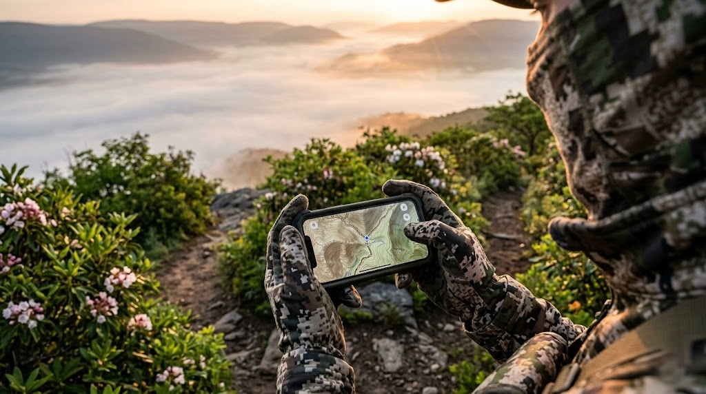
Access Tips for PA State Game Lands and State Forests
A few things that'll save you trouble on Pennsylvania public ground:
No check-in system. Pennsylvania doesn't run check-in stations on game lands or state forests. You're free to hunt anywhere on the tract during legal season hours with a valid license. Harvest reporting is done online or by phone through the PA Game Commission.
Vehicle access. On State Game Lands, vehicles are restricted to designated roads only. No driving on gated roads or trails. State forests have more open road networks, but many interior roads are gated or seasonal. Don't assume you can drive to your spot.
Camping. Camping is NOT allowed on State Game Lands. This catches many out-of-state hunters off guard. You can camp on state forest land (primitive camping, up to one night in a single spot without a permit; longer stays require a free permit from the district office). The Allegheny National Forest allows dispersed camping up to 14 days.
Sunday hunting. Pennsylvania now allows Sunday hunting on three Sundays during the season, one each in archery, rifle, and spring turkey. This is a recent change and a big deal for hunters who only have weekends.
Safety zones. PA law requires 150 yards from occupied buildings for firearms, 50 yards for archery, unless you have written permission. On game lands bordered by houses, this can cut into your hunting area. Check boundaries before setting up.
Posting and boundaries. Game lands are marked with white paint blazes on boundary trees. State forests use different signage. Carry a Pennsylvania hunting map through your mapping app to stay on the right side of the line.
Gear Considerations for Pennsylvania
Pennsylvania's terrain and weather demand gear that handles two things: steep ground and cold, wet conditions.
Boots that grip. The mountain ridges and laurel-covered slopes in the northern and central zones are steep and slippery when wet. You need ankle support and aggressive tread. Danner Pronghorn (Check current price on Amazon) is one of the best all-around PA hunting boots for dry ground. For late-season wet and cold conditions, the LaCrosse Alphaburly Pro in 800- or 1600-gram insulation handles the worst of it (Check current price on Amazon).
Rain gear that works. November in Pennsylvania means rain, sleet, and sometimes wet snow before rifle season opens. A quality rain jacket over your outer layer is non-negotiable. KUIU Axis Hybrid jacket sheds weather while staying quiet enough for archery and still-hunting.
Layering for temperature swings. Archery season starts in 60-degree weather, and rifle season ends with single digits. A modular layering system beats one heavy coat every time. I prefer the KUIU Peloton 97 base layer because it works from October through January when you build on top of it, but it is no longer made. The closest option I have found is First Lite’s Yuma Synthetic. You need something to keep sweat off your skin that dries fast, and these do the trick.For a warmer option during late rifle and flintlock season, Kuiu’s Super Down Haven, First Lite’s Thermic, or Sitka’s Fanatic jackets are all bombproof options that handle the cold extremely well.
Optics for timber. You don't need 500-yard glass in PA. Most shots happen under 100 yards in hardwood timber. But good glass helps you pick apart dark timber at first and last light when deer move. The Vortex Diamondback HD 10x42 delivers the low-light performance that matters in thick PA woods. On a budget, Vortex Crossfire HD 10x42 gets the job done for around $150. Check the current price at Amazon.
A mobile setup. Public land hunting in Pennsylvania means adapting to pressure. A saddle or lightweight hang-on stand lets you move with the deer instead of hoping they walk past a fixed position. Tethrd Phantom saddle platform is the go-to for mobile public land setups.
Mapping app. onX Hunt with the Pennsylvania layer shows you every State Game Lands tract, state forest boundary, and property line. On PA public ground where game lands butt up against private land with minimal signage, knowing exactly where you are prevents trespassing headaches.
Finding Unpressured Spots on Public Hunting Land in Pennsylvania
Pennsylvania has a lot of hunters. Around 900,000 people buy licenses each year, and rifle opener still shuts down some rural school districts. Pressure is the defining challenge in PA public-land hunting.
The good news is that pressure is predictable. Hunters park at road pull-offs, walk along established trails, and set up within a half-mile of their trucks. In the mountain country of north-central PA, that means the ridgetops and easy-walking benches near roads get hammered while the steep hollows, laurel thickets, and stream bottoms a mile from any road see almost no hunters after opening morning.
Start your scouting digitally. Pull up a topo map of your target game lands or state forest and look for terrain features that discourage foot traffic: steep-sided ravines, laurel-covered slopes, swampy creek bottoms, and any area where the nearest road access requires a climb or a long walk. Those are the spots deer retreat to after the first wave of orange coats hits the woods.
Satellite imagery tells you what the topo doesn't. Look for recent timber cuts (5 to 15 years old) on the far side of a ridge away from the nearest parking area. Young regrowth offers food and cover, and if the walk-in is tough enough, you'll have the whole cut to yourself by day three of rifle season.
onX Hunt shows you parking areas and road access, which lets you work backward from where other hunters enter to find the gaps in coverage. For deeper property-level analysis,
Timing matters as much as location. Pennsylvania's rifle season concentrates 700,000 plus hunters into two weeks. Archery season, by contrast, draws a much smaller crowd over a much longer timeframe. If you can hunt weekday sits during late October and early November, archery, you'll encounter a fraction of the pressure, and the rut will be working in your favor.
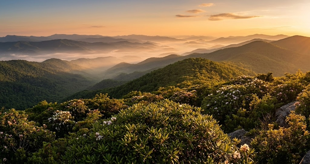
Frequently Asked Questions
How much public hunting land is in Pennsylvania?
Pennsylvania has roughly 4.7 million acres of public hunting land when you combine PA State Game Lands (1.5 million), state forests (2.2 million), the Allegheny National Forest (513,000), and scattered Army Corps, state park, and other public tracts. That's one of the largest public hunting land bases in the eastern United States.
Do I need a special permit to hunt PA State Game Lands?
No. A valid Pennsylvania hunting license is all you need to hunt any State Game Lands tract during the appropriate season. There's no additional public land permit, no check-in requirement, and no quota system for deer or bear on game lands. Turkey requires a tag, but it comes with your license.
Can you camp on PA State Game Lands?
No. Camping is not allowed on State Game Lands. This is a common surprise for out-of-state hunters. If you need to camp, use nearby state forests (primitive camping permitted with a free permit for stays longer than one night), the Allegheny National Forest (dispersed camping up to 14 days), or private campgrounds. Plan your lodging before your hunt.
Is Sunday hunting legal in Pennsylvania?
Yes, on a limited basis. Pennsylvania now allows hunting on three Sundays per year: one during archery, one during rifle, and one during spring turkey. This is a relatively new change and a big win for weekend-only hunters. Check the current PGC season calendar for the exact dates each year.
What are the best counties for public land deer hunting in Pennsylvania?
For trophy potential on ag-edge habitat: Greene, Fayette, and Washington counties in the southwest and Susquehanna and Bradford counties in the northeast. For big-woods, lower-density but mature bucks: Potter, Clinton, Cameron, and Elk counties in the north-central mountains. Your choice depends on whether you want more deer sightings (south and east) or more solitude and mature buck potential (north-central).
How do I apply for a Pennsylvania elk tag?
Applications open annually through the PA Game Commission website, usually in the spring or early summer. There's no preference point system. The draw is a straight lottery, and the number of tags issued varies year to year (usually 130 to 180). The elk herd is centered in Elk and Cameron counties. Apply every year. Someone draws every year, and the experience is once-in-a-lifetime.
Can non-residents hunt Pennsylvania public land?
Yes. Non-residents buy a non-resident hunting license and have access to the same game lands, state forests, and national forests as residents. There's no separate non-resident quota or restriction on public land access. License fees are higher than resident rates, but the access is identical.
What's the difference between State Game Lands and state forests for hunting?
Both are open to public hunting with a valid license. The main differences are management focus and rules. State Game Lands are managed primarily for wildlife and hunting. State forests are managed for timber, recreation, and wildlife together. Game lands don't allow camping. State forests do. Game lands often have more active habitat management (food plots, brush clearing, timber cuts) specifically designed for game species. In practice, both hold huntable populations, and both deserve a spot on your Pennsylvania hunting map.
Want the full breakdown of every PA State Game Lands tract with WMU maps, plus the same for all 50 states? Subscribe to the LandsToHunt newsletter below and get our free state-by-state public land hunting guides delivered to your inbox.

How to Hunt Whitetail on Public Land: A Practitioner's Guide
Public land whitetail hunting rewards hunters who walk farther, read terrain harder, and play wind better than the guy parked next to them. Here's the scouting, access, and stand strategy that puts deer in front of you season after season.
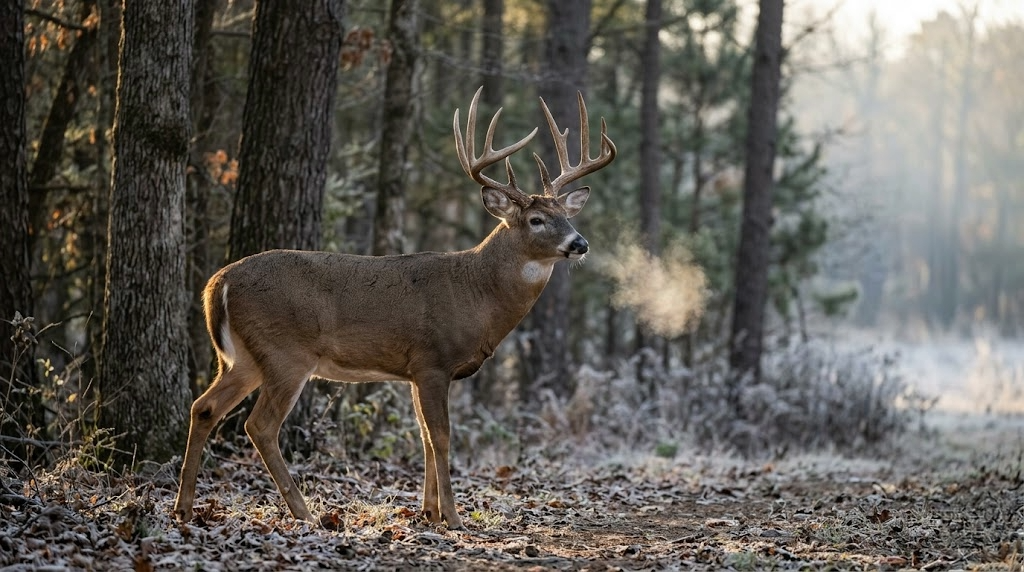
Public land whitetail hunting rewards patience, planning, and a willingness to walk farther than the other guy. If you've spent your hunting career on private ground and want to know how to hunt whitetail on public land without getting buried by pressure, the playbook is different than what works on a 40-acre lease. This guide walks you through the scouting, access, and stand strategy that puts deer in front of you on public ground season after season.
Most public land hunters fail for the same three reasons. They hunt too close to the parking area. They ignore wind and access. And they follow other people's sign instead of finding their own. Fix those three things and your odds jump dramatically.
Why Public Land Whitetail Hunting Is Different
On private land, you control the variables. You know where the food plot is, where the bedding is, who else is on the property, and when. On public land, you're one of dozens of hunters sharing the same chunk of woods, and the deer know it.
By the third day of firearm season, every piece of easy-access timber within 300 yards of a road has seen pressure. Deer adjust fast. They go nocturnal, push deeper into cover, and start bedding in spots that look miserable to hunt but stay quiet.
Your job is to think like the deer. Where would you bed if hunters pushed you around every weekend? The answer is almost always thick cover, awkward terrain, or a spot that takes real effort to reach.
E-Scout Before You Boot-Scout
Before you ever step foot on a piece of public ground, pull up the parcel on a mapping app. I run onX Hunt because the public land boundary layers and offline maps save me from trespassing and from getting lost in national forest timber I've never set foot in.
Here's what you're looking for during e-scouting:
Pinch points where two terrain features force deer through a narrow area
Inside corners of clearcuts, timber, or ag fields
Benches and saddles on ridges that funnel travel
Water sources in dry timber, especially during the early and late seasons
Thick cover more than a half-mile from the nearest road or trail
Mark 8 to 10 potential spots before you ever walk in. Then on your first boots-on-the-ground trip, you're verifying sign, not wandering aimlessly. I am working on an app that will make this a much easier process. Exciting news to come.
Finding the Terrain Features That Hold Whitetails on Public Land
Terrain tells you more than the sign does, especially after opening weekend when the rubs and scrapes you're reading might be two weeks cold. Focus on features that concentrate deer movement regardless of pressure.
Pinch points and saddles
A saddle is a low point on a ridge where deer cross from one drainage to another. In rolling hill country, Appalachian timber, or anywhere with real elevation change, saddles are gold. Deer use them because walking over a saddle burns less energy than climbing the whole ridge.
Pinch points work the same way. Anywhere two features squeeze deer movement into a narrow lane (a creek bend against a bluff, a fence corner against thick cover, a swamp edge along timber), you've got a high-percentage stand location.
Inside corners and transitions
The inside corner of a clearcut, ag field, or meadow where it meets standing timber is one of the most consistent deer movement features in existence. Deer skirt edges. They don't walk out into wide-open space during daylight if they can help it, and inside corners let them stage along the edge with multiple escape routes.
Thick bedding nobody else wants
Find the nastiest, thickest, most miserable cover on the parcel. Briars, blowdowns, cattail swamps, regenerating clearcut. That's where pressured bucks go. You're not hunting inside the bedding, you're hunting the access trail between that bedding and the nearest food source.

Beat the Pressure: How to Hunt Public Land Spots Other Hunters Skip
Here's the rule I live by on public land. If getting to the stand is easy, you're hunting the wrong spot.
Most public land hunters walk in no more than 400 yards. Some don't walk in at all. That means everything beyond the half-mile mark sees a fraction of the pressure, and the deer know which zones are safe.
Look at access differently:
Cross a creek that requires waders, and everyone else drives past
Walk a mile through a cattail swamp to reach an isolated island of timber
Come in from the non-obvious side, even if your walk triples in distance
Hunt the deep interior during midday when most hunters have packed up
The physical investment is real. You want solid boots for this kind of miles-heavy access. I run Danner Pronghorn on dry ground and LaCrosse Alphaburly Pro when I'm hitting wet cattail country. Check the most up-to-date prices on Amazon.
The Gear That Matters on Public Land
You don't need a truckload of gear for public land whitetail hunting. You need mobile gear that lets you move when a spot goes cold.
Mobile setups mean saddle hunting or a lightweight hang-on with climbing sticks. A saddle system like the Tethrd Phantom lets you slip in, set up on any tree, and be ready to hunt in under 20 minutes. Full disclosure: the learning curve on saddles is real. Most hunters need 5 to 10 practice sessions in the backyard before they're comfortable hunting from one.
Other gear that earns its place in my public land pack:
Quality mid-range binoculars like the Vortex Diamondback HD 10x42 for picking apart timber and verifying antlers at a distance
A quiet outer layer. I run the KUIU Axis Hybris jacket because it's weatherproof and is pretty quiet when you brush against branches
A cellular trail camera like the Muddy Matrix 2.0 positioned on an access trail or water source, assuming your state allows trail cameras on public land
A good headlamp with a red light mode for walking in and out quietly
Skip the gadgets you don't need. Grunt calls and rattling antlers earn their place during the rut. Scent eliminators matter less than playing the wind right. For a full breakdown of what to run in the woods, see our public land hunting gear guide.
Wind and Access: The Two Things That Kill Your Hunts
You can set up on the best pinch point in the county, but if you're walking in upwind of a bedding area or your scent is blowing into your shooting lane, deer know you're there before the sun comes up.
Before you pick a stand, map two things:
Your access route in. What wind direction lets you walk in without your scent hitting bedded deer or the travel corridor you plan to hunt?
Your stand wind. What wind lets you sit at the spot without deer catching you on approach?
Sometimes a spot only hunts well on one wind, like a northwest out of the northwest, and you just don't hunt it on other days. That's fine. You want a minimum of 5 or 6 stand locations so you can match stands to wind direction all season long.
Seasonal Strategy for Public Land Whitetails
How you hunt whitetail on public land shifts across the season. Bucks behave differently in September than they do in November, and your stand selection has to track those changes.
Early season: September through early October
Bucks are on a bed-to-food pattern. Find mast (white oak acorns are king), soft mast (persimmons, apples, crabapple), or any ag crop bordering the parcel. Set up 50 to 100 yards back from the food source on the travel corridor between bedding and feed. Hunt evenings. Morning hunts this time of year often push deer off their beds as you walk in.
The rut: November
Rut hunting is when public land gets its best window. Bucks drop their caution, and mature deer you've never caught on camera show up in daylight chasing does. Hunt all day if you can. Hunt doe bedding areas and the downwind trails they run. Pinch points between doe groups see the most buck traffic. Grunt calls and rattling work on pressured deer when used sparingly.
Late season: December through January
Deer are patterned on food and thermal cover. Find the most concentrated food source on the parcel (late-cut ag fields, standing corn, food plots on adjacent ground) and set up on the bedding side of the travel corridor. South-facing slopes hold deer on cold sunny days. Hunt midday if the temperature rises above freezing after a cold snap.
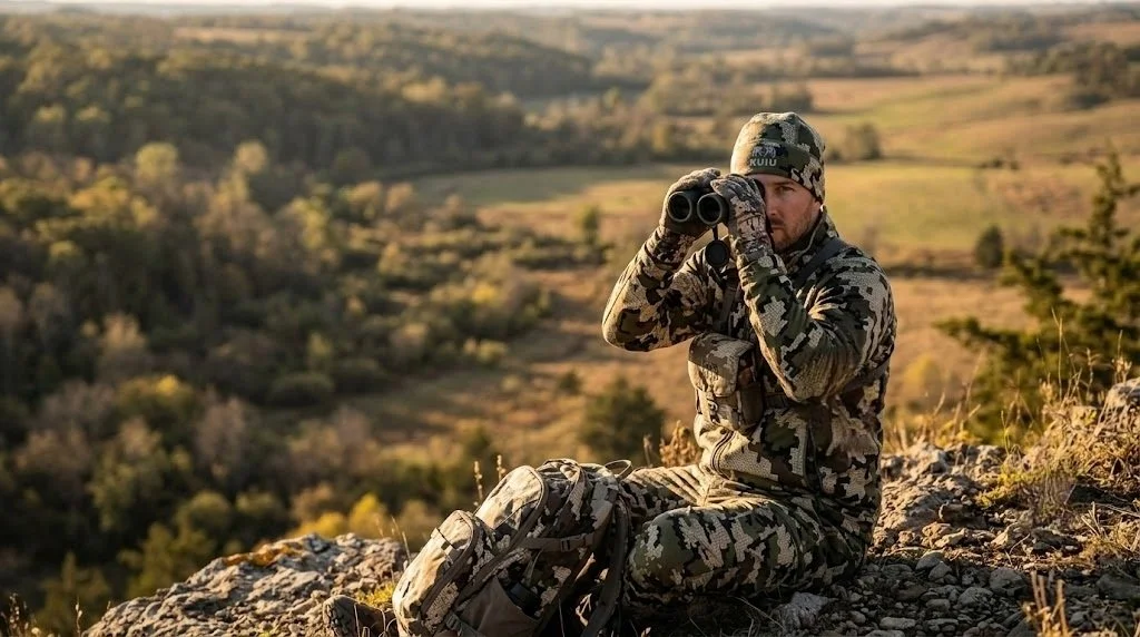
Common Public Land Mistakes to Avoid
I've watched hunters make the same mistakes for 25 years. Here are the big ones:
Hunting the same stand too many times. Pressured deer learn fast. Rotate through 3 or 4 stands minimum per season.
Ignoring thermals. In hill country, scent rises uphill in the morning and falls downhill in the evening, regardless of prevailing wind.
Walking past sign to get to "the spot." If you see fresh sign on your way in, hunt it. Don't push another half-mile out of stubbornness.
Skipping midday hunts during the rut. The 10 a.m. to 2 p.m. window produces a lot of mature bucks on public ground because most hunters are back at the truck eating lunch.
Not scouting post-season. February and March give you a clean look at rubs, scrapes, and bedding from the previous fall. That's your scouting window for next year.
If you want a more thorough property-level look before you invest weeks on a parcel, a drone-based assessment from ScoutFlight Hunting Assessments maps habitat features, access routes, and travel corridors from the air, which saves you a lot of boot miles.
Frequently Asked Questions
How far should I walk in from the road on public land?
The sweet spot on most public parcels starts around three-quarters of a mile from the nearest road or trailhead. That's far enough to get past the majority of hunters but close enough that you can pack out a deer without destroying yourself. On larger tracts with remote interior zones, walking 1.5 to 2 miles rewards you with undisturbed deer.
Is saddle hunting better than a climber on public land?
For mobile in-and-out public-land hunting, saddle systems have real advantages. They're lighter, work on any tree regardless of branch size or taper, and set up faster than a traditional climber. The tradeoff is comfort during long sits and a learning curve that takes practice. Climbers still work great on straight, branch-free trees if that's what's on your parcel.
When is the best time to hunt public land whitetails?
The first three days of archery season, before pressure builds, and the first two weeks of November during the rut, produce the highest daylight buck movement on public ground. Late season, after the first heavy snow, puts deer on a predictable food pattern, which gives patient hunters a third strong window.
Do I need a cellular trail camera on public land?
Cellular cameras help you monitor a spot without adding pressure from repeated check-ins. That said, some states restrict or prohibit trail cameras on public land, especially during hunting seasons. Check your state regulations first. When legal, one well-placed cellular camera on an access trail gives you better intel than a half-dozen standard cameras you only check every two weeks.
How do I avoid other hunters on public land?
Hunt harder-to-reach spots, come in from non-obvious access points, and shift your hunting hours. Midday hunts between 10 a.m. and 2 p.m. see far less competition, and the deer don't care what time it is on the clock during the rut.
Subscribe below for free state-by-state public land hunting guides delivered straight to your inbox, plus new tactics, gear breakdowns, and scouting resources from LandsToHunt.com.
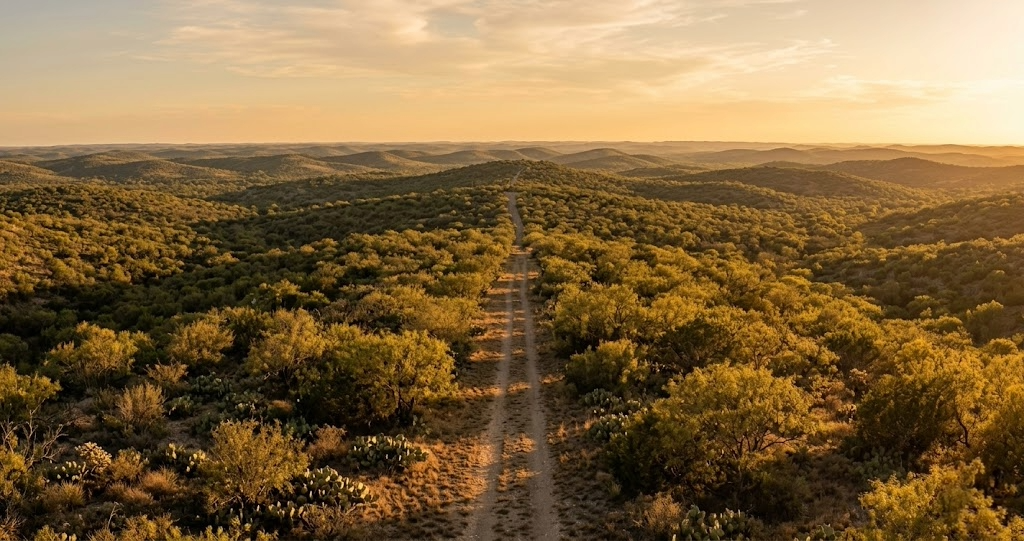
Public Land Hunting in Texas: The DIY Hunter's Playbook
Texas has more than a million acres of public hunting ground if you know how to work the system. From the South Texas brush country to the Piney Woods and the Trans-Pecos desert, here's the DIY hunter's playbook for WMAs, national forests, and the Annual Public Hunting Permit that unlocks it all.
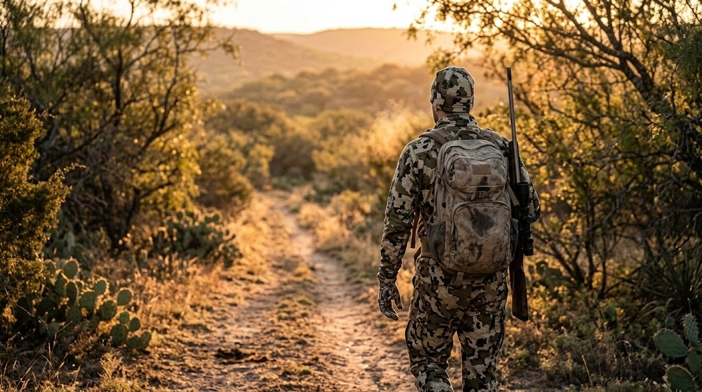
Texas gets a bad rap with public land hunters, and most of it is wrong. Yes, the state is roughly 95 percent privately owned. Yes, you won't find the giant blocks of federal ground you'd hunt in Montana or Colorado. But Texas also runs one of the most creative public hunting programs in the country, and if you know where to look, you can hunt whitetail, hogs, turkey, waterfowl, javelina, mule deer, aoudad, and dove across more than a million acres without ever knocking on a gate.
The catch is that public land hunting in Texas rewards hunters who do their homework. The state's system is built around permits, draws, and specific rules that trip up first-timers. Once you understand how the pieces fit together, Texas opens up in ways most out-of-state hunters never realize.
How Much Public Land Texas Really Has
The Texas Parks and Wildlife Department (TPWD) operates more than 50 Wildlife Management Areas totaling around 760,000 acres. Add in four national forests in East Texas (Sam Houston, Davy Crockett, Angelina, and Sabine) covering about 637,000 acres, plus scattered Corps of Engineers lakes, state parks that allow hunting, and leased private tracts inside the state's public hunting program, and the number climbs past a million accessible acres.
The key document for any Texas public land hunter is the Annual Public Hunting (APH) Permit. It runs about $48, and it unlocks roughly 180 hunt units across the state. That permit is the single best value in Texas hunting, and if you're serious about chasing public ground here, it's your first purchase every fall.
For residents, a standard hunting license runs around $25. Non-residents pay roughly $315 for a general non-resident license, with a $48 five-day special non-resident license available for dove, waterfowl, and exotic hunts. Everyone who buys a license also pays into the federal migratory bird stamp and the state habitat stamp, depending on the species.
TPWD also runs a drawn hunt program, issuing roughly 8,000 permits each year for high-quality hunts on premium properties. Application fees are small (usually $3 to $10), and the odds on some hunts are better than people think. Applying every year is free money if you like a chance at quality ground.

Top Public Hunting Areas in Texas
These are the places worth your time if you're building a Texas public land strategy from scratch.
Sam Houston National Forest
Managing agency: U.S. Forest Service
Acreage: 163,000
Region: Walker, Montgomery, and San Jacinto counties (east of Huntsville)
Primary species: Whitetail, feral hogs, squirrel, turkey
Terrain: Pine and hardwood bottoms, creek drainages, thick understory
Access: Open with a valid Texas hunting license. No APH permit required for general seasons, but check the Stubblefield and Big Creek units for specific rules.
Insider tip: Get deep. Sam Houston gets pounded within a half mile of any forest road, so plan to walk at least a mile and hunt the nasty stuff near creek bottoms. The hogs don't read the pressure maps.
Chaparral WMA
Managing agency: TPWD
Acreage: 15,200
Region: Dimmit and La Salle counties, South Texas brush country
Primary species: Whitetail, javelina, feral hogs, bobwhite quail, dove
Terrain: Classic South Texas thornscrub, mesquite flats, sendero country
Access: Requires an APH permit for most hunts or a drawn permit for the quality deer hunts
Insider tip: The drawn gun deer hunts here are some of the best odds in the state for a mature South Texas buck on public ground. Apply every year. If you don't draw, the APH-period archery hunts still put you on deer that most Texans only see in brochures.
Alabama Creek WMA
Managing agency: TPWD inside Davy Crockett National Forest
Acreage: 14,561
Region: Trinity County
Primary species: Whitetail, hogs, turkey, squirrel
Terrain: Mixed pine and hardwood, creek drainages
Access: APH permit required during TPWD hunt periods
Insider tip: The creek bottoms along Hickory Creek hold good deer and see a fraction of the pressure Sam Houston gets. Use the boundary between the WMA rules and the surrounding national forest to your advantage on pressured days.
Gene Howe WMA
Managing agency: TPWD
Acreage: 5,821
Region: Hemphill County in the Panhandle
Primary species: Whitetail, Rio Grande turkey, bobwhite, dove
Terrain: Canadian River bottomlands, sand sage, cottonwoods
Access: APH permit or drawn hunt
Insider tip: This is one of the better Rio Grande turkey spots on public ground in Texas. The river bottom roost trees are obvious, so set up on travel corridors between roost and feed rather than trying to call birds off the limb.
Black Gap WMA
Managing agency: TPWD
Acreage: 103,000
Region: Brewster County, Big Bend Country
Primary species: Mule deer, aoudad, javelina, desert bighorn (drawn only)
Terrain: Desert mountains, arroyos, cliffs, sotol flats
Access: Most hunts are drawn, but there are APH-eligible archery windows
Insider tip: Aoudad hunting here is world-class and often overlooked by out-of-staters. You can hunt them year-round on APH archery days, and the population is strong enough that success rates for spot-and-stalk hunters who put in miles are legitimate.
Matagorda Island WMA
Managing agency: TPWD
Acreage: 43,893
Region: Calhoun County, Gulf Coast barrier island
Primary species: Whitetail, feral hogs, waterfowl
Terrain: Coastal prairie, salt marsh, brush pockets
Access: Boat access only, drawn hunts for deer, APH for some hunts
Insider tip: The deer here are smaller-bodied than inland Texas whitetail, but the hunt experience is unlike anything else in the state. Bring a kayak or shallow-draft boat and plan for wind.
J.D. Murphree WMA
Managing agency: TPWD
Acreage: 24,498
Region: Jefferson County, Southeast Texas
Primary species: Waterfowl (puddle ducks, teal, geese), alligator (drawn)
Terrain: Freshwater and brackish marsh
Access: APH permit, boat required for most productive areas
Insider tip: Teal season in September is a sleeper here. Locals know about it, but out-of-staters almost never make the trip. A shallow-water boat and a handful of decoys is all you need.
Las Palomas WMA (Ocotillo Unit)
Managing agency: TPWD
Acreage: 3,300 across multiple units in the Rio Grande Valley
Region: Hidalgo, Cameron, and Starr counties
Primary species: White-winged dove, mourning dove, quail
Terrain: Mesquite brush, agricultural edges, river bottom
Access: APH permit
Insider tip: White-wing opening weekend in September is the whole point of this place. Scout for water tanks and roost trees a week ahead, and expect company.
Caddo National Grasslands
Managing agency: U.S. Forest Service
Acreage: 17,785
Region: Fannin County, North Texas
Primary species: Whitetail, hogs, dove, rabbit, squirrel
Terrain: Post oak savannah, creek bottoms, scattered hardwoods
Access: Texas hunting license only, no APH required
Insider tip: The little pockets of thick cover along Bois d'Arc Creek hold surprising numbers of deer for how open the surrounding ground looks. Hunt the transitions.
What You Can Hunt on Texas Public Land
Whitetail are the headliner, and you'll find them across every ecoregion from the Piney Woods to the South Texas brush to the Edwards Plateau. Rio Grande turkey populations are strong in the Hill Country, Panhandle, and Cross Timbers, while Eastern turkey populations are under tighter regulations in a handful of East Texas counties.
Feral hogs are open year-round on most public land with a valid hunting license, and they're the best excuse to learn a new piece of ground. Waterfowl hunters have strong options on the coastal WMAs and the Texas High Plains playa lakes. Dove hunting is a September tradition, especially on the Las Palomas units.
For something different, Texas public ground also offers javelina in South and West Texas, aoudad (free-range Barbary sheep) in Black Gap and other Trans-Pecos units, and occasional drawn hunts for desert bighorn, pronghorn, and exotics like blackbuck.
Season Structure and Drawn Hunts
Texas runs a split general whitetail season roughly from early November through early January in most counties, with a special late youth-only season and a late muzzleloader and archery window in select areas. The archery-only season starts statewide in late September or early October. The specific dates shift each year, so always check current TPWD regulations before planning a trip.
Turkey seasons run from spring (roughly mid-March through early May, depending on zone) and fall in some counties. Waterfowl seasons follow federal frameworks, with the High Plains, North, and South zones splitting Texas into different calendars.
The drawn hunt system is worth understanding. Applications open in August and run through mid-October for most fall hunts. You pay a small non-refundable application fee, list your preferred hunts, and wait for draw results. Some hunts have preference points, some don't. Reading the drawn hunt booklet cover to cover before applying is time well spent.
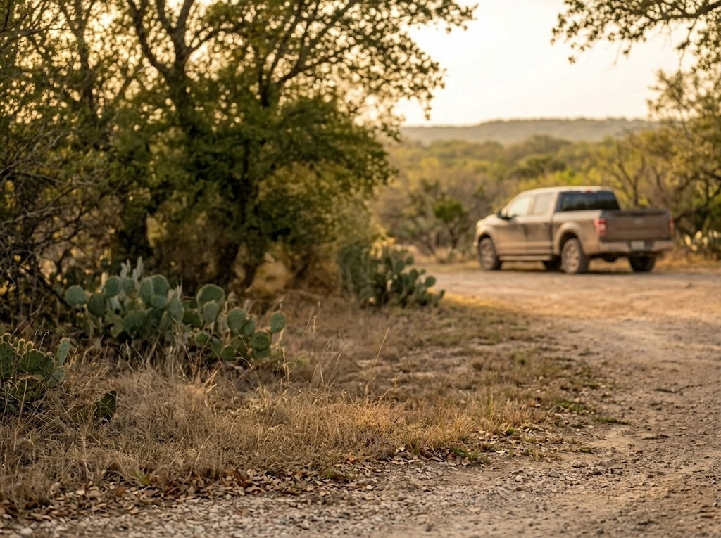
Access Tips That Save You Headaches
Carry your APH permit in your wallet and keep a printed copy of the current Map Booklet in your truck. Wardens do check, and some units have sign-in boards at entry points that you're required to fill out.
Not every WMA allows vehicle access beyond the entrance. Walk-in-only rules are common, and driving past a gate you weren't supposed to pass is a fast way to lose your permit and get a citation. Read the unit-specific rules in the Map Booklet for the place you're hunting.
Camping rules vary by unit. Some allow primitive camping on the WMA itself, some require you to camp off-site at nearby state parks or private campgrounds. The national forests in East Texas are more flexible, with dispersed camping allowed in most areas.
Check-in stations are available at some high-pressure WMAs during scheduled hunts. If a unit requires self-check-in, do it. That data is what keeps the hunt structure funded.
Gear Considerations for Texas
The terrain and climate in Texas demand gear that handles heat, thorns, and long sightlines. A few things that make a real difference:
Snake boots or gaiters. Western diamondback, copperhead, and coral snake are all part of the deal in Texas, and archery deer season overlaps with the warm months when snakes are still active. The LaCrosse AeroHead Sport and Irish Setter VaprTrek with snake protection are solid picks. Check the current price at Cabela's
Brush-proof pants. South Texas thornscrub and West Texas sotol will shred regular hunting pants in a day. KUIU Attack pants hold up well, and the First Lite Guide pants are another strong option. Check the current price at KUIU.com
Quality optics. The open country of the Panhandle, Hill Country, and Trans-Pecos makes binoculars the single most valuable piece of gear. The Vortex Diamondback HD 10x42 is the best value pick under $300. Check the current price at Amazon. If you're on a tighter budget, the Vortex Crossfire HD 10x42 runs around $150 and gets the job done.
A mapping app with Texas public land layers. OnX Hunt is the standard for good reason. The APH unit boundaries are loaded in, and being able to verify you're on legal ground in real time is worth the subscription cost by itself. Try onX Hunt free for seven days.
Heat management. Even in November, Texas afternoons run 70-plus in South Texas. Light base layers, plenty of water, and a way to quickly carry quartered meat matter more here than insulated everything.
The limitation on Texas gear is that no single setup works statewide. What you wear in Sam Houston National Forest in December is very different from what you need in the Panhandle during the same week. Plan by region, not by season alone.
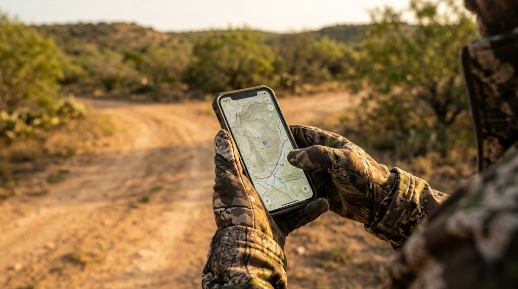
Finding Spots Other Hunters Skip
The single best edge on Texas public land is effort. The pressure on most WMAs drops off sharply past the first half mile from any road or parking area. People drive the two-tracks, hunt the obvious stands, and go home.
Pull up satellite imagery and look for thick cover pockets that are hard to reach. Creek bottoms, old burn scars that have grown back into cover, and transition zones between habitat types are your friends. Hogs and mature deer both key on the stuff other hunters can't be bothered to push into.
Timing matters as much as location. Weekday hunts on any Texas WMA are dramatically less pressured than weekends. If you can hunt Tuesday through Thursday, you're essentially on private ground compared to the Saturday crowd.
Mapping apps like onX Hunt let you do serious e-scouting from your couch. Drop pins on terrain features, water sources, and bedding cover, then verify on the ground your first morning.
Frequently Asked Questions
Do I need a separate permit to hunt Texas WMAs?
Yes, most TPWD WMAs require an Annual Public Hunting Permit ($48) in addition to your regular Texas hunting license. The national forests in East Texas (Sam Houston, Davy Crockett, Angelina, Sabine) don't require an APH permit for general-season hunting, just a valid Texas license.
How hard is it to draw a Texas quality deer hunt?
Odds vary by unit, but some drawn hunts have 1 in 20 odds or better, and most cost only a few dollars to apply. The premium South Texas and Hill Country hunts are the longest odds. Apply every year, even for hunts you think you'll never draw, because the application fees are cheap and somebody wins every draw.
Can non-residents hunt Texas public land?
Yes. Non-residents buy a non-resident hunting license (around $315 for general or $48 for a five-day special) and, if they're hunting on WMAs that require it, the APH permit. There's no separate public land tag lottery for non-residents. You're on the same ground as Texas residents.
Is there free hunting land in Texas?
The Caddo National Grasslands and the four East Texas national forests are the closest thing to truly free public hunting in Texas, requiring only a standard hunting license. Everything else through TPWD needs either the APH permit or a drawn hunt tag.
What's the best WMA for a first-time Texas public land hunter?
Sam Houston National Forest is the most forgiving entry point. It's big, it holds deer and hogs, it doesn't require an APH permit, and it's within driving distance of Houston, Dallas, and Austin. You'll get your feet wet without committing to a drawn hunt system you don't yet understand.
Want the full breakdown of Texas WMAs with unit-by-unit notes plus the same for all 50 states? Subscribe to the LandsToHunt newsletter below and get our free state-by-state public land hunting guides delivered to your inbox.

My Honest Take on the One-Buck Rule: Why It's the Wrong Conversation
Michigan's NRC votes May 13 on the one-buck rule. Here's my honest take, and why the real conversation is bigger than anyone's having right now.
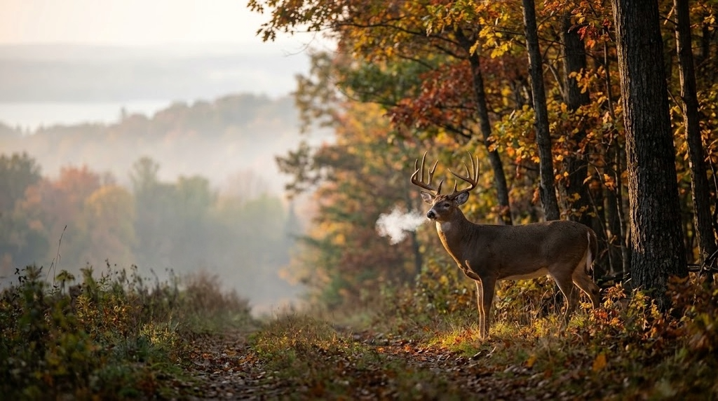
The Michigan one-buck rule debate comes back around every few years, and every few years, the same fight breaks out. Supporters say a one-buck rule will protect young bucks and push hunters toward does. Opponents say it punishes successful hunters and tramples tradition. Both sides dig in, the Natural Resources Commission takes public comment, and Michigan deer management drifts another year without a real answer.
But if you've been anywhere near Michigan hunting media this week, you've seen it. WNEM, CBS Detroit, Deer & Deer Hunting, WTV, the proposed one-buck rule is everywhere, and the Natural Resources Commission is scheduled to vote on it on May 13. This is no longer a hypothetical. It's a real proposal on a real timeline, and hunters across the state are being asked to take a side.
I've been asked what I think. Here's the straight answer.
What a Michigan One-Buck Rule Would Actually Do
A one-buck rule, by itself, would probably produce a small bump in antlerless harvest in the southern Lower Peninsula. Not a big one. The research from Wisconsin and across the Midwest is pretty clear that traditional regulatory tweaks move harvest numbers by single digits, not double digits. Hunters who want a big buck will keep passing young ones, whether they have one tag or two. Hunters who shoot the first legal buck they see will keep doing that, too. A one-buck rule doesn't rewrite hunter behavior. It nibbles at the edges.
That doesn't make it a bad idea in the right place. In the southern Lower, where deer densities are high, EHD outbreaks keep reminding us that the herd is too big for the country it lives in, and that crop damage and vehicle collisions are chronic problems; a one-buck rule could be a useful piece of a herd-reduction strategy. The keyword is piece. It's not a silver bullet. It's one tool among several, and it only makes sense where the biology actually calls for it.
Michigan Has Three Deer Herds, Not One
That's where the whole debate goes off the rails, because Michigan keeps trying to apply statewide rules to a state that clearly has three different deer herds.
The southern Lower (Zone 3) is overabundant. The northern Lower (Zone 2) is mixed country with moderate densities and a strong local appetite for better buck age structure in some areas. The UP (Zone 1) is a northern-edge herd facing harsh winters, predation, aging habitat, and declining hunter participation. These are three different management problems, and they deserve three different management answers. Treating them like one herd is how we've ended up with regulations that satisfy nobody and deer management that drifts further from biological reality every year.
What Michigan Should Actually Do
Southern Lower Peninsula: One-Buck Rule, Tied to the Real Problem
In the southern Lower, adopt a one-buck rule. Tie it to the real problem: too many deer, chronic EHD outbreaks, and a herd that's outgrown its country. Pair it with generous antlerless tag allocations and a firearm opener moved to the last Saturday in November, which extends the effective hunting season into December, when deer concentrate on food sources. Let hunters focus their effort when it matters most. Possibly even work in Earn a Buck.
Northern Lower Peninsula: Combination Tag with Antler Restriction Criteria
In the northern Lower, keep the combination tag, one tag, valid for a legal buck meeting regional antler restriction criteria or an antlerless deer. Make the hunter choose at the moment of truth. This is the region where local support for buck age structure management is strongest, and a combo tag restructures the decision without forcing anyone into a rule they didn't ask for. Move the firearm opener to the third Saturday in November to align it with the end of peak rut.
Upper Peninsula: Combo Tag, No Antler Restrictions
In the UP, they would also run a combination tag, but without antler restrictions. UP deer have smaller antlers at given ages due to nutritional and winter constraints, and a point-count rule that works downstate would cut too deeply into available harvest up north. Move the firearm opener to the first Saturday in November. It catches the rut closer to peak, beats the worst of the weather, and respects deer camp culture that's built on a weekend anchor.
Fund It Through Region-Specific Licensing
And fund it properly through region-specific licensing. A hunter who hunts one region buys one regional license at a fair price. A hunter who wants two regions buys two. A hunter who wants all three pays for the privilege. License dollars follow the herd they support. Data follows the hunter to the region they actually use. Enforcement gets clearer because the license itself tells the DNR officer which rules apply.

The Real Conversation Michigan Isn't Having
This isn't a small change. It's a structural rethink of how Michigan manages its deer herd, and it asks more from hunters than the current system does. But it also gives back something the current system can't, management that actually matches the deer you're hunting. The UP hunter gets rules built for the UP. The southern Lower Hunter gets rules built to address the overabundance problem he sees every time he drives to work. The northern Lower Hunter gets the buck age structure its community has been asking for without forcing it on a state that doesn't uniformly want it.
The one-buck rule debate isn't wrong. It's just too small. Michigan has three herds, three hunting cultures, and three sets of problems, and we've been debating statewide regulations for twenty years while the real questions go unasked.
Time to ask them.
Michigan One-Buck Rule FAQ
Does Michigan have a one-buck rule?
No. Michigan currently allows licensed deer hunters to harvest two bucks per year under the combination license, with antler-point restrictions that vary by deer management unit. A statewide one-buck rule has been proposed multiple times but has not been adopted.
Would a one-buck rule grow bigger bucks in Michigan?
By itself, not much. Research from Wisconsin and the broader Midwest shows that single-regulation changes move harvest numbers in single-digit percentages. Buck age structure improves more from antler restrictions and habitat than from tag count alone.
Why does Michigan need different deer rules by region?
Michigan has three biologically distinct deer herds. The southern Lower Peninsula is overabundant and is dealing with chronic EHD outbreaks. The northern Lower has moderate densities and a local appetite for better buck age structure. The Upper Peninsula faces hard winters, predation, and aging habitat. One statewide rulebook can't serve all three.
When is the Michigan firearm deer opener?
Michigan's firearm deer season currently opens statewide on November 15th. Several proposals, including the regional approach outlined above, would shift the opener to better align with rut timing and weather patterns on each peninsula.
Get the Free Michigan Public Land Hunting Guide
Want practitioner-level breakdowns of Michigan's state game areas, national forests, and best public hunting by region? Subscribe below for free state-by-state public land hunting guides, including the full Michigan rundown.

Spring Turkey Hunting Tactics That Actually Work
The gobbler you chase opening morning isn't the same bird three weeks later. Here's how to hunt spring turkeys week by week on pressured land.
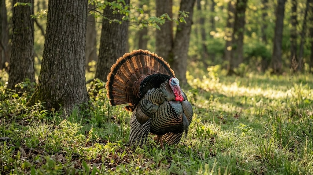
The tom that hammers from the limb on opening morning isn't the same bird you're chasing three weeks later. If you hunt him the same way in May that you did in April, you're going to eat tag soup. Spring turkey hunting tactics have to shift with the season, with the hens, and with the pressure stacking up on every piece of public dirt within driving distance.
Here's how I break down a spring season on public land, week by week, mood by mood.
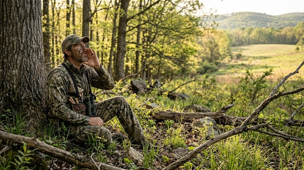
Opening Week: Be the Loudmouth
Opening week birds haven't been called to yet. They've been gobbling at owls, crows, and each other for two weeks, and they're fired up. This is the one stretch of the season where you can get away with being loud, aggressive, and a little sloppy.
Roost a bird the night before if you can. Slip in 45 minutes before legal light, set up 100 to 150 yards from the tree, and let him gobble first. When he hits the ground, hit him with a sharp cutting sequence on a mouth call, three to five sharp cuts followed by a string of excited yelps. If he cuts you off mid-call, shut up. He's coming.
Opening week setup that works on pressured ground: - Single hen decoy, no jake, no strutter - Back against a tree wider than your shoulders - Shooting lanes cleared to 40 yards in a half circle - Sun at your back if you can manage it.
Don't overthink the decoy spread. A lot of these birds have already seen a strutter and bailed. One soft hen looks honest.
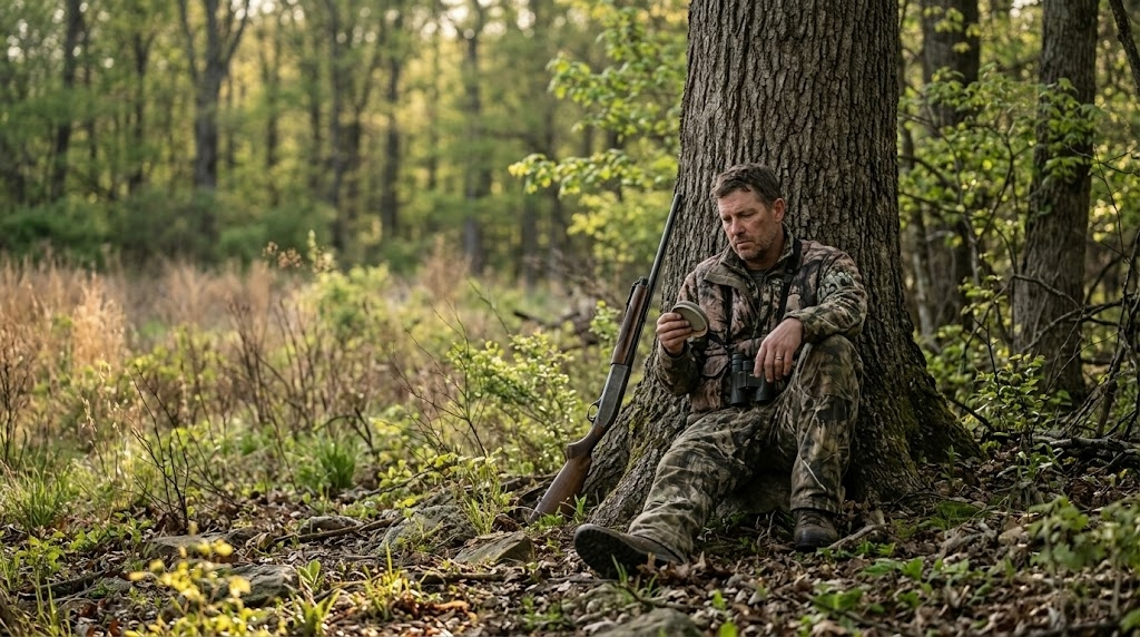
Mid-Season: The Henned-Up Slump
Two weeks in, every gobbler worth shooting has hens on him at daylight. He'll gobble on the limb, fly down, and go silent for four hours while his harem feeds him through the woods. This is when most hunters quit. Don't.
You've got two ways to beat a henned-up gobbler. You can fight the boss hen, or you can wait her out.
Fighting the boss hen means getting close, really close, 75 yards if the cover lets you, and mimicking her exactly. She yelps, you yelp louder. She cuts, you cut over the top of her. You're not trying to call the tom. You're trying to make her so mad she marches over to whip you, and she drags him along behind her. It works maybe one time in four, but when it works it's the most exciting hunt of the spring.
Waiting her out is the patient play. Hens leave gobblers around 10 a.m. to go lay eggs. That lonesome tom is suddenly very interested in any soft yelp he hears. Set up on a known strut zone, a logging road bend, a field edge, an oak flat with a southern exposure, and call sparingly. Three soft yelps every 15 minutes. Let him come looking.
Late Season: Quiet, Slow, and Deadly
By the third and fourth weeks of the season, most toms have been called to, shot at, and spooked off every ridge they own. They're quiet. They might gobble once on the limb and not again all day. People assume the birds are gone. They're not. They're just done talking.
Late season is when you hunt like a bowhunter hunts whitetails. Set up on sign, not sound. Look for fresh strut marks in dusty two tracks, J shaped droppings under roost trees, dusting bowls, and feathers along field edges. Pick a spot where a bird wants to be and sit on it.
Calling late season is a whisper game. Soft tree yelps before fly down, a few clucks and purrs an hour later, and a lot of nothing in between. If you hear a gobble, don't run at it. Move once, set up tight, and make him think a hen is feeding away from him.
Running and Gunning the Right Way
Run and gun gets romanticized, and on public land it gets a lot of guys busted. You can cover ground without bumping every bird in the county if you do it right.
Walk the ridges, not the bottoms. Sound carries up. Stop every 200 yards and hit a loud locator call, a crow call early, an owl hooter at midday, a coyote howler if nothing else is working. Do not yelp to locate. You'll pull in silent toms you never knew were there and educate them when you stand up to leave.
When a bird answers, mark him on your onX Hunt app, drop a waypoint, and close the distance using terrain. Get a ridge or a creek bottom between you and him so you can move fast without being seen. Set up 100 to 150 yards out, never closer on the first sit unless the cover is thick. A mapping app like onX Hunt earns its keep on these moves because the topo lines tell you where you can sneak and where you'll skyline yourself.
Gear that matters for running and gunning: - Lightweight vest with a built-in seat, the TIDEWE Vest, or a Lucky Duck Predator Seat - Quality 10x42 binoculars for glassing fields and openings; the Vortex Diamondback HD does the job for the money. Check current price at Amazon. The downside is they're heavier than premium glass, so if you're walking eight miles a day, you'll feel it. - Two-month calls and a pot call, that's it. Leave the box call in the truck unless it's windy. - Quiet boots that drain. The LaCrosse Alphaburly Pro handles wet spring mornings and creek crossings. Check the current price. They run hot once the day warms up, so plan your walks for early.
Budget option for the guy just getting started: a Primos Hook Hunter mouth call and a slate pot call from any farm store will kill turkeys all day long.

Afternoon Hunting Tactics Most Guys Skip
Where it's legal, and check your state regulations because some states still have half-day seasons, afternoon turkey hunting is the most underused tactic in the spring woods. By 1 p.m., the morning crowd has gone home, the hens have left to nest, and gobblers are looking for one more date before flying up.
Find a known roost area and set up within 200 yards of it by 2 p.m. Call softly every 20 minutes. Yelps, clucks, soft purrs. Don't move. Birds drift back toward the roost slowly through the afternoon, and a lonesome gobbler will commit to a single hen call when he won't come to anything in the morning.
Afternoon birds also hit green fields and food plots hard between 4 and 6 p.m. for bugs and grit. If you've got access to a clover plot or a logging road with green up, that's your spot.
Calling Sequences for Three Common Scenarios
Bird gobbles hard on the limb, no hens visible. Soft tree yelps before flying down, three notes, barely audible. After flying down, a fly down cackle and some loud, excited yelps. Then shut up for 10 minutes. If he hangs up, scratch the leaves with your hand to mimic a feeding hen.
Bird is henned up and drifting away. Get aggressive. Cutting and excited yelping aimed at the boss hen. Match her cadence and step on her calls. If she responds, you're in business.
Bird gobbles once at midday and goes silent. Set up immediately, 100 yards toward where you think he is. Three soft yelps. Wait 20 minutes. Three more. Don't move for at least an hour. Silent toms kill more hunters' patience than they kill themselves.
Frequently Asked Questions
What's the best time of day to kill a public land gobbler?
First light gets the headlines, but the 10 a.m. to noon window is when mature public-land toms die. Hens have left them, hunter pressure has cleared out, and a soft calling setup on a strut zone is hard to beat.
Should you use a decoy on pressured public land?
A single hen decoy works most of the season. Skip the strutter and the jake on heavily pressured ground after week one. Mature toms have seen the trick and will hang up at 60 yards or fade out completely.
How far should you set up from a roosted gobbler?
100 to 150 yards is the sweet spot. Closer, and you risk getting busted at flydown. Farther and a hen can pull him the wrong way before he ever hears you.
Is it worth hunting turkeys in the rain?
Yes, especially light steady rain. Birds spend more time in fields and open areas where they can see, and they tend to be quieter but very killable over decoys.
How do you find turkeys on new public land?
Start with onX Hunt and look for a mix of mature hardwoods, open fields or food plots, and a water source within half a mile. Then go listen at dawn from a high point. Two mornings of scouting tell you more than two weeks of map study.
Want the full state-by-state breakdown of where to chase spring gobblers on public ground? Subscribe to our free state-by-state public land hunting guides, and we'll send the spring turkey edition straight to your inbox.
Subscribe for free state-by-state public land hunting guides and get the spring turkey edition delivered to your inbox before opening day.

Public Land Hunting in Indiana: A DIY Hunter's Guide
Public land hunting in Indiana covers 570,000+ acres across FWAs, state forests, and the Hoosier National Forest. Here's where to hunt and how to find unpressured ground.
Indiana gets dismissed by hunters who think only of Iowa, Illinois, and Kansas when they think of the Midwest. That's a mistake. Public land hunting in Indiana puts you on more than half a million acres of huntable ground, from the rugged ridges of the Hoosier National Forest down south to the marshes of the Kankakee River up north, and the deer herd is healthier than most outsiders realize. The state quietly produces Pope and Young bucks every season, and the turkey hunting in the southern hardwoods is as good as anything in the Midwest if you're willing to walk away from the parking lot.
This is a state where DIY hunters can put together a real season without leasing private ground. You just need to know where to look, how to read the access rules, and which properties reward boot leather over road hunting.
Public Land Overview: How Much Ground Are We Talking About?
Indiana's public hunting land is divided into three major categories, each managed by a different agency.
The Indiana DNR Division of Fish & Wildlife manages over 170,000 acres of land, including Fish & Wildlife Areas, Wetland Conservation Areas, and Wildlife Management Areas. There are 24 Fish and Wildlife Areas managed by the Indiana Department of Natural Resources spread across the state, each one open to public hunting under a mix of statewide and property-specific rules.
State forests and reservoir properties add another 200,000-plus acres. Indiana's state forest system is one of the most underrated public hunting resources east of the Mississippi. These are working forests, not state parks, and they allow general hunting under DNR regulations.
The Hoosier National Forest, managed by the U.S. Forest Service, covers 200,000+ acres across southern Indiana, offering extensive deer, turkey, and small-game hunting in rugged, forested terrain. This is the biggest single chunk of huntable public ground in the state and the place where DIY hunters willing to hike can find genuinely unpressured deer.
Add it all up, and you're looking at roughly 570,000+ acres of legally accessible public hunting land in Indiana, before you count federal wildlife refuges that allow limited hunting and the Indiana Private Lands Access (IPLA) program.
License Requirements
A resident hunting license, plus the appropriate species-specific license, is required for almost all public land hunting in Indiana. The state runs a deer license bundle that simplifies things for whitetail hunters; one purchase covers archery, firearms, and muzzleloader for one antlered and two antlerless deer.
Nonresidents pay substantially more. A person must first purchase a multi-season antlerless deer license at the rate of $39 (residents) or $240 (nonresidents) before purchasing the second and any additional multi-season antlerless licenses at the reduced rate. Anyone born after December 31, 1986, must complete a hunter education course before purchasing a license. Always check the current Indiana DNR fee schedule before you buy; fees and stamp requirements get adjusted annually.
Top Public Hunting Areas in Indiana

These are the properties I'd put on a DIY hunter's shortlist. None of them is a secret, but the way most hunters use them leaves plenty of unpressured ground for anyone willing to walk past the second parking lot.
1. Hoosier National Forest
Managing agency: U.S. Forest Service
Acreage: 204,000 acres
Region: South-central Indiana (Brown, Monroe, Jackson, Lawrence, Orange, Crawford, Perry, Dubois counties)
Primary species: Whitetail deer, eastern wild turkey, gray squirrel, ruffed grouse (sparse)
Terrain: Steep oak-hickory ridges, deep hollows, mature hardwoods, scattered openings
Access: Forest roads, trailheads, dispersed camping allowed in most areas
Insider tip: Most pressure stays within a half-mile of Forest Service road pull-offs. Pull up the Hoosier NF on a mapping app, find a saddle or bench at least 3/4 mile from the nearest road, and you'll often hunt all day without seeing another orange vest.
2. Morgan-Monroe State Forest
Managing agency: Indiana DNR Division of Forestry
Acreage: 24,000+ acres
Region: Morgan and Monroe counties (south-central Indiana)
Primary species: Whitetail, turkey, squirrel
Terrain: Rolling hardwood ridges, oak benches, drainages
Access: Multiple road-accessible parking areas; backcountry hiking required for the best stand sites
Insider tip: The areas south of Three Lakes Trail get hammered during firearms opener. Hunt the eastern third of the property during the rut, with fewer hunters, and the ridge system funnels cruising bucks predictably.
3. Yellowwood State Forest
Managing agency: Indiana DNR Division of Forestry
Acreage: 24,000 acres
Region: Brown and Monroe counties
Primary species: Whitetail, turkey, squirrel
Terrain: Steep hardwood ridges, scenic lakes, mature timber
Access: Forest roads off SR 46; campground on-site
Insider tip: Yellowwood butts up against Brown County State Park, which doesn't allow general hunting. Deer use the park as a refuge, spilling into Yellowwood at first and last light. Hunt the boundary edges in the morning.
4. Jasper-Pulaski Fish & Wildlife Area
Managing agency: Indiana DNR Division of Fish & Wildlife
Acreage: 8,000 acres
Region: Pulaski County (northwest Indiana)
Primary species: Sandhill crane (no-hunt, viewing only), waterfowl, deer, pheasant, rabbit
Terrain: Mixed marsh, oak savanna, brushy upland, restored prairie
Access: Daily sign-in required; refuge zones closed seasonally for crane staging
Insider tip: This property is famous for its sandhill crane migration and gets hammered by birders in late fall. Use that to your advantage during the late deer seasons; most upland and bottomland zones see far less hunting pressure than you'd expect for a property this well-known.
5. Goose Pond Fish & Wildlife Area
Managing agency: Indiana DNR Division of Fish & Wildlife
Acreage: 9,000 acres
Region: Greene County (southwest Indiana)
Primary species: Waterfowl (premier), deer, dove, pheasant, rabbit
Terrain: Restored wetland complex, grassland, scattered timber blocks
Access: Daily sign-in; some waterfowl zones managed by reserved hunt draw
Insider tip: Goose Pond is the best public waterfowl property in the state, but the deer hunting on the timbered edges is criminally overlooked. Bucks bed in the cattails and walk the timber transitions at first light during the rut.
6. Willow Slough Fish & Wildlife Area
Managing agency: Indiana DNR Division of Fish & Wildlife
Acreage: 9,956 acres
Region: Newton County (northwest Indiana)
Primary species: Whitetail, pheasant, quail, waterfowl, dove, woodcock, rabbit, squirrel
Terrain: Marsh, oak savanna, brushy fields, restored grassland
Access: Daily sign-in permit; camping available
Insider tip: Willow Slough is one of the few public spots in Indiana where you can still build a credible day hunting wild pheasants and rabbits with a dog. Plan a mixed-bag day, early morning waterfowl, mid-day upland.
7. Kingsbury Fish & Wildlife Area
Managing agency: Indiana DNR Division of Fish & Wildlife
Acreage: 7,280 acres
Region: LaPorte County (northwest Indiana)
Primary species: Whitetail, pheasant, rabbit, dove, waterfowl
Terrain: Grasslands, crop fields, scattered timber blocks, wetlands
Access: Daily sign-in
Insider tip: The CRP-style grasslands hold deer in numbers most hunters don't expect. Glass field edges from the access road at last light in October to pattern movement before the firearms opener pushes deer into the timber.
8. Glendale Fish & Wildlife Area
Managing agency: Indiana DNR Division of Fish & Wildlife
Acreage: 8,060 acres
Region: Daviess County (southwest Indiana)
Primary species: Whitetail, turkey, waterfowl, squirrel
Terrain: Mixed hardwoods, lake, agricultural openings, brushy edges
Access: Camping allowed at the property; daily sign-in
Insider tip: Glendale is one of three FWAs that allow camping on-property, which lets you stay close and hunt morning and evening without burning two hours of drive time. Use the camping advantage to pull off-shift hunts the road hunters will never make.
9. Busseron Creek Fish & Wildlife Area
Managing agency: Indiana DNR Division of Fish & Wildlife
Acreage: 3,950 acres
Region: Sullivan County (southwest Indiana)
Primary species: Whitetail, turkey, small game
Terrain: Reclaimed mine ground transitioning to grassland and young hardwoods
Access: Daily sign-in
Insider tip: This one is brand new. Busseron Creek Fish & Wildlife Area. Newly opened in April 2025, this 3,950-acre DNR-managed property in Sullivan County offers pristine forests, wetlands, and grasslands for hunting, which means it has not yet developed the regular hunter rotation that hits the older FWAs. Get there before the locals figure it out.
10. Harrison-Crawford State Forest
Managing agency: Indiana DNR Division of Forestry
Acreage: 24,000 acres
Region: Harrison and Crawford counties (south-central Indiana, Ohio River country)
Primary species: Whitetail, turkey, squirrel
Terrain: Karst topography, deep hollows, limestone bluffs, mature hardwoods
Access: Multiple forest roads; rugged interior
Insider tip: The terrain here is the closest thing Indiana has to West Virginia. The hollows are steep enough that most hunters won't drop into them. Hunt the bottoms of the deepest hollows you can find on a map. That's where the mature bucks live.
Species Available on Indiana Public Land

Whitetail deer are the main attraction. The herd is healthy statewide, and southern Indiana consistently produces mature bucks on public ground. Northern Indiana FWAs have higher deer densities in agricultural areas.
Eastern wild turkey populations are strong statewide, with the best public land hunting in the southern hardwood country (Hoosier NF, Morgan-Monroe, Yellowwood, Harrison-Crawford). The spring season runs from late April through mid-May.
Waterfowl hunting on public ground is centered on the northwest marshes (Willow Slough, Kankakee, LaSalle FWAs) and the southwest wetlands (Goose Pond, Hovey Lake, Glendale). Goose Pond is the standout.
Upland birds — wild pheasant and bobwhite quail are available on a handful of grassland-managed FWAs (Willow Slough, Pigeon River, Kingsbury, Sugar Ridge). Don't expect Kansas. Do expect honest mixed-bag days.
Small game — squirrel, rabbit, dove, and woodcock are criminally underhunted on Indiana public land. Squirrel season opens in mid-August and provides the cheapest, easiest entry into public land hunting in the state.
Furbearers and predators — coyote, fox, raccoon are open under separate seasons and rules.
Indiana Hunting Season Structure (2025-26 and Beyond)
Indiana overhauled its deer regulations starting with the 2025-26 season. The statewide limit is now fixed at six antlerless deer and one antlered deer for all combined seasons, which replaced the older patchwork of season-specific bag limits.
General season windows look like this (always verify current dates with the Indiana DNR before you hunt):
Archery deer: Early October through early January
Firearms deer: Mid-November through early December
Muzzleloader deer: Mid-to-late December
Youth deer: Late September weekend
Deer reduction zones: Mid-September through January
Spring turkey: Late April through mid-May
Waterfowl: Federally set frameworks, split seasons by zone
One critical public land rule that catches hunters off guard: on Indiana DNR Fish & Wildlife properties, you generally cannot harvest an antlerless deer with a firearm during firearms season. Hunters cannot harvest an antlerless deer with a firearm during firearms season on Fish & Wildlife properties. State forests and the Hoosier National Forest are typically less restrictive on antlerless harvest with a firearm, but always read the property-specific regulations before hunting.
Several public land draws youth hunts, waterfowl reserved hunts, and IPLA private-land hunts are administered through the DNR's reserved hunt system. Check the application windows in late summer.
Access Tips Specific to Indiana
Daily sign-in is the rule on FWAs. Almost every Indiana Fish & Wildlife Area requires hunters to fill out a one-day access permit at a self-service booth before entering the field, then return the completed card before leaving. All hunters and dog runners are required to sign in and obtain the appropriate one-day access permit before entering the field at this property. The one-day permit card must be completed and returned to a self-service booth, drop box, or property office before you leave. It's free, takes two minutes, and helps the DNR track use. Skipping it risks a citation.
Vehicle access is restricted to designated parking and roads. Off-road driving is prohibited on virtually all Indiana public hunting grounds. ATVs are not legal for general access on FWAs or state forests except for handicapped hunters with the proper permits.
Camping rules vary by property. Most state forests offer designated campgrounds. The Hoosier National Forest allows dispersed camping in many areas. Among the FWAs, Glendale, J.E. Roush Lake, and Willow Slough offer camping, while most others do not.
Trail cameras are legal on most public ground, but they must be marked with the owner's identification. Trail or game cameras can be placed on Fish & Wildlife areas, Wetland Conservation Areas, Wildlife Management Areas, State Forests, and State Recreation Areas as long as the camera is legibly marked with (A) the name, address, and telephone number of the owner of the camera in the English language; or (B) the individual's customer identification number issued by the department. They are not allowed in state parks or dedicated nature preserves.
Indiana Private Lands Access (IPLA) is worth applying for. The program enrolls private acreage that's accessible to drawn hunters. Applications are free and run through the reserved hunt system.
Gear Considerations for Indiana Public Land
Indiana's terrain doesn't punish you the way Montana or Colorado will, but the climate and country still drive your gear list.
Boots: South of I-70, you're hunting steep ridges and slick clay. A supportive, broken-in leather hunting boot, like the Danner Pronghorn or Irish Setter Vaprtrek, handles the ground better than a stiff mountain boot. North of I-70, in the FWA marsh country, you'll want knee-high rubber. The LaCrosse Alphaburly Pro is the standard for a reason. Check the current price at Cabela's
Layering: Indiana firearms season runs from 30°F mornings to 55°F afternoons in the same hunt. A merino base layer plus a midweight insulated jacket beats one heavy coat every time. The KUIU Peloton 200 base and a Guide DCS jacket combination handle the full range. Check the current price at KUIU.com
Optics: A 10x42 binocular is the right call for Indiana's mixed timber and field-edge work. The Vortex Diamondback HD 10x42 punches well above its price point and is the binocular I recommend most often for Midwest whitetail hunters. Check the current price at Amazon. If you're on a tight budget, the Vortex Crossfire HD 10x42 will get you through the season.
Mapping app: Non-negotiable on Indiana public ground. Boundary lines on the Hoosier NF and many FWAs are not always obvious in the field, and the consequences of a mistake are real. onX Hunt is the standard. The boundary layers alone will pay for the subscription the first time they keep you out of trouble. [Try onX Hunt free for 7 days]
Climbing stick or saddle setup: Most Indiana public land is timber, and most timber hunters either climb or hunt from a saddle. A climbing stick system like the NOVIX Echo Hunt Ready System works on the straight oaks and hickories that dominate the southern forests. A saddle setup is lighter for the long walks the Hoosier NF requires.
How to Find Unpressured Spots

This is where most Indiana public land hunters give up too early. The trick isn't a secret property; it's hunting the properties you already know in places no one else will walk.
Use the half-mile rule. Pull up any FWA or state forest on onX Hunt and draw a half-mile circle around every parking area. The deer are still there inside that circle, but the hunters are stacked. Walk past it. On the Hoosier NF, push the rule to three-quarters of a mile and watch the pressure disappear.
Hunt the awkward access. Look for public ground that requires crossing a creek, climbing a steep hollow, or parking on a county road without an official access point. Most hunters drive to the designated parking area, walk a few hundred yards, and sit. Anything that requires more effort than that filters out 80% of the competition.
Use satellite imagery for cover transitions. Pull up the leaf-off aerial layer in onX or Hunt Scout and look for the seam places where mature timber meets cutover, where a CRP field meets a wood line, where a creek bottom forces deer through a pinch. These edge transitions hold deer regardless of pressure. For a deeper aerial workup of a specific property, ScoutFlight Hunting Assessments can deploy a drone in a public area and produce a property report showing exactly where cover transitions and bedding areas are located.
Time your hunts around the rut and the weather. Indiana firearms season falls during the post-rut period on most properties, meaning the cruising buck movement is winding down by the time the orange army shows up. The first week of November, during archery season, is the highest-quality public-land deer-hunting window the state offers. Most public-land hunters skip it because the weather is warm and the bow setup is harder. That's exactly why it works.
Hunt mid-week if you can. Indiana's public ground is overwhelmingly weekend-pressured. A Tuesday morning sit on the same FWA that's stacked on Saturday is a different property.
Frequently Asked Questions
Can a non-resident hunt public land in Indiana?
Yes. Non-residents can hunt any Indiana public land open to general hunting, but they need a non-resident hunting license plus the appropriate species license. Non-resident deer licenses run several times the resident price, and turkey, waterfowl, and small game require their own non-resident permits. There are no public land restrictions specific to non-residents; the same FWAs, state forests, and Hoosier National Forest acreage are open to anyone with a valid license.
What is the best public land for deer hunting in Indiana?
The Hoosier National Forest is the largest and most consistently productive public deer-hunting ground in the state, particularly for hunters willing to walk off forest roads. Morgan-Monroe State Forest, Yellowwood State Forest, and Harrison-Crawford State Forest are the strongest state forest options. Among the FWAs, Goose Pond, Glendale, and Crosley produce surprisingly consistent deer hunting in the timbered transitions.
Do I need a permit to hunt Indiana state forests?
You need a current Indiana hunting license and the appropriate species license. State forests don't require a separate access permit for general hunting, unlike Fish & Wildlife Areas, which require a daily sign-in card. Always check property-specific rules before hunting; some state forest tracts have closed areas, controlled hunts, or seasonal restrictions.
Can I use a firearm to take an antlerless deer on Indiana public land?
It depends on the property. On Indiana DNR Fish & Wildlife Areas, you generally cannot harvest an antlerless deer with a firearm during the regular firearms season, which is a property-specific restriction designed to manage public-land buck-to-doe ratios. State forests, the Hoosier National Forest, and reservoir properties typically allow firearm antlerless harvest under the statewide bag limits, but always confirm the specific property's regulations before you go.
Is the Hoosier National Forest worth hunting?
Yes, especially for hunters who are willing to hike. The Hoosier NF supports healthy whitetail and turkey populations, receives less consistent pressure than the smaller state forests, and offers the kind of solitude that's hard to find anywhere else in Indiana. The terrain is steep, and the cover is thick, but the trade-off is real: public-land hunting on public land that feels public.
Want a printable PDF of this Indiana public land guide plus the rest of our 50-state series? Subscribe below for free state-by-state hunting guides delivered to your inbox, built for DIY hunters who want legal, accessible ground in every state.
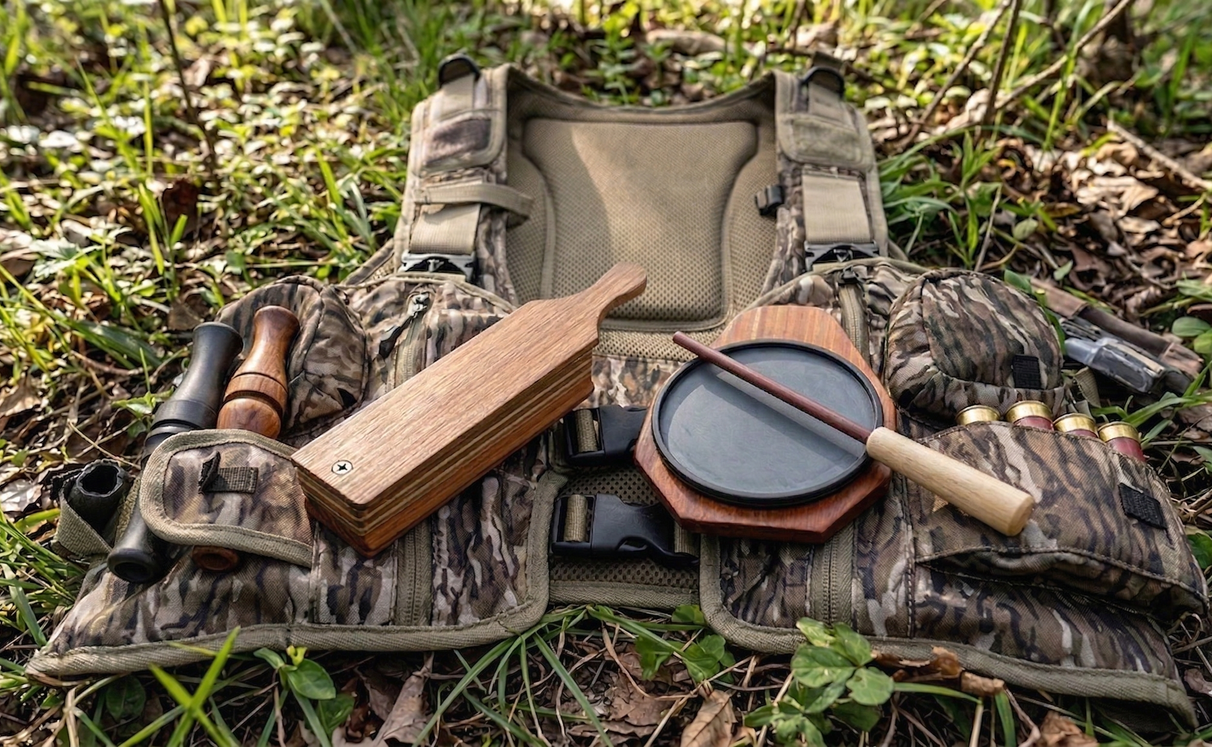
Michigan Spring Turkey Hunting on Public Land: 2026 Guide
Michigan holds about 200,000 wild turkeys. Hunters tag 30,000 to 40,000 of them every spring. And with roughly 4.6 million acres of publicly accessible hunting land spread across both peninsulas, you don't need private ground to fill a tag.
But hunting turkeys on public land in Michigan is a different game than sitting in a field behind your buddy's barn. The birds get pressured. The good spots get crowded. And the regulations changed for 2026, so if you're running on last year's playbook, you need to update it.
This guide covers everything you need to plan a public land spring turkey hunt in Michigan this year. The new TMU structure, license options, the best state game areas and national forest land to hunt, calling strategies for pressured birds, gear that matters, and the mistakes that send most public-land turkey hunters home empty-handed.

What Changed for 2026
The Michigan DNR made some significant changes to the spring turkey season this year. If you hunted Michigan turkeys before 2025, pay attention here.
The biggest change is the structure of the Turkey Management Unit. Michigan reduced the number of TMUs from 14 down to three. That's it. Three units for the entire state.
Unit M covers the Upper Peninsula. Unit NN covers the Northern Lower Peninsula. Unit ZZ covers the Southern Lower Peninsula.
The DNR's upland game bird specialist, Adam Bump, said the goal was to give hunters longer seasons and bigger units. In practice, this means less boundary confusion and more flexibility in where you hunt within your unit. But it also means more hunters spread across fewer administrative zones, so quota dynamics shifted.
The other major change: mandatory harvest reporting. All successful spring turkey hunters must report harvests within 72 hours or before transferring possession of the birds, whichever comes first. You can report online or through the Michigan DNR Hunt Fish app. Don't skip this. It's not optional anymore.
2026 Season Dates and License Options
Here's the full breakdown of license types, dates, and quotas for 2026.
Drawing Licenses (required application by Feb. 1)
These options are valid on public and private land within the three TMUs.
Hunt 0110, Unit M (Upper Peninsula): April 18 through May 31. Quota of 6,000 licenses. This is the longest season window in the state, covering the entire UP. If you drew this tag, you've got over six weeks to find a gobbler.
Hunt 0134, Unit NN (Northern Lower Peninsula): April 18 through May 1. Quota of 18,000 licenses. A shorter window, just two weeks, but it lands right on peak gobbling activity for the northern LP.
Hunt 0302, Unit ZZ (Southern Lower Peninsula): April 18 through May 1. Quota of 8,000 licenses.
Hunt 0303, Unit ZZ (Southern Lower Peninsula): May 2 through May 31. Quota of 8,000 licenses. This is the latter season in southern Michigan, running through the entire month of May.
Guaranteed Licenses (no drawing required)
These went on sale on March 16 at 10 a.m. and don't require entry into the drawing.
Hunt 0234, Statewide: May 2 through May 31. Unlimited quota. Valid on public and private lands statewide except for public lands in Unit ZZ. This is your fallback if you didn't draw. You can hunt public land in the UP and northern LP, plus all private land statewide, for the entire month of May.
Hunt 0301, Unit ZZ (Private land only): April 18 through May 31. Unlimited quota. Valid only on private land in southern Michigan.
Leftover Licenses
If you didn't draw, leftover licenses became available on March 9 for unsuccessful applicants and on March 16 for everyone else. Availability depends on how many people applied in each unit.
The Bottom Line on Licenses
If you're reading this and didn't apply for the drawing, your best public land option is the Hunt 0234 statewide license. It runs May 2-31 and gives you access to public land everywhere except the southern LP. For a public land hunter willing to drive to the northern LP or UP, this is a very good tag. May gobbling activity is strong, and you'll face less pressure than the early-season hunters who hit the woods in mid-April.
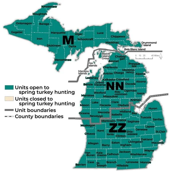
Regulations You Need to Know
Bag limit: one bearded turkey per license. You get one tag for the entire spring season.
Legal weapons: shotgun (must fire a fixed shotgun shell), muzzle-loading shotgun, bow and arrow, or crossbow. No rifles. No handguns.
Decoy rules: mechanical, electronic, and live decoys are prohibited. You can use standard foam or inflatable decoys. Just nothing that moves on its own.
Baiting: illegal. You cannot bait turkeys in Michigan. Hunting over standing crops is legal, but anything you place to attract birds is a violation.
Roosted birds: You cannot shoot a turkey while it's roosting or sitting in a tree.
Shooting hours: half an hour before sunrise to sunset.
Your name and address must be on any equipment left in the field, including ground blinds on public land.
For complete regulations, visit the Michigan DNR Spring Turkey Regulations page.
Looking for more Michigan public land info? Check out our full Michigan public land hunting guide.
Best Public Land for Spring Turkeys in Michigan
Michigan's turkey population is concentrated in the Lower Peninsula, with the southern LP holding the highest densities. The UP has a growing population, particularly in the eastern counties. Here are the properties that consistently produce for public land turkey hunters.
Southern Lower Peninsula
Allegan State Game Area. Allegan County. 50,000 acres. This is arguably the best public land spring turkey property in Michigan. The mix of mature hardwoods, agricultural edges, and open ridges creates textbook turkey habitat. Gobblers use the oak ridges as strut zones and roost in the tall hardwoods along creek drainages. Morning gobbling activity is very strong here from mid-April through early May.
The pressure is real, especially opening weekend. Your edge is going deeper than the parking lot crowds. Most turkey hunters in Allegan set up within 400 yards of a road. The birds learn this fast. Push into the interior timber, especially along the hardwood ridges between creek bottoms, and you'll find gobblers that haven't heard a call in days.
Barry State Game Area. Barry County. 17,000 acres. Rolling hardwood terrain with scattered agricultural fields. Turkey populations are strong, and the terrain creates natural funnels where birds travel between roosting timber and feeding areas. The interior ridges south of Thornapple Lake consistently hold birds.
Flat River State Game Area. Montcalm and Ionia Counties. 11,000 acres. The river bottom and adjacent hardwood ridges provide roosting and strutting habitat. Turkeys work the field edges in the morning and retreat to timber by mid-morning. Set up along the transition zones where hardwoods meet the river floodplain for morning hunts.
Rogue River State Game Area. Kent County. 7,000 acres. Closer to Grand Rapids than most quality turkey ground. The upland hardwoods and swamp edges hold birds throughout the season. Pressure is moderate, and the property is small enough that you can e-scout it thoroughly before your hunt.
Sharonville State Game Area. Lenawee County. 4,000 acres. Southern Michigan farmland is fringed with good turkey numbers. The small size concentrates birds, and the surrounding agricultural land brings them onto public ground to roost and loaf during the day.
Portland State Game Area. Ionia County. 6,400 acres. Underrated turkey property. The mix of upland forest and grassland openings gives you room to work birds with decoys in open areas or call them through timber.
Northern Lower Peninsula
Pigeon River Country State Forest. Otsego and Cheboygan Counties. 106,000 acres. This is big country, and the turkeys here are spread out, but the population is growing. The hardwood ridges in the southern portion of Pigeon River hold the best turkey numbers. The birds are under less pressure than anywhere else in the southern LP.
Your challenge here is to locate birds in a vast landscape. Spend time on the roads at dawn, windows down, listening for gobbles. Once you locate a vocal bird, mark the spot on your app and plan your approach for the next morning.
Au Sable State Forest. Multiple counties. 782,000 acres. The scattered parcels of state forest across the northern LP include some very good turkey ground, especially where the forest borders agricultural land. Look for hardwood stands near open fields. The turkeys in these transition areas are patternable and often less pressured than state game area birds.
Huron National Forest. Multiple counties. 439,000 acres. The hardwood ridges along the Au Sable River corridor hold turkeys, and the dispersed camping option means you can set up a base camp right in the middle of your hunting area. Get on a ridge at dawn and listen. The river bottom acts as a sound funnel, and you can locate gobbling birds from surprising distances.
Upper Peninsula
Menominee and Delta County state lands. The southeastern UP has the strongest turkey population in the Upper Peninsula. State forest parcels near agricultural land hold huntable numbers of birds, and the pressure is almost nonexistent compared to the LP. If you drew a Hunt 0110 tag, the southeastern UP counties are your best bet.
Hiawatha National Forest. Schoolcraft and Alger Counties. 880,000 acres. Turkey numbers in the interior are low, but the southern fringe near farmland holds birds. This is adventure turkey hunting. You won't see other hunters, but you'll need to work for your gobbler.
Explore our state-by-state public hunting directory for more public land across the country.
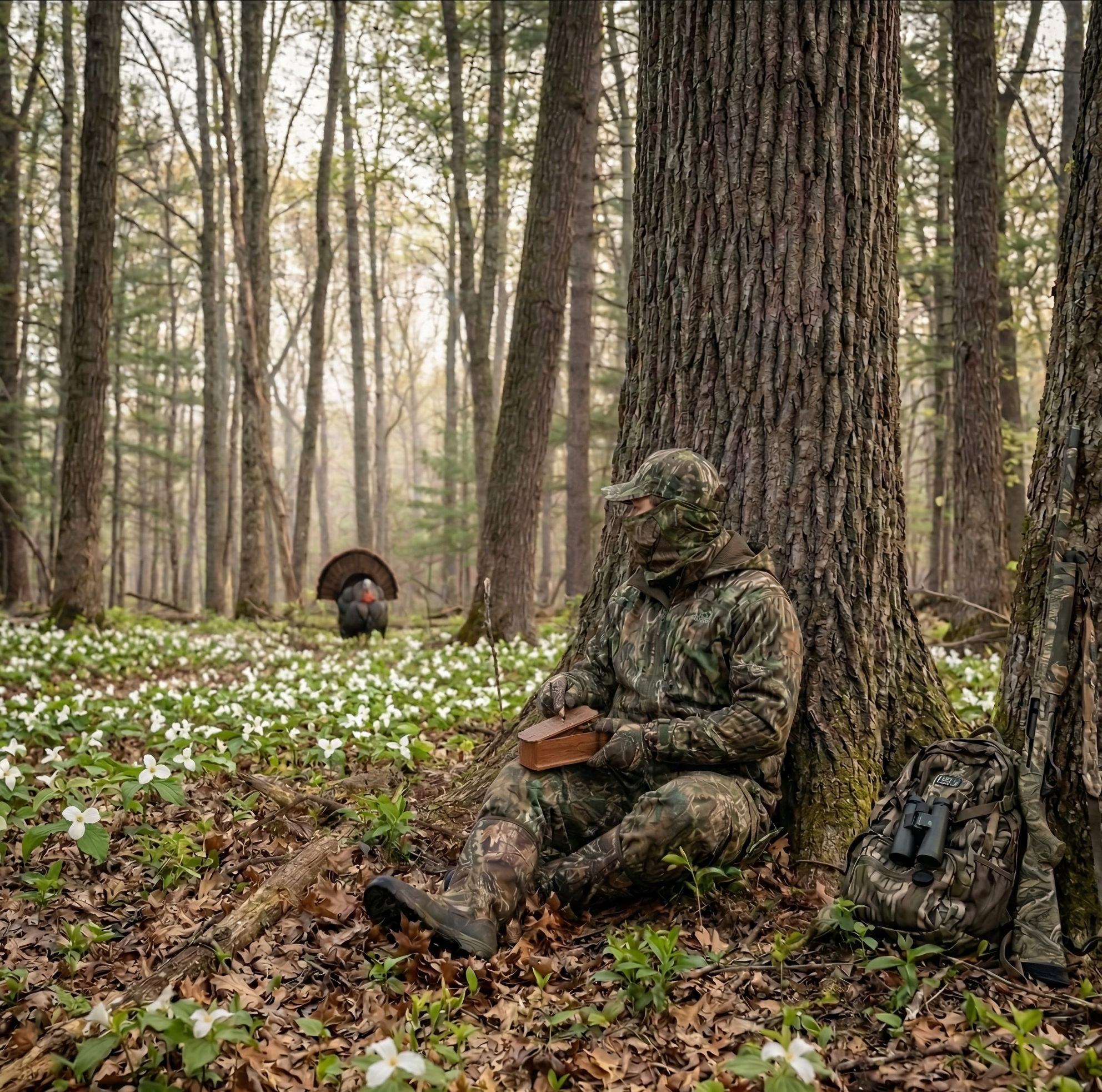
Scouting for Spring Gobblers on Public Land
Start scouting weeks before the season opens. The goal is simple: find where turkeys roost and where they go in the morning.
Roosting
Turkeys roost in mature trees, usually hardwoods, near some kind of terrain feature that provides them a clear view. River bluffs, ridgelines, and timber edges are prime roosting spots. On a calm evening in early April, drive the roads near your hunting area and listen for fly-up gobbles or wingbeats 30-45 minutes before dark. Mark every roost location on your mapping app.
On public land, don't roost a bird and then set up 50 yards from his tree at dawn. You'll bump him. Set up 150-200 yards away, in the direction he's likely to fly down and travel. That usually means downhill, toward an opening or a field edge.
Strutting Areas
Gobblers strut where hens can see them. That means open ground. Look for field edges, logging roads, ridgetop clearings, power line cuts, and grassy openings within the timber. Glass these areas from a distance during mid-morning (9-11 a.m.) in the weeks before the season. If you find a strut zone, you've found a repeatable setup.
Sign
Turkey scratching in leaf litter is hard to miss. Look for disturbed leaves in hardwood stands, especially on south-facing slopes where the ground thaws first in spring. Dusting bowls (shallow depressions in dry dirt where turkeys dust their feathers) indicate regular use. Droppings and feathers confirm the area is getting consistent traffic.
Use Technology
A mapping app like onX Hunt or HuntStand shows you every piece of public land, terrain contours, and property boundaries. Zoom in on the hardwood ridges and field edges adjacent to state game areas. Those transition zones are where turkeys spend their mornings.
Satellite imagery on Google Earth is free and lets you identify strutting areas, clearings, and logging roads from your couch. Look for open patches within hardwood stands. Those are your setup spots.
Calling Strategy for Pressured Public Land Gobblers
Public land turkeys in Michigan hear a lot of calling. By the second week of the season, most gobblers in popular state game areas have been called to, set up on, and either spooked or pressured into going silent.
Here's how to beat that.
Less is More
The biggest mistake public land turkey hunters make is calling too much. A gobbler that answers but won't commit is telling you something. He's heard this before. Instead of cranking up the volume and frequency, do the opposite. Give him a few soft yelps, then go quiet. Set a timer on your phone for 20 minutes. Don't touch your call. Patience kills more pressured gobblers than aggressive calling ever will.
Use Soft Calls
Leave the loud box call in the truck after opening week. Switch to a slate call or a mouth call and keep your volume down. Soft purrs, clucks, and feeding yelps sound like a real hen going about her business. A three-note tree yelp at first light, followed by a fly-down cackle, followed by silence, is a deadly sequence for a roost-adjacent setup.
Call from Where He Wants to Go
Don't call from where you are. Call from where the gobbler wants to be. If you know he roosts on a ridge and flies down to a field edge every morning, set up on the field edge and call from his travel route, not from 200 yards away in the wrong direction. Turkeys take the path of least resistance. Set up on it.
Reap the Silent Bird
Some gobblers go completely silent under pressure. They still gobble, just not when they hear calling. If you've located a bird through scouting but he won't answer your calls, try a silent setup. Get in his travel path between the roost and the strut zone before dawn. Put out a single hen decoy. Don't call. Wait. These silent setups account for a lot of mature longbeards on public ground.
Mid-Morning Reset
Opening morning chaos dies down by 9 a.m. Most hunters leave. The woods get quiet. And gobblers that went silent at dawn often fire back up between 10 a.m. and noon once the hens leave them to nest. Stay in the woods. Move slowly through the timber, pausing every 100-150 yards to give a series of yelps. If a bird answers, sit down immediately, set up, and work him. Some of the best public land turkey hunting of the season happens between 10 a.m. and 1 p.m.
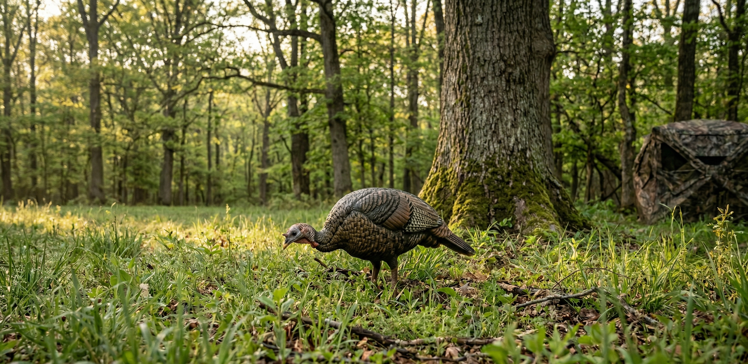
Gear for Michigan Spring Turkey Hunting
You don't need a truckload of equipment. Here's what matters.
Shotgun and Ammo
A 12-gauge is the standard. A 20-gauge works well out to 35 yards, especially with modern TSS (Tungsten Super Shot) loads. If you're shooting lead or standard tungsten, stick with the 12.
Pattern your gun before the season. This is non-negotiable. Set up a turkey target at 30 and 40 yards and shoot it with the choke and load combination you plan to hunt with. You need to know where your pattern centers and where your pellet density drops off. Most turkey misses happen because hunters never pattern their gun.
TSS loads have changed the game. They extend clean kill range to 50-60 yards with the right choke. Federal Heavyweight TSS and Apex TSS are two of the best options. They're expensive, around $5-7 per shell, but you only need one.
Calls
Bring at least three types. A box call for volume and for windy days. A slate or glass call for soft, realistic yelps and purrs. A diaphragm (mouth) call for hands-free calling when a bird is close. If you can only carry one, make it a slate call. It's the most versatile and forgiving for calling cadence.
Primos, Woodhaven, and Zink all make quality slate calls in the $20-35 range. Don't overthink the brand. Pick one and practice with it until your yelps sound clean and consistent. Check the current price on the Woodhaven cherry classic.
Decoys
You're allowed standard, non-mechanical decoys in Michigan. A single hen decoy is enough for most public land setups. A hen and jake combination gets aggressive gobblers to commit faster, but it can also spook subordinate toms. Read the situation.
Avian-X and Dave Smith Decoys make the most realistic options. A budget-friendly Avian-X Lookout Hen does the job for under $80.
Clothing
Full camo from head to toe. Face mask or face paint. Gloves. Turkeys have extraordinary eyesight, and they pick up movement and contrast at distances that will humble you. Your camo pattern matters less than breaking up your outline and staying still.
Michigan spring mornings are cold. Expect 30s at dawn in mid-April, warming to the 50s by mid-morning. Layer accordingly. A lightweight insulated jacket over a moisture-wicking base layer works for the cold sit, and you can shed the jacket as the morning warms up.
Ground Blind vs. Run-and-Gun
Both work on public land. A pop-up ground blind is excellent for field edge setups where you're watching a strut zone and working decoys. It hides your movement completely and keeps you comfortable during long sits. Set the blind several days before you plan to hunt so turkeys can acclimate to it.
For timber hunting and covering ground to locate birds, go mobile. A lightweight turkey vest with a built-in seat pad lets you sit against a tree anywhere. The Tenzing or Alps OutdoorZ turkey vests give you a seat, call pockets, and storage without bulk.
Other Essentials
Bring a headlamp with a red light mode for the pre-dawn walk-in. Bring insect repellent because Michigan mosquitoes show up in May and are aggressive. A compact pair of binoculars lets you glass field edges and identify birds at a distance without moving. The Vortex Crossfire HD 8x42 is a solid, affordable option that earns its place in a turkey vest.
See all of our hunting gear reviews for more recommendations.

Common Mistakes on Public Land
These are the things that burn most hunters every spring.
Setting up too close to the roost. You spook the bird before he even flies down. Give roosting gobblers 150-200 yards of space, minimum.
Calling too aggressively, too early in the sit. Let the woods wake up. Give a bird time to gobble on its own. Your first calls of the morning should be soft.
Leaving too early. Most public land turkey hunters are back at the truck by 9 a.m. Stay until noon. Mid-morning is when lonely gobblers come looking for company.
Hunting the same spot every day. If you pressure a bird two mornings in a row without killing him, he'll change his pattern. Rotate spots. Give areas a day or two of rest.
Not patterning your shotgun. You get one shot. Make sure you know exactly where your pellets are going at 30 and 40 yards.
Ignoring the wind. Turkeys don't smell you, but wind affects how far your calls carry and how well you can hear gobbles. Hunt with the wind at your back or quartering so your calls project toward where you expect birds. On windy days, get into sheltered timber where gobbles carry better, and birds feel more comfortable.
Frequently Asked Questions
Can I hunt spring turkeys on Michigan public land without entering the drawing?
Yes. The Hunt 0234 statewide license is available without a drawing and costs $15. It runs May 2-31 and is valid on public and private land statewide, except for public land in TMU ZZ (southern LP). If you want to hunt public land specifically in the southern LP, you need to draw a Hunt 0302 or 0303 tag or purchase a leftover license, if available.
What time should I be set up for a morning turkey hunt?
Be in position at least 30 minutes before first light. In mid-April, that means being set up by about 6:15 a.m. In May, you'll want to be in place by 5:45 a.m. Getting in early matters because turkeys can gobble on the roost before you can see your hand in front of your face. If you're still walking in when the first gobble rips, you're late.
Is a ground blind or sitting against a tree better for public land turkeys?
Both work. A ground blind is better for field edge setups where you're watching a strut zone and working decoys. Sitting against a tree is better for timber hunting, run-and-gun tactics, and situations where you need to move quickly to a new spot. On public land, versatility matters. If you had to pick one approach, go mobile with a turkey vest and a good seat pad.
Can I use a crossbow for spring turkeys in Michigan?
Yes. Crossbows are legal during the spring turkey season. Bow and crossbow are both valid methods alongside the shotgun and the muzzle-loading shotgun.
What's the best call for public land turkeys in Michigan?
A slate call is the most versatile. It produces soft, realistic yelps and purrs that don't sound like every other hunter in the woods running a box call at full volume. For hands-free calling when a bird is inside 100 yards, a diaphragm call is essential. Carry both plus a box call for high-wind situations or locating distant birds.
The drawing is done, and the season is either open or about to open, depending on your tag. Get your gun patterned, your boots muddy, and your calls tuned. Michigan's 200,000 turkeys are out there. Go find one.
Sign up for our free Michigan Public Land Hunting Guide (PDF) and get weekly updates on access tips, gear reviews, and hunting strategy delivered to your inbox.

Best Turkey Hunting Boots for 2026: 7 Picks for Every Terrain and Budget
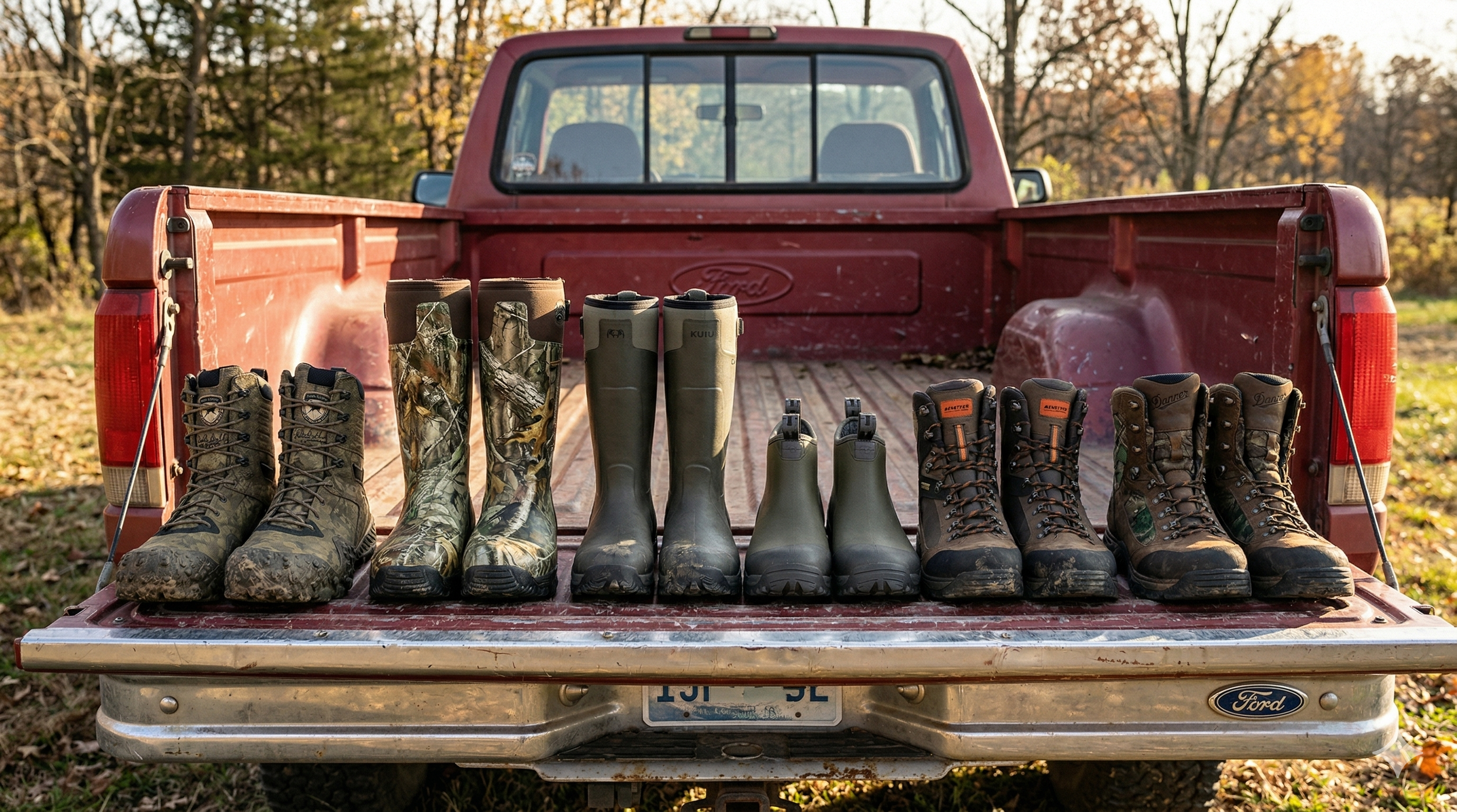
Turkey season punishes your feet in ways deer season doesn't. You're walking logging roads in the dark, crossing flooded creek bottoms at first light, sitting motionless against a tree for two hours, then jumping up and covering a half mile to get ahead of a gobbler that just moved. The boot that handles all of that without leaving you blistered, soaked, or snake-bit is the boot you want on your feet this spring.
I've worn everything from trail runners to knee-high rubber boots chasing birds across public land, and the truth is this: there's no single perfect turkey boot. The right pick depends on your terrain, your hunting style, and what might try to bite your ankle where you hunt. Here are seven boots that cover the full range, ranked by how well they perform for the spring turkey hunter who covers real ground.
Quick Picks: Best Turkey Hunting Boots at a Glance
Best Overall (Lace-Up): Irish Setter VaprTrek 8" — Ultralight, athletic feel, built for run-and-gun hunters. $190-$230.
Best Rubber Boot for Turkey Season: LaCrosse Alphaburly Pro 18" — Waterproof, comfortable enough for miles. $160-$230.
Best for Wet and Muddy Public Land: KUIU HD Mud Boot — Self-cleaning tread and real ankle support in a neoprene boot. $199-$229.
Best Budget Rubber Boot: KUIU Ankle Mud Boot — Same tread technology as the HD, lower profile, lower price. $149.
Best for Hilly Terrain: Kenetrek Corrie 3.2 Hiker — Mountain-boot support with all-day comfort. $250-$290.
Best Snake Boot: Danner Sharptail — 17 inches of fang protection without the typical brick-on-your-foot feel. $320-360.
Best Leather All-Rounder: Danner Pronghorn — Five generations of proven performance in a boot that works from September through May. $240-$270.
Best Boots 2026: Individual Reviews
Irish Setter VaprTrek 8" — Best Overall for Turkey Hunting
The VaprTrek is the boot I grab when I know I'm going to cover ground. At roughly 18 ounces per boot, it weighs less than some trail runners, but it's still a legitimate hunting boot with full-grain waterproof leather, ankle support, and an aggressive Hex Lite outsole that grabs wet hillsides and leaf-covered slopes better than it has any right to at this weight.
What makes it a standout turkey boot is the athletic fit. When a gobbler moves, and you need to circle 300 yards through timber to cut him off, you're not fighting a clunky boot. The sugarcane-based EVA midsole returns energy with every step, and the CuShin tongue design eliminates the pressure point at the front of your shin that most 8-inch boots cause during long walks. UltraDry waterproofing has held up through dewy fields and shallow creek crossings without letting moisture in.
Limitations: This isn't a deep-water or snake-country boot. At 8 inches tall, it won't keep water out if you sink past the ankle, and it offers zero snake protection. If you're hunting bottomland swamps or southern pine flats where copperheads and rattlesnakes are active in April, look further down this list.
Best for: The run-and-gun turkey hunter on public land who covers miles of ridges, hardwood flats, and moderate terrain. Also doubles as an excellent early-season deer boot and scouting shoe.
Price: $190-$230, depending on model and insulation level. Check current price
LaCrosse Alphaburly Pro 18" — Best Rubber Boot for Spring Turkey
The Alphaburly Pro has been the standard rubber hunting boot for a reason. The hand-laid rubber-over-neoprene construction is waterproof, a feature that matters more during spring turkey season than most hunters realize. You're walking through wet fields, crossing creeks, and sitting on damp ground for hours. A boot that keeps moisture out is doing real work.
The EVA midsole is what separates this from cheaper rubber boots. It absorbs impact and adds genuine comfort even after several miles of walking. The adjustable rear gusset fits different calf sizes and makes slipping the boot on and off easier than most 18-inch designs. The multi-layered rubber in the toe and heel withstands rocks and roots without cracking, even in cold morning temps.
Limitations: At 18 inches tall and with a rubber exterior, these are heavier and hotter than lace-up boots. On warm late-April mornings in the South, your feet will sweat. They also take up more pack space if you're traveling, and the break-in period is real; give them a few walks before opening morning. Some users report the neoprene-to-rubber seam degrading after two to three seasons of heavy use.
Best for: Hunters working wet bottomland, river timber, or any ground where you're consistently stepping in water. Also excellent for scent-conscious whitetail hunters who want a boot that pulls double duty in fall.
Price: $160-$230, depending on insulation level. Non-insulated runs are the cheapest and are the right pick for spring. Check the current price on Amazon
KUIU HD Mud Boot — Best for Wet and Muddy Public Land
KUIU's boot lineup is newer to the market than that of the legacy names on this list, but the HD Mud Boot has earned its spot. The standout feature is the patent-pending tread design, inspired by self-cleaning mountain bike tires. The spaced lugs shed mud instead of packing it into the sole, a detail that matters enormously when you're crossing clay bottoms on public WMAs in Missouri or Tennessee, where every step in a standard boot adds a pound of mud to each foot.
The heavy-duty neoprene with a vulcanized rubber overlay keeps water out, and the interior grid fleece liner adds warmth without trapping moisture. What surprised me most about this boot is the ankle support. Most neoprene slip-ons feel sloppy laterally, but the combination of the fitted ankle and 3/4 shank in the HD Mud Boot gives you structure that a typical rubber boot doesn't offer. The EVA sole is comfortable enough for multi-mile walks to remote public land spots.
Limitations: Like all neoprene boots, these will run warm on hot days. The slip-on design means no lacing adjustment; if the fit isn't right out of the box, you're stuck with it. Some users report a pressure point on the front shin from the rubber overlay during long hikes, particularly when wearing jeans instead of hunting pants. Size carefully, as the snug ankle fit that provides support also makes them harder to pull off at the end of the day.
Best for: Turkey hunters on flat to rolling public land where mud, standing water, and creek crossings are constant. The self-cleaning tread earns its keep in clay-heavy soils across the Midwest and Southeast.
Price: $199-$229, depending on color/pattern. Available exclusively at KUIU.com. Check the current price at KUIU.com
KUIU Ankle Mud Boot — Best Budget Pick
If you want the same self-cleaning tread technology and neoprene construction as the HD Mud Boot but don't need 16 inches of height, the Ankle Mud Boot delivers at a meaningfully lower price. It uses the same vulcanized rubber overlay and EVA sole in a lower-profile design that's easier to slip on, lighter on the foot, and cooler in warm weather.
The ankle height makes it a true do-everything boot. I've worn this style for everything from pre-season scouting to food plot work to early-morning turkey sits on higher, drier ground. It works well when paired with gaiters for snake protection or when you just need a reliable, waterproof boot that won't slow you down.
Limitations: The ankle height means no protection in deep water or tall grass with snakes. The neoprene offers no bite resistance. On steep, uneven terrain, you'll miss the ankle support of a taller lace-up boot. This is a fair-weather, moderate-terrain boot; don't ask it to do more than that.
Best for: Budget-conscious hunters who want quality construction without paying $ 200 or more. Also works well as a camp boot, scouting boot, or casual hunting shoe for quick morning hunts on familiar ground.
Price: $149 at KUIU.com. Check the current price at KUIU.com
Kenetrek Corrie 3.2 Hiker — Best for Hilly Terrain
A hiking boot on a turkey hunting list might raise eyebrows, but the Corrie 3.2 is the best boot I've used for covering serious elevation on spring gobbler hunts. If you're chasing Merriam's in the Black Hills, eastern birds through Appalachian hollows, or Rio Grandes across canyon country in Texas, you need a boot built for climbing and descending, not just walking flat logging roads.
The 7-inch leather-and-synthetic upper with K-strap ankle support provides stability on steep sidehills without restricting mobility. The 5mm nylon midsole paired with lightweight Grapon outsoles grips rock and loose dirt confidently, and the cushioning holds up through 10-plus-mile days without breaking down. This boot hikes like a premium backpacking shoe but has the durability and protection of a hunting boot.
Limitations: Not waterproof like a rubber boot; Gore-Tex lined, which means it handles rain and dew but won't survive a creek crossing above the ankle. No insulation in the standard model, so cold early-morning sits can be chilly. The price is steep for a boot that doesn't do everything. And like any lace-up leather boot, there's a break-in period of 15-20 miles before it truly conforms to your foot.
Best for: The mobile turkey hunter in mountainous or hilly terrain who values stability, support, and all-day hiking comfort over waterproof depth. Western turkey hunters chasing Merriam's and Rio Grandes will appreciate this boot most.
Price: $290-325. Check current price
Danner Sharptail Snake Boot Side Zip — Best Snake Boot
Every turkey hunter south of the Mason-Dixon line should own a snake boot, and the Sharptail is the one I recommend for spring. Most snake boots feel like you're wearing a cast, stiff, heavy, and guaranteed to cause blisters by noon. Danner built the Sharptail differently. At 17 inches tall, it provides full lower-leg protection against copperheads, timber rattlesnakes, and cottonmouths, and its full-grain leather upper is noticeably more flexible than that of competing models.
The Open Cell Polyurethane footbed absorbs shock well, and the Plyolite midsole keeps overall weight manageable for a boot in this protection class. The multi-directional lug outsole handles the mix of hardwood ridges, swamp edges, and pine plantations that define Southern and Southeastern turkey country. The 360-degree snake guard doesn't rely on a single panel; it wraps the entire boot.
Limitations: They're still a snake boot, which means they're heavier and less breathable than any lace-up hiker or rubber boot on this list. Breaking them in takes time and patience. On long, aggressive walks in warm weather, your feet will be hot. If you don't hunt in active snake territory, there's no reason to carry this weight.
Best for: Turkey hunters in the Southeast, South, and Mid-Atlantic, where venomous snakes are active in the spring. If you hunt public land in Alabama, Georgia, Florida, the Carolinas, Arkansas, or East Texas, this boot should be in your truck.
Price: $320-360. Check current price
Danner Pronghorn — Best Leather All-Rounder
The Pronghorn is on its fifth generation, and it's earned the reputation it carries. Military, law enforcement, and serious hunters have been wearing this boot for decades, and the combination of full-grain leather, Gore-Tex lining, and Vibram outsole delivers performance that justifies the price across multiple seasons and species.
For turkey hunting specifically, the Pronghorn works on almost any terrain. It provides enough ankle support for steep ridges, enough waterproofing for morning dew and light creek crossings, and enough cushioning for all-day comfort. The build quality means this boot will last three to five seasons of hard use, making the per-season cost very competitive with cheaper boots you'll replace every year or two.
Limitations: At roughly $270, this is one of the most expensive lace-ups on the list. The leather upper is heavier than synthetic alternatives, and it takes 20-plus miles to fully break in. It's also not the quietest boot in the woods; the Vibram sole can click on rock and hardpan in a way that softer-soled boots won't. Not ideal for run-and-gun speed, and not a rubber boot, so deep mud and standing water will get inside.
Best for: The hunter who wants one boot that works for turkey season, early bow season, and late-season sits. If you're buying one pair of lace-up hunting boots and want them to last, this is the investment pick.
Price: $240-$270. Check current price
Turkey Hunting Boots Buyer's Guide: What Actually Matters
Height
Boot height should match your terrain and threats. In snake country, 16 to 18 inches is mandatory. For wet bottomland and creek crossings, 14 to 18 inches keeps water out. For dry ridges and upland timber, 6 to 8 inches is plenty, and you'll move faster and more quietly for it.
Weight
This matters more to turkey hunters than to most other hunters. You're covering ground, sometimes lots of it, in a single morning. Every ounce adds up over miles. A sub-20-ounce-per-boot lace-up like the VaprTrek vs. a 3-pound rubber boot is a meaningful difference by your fifth mile.
Waterproofing vs. Breathability
These are always a tradeoff. Full rubber boots are 100% waterproof but trap heat. Gore-Tex lined leather boots breathe better but won't survive a deep crossing. For spring turkey, where temps can swing from 30 degrees at dawn to 65 degrees by 10 AM, I lean toward boots that breathe unless I know I'm hitting standing water.
Tread Design
Ignore marketing language about "aggressive traction." What matters is how the sole performs on wet leaves, clay, and loose hillside dirt, the three surfaces you'll encounter most during spring turkey season. Self-cleaning designs like KUIU's spaced-lug system matter in heavy mud. Vibram and similar compounds grip wet rock. Shallow lugs tend to pack with clay and become skis.
What's Marketing Hype
Temperature ratings on boots are largely meaningless; they're not standardized, and your feet's warmth depends more on socks, activity level, and blood circulation than any insulation rating. And any boot claiming to be "the only boot you'll ever need" is lying. Different hunts demand different boots.
Budget Spotlight: KUIU Ankle Mud Boot
At $149, the KUIU Ankle Mud Boot is the best value on this list for the turkey hunter who doesn't need snake protection or deep-water capability. You get the same self-cleaning tread technology and waterproof neoprene construction as the $229 HD model, just in a lower-profile package. Pair it with a quality merino wool sock and, if needed, snake gaiters, and you have a spring setup that costs less than most single boots on this list. The ankle height also makes it the most versatile option here; it works for scouting, food plot work, early-season hunts, and camp duty without feeling like specialized gear.
Frequently Asked Questions
Do You Need Snake Boots for Turkey Hunting?
It depends entirely on where you hunt. If you're in the Southeast, Gulf states, or anywhere with an active venomous snake population during April and May, yes, invest in snake boots or, at a minimum, snake gaiters. Copperheads, timber rattlesnakes, and cottonmouths are active during the same warm-up that triggers spring gobbling. If you hunt the Upper Midwest, Northeast, or the Mountain West, where venomous snakes are rare or absent, standard boots are fine.
Are Rubber Boots or Lace-Up Boots Better for Turkey Hunting?
Rubber boots are better for consistently wet terrain, swamps, flooded timber, and creek-bottom hunts. Lace-up boots are better for covering distance on dry to moderately wet ground because they're lighter, more supportive on uneven terrain, and breathe better in warm weather. Most serious turkey hunters own one of each and choose based on the morning's conditions.
How Important Is Boot Weight for Turkey Hunting?
More important than most hunters think. Turkey hunting involves more walking than a typical deer sit, and spring conditions mean warmer temps, which cause fatigue to set in faster. If you regularly cover two to five miles per hunt, the difference between a 20-ounce boot and a 40-ounce boot is significant by mid-morning. Lighter boots also let you move more quietly through dry leaves and timber, a real advantage when you're trying to close distance on a gobbler.
Should You Wear Insulated Boots for Spring Turkey Season?
In most regions, no. Non-insulated or lightly insulated boots are the better choice for spring. Early-morning temps might be cold, but you'll be walking to your setup and generating heat. By mid-morning, insulation becomes a liability. If you hunt northern states where opening week can still bring frost or snow, a lightly insulated option (200-400 grams) makes sense. For the Southeast, Gulf Coast, or any hunt after mid-April, skip the insulation entirely and wear a heavier sock if mornings are cool.
Can You Use the Same Boots for Turkey and Deer Season?
Absolutely. Crossover is one of the best ways to justify spending more on quality boots. The Danner Pronghorn, Irish Setter VaprTrek, and LaCrosse Alphaburly Pro all transition seamlessly from spring turkey to fall deer. The only adjustments are insulation level (swap to insulated models or heavier socks for late-season deer sits) and height (you might want a taller rubber boot for November's rain and snow). Buying a boot that works across seasons is smarter than owning a closet full of specialized footwear you wear three times a year.
Want more gear recommendations and public land strategies delivered straight to your inbox? Sign up for our free state-by-state public land hunting guides and never miss a new review.
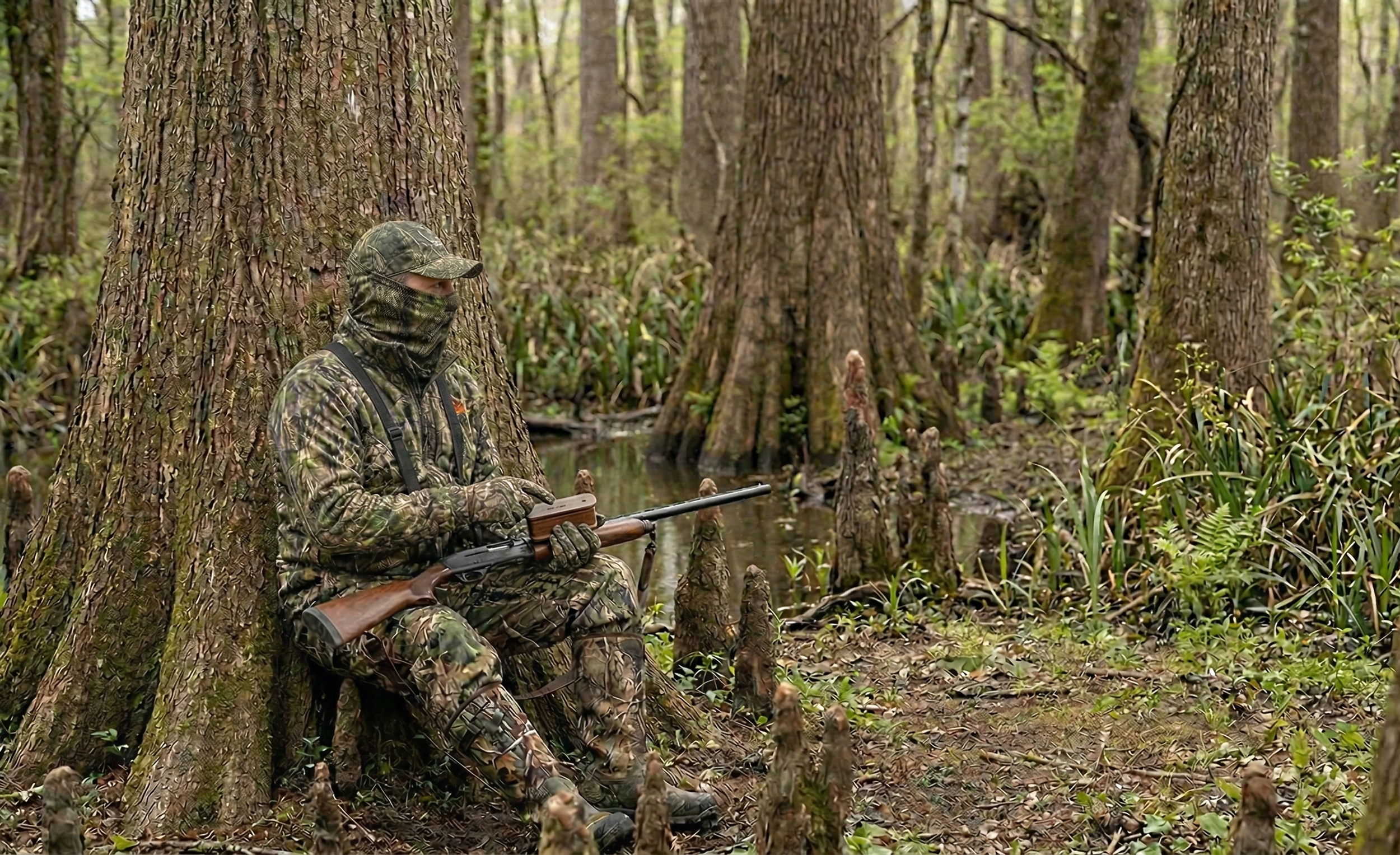

Public Land Turkey Hunting: How to Kill Pressured Toms
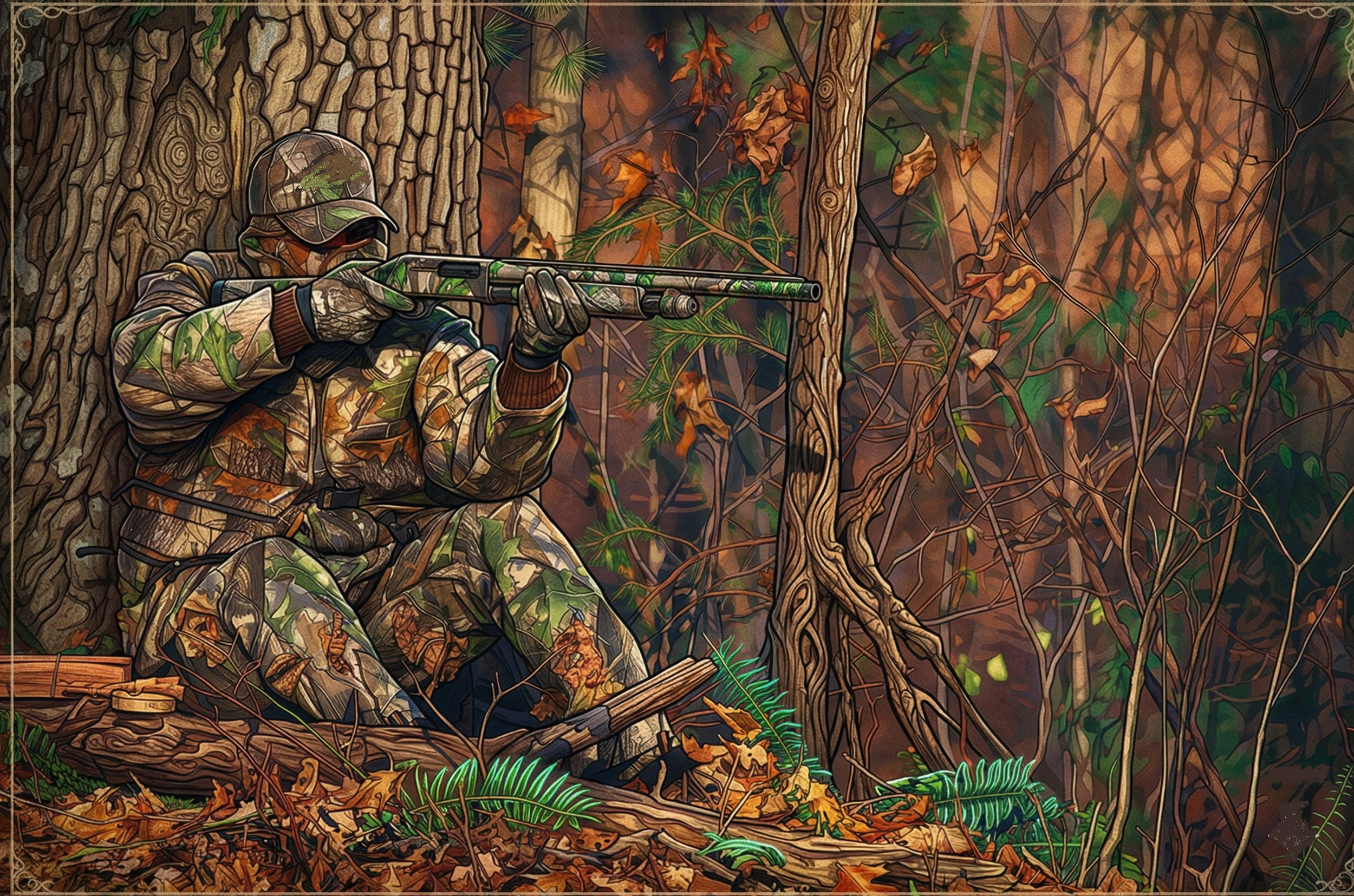
How to Kill Pressured Toms on Public Land
A pressured gobbler doesn't act like the birds you see on TV. He doesn't sprint into your decoy spread at 40 yards. He doesn't hammer back at every yelp you throw at him. He gobbles once on the roost, pitches down the opposite direction, and disappears into a drainage you didn't know existed. If you've hunted public-land turkey for more than one season, you've met this bird, and he's probably still alive.
Killing educated toms on public land requires a fundamentally different approach than what works on private ground or early in the season before pressure sets in. The tactics below aren't theoretical. They come from years of chasing the same birds that every other truck at the parking lot is chasing, and consistently tagging out when the woods go quiet.
Why Standard Turkey Tactics Fail on Pressured Public Land
Most turkey hunting advice assumes a cooperative bird. Set up, call, wait. That sequence works on a gobbler that hasn't been bumped off his roost three mornings in a row or had six different hunters throw slate calls at him from the same field edge.
Public land toms, especially after the first week of season, learn a specific pattern: the sound of a call followed by a motionless setup equals danger. They've been educated by every hunter who parked at the main access, walked 200 yards in, set up on the first ridge, and started hammering a box call at flydown. These birds aren't stupid. They're conditioned.
Your job is to break the pattern they've learned to avoid.
Step-by-Step: A Pressured Tom System That Works
Scout Before Season With Purpose
Don't just listen for gobbles during your pre-season scouting. Map the terrain. You need to know where birds roost, where they go after flydown, and critically, where other hunters set up. Mark trailhead parking areas on your onX Hunt app. Note boot tracks, ground blind locations, and field edges that get the most attention. The spots every hunter gravitates toward are exactly the spots you're going to avoid.
Walk ridgelines and creek bottoms during mid-morning in March and early April. Locate dusting sites, strut zones (look for drag marks in the dirt), and travel corridors between roosting timber and open feeding areas. Log all of it on your mapping app with waypoints. You're building an intelligence file on the landscape, not just listening for noise.
Change Your Access
The single biggest edge you can give yourself on public land is entering from a direction no one else uses. Most hunters walk in from established trailheads and work inward. Pressured gobblers learn to avoid those approach corridors within days.
Study aerial imagery and topo lines on onX Hunt to find alternate entries. Maybe it's a power line right-of-way on the back side. Maybe it's a creek crossing 400 yards downstream from the bridge everyone else uses. Maybe it's a logging road that dead-ends a half mile from the main parking lot, but connects to the same ridge system from the opposite side. The harder the walk-in, the fewer hunters, and the less educated the birds.
Get in early. Forty-five minutes before first light, minimum. If you're walking in at shooting light, you're already behind. Pressured birds gobble less on the roost, and when they do, it's brief. You need to be in position before they make a sound.
Call Less, Listen More
This is where most hunters on public land fail completely. They overcall. A pressured gobbler has heard aggressive yelping, cutting, and purring from every setup in the area. He associates that volume and frequency with danger.
Your first sequence of the morning should be soft. Two or three tree yelps before flydown, nothing more. If a bird gobbles, resist the urge to hammer back. Give him one soft yelp and then shut up. Let silence do the work. A tom that won't commit to aggressive calling will often walk quietly toward a hen he thinks is just out of sight, precisely because she's not making a scene.
If you don't hear a gobble at all, sit tight for at least 30 minutes after flydown and scratch leaves with your hand or the back of your call. Subtle, intermittent feeding sounds, a few soft clucks, a gentle purr, mimic a real hen better than any aggressive sequence.
Set Up Off the Obvious Spots
Where most hunters set up: field edges, food plot borders, road intersections, and open hardwood flats with good visibility.
Where pressured gobblers go: inside the timber, along benches halfway up a ridge, through saddles between two ridge points, and down into creek bottoms where they can travel without skylining themselves.
Set up 80 to 150 yards off the main travel routes other hunters use. Get into the terrain features, the inside corners, the small benches on steep hillsides, and the pinch points between two drainages. Use your topo map to identify terrain funnels: places where the ridge narrows, where two hollows converge, or where a strip of mature timber connects two larger blocks. These are the travel lanes that pressured birds default to because they offer cover and escape routes.
Be Willing to Reposition
Static setups kill more unpressured birds than they kill educated ones. If you've been sitting for 90 minutes without hearing a sound, move. Not to another road or parking lot, deeper into the cover.
When you reposition, go slow. Take 50 to 75 steps, stop, scan, and listen for five minutes. If you hear drumming or spot movement, drop immediately and set up right there. Pressured gobblers often close distance silently, no gobbling, no drumming, you can hear beyond 75 yards. A slow creep through likely habitat lets you intercept birds that aren't announcing themselves.
The Afternoon Shift
Most public land turkey pressure is concentrated between 5:30 AM and 10:00 AM. By noon, the parking lots are empty. That's when pressured gobblers start to loosen up.
Afternoon hunting, where legal, is one of the most underutilized tactics on public land. Toms that were lockjaw all morning will start gobbling again between 2:00 PM and roosting time. Set up near known roost areas, strut zones, or field edges with fresh sign. Call softly every 20 to 30 minutes. Afternoon gobblers are often henned-up toms who've bred and are now looking for company again, and they're more responsive because they haven't been pressured for six hours straight.
Check your state regulations. Some states allow all-day hunting, while others restrict hours to morning only or close turkey hunting at noon or 1:00 PM.
A Real Scenario: Creek Bottom Tom in Southeast Ohio
Late April, second week of Ohio's spring season. The main parking lot at a Wayne National Forest tract had four trucks in it by 5:00 AM. I'd scouted the area two weeks earlier and marked a roost site 600 yards east of a creek, accessible from a township road a half mile south, a route no one was using because it required crossing a knee-deep creek in the dark.
I crossed the creek at 4:45 AM, worked up the east-facing slope, and set up on a small bench 80 yards below the ridgetop. At 5:50 AM, one gobble. Just one. Then silence. Three other hunters on the west side of the ridge started calling aggressively. I could hear at least two box calls and a slate working hard.
I did nothing. Sat against an oak with my Vortex Diamondback HD 10x42 binoculars in my lap, shotgun on my knee, and waited. At 6:20 AM, I caught movement below me, a tom walking the creek bottom, heading south, away from the calling. He was doing exactly what pressured birds do: going the opposite direction from the noise.
I gave one soft cluck. He stopped. I clucked once more and scratched the leaves. He turned and walked uphill toward me, completely silent. No gobble, no drum. At 30 yards, he hit a small opening. I could see his beard dragging the ground, and I took the shot. That bird had been bumped by the same hunters from the same side three mornings running. He'd learned the pattern. I just gave him a different one.
When to Use These Tactics
These approaches work best in specific conditions:
Season timing. After the first week of any public land turkey season. Early-season birds are often still responsive to standard tactics; save the pressure strategies for when the woods have been hammered.
Weather. Overcast, drizzly mornings are ideal for pressured birds. Rain keeps casual hunters home, which means less pressure. Gobblers are also more likely to move through open areas during low-light conditions.
Terrain. Hilly, timbered country with drainages and mixed cover gives you the most options for alternate access and unconventional setups. Flat, open public areas with limited cover are harder. Pressured birds on flat ground tend to hang up at extreme range because they can see so far.
Species. Eastern wild turkeys are the most susceptible to pressure conditioning because they inhabit the most heavily hunted regions. Merriam's and Rio Grande birds in western states face less concentrated pressure, though the same principles apply in walk-in areas near population centers.
Gear That Matters for Pressured Birds
You don't need a truck full of equipment. But a few specific items make a measurable difference.
Mapping app. onX Hunt is non-negotiable. The property boundary layers keep you legal on public parcels with confusing borders, and the satellite imagery lets you scout access routes from your couch. [Try onX Hunt free for 7 days]
Binoculars. A compact pair like the Vortex Diamondback HD 8x32 lets you glass timber edges and creek bottoms without moving. On pressured birds, spotting a tom at 200 yards before he sees you is the difference between a filled tag and a busted setup.
Calls. Keep it simple. A quality pot call with a wood peg for soft, raspy yelps. The Woodhaven Ninja is a go-to for quiet, realistic tones. A mouth call for hands-free work when a bird is closing. Skip the loud box call on pressured birds entirely.
Decoys. On pressured public land, decoys can hurt you more than help. Every other hunter is using them, and educated toms learn to hang up at the sight of a motionless fake hen at 60 yards. If you do use one, go with a single feeding hen, no jakes, no full-strut toms. Better yet, leave the decoys in the truck and rely on calling and position.
Seat or pad. You're going to sit longer than you think. A quality vest with an attached lightweight chair like the ALPS OutdoorZ NWTF Grand Slam keeps you comfortable and still during the long waits pressured hunts demand. Fidgeting and shifting kill more turkey hunts than bad calling.
What Most Hunters Get Wrong
Overcalling
This is the number one mistake. Pressured gobblers don't respond to volume; they respond to silence and subtlety. If a bird gobbles once and shuts up, your instinct says call louder and more aggressively. That instinct is wrong. He heard you the first time. He's either coming quietly or he's not coming at all. Adding more calling only confirms his suspicion that something isn't right.
Hunting the Same Spots Everyone Else Hunts
Walking 200 yards from the parking lot and setting up on the first good-looking ridge isn't a strategy; it's convenience. Every other hunter does the same thing. Pressured birds learn to avoid those setups within days. Put in the extra distance. Cross the creek. Climb the steep side. If you're comfortable, you're probably not far enough from the truck.
Not Staying Long Enough
Most hunters move on after 30 to 45 minutes of silence. Pressured gobblers can take two hours to commit. They circle downwind, approach from unexpected directions, and close the last 100 yards in absolute silence. If you picked a good spot based on solid scouting, trust it. Sit there until at least 1000 AM before repositioning.
Advanced Tactics for Experienced Hunters
Run-and-Gun in the Timber Interior
Once you've identified where pressured birds travel mid-morning, typically through interior timber, along benches, and through saddles, use an aggressive mobile approach. Move through these corridors slowly, calling every 100 to 150 yards with a single series of soft yelps, then sitting for 10 to 15 minutes. You're not trying to pull a bird to you from a distance. You're trying to bump into one that's already moving through the same cover.
The Two-Day Setup
Hunt a specific bird's pattern over consecutive days without trying to kill him on day one. Day one is pure observation. Note what time he flies down, which direction he goes, where he ends up by 9:00 AM, and what terrain features he uses. Day two, set up directly on his travel route before he gets there. This is patience-intensive, but it's deadly on that one bird nobody else can figure out.
Roost Ambush at Last Light
The evening before your morning hunt, slip into the area and listen for birds flying up to roost. Don't call. Just note the tree, the direction the bird faces on the limb, and the terrain below. The next morning, set up 100 yards downhill of the roost tree in the direction you expect him to pitch, which is almost always downhill and into an opening. Be in position an hour before first light and do not make a sound until he's on the ground.
Frequently Asked Questions
How Do You Know if a Tom Is Pressured?
A pressured tom gobbles infrequently, often once or twice on the roost, then goes silent. He tends to move away from calling rather than toward it. He may hang up at 80 to 100 yards and refuse to close the distance. If birds in your area were responsive early in the season and have gone quiet, pressure is almost certainly the cause.
Should You Use a Gobble Call on Public Land?
Generally, no. Gobble calls on public land create two problems: they can pull other hunters toward your position, which is a safety concern, and pressured toms often retreat from gobble calls because they associate aggressive tom sounds with competition they've learned to avoid. Stick with hen sounds, and keep them quiet.
What Time of Day Are Pressured Toms Most Active?
Mid-morning (9:00 to 11:00 AM) and late afternoon (2:00 to 6:00 PM, where legal) tend to be the windows when pressured birds let their guard down. Most hunter activity is concentrated around flydown, so the later you're willing to hunt, the less competition you'll face.
How Far Should You Walk In on Public Land to Avoid Other Hunters?
There's no magic number, but data on GPS-tracked hunter movements suggests that most public-land hunters stay within a quarter mile of road access. Getting a half mile or more from a trailhead puts you past the majority of the competition. On flat terrain, that number drops; even 400 yards off the road can make a difference if you use terrain or water crossings to access areas others skip.
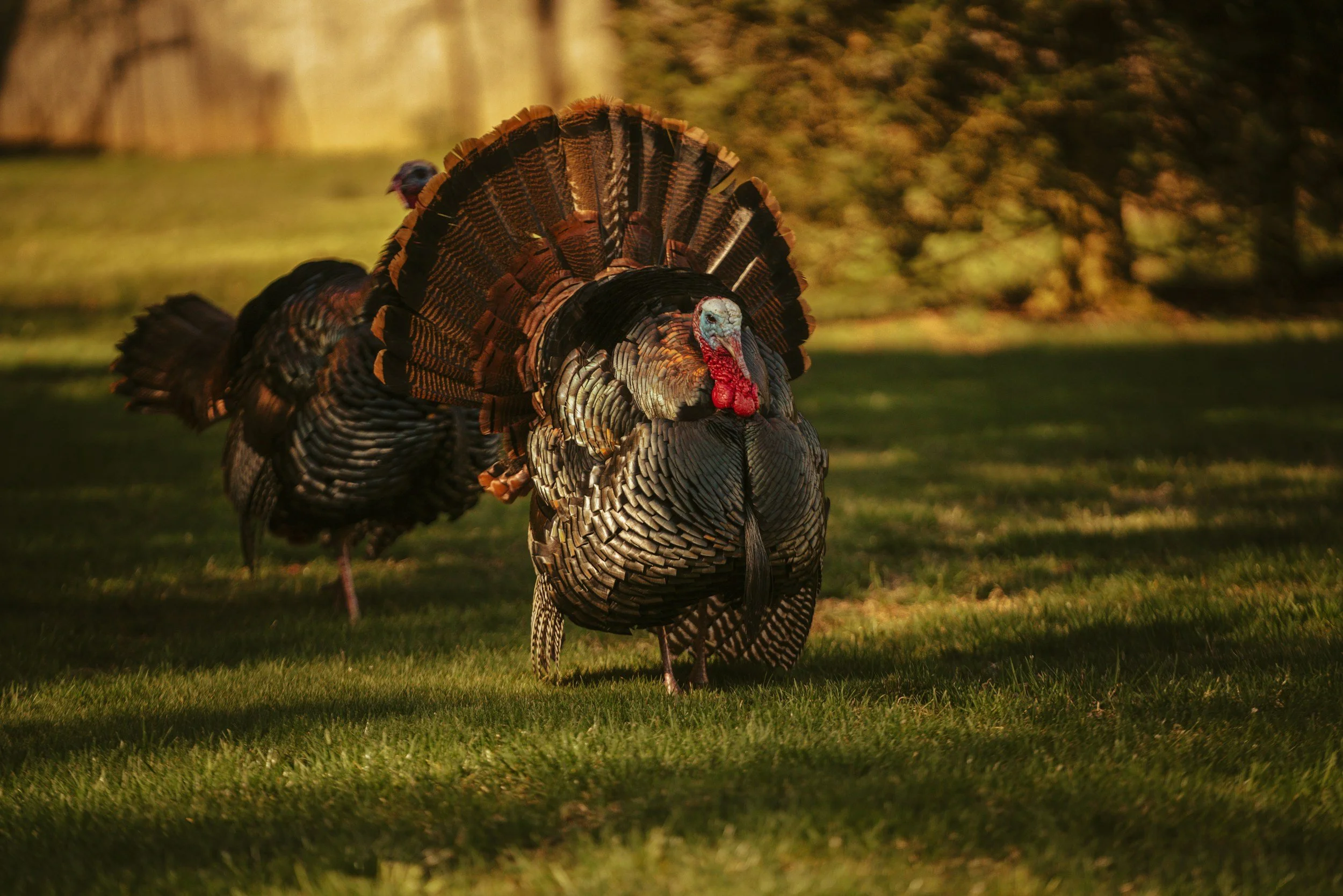

My KUIU Kit: What I Wear for Whitetail
When you're chasing whitetails, your gear isn't just about comfort — it's about confidence. From silent stand approaches to long, frozen sits, every layer matters. In this article, I break down my full KUIU whitetail kit, piece by piece, and explain why I trust their gear exclusively. Whether you're new to hunting or fine-tuning your setup, this guide is built to help you hunt smarter, stay warmer, and move quieter.
Whitetail hunting isn’t about convenience. It’s about adaptability, preparation, and being willing to do the hard work to earn your shot. And when you’re hauling gear in before dawn, hanging mobile setups, or glassing from a ridge line in shifting November winds — the last thing you want to question is your clothing system.
That’s why I wear KUIU exclusively.
This isn’t a sponsored post, and I’m not part of a pro team. I chose KUIU because their gear flat-out works, especially for hunters like me who value performance, weight, durability, and function over hype.
Here’s a breakdown of what I wear for whitetail season in various conditions, from early-season scouting missions to frosty all-day rut sits.
Early Season (60°– 75°F)
Base Layer (Top & Bottom):
Gila LS Crew
It is lightweight, breathable, and designed for heat. It has built-in thumb loops and provides great sun and bug protection. It dries quickly after a sweaty walk.
Pants:
Kutana Stretch Woven Pant
If you know, you know. Flexible, breathable, and nearly silent, the Kutana Pants are ideal for mobile setups. I can hike, climb, and crouch without restriction.
Bonus Gear:
Mid Season (45°– 60°F)
Jacket:
Encounter Jacket
Dead quiet in the woods and built for flexibility — perfect on its own during cool sits or layered under heavier insulation in frigid weather.
Base Layer:
Peloton 200 Zip-T
Great for layering when temps start to dip. Lightweight warmth without bulk.
Mid Layer:
Kenai Jacket
This is my go-to for chilly mornings when I don’t want to pack bulky outerwear. It breathes well and stays quiet when I draw or move.
Pants:
Encounter Pant
Silent in the stand, flexible in the field, it is ideal as a stand-alone garment in mild temperatures or layered up when the cold moves in.
Gloves/Hat:
StrongFleece 220 Gloves, Peloton 240 Beanie
Great warmth-to-weight ratio.
Late Season (20°– 45°F)
This is when public land hunting gets real — long sits, limited movement, and biting cold. This is where KUIU’s layering system shines.
Base Layer:
Peloton 118
It's a lightweight synthetic base layer with just enough stretch to dry fast and not sag. Although the bottoms are longer in production (you can find them in the outlet), they’re still my go-to for early-season comfort and quick-drying performance. For a current option, I recommend the ULTRA Merino 145, KUIU’s best-selling mid-weight Merino base layer. It’s naturally odor-resistant, breathable, and built for multi-day hunts without the funk.
Mid Layer:
Super Down LT Jacket
Serious warmth from high-loft goose down, windproof when the weather turns, and packable into its pocket for easy carry. The matte finish keeps it low-profile in the field—no shine, no noise, just performance.
Outer Layer (Top):
Proximity Insulated Jacket
Ultra-quiet and built for the stand, this insulated jacket delivers reliable warmth for cold whitetail hunts without giving away your position.
Outer Layer (Bottom) above freezing:
Kenai Insulated Pant (zip-off)
Easy to slide on over my base layer when I settle into a stand. Zip-off sides mean I can ditch them when hiking out or repositioning.
Outer Layer (Bottom) below freezing:
Proximity Insulated Pant
Ultra-quiet and built for long sits, these insulated pants keep you warm in frigid whitetail conditions without sacrificing stealth or comfort.
Extras:
Kenai Beanie
KUIU’s warmest beanie — high-loft sherpa fleece lined with 3DeFX+ insulation to trap heat and cut the cold on those bitter late-season hunts.
Proximity Hand Muff
Ultra-quiet, windproof, and insulated, it is built to keep your hands warm and ready when the cold bites and the moment matters.
Proximity Neck Gaiter
Soft, silent, and wind-resistant, it adds critical warmth and concealment without bulk, perfect for cold sits.
Merino Over-the-Calf Sock
Warm, breathable, and built to stay put — the ULTRA Merino OTC Sock delivers all-day comfort, natural odor resistance, and zero bunching during long hikes or cold sits.
Why KUIU Works for Whitetail
Stealth: Soft, quiet fabrics that don’t betray your movement in the stand.
Mobility: Built for hunters who move — not just sit.
Layering Flexibility: Easily adjust to unpredictable weather swings.
Weight-to-Warmth Ratio: When you're deep in, every ounce counts.
Whitetail hunting is hard enough. Your gear shouldn’t hold you back — it should elevate your hunt. KUIU has done that for me, season after season. Whether you’re saddle-hunting deep in state land or ground-sitting a creek-bottom funnel, having the right kit matters.If you're looking to overhaul your kit, I’d confidently recommend any of the pieces above. Build your system one layer at a time, and KUIU will prove its worth every step of the way.
About the Author:
Jamie Jent has been hunting for over 35 years and is deeply involved in habitat restoration and wildlife management through organizations like the Quality Deer Management Association and Pheasants Forever. A retired firefighter, he now dedicates his time to conservation and helping others succeed on public land. He founded LandsToHunt.com, Your DIY Public Land Hunting Resource, to make public land hunting more accessible, ethical, and rewarding.

Think Outside the WMA: Your Guide to BLM, State Forests, Trust Lands & Other Public Hunting Spots
Feel like you're hunting the same WMA year after year? You might be missing out! Millions of acres of BLM lands, National Forests, State Forests, and even State Trust Lands offer incredible opportunities. Learn how to identify, understand, and access these diverse public lands beyond the familiar WMA. Click here to unlock more hunting spots...
So, you've scouted your local Wildlife Management Area (WMA) inside and out. You know every trail, every food plot. That's fantastic! WMAs are invaluable resources for hunters across the country. But what if I told you they often represent just a fraction of the publicly accessible land available for your next hunt?
Millions upon millions of acres across the United States are open to public access and hunting, managed by various state and federal agencies. Understanding these different land types can unlock incredible new opportunities, reduce pressure, and lead you to entirely new adventures. Let's look beyond the WMA and explore the diverse landscape of public hunting lands.
Wildlife Management Areas (WMAs): The Familiar Starting Point
Let's start with the familiar. WMAs (sometimes called Game Lands, Wildlife Areas, etc.) are typically managed by your state's fish and wildlife agency. Their primary purpose is usually wildlife conservation and providing public hunting and fishing opportunities. They often feature habitat improvements specifically designed to attract game species.
Key Characteristics:
Managed by state wildlife agencies.
The primary focus is on wildlife habitat and hunting/fishing access.
Regulations are specific to hunting and wildlife management goals.
While crucial, limiting your search to WMAs means potentially overlooking vast tracts of other accessible lands.
Bureau of Land Management (BLM) Lands: Wide Open Spaces
(Image Placeholder: Photo typical of BLM land - high desert, sagebrush, Western landscape)
Primarily located in the Western United States and Alaska, BLM lands encompass a staggering amount of acreage – roughly 245 million acres! Managed by the Federal Bureau of Land Management, these lands are typically managed for multiple uses, including recreation, grazing, mining, and conservation.
Key Characteristics:
Managed by the federal BLM.
Concentrated primarily on Western states and Alaska.
It often features grasslands, deserts, foothills, and some forested areas.
Generally open to hunting under state regulations unless specifically posted closed.
Often less developed than National Forests or WMAs, access can be rugged.
Emphasis is on multiple uses, so be aware of other potential users (grazing cattle, mining activity, recreationists).
BLM lands offer incredible opportunities for big game, upland birds, and exploring vast, less-pressured areas, especially if you're willing to hike and navigate.
National Forests (USFS): Forests for Many Uses
(Image Placeholder: Photo of a National Forest landscape - dense woods, mountains)
The U.S. Forest Service (USFS) manages our National Forests, which cover nearly 193 million acres across the country. Like BLM land, National Forests are managed for multiple uses: timber harvesting, recreation (camping, hiking, hunting, fishing), watershed protection, grazing, and wildlife habitat.
Key Characteristics:
Managed by the federal U.S. Forest Service.
Found across the country, often in mountainous or heavily forested regions.
Managed for multiple uses, balancing resource extraction and recreation.
Generally open to hunting under state regulations unless specifically signed otherwise (e.g., around developed campgrounds or administrative sites).
Often have more developed road and trail systems than BLM lands.
Regulations can cover vehicle use (designated routes), camping (dispersed camping often allowed), and timber management activities.
National Forests provide diverse habitats, from high-elevation wilderness to dense eastern woodlands, supporting a wide array of game species.
State Forests: Your State's Woodlands
Distinct from State Parks and often from WMAs, State Forests are managed by a state-level agency (often a Department of Natural Resources or Forestry Commission). Like National Forests, they are frequently managed for multiple uses, including timber production, recreation, and wildlife habitat.
Key Characteristics:
Managed by state forestry or natural resource agencies.
Rules and regulations vary significantly by state.
Often managed for timber production alongside recreation.
Hunting is usually permitted according to state regulations, but always verify specific rules for the forest you plan to visit.
There may be different access rules or permit requirements than state WMAs or parks within the same state.
Don't overlook State Forests – they can offer substantial acreage and excellent hunting opportunities closer to home than some federal lands.
(Use H2 Heading in SquareSpace)
State Trust Lands (School Lands): A Unique Category (Research Required!)
This category requires careful attention. The federal government granted State Trust Lands to states specifically to generate revenue for public institutions, primarily schools.
Key Characteristics:
Managed by a state agency (often separate from fish & wildlife or forestry).
Primary Goal: Generate revenue (through grazing leases, timber sales, mining, etc.).
Access Varies WIDELY by State: This is the crucial point.
Some states allow public hunting access with a standard hunting license (similar to BLM/National Forest).
Some states require a specific "State Trust Land Access Permit" in addition to your hunting license.
Some states restrict access only to specific tracts enrolled in access programs.
Some states lease tracts exclusively, meaning no public access is allowed on those parcels.
Always Verify: You MUST check the specific regulations for State Trust Land access in the state you intend to hunt. Assuming they are open like other public lands can lead to trespassing.
When accessible, Trust Lands can offer good hunting, but diligent research into state-specific rules is non-negotiable.
(Use H2 Heading in SquareSpace)
Don't Forget These! Other Public Access Opportunities
Beyond the major categories, keep an eye out for:
National Grasslands: Managed by the USFS, similar multi-use principles as National Forests but in prairie ecosystems.
National Wildlife Refuges (NWRs): Managed by the U.S. Fish & Wildlife Service. Primarily for wildlife conservation, but many offer specific hunting programs (often require special permits, have specific hunt areas/dates, and stricter regulations). Research each refuge's rules individually.
State Parks: While often focused on non-consumptive recreation, some State Parks offer limited hunting opportunities, frequently through special permit drawings or restricted seasons/areas. Check state park regulations carefully.
U.S. Army Corps of Engineers (USACE) Lands: Many USACE properties, often associated with reservoirs and waterways, allow hunting. Check project-specific maps and regulations.
County/Municipal Lands: Some counties or towns manage forests or natural areas that may permit hunting. Requires local research.
Public Access Programs (e.g., Walk-In Areas): State-run programs that provide public hunting access to enrolled private lands (like PLOTS in ND/SD, WIHA in KS, etc.). These are invaluable and usually detailed on state agency websites/atlases.
Finding Your Spot: Tools & Resources
Okay, how do you find all these different land types?
State Fish & Wildlife Agency Websites: Your primary resource for WMAs, state-specific regulations, and public access program maps (Walk-In Areas).
Federal Agency Websites: BLM, USFS, and USFWS websites have maps and recreational information for their lands. Recreation.gov can also be a starting point.
Digital Mapping Apps: Tools like onX Hunt, HuntStand, BaseMap, and GoHunt Maps are invaluable. They aggregate public land layers from various agencies, show boundaries and landowner information, and often include specific regulations or points of interest. These are crucial for identifying different land types and staying legal.
LandsToHunt.com!: Our directory aims to bring together links and information for public hunting opportunities across all 50 states, helping you navigate these different agencies and land types. (Link this to your homepage or relevant directory section)
The Golden Rule: Research Specific Regulations BEFORE You Go!
If there's one takeaway, it's this: Public land access rules are not universal. Just because land is publicly owned doesn't automatically mean you can hunt it, or hunt it the same way as the WMA down the road. Before setting foot on any new piece of public land, verify:
Is hunting allowed? (Are you sure it's open?)
Property Boundaries: Know exactly where public land starts and ends. Use GPS/mapping apps.
Specific Agency Rules: BLM, USFS, State Forest, NWR, etc., all have particular regulations.
State Hunting Regulations: Seasons, bag limits, and license requirements still apply.
Access Points: Where can you legally enter the property?
Vehicle Use Rules: Are vehicles restricted to certain roads? Is off-road travel permitted (usually not)?
Camping Regulations: Is dispersed camping allowed? Designated sites only?
Any Special Permits Required? (Especially for NWRs, State Trust Lands, quota hunts).
Explore, Discover, and Hunt Responsibly
Understanding the full spectrum of public land opens up a world of opportunity for hunters. From the vast deserts of the BLM West to the dense woodlands of eastern State Forests, incredible adventures await beyond the familiar WMA.
Take the time to research the different types of public land available in the states you hunt in. Use the available tools, respect the land and its specific regulations, and enjoy the immense privilege of hunting on America's public lands.
What's your favorite type of public land to hunt beyond WMAs? Share your experiences or tips in the comments below! Don't forget to check out our LandsToHunt Directory to start exploring opportunities in your state.

Solo Hunt, Solo Film: Mastering the Art of Self-Filmed Turkey Hunts on Public Land
How to Successfully Self-Film Your Public Land Turkey Hunt
Self-filming a turkey hunt on public land is an ambitious yet rewarding pursuit. Capturing your outdoor experiences on camera can enhance the hunt, help preserve memories, and offer learning opportunities through reviewing your footage. However, successfully filming your hunt while pursuing wary gobblers on public land presents unique challenges. Here's a practical guide to help you document your next spring turkey adventure effectively.
Why Self-Film Your Hunt?
Documenting your hunt provides lasting memories and valuable learning experiences. Reviewing a film can reveal subtle details like turkey behavior, calling effectiveness, and critical mistakes made during the hunt. Additionally, sharing your footage can inspire others, help preserve hunting traditions, and highlight opportunities on public lands. Groups like the National Wild Turkey Federation use hunter-produced footage to educate new spring hunters and preserve wild turkey habitat, and your film can contribute to that tradition.
Essential Filming Equipment
Quality filming requires the right gear. Here’s a rundown of essential equipment:
Camera Options:
Action Cameras (e.g., GoPro): Small, lightweight, and durable, perfect for POV shots or secondary angles.
Camcorders: Reliable and featuring excellent zoom capabilities, ideal for capturing clear footage at varying distances.
Mirrorless/DSLR Cameras: Excellent image quality, but require careful handling and more elaborate setups.
Tripods and Mounts:
Fluid Head Tripod: Offers smooth panning and tilting, crucial for capturing steady footage of moving turkeys.
Ground Stake Camera Mounts: Ideal for quick setups and versatile placement, especially when sitting against a tree or in brush blinds.
Tree or Limb Mounts: Useful for unique angles, overhead shots, or tight setups on public land.
Microphones:
External Shotgun Microphones: Critical for clear, directional audio, particularly when capturing gobbles and hen calls.
Lapel Microphone: Great for clear narration and capturing your live reactions quietly.
Extra Batteries and Storage:
Always bring multiple charged batteries and spare memory cards. Turkey hunts can extend longer than anticipated, and being prepared ensures you don't miss critical footage.
Best Camera Gear for Public Land Turkey Hunting
For capturing your turkey hunt, select gear that combines portability, durability, and quality. Consider using a compact camcorder or mirrorless camera with strong zoom capabilities for clear footage. A fluid head tripod is essential for achieving stable and smooth camera movements. Small action cameras, such as GoPros, are excellent for capturing secondary angles and point-of-view shots. Ensure you pack additional batteries, memory cards, and protective camo wraps to maintain stealth and preparedness in diverse conditions.
Planning and Pre-Scouting
Effective self-filming starts long before the hunt:
Scouting: Identify high-percentage areas on public land, roost sites, travel corridors, strut zones, and set camera positions ahead of time.
Visualize Camera Angles: Determine setup points where you can place your tripod or mounts discreetly without sacrificing hunting effectiveness.
Setting Up in the Field
Early Arrival: Arrive earlier than usual to set up filming gear quietly and without haste. Public land gobblers can be highly pressured, so a stealthy setup is critical.
Camera Positioning: Position your primary camera strategically to capture anticipated turkey movements and your calling sequences clearly. Place secondary action cameras for alternate angles, such as facing toward your blind or facing the anticipated turkey approach path.
Concealment: Ensure that your camera setups are concealed and minimally intrusive. Utilize natural cover, ghillie tape, or camouflage fabric to hide your gear from wary birds and other hunters.
Filming Techniques for Turkey Hunts
Capturing Authenticity: Film every aspect of your hunt, including hiking in, calling, setting decoys, and waiting periods. This provides an authentic storytelling element to your footage.
Steady Shots and Patience: Practice smooth camera movements to achieve steady shots. Use slow pans and deliberate zooms. Turkeys are notoriously observant; minimizing camera movement can mean the difference between success and failure.
Audio Capture: Clearly record calling sequences, gobbles, wingbeats, and natural ambient sounds. High-quality audio dramatically enhances the viewing experience.
Challenges and Solutions
Self-filming presents unique challenges. Here's how to manage them effectively:
Limited Mobility:
Solution: Use compact, lightweight setups that allow for rapid repositioning if turkeys move unexpectedly.Maintaining Stealth:
Solution: Use remote camera controls or smartphone apps to minimize movement during critical hunting moments.Managing Multiple Tasks:
Solution: Practice camera operation thoroughly beforehand to make filming second nature, allowing you to focus primarily on hunting.
Ethical Considerations on Public Land
Respect Other Hunters: Be mindful of other public land users. Avoid filming areas crowded by fellow hunters and respect their space and hunting experience. Organizations like Backcountry Hunters & Anglers exist specifically to preserve the DIY public land experience that self-filming helps document, and their code of ethics is worth reading before you post.
Minimal Impact: Follow the Leave No Trace 7 Principles. Public land ethics extend to filming equipment, so your setups should not negatively impact the environment or other users. Pack out every zip tie, every strip of ghillie tape, every battery.
Editing and Sharing Your Story
Authenticity: Edit your footage honestly and transparently, portraying both successful and unsuccessful moments to accurately reflect the hunting experience.
Storytelling: Construct a narrative—beginning with scouting and setup, progressing through anticipation and calling, and concluding with the climax of your encounter.
Educational Value: Share what you learned, including mistakes and successes, to help educate others and encourage responsible, ethical hunting practices.
Final Thoughts
Self-filming a public land turkey hunt demands extra preparation and patience, but offers immense satisfaction. With thoughtful gear selection, careful planning, stealthy setups, and responsible ethics, you’ll not only capture compelling footage but also create lasting memories and valuable educational content.
This spring, take on the rewarding challenge of self-filming your turkey hunt, it might become your new favorite way to enjoy the great outdoors.