
Public Land Hunting in Ohio: Big Deer, Big Opportunity, and How to Hunt the Buckeye State
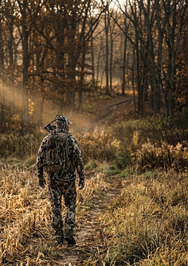
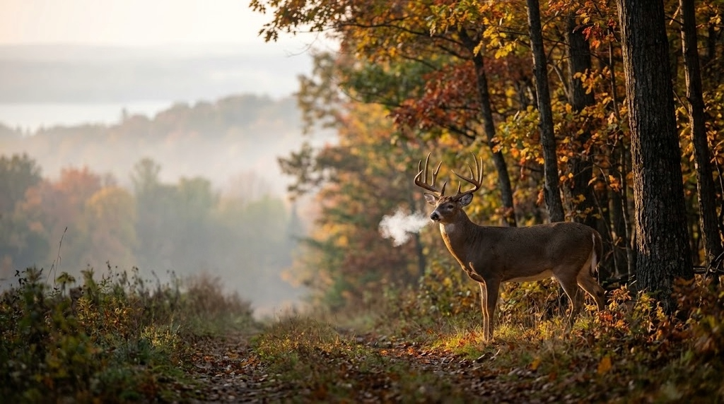
Ohio holds 400,000 acres of public hunting land and grows whitetails that compete with anything in the Midwest. The state's no-rifle regulation and statewide antler restrictions produce bucks in the 140 to 160 class on public ground, and the archery season runs from late September into early February. Here's your complete guide to the Wayne National Forest, top wildlife areas, season structure, and how to find mature deer on the Buckeye State's most productive public tracts.
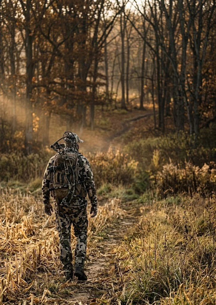
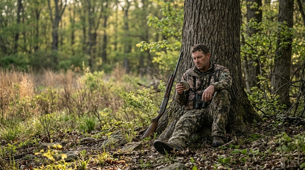
Ohio grows whitetails that compete with anything in the Midwest, and most of the country doesn't realize how much of that hunting happens on public ground. The state holds roughly 400,000 acres of public hunting land across wildlife areas, state forests, and the Wayne National Forest. The deer herd is managed with statewide antler restrictions and a firearms season limited to shotguns and straight-walled cartridges, which keeps the age structure healthier than in most neighboring states. Bucks in the 140 to 160 class come off public land in Ohio every year, and the archery season runs from late September into early February, one of the longest in the country.
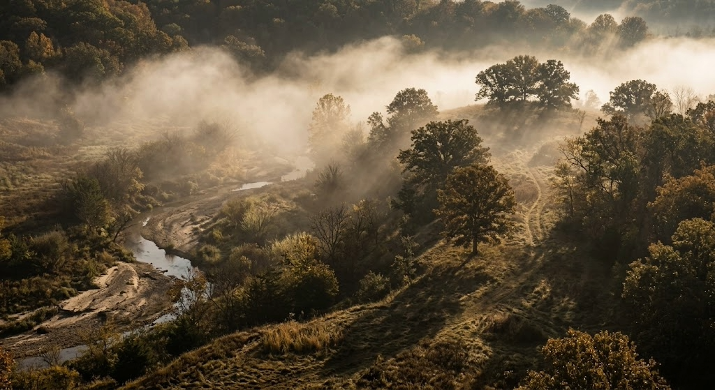
Public land hunting in Ohio rewards the archer who's willing to learn the terrain. The southeast hill country, centered on the Wayne National Forest and surrounding wildlife areas, produces the state's best combination of mature bucks and low hunter density. The farm-country wildlife areas in the western and central regions have higher deer densities but face greater pressure. And the Lake Erie marshes give waterfowl hunters some of the best public access in the Great Lakes region.
If you're a DIY hunter looking for a state where you can buy a tag over the counter and hunt quality whitetails on accessible public ground through a season that stretches five months, Ohio belongs on your short list.
How Much Public Hunting Land Ohio Has
The breakdown of Ohio public hunting areas looks like this:
Wildlife Areas: More than 100 wildlife areas totaling roughly 200,000 acres, managed by the Ohio DNR Division of Wildlife
Wayne National Forest: 240,000 acres across three units in southeast Ohio, managed by the U.S. Forest Service
State Forests: Several state forests open to hunting, managed by the Ohio DNR Division of Forestry
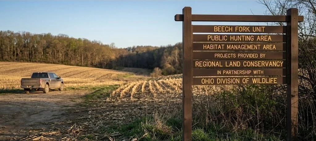
Army Corps of Engineers lands: Tracts around reservoirs, including Deer Creek, Salt Fork, and Seneca
Metro parks and select nature preserves: Some allow controlled hunts through special permit programs
The Wayne National Forest is the centerpiece for DIY public land hunters. It's the only national forest in Ohio, and it sprawls across the unglaciated hill country of the southeast in three separate units: the Athens, Ironton, and Marietta. The terrain down there is steep, wooded, and very different from the flat farm country most people picture when they think about Ohio.
Licensing is straightforward. Ohio residents pay about $19 for a hunting license and $24 for a deer permit (one antlered, one antlerless per permit). Non-residents pay $149 for a hunting license and $40 for a deer permit. Tags are over the counter for both residents and non-residents. No draws, no preference points, no waiting. Turkey requires a separate permit ($28 for residents, $40 for non-residents). Waterfowl needs the federal duck stamp plus a state wetland habitat stamp.

Top 12 Ohio Public Hunting Areas for Deer and More
These are the properties that consistently produce for public land hunters across the state.
Wayne National Forest (Athens Unit)
Managing agency: U.S. Forest Service
Acreage: 74,000 (Athens Unit)
Region: Athens, Hocking, and Perry counties, southeast Ohio
Primary species: Whitetail, turkey, grouse, squirrel
Terrain: Steep wooded ridges, narrow hollows, oak-hickory forest, reclaimed mine land, small creek bottoms
Access: Open with a valid Ohio hunting license. Dispersed camping allowed. Extensive forest road and trail network.
Insider tip: The reclaimed mine land sections create open grassy areas surrounded by mature timber, and deer use these openings the way they use ag fields in farm country. Hunt the edges where reclaimed grassland meets standing hardwood, especially during early archery when deer are still on summer feed patterns. Most hunters walk the ridgetops and miss these openings entirely.
Wayne National Forest (Ironton Unit)
Managing agency: U.S. Forest Service
Acreage: 66,000
Region: Lawrence, Gallia, and Jackson counties
Primary species: Whitetail, turkey, squirrel
Terrain: Steep ridges, narrow bottoms, mature oak forest, laurel thickets on north-facing slopes
Access: Standard national forest access. Some interior roads are gated and seasonal.
Insider tip: The Ironton Unit is the least visited of the three Wayne units and holds bucks that see very little pressure outside of gun week. The terrain is steeper and the access is harder than the Athens Unit, which keeps the casual hunters out. Hunt the benches on the upper third of the ridges where deer bed with a view downhill.
Wayne National Forest (Marietta Unit)
Managing agency: U.S. Forest Service
Acreage: 98,000
Region: Washington, Noble, and Monroe counties
Primary species: Whitetail, turkey, grouse, squirrel
Terrain: Rolling hills, oak-hickory ridges, gas well roads, small stream valleys
Access: Good road network, including access roads to gas wells. Dispersed camping.
Insider tip: The gas well roads that crisscross the Marietta Unit give you access to interior terrain that would otherwise require long walks. Park at a locked gate and walk in on a gas road. The deer use these openings as travel corridors, and the two-track road edges hold browse that attracts feeding deer at first and last light.
Salt Fork Wildlife Area
Managing agency: Ohio DNR Division of Wildlife
Acreage: 19,000
Region: Guernsey County, east-central Ohio
Primary species: Whitetail, turkey, waterfowl, small game
Terrain: Rolling hills, mixed hardwood, pine plantations, Salt Fork Reservoir shoreline
Access: Multiple parking areas and road access. Adjacent to Salt Fork State Park.
Insider tip: Salt Fork is one of the most well-known Ohio WMA deer hunting destinations, and opening weekend pressure reflects it. The deer here are educated. Hunt weekdays during archery season and focus on the steep terrain between the reservoir fingers where the ground drops off sharply. Other hunters stick to the ridgetops and easy-walking pine plantations. The deer know that and bed in the steep stuff by day two of gun season.
Woodbury Wildlife Area
Managing agency: Ohio DNR Division of Wildlife
Acreage: 20,000
Region: Coshocton County
Primary species: Whitetail, turkey, grouse, waterfowl
Terrain: Steep wooded hollows, mature hardwood, creek bottoms, old strip mine reclamation areas
Access: Walk-in for most of the interior. Road access to perimeter parking areas.
Insider tip: Woodbury consistently produces mature bucks because the terrain discourages lazy hunting. The hollows are deep, and the climbs are real. Hunt the saddles connecting parallel ridges during the rut when bucks cruise between doe groups bedded on different drainages. A topo map makes these saddles obvious.
Shawnee State Forest
Managing agency: Ohio DNR Division of Forestry
Acreage: 63,000
Region: Scioto and Adams counties, far southern Ohio
Primary species: Whitetail, turkey, grouse, squirrel
Terrain: The most rugged terrain in Ohio. Deep ravines, sandstone cliffs, dense hardwood, rhododendron thickets
Access: Forest roads and hiking trails. Primitive camping available at designated sites.
Insider tip: Shawnee gets called "The Little Smokies" for a reason. The terrain is brutal, and the cover is thick. That combination produces deer that rarely see hunters past the first Saturday of gun season. If you can handle the hills and don't mind dragging a deer up a 400-foot elevation change, Shawnee rewards effort like few other public tracts in the Midwest.
Zaleski State Forest
Managing agency: Ohio DNR Division of Forestry
Acreage: 28,000
Region: Vinton County
Primary species: Whitetail, turkey, grouse, squirrel
Terrain: Deep hollows, oak-hickory ridges, hemlock ravines
Access: Backpack trail loops provide access to the remote interior. Horse camp and primitive camping are available.
Insider tip: The backpack trail system at Zaleski puts you deep into terrain that day-trippers from Columbus and Cincinnati never reach. Pack in for a two-day archery hunt during the first week of November and hunt the ridgetop saddles along the trail system. The deer in the interior of Zaleski see almost no hunting pressure during archery season.
Killdeer Plains Wildlife Area
Managing agency: Ohio DNR Division of Wildlife
Acreage: 8,600
Region: Wyandot County, northwest Ohio
Primary species: Waterfowl, pheasant (stocked), whitetail, dove
Terrain: Flat marshland, managed impoundments, agricultural fields, prairie grass
Access: Good road access. Designated parking areas. Waterfowl blinds on some units.
Insider tip: Killdeer Plains is the premier public land waterfowl spot in Ohio. The managed impoundments draw large numbers of ducks and geese during migration. Get there mid-week, and you'll have blinds to yourself that are standing room only on Saturday mornings. The pheasant stocking program also makes this one of the few places in Ohio where you can hunt roosters on public ground.
Grand River Wildlife Area
Managing agency: Ohio DNR Division of Wildlife
Acreage: 5,000
Region: Trumbull and Ashtabula counties, northeast Ohio
Primary species: Whitetail, turkey, waterfowl, pheasant (stocked), rabbit
Terrain: River bottomland, marshy wetlands, hardwood timber, brushy edges
Access: Multiple access points along the Grand River corridor.
Insider tip: The river bottom hardwood along the Grand River holds deer that feed on the ag fields bordering the wildlife area. Hunt the timber funnels between the river and the field edges during the rut. The narrow strips of cover squeeze buck movement into predictable travel lanes.
Crown City Wildlife Area
Managing agency: Ohio DNR Division of Wildlife
Acreage: ~22,000
Region: Gallia and Lawrence counties, far southeast Ohio
Primary species: Whitetail, turkey, grouse
Terrain: Reclaimed strip mine land, young hardwood regrowth, scrubby cover, steep grades
Access: Walk-in from designated parking. Interior is rugged and remote.
Insider tip: Crown City is reclaimed mine land that's growing back into excellent early successional habitat. The thick young cover holds deer and turkeys that rarely see pressure because the terrain is ugly and the walking is hard. Don't let the "reclaimed mine" label turn you away. The habitat quality here is better than a lot of mature timber tracts in the region.
Mosquito Creek Wildlife Area
Managing agency: Ohio DNR Division of Wildlife
Acreage: ~10,000
Region: Trumbull County, northeast Ohio
Primary species: Waterfowl, whitetail, turkey, rabbit, pheasant (stocked)
Terrain: Reservoir shoreline, managed wetlands, mixed hardwood and brush, ag field edges
Access: Road access around the reservoir. Boat access for waterfowl.
Insider tip: Mosquito Creek is primarily known for waterfowl, but the deer hunting on the wooded ridges above the reservoir gets overlooked. During archery season, the waterfowl hunters haven't shown up yet and the deer have the timber mostly to themselves. Hunt the transition between the hardwood ridges and the marshy reservoir edge where deer move to water in the evenings.
Tar Hollow State Forest
Managing agency: Ohio DNR Division of Forestry
Acreage: 16,000
Region: Ross and Vinton counties
Primary species: Whitetail, turkey, squirrel, grouse
Terrain: Deep hollows, sandstone outcrops, oak-hickory ridges, pine plantations
Access: Forest roads and hiking trails. Primitive camping at designated areas.
Insider tip: The pine plantations at Tar Hollow create thermal bedding cover that deer use heavily in late season when temperatures drop. Hunt the transition between the pine and the surrounding hardwood during the late muzzleloader and archery seasons. Deer bed in the warm pines and feed on the acorns in the adjacent hardwood.
What You Can Hunt on Public Land in Ohio
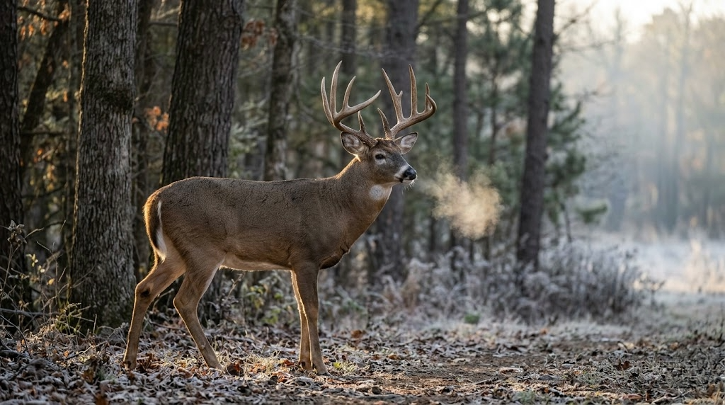
Whitetail is the main draw, and Ohio delivers. The state consistently ranks in the top ten nationally for Boone and Crockett entries, and the statewide antler point restriction (at least four points on one side in most counties) pushes bucks past the 2.5-year-old mark before they become legal. That single regulation is why Ohio's public land buck quality outperforms neighboring states with more liberal harvest rules.
The state harvests between 180,000 and 200,000 deer in a typical season. The southeast hill country (Vinton, Athens, Hocking, Gallia, Lawrence counties) produces the best trophy potential on public ground, while the farm-country wildlife areas in the west and north hold higher deer densities with slightly younger age structure.
Turkey hunting is strong throughout the state, with a spring gobbler season running from late April through late May. Ohio's turkey population has expanded significantly over the past two decades, and nearly every wildlife area and state forest in the southeast holds huntable numbers. Fall turkey is also available in select counties.
Waterfowl hunters find the best public access on the Lake Erie marshes, the managed impoundments at Killdeer Plains and Mosquito Creek, and along the major river corridors. The western Lake Erie marshes are a migration corridor for ducks and geese that rivals anything in the Mississippi Flyway.
Small-game options include squirrel (common throughout the southeastern forests), rabbit, pheasant (stocked in select wildlife areas), grouse (limited but present in the hill country), and dove. Ohio also offers limited opportunities for bobcat (draw only) and river otter trapping.
Season Structure: Why Ohio Is an Archery State
Ohio's season structure is built around archery, which is the biggest advantage for DIY public-land hunters.
Archery: Late September through early February. That's roughly five months of bow season. The rut peaks in early to mid-November, which means you get the entire rut window during archery season with a fraction of the pressure that gun season brings.
Gun season: One week in late November/early December. Shotgun and straight-wall cartridge only (no centerfire rifles for deer). This short window concentrates pressure, and then it's over.
Muzzleloader: A short season in early January.
Youth gun: One weekend before the regular gun opener.
The gun-only restriction (no rifles) means the effective range of most deer hunters during firearms season is under 150 yards. That's important because it means deer don't get educated at long distances the way they do in rifle states. A mature buck that survives gun week in Ohio can still be killed at 25 yards with a bow in January because he hasn't been shot at from 300 yards across a field.
Turkey’s spring season runs from Saturday closest to the last Monday in April through late May. Tags come with a $28 resident or $40 non-resident permit. No draw required.
Ohio runs controlled hunts on select wildlife areas and metro parks for deer and other species. These require separate applications and are managed through the Ohio DNR website. The controlled hunts on metro park properties near Columbus, Cleveland, and Cincinnati often produce very good deer because the herds build up in suburban habitats with limited hunting pressure.
Access Tips for Public Land Hunting in Ohio
No check-in system in most areas. Ohio wildlife areas and state forests don't require hunter check-in. You park, walk in, and hunt. Harvest reporting is done online through the Ohio DNR Game Check system within 24 hours of the kill.
Vehicle access. In wildlife areas, vehicles are restricted to designated roads and parking lots. Don't drive on gated roads or field edges. The Wayne National Forest has a more open road network, but many interior roads are seasonal or gated.
Camping. Camping is not allowed on most Ohio wildlife areas. The Wayne National Forest allows dispersed camping (up to 14 days). State forests have designated primitive camping areas. If you're planning an out-of-state trip, book a nearby campground or plan around the Wayne for camping flexibility.
Blaze orange. Ohio requires a minimum of 400 square inches of blaze orange on the head, chest, and back during gun season. This also applies to anyone in the field during gun season, even if you're carrying a bow. Don't get caught without it.
Tree stand rules. You can use portable tree stands on public land in Ohio, but they must be removed at the end of each day in wildlife areas. The Wayne National Forest allows stands to remain up during the season,, but requires your name and address on each stand. Know the rules for the specific property you're hunting.
No baiting. Baiting for deer and turkey is illegal statewide. No corn piles, no mineral licks, no food-based attractants on public or private land.
Gear Considerations for Ohio
Ohio's terrain and climate vary enough between the hill country and the farm-country flatlands that your gear needs to flex. Here's what matters most.
Boots for steep terrain. The southeast hill country is the real deal. Steep ridges, loose shale, and slippery creek crossings demand boots with ankle support and aggressive tread. Danner Pronghorn handles the dry-ground ridge hunting well. For the creek bottoms and wet weather, the LaCrosse Alphaburly Pro with 800-gram insulation covers late-season cold and standing water.
A mobile stand setup. Ohio's daily-removal rule on wildlife areas means you're either carrying your stand in and out every sit or you're hunting saddle-style. Tethrd Phantom saddle platform is the go-to for mobile public land setups where you need to move light and fast. If you prefer a hang-on, keep it packable enough to carry in a stand bag with sticks every trip.
Mid-weight layering. Ohio archery runs from 70-degree September afternoons to single-digit January mornings. You need a system that covers all of it. First Lite’s Kiln Zip Off Long John serves as a foundation from October through January. Add the KUIU Axis Hybrid jacket as a quiet, weather-shedding outer layer for the November rut sits. For late-season cold, the First Lite Thermic insulated jacket handles long sits in the 10- to 20-degree range.
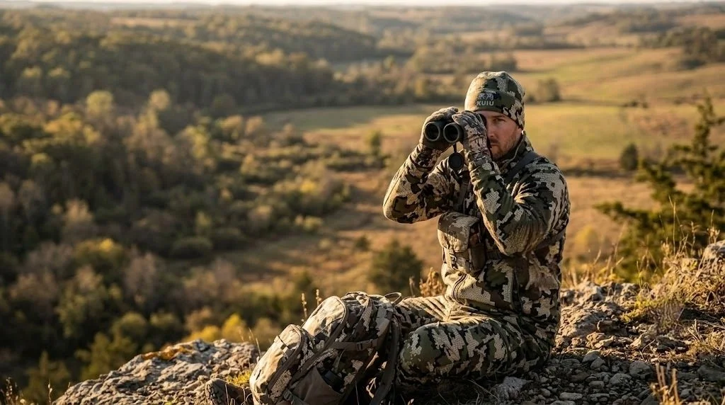
Good low-light optics. Ohio's thick hardwood timber means most shots happen under 30 yards, but a quality binocular helps you pick apart dark timber at first and last light when deer move. Vortex Diamondback HD 10x42 is the standard recommendation. Budget pick: Vortex Crossfire HD 10x42 at around $150.
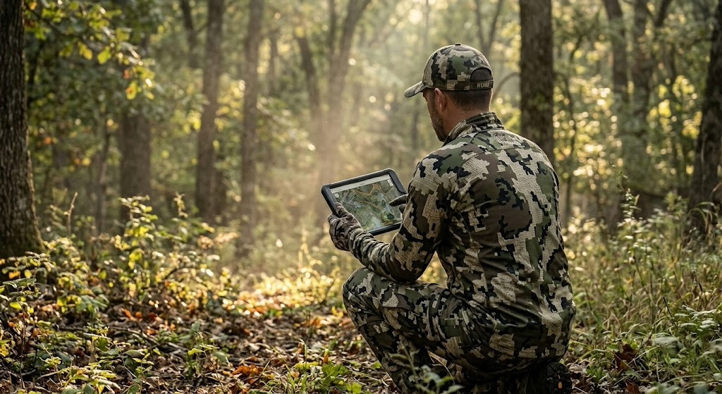
Mapping app. onX Hunt with the Ohio layer shows you wildlife area boundaries, Wayne National Forest tracts, and the private-public lines that are critical in southeast Ohio,, where the national forest is broken into scattered parcels mixed with private land. Knowing exactly where you stand keeps you legal in a region where boundary signage is inconsistent.
Finding Unpressured Spots on Public Land in Ohio
Ohio sells about 400,000 deer permits a year. That's a lot of hunters on 400,000 acres of public ground. Pressure management is the defining skill for public land hunting in Ohio.
The good news is that Ohio's pressure concentrates predictably. Gun week is the worst of it, a short, intense burst that pushes every casual hunter into the woods for seven days and then it's over. Archery season, by contrast, draws a fraction of the crowd spread over five months. If you hunt archery during the week, you're on functionally different ground than the weekend gun-season hunter.
In the Wayne National Forest, the scattered-parcel structure is your friend. The forest is broken into dozens of disconnected tracts mixed with private land. The big, easy-to-find tracts near the main ranger station and popular trailheads get the most pressure. The small, isolated parcels that require a mapping app to even locate, and a longer drive on township roads to access, hold deer that see very few hunters all season.
In wildlife management areas, push past the half-mile mark from any parking lot. Ohio's hill country is steep enough that most hunters don't walk far. Drop into a hollow, cross a creek, and climb to a bench or saddle on the far ridge. The deer you find there are on a different schedule than those within earshot of the parking area.
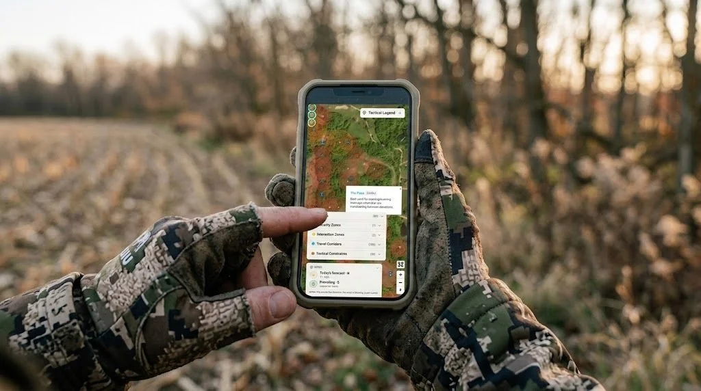
For property-level terrain analysis, Hunting Scout builds interactive scouting reports from real USGS and NOAA data for any public or private tract. Run a report on your target wildlife area before your trip and you'll find funnels and terrain features the topo alone won't show you. If you're evaluating a property adjacent to public ground for a lease or purchase, ScoutFlight Hunting Assessments gives you the aerial perspective and habitat analysis that walking the ground can take months to provide.
Frequently Asked Questions About Public Land Hunting in Ohio
How much public hunting land is in Ohio?
Ohio has roughly 400,000 acres of public hunting land, combining wildlife management areas (200,000 acres), the Wayne National Forest (240,000 acres), state forests, and Army Corps lands. The southeast hill country holds the largest concentrations of contiguous public ground.
Can you use a rifle for deer in Ohio?
No. Ohio does not allow centerfire rifles for deer hunting. The legal firearms are shotguns (slugs), straight-wall cartridges (.357 minimum through .50 caliber), muzzleloaders, bows, and crossbows. This regulation keeps the effective range short and is a major reason Ohio's buck age structure is so strong. Deer don't get shot at from 300 yards across a bean field.
Can non-residents hunt Ohio public land?
Yes. Non-residents buy a hunting license ($149) and a deer permit ($40) over the counter. No draws, no preference points, no non-resident quotas. You have access to the same wildlife areas, state forests, and national forests as residents. Ohio is one of the most non-resident-friendly states in the Midwest for public land deer hunting.
Can you camp in Ohio wildlife areas?
No. Camping is not allowed on most Ohio DNR wildlife areas. The Wayne National Forest allows dispersed camping up to 14 days. State forests have designated primitive camping areas. If you're planning a multi-day hunt in a wildlife management area, you'll need to find a nearby campground, state park campground, or private lodging.
Do you have to remove your tree stand daily on Ohio public land?
In wildlife management areas, yes. Portable stands must be removed at the end of each day. In the Wayne National Forest, stands can remain in place during the hunting season, but must have your name and address attached. On state forests, check the specific property rules. The daily-removal rule for wildlife areas makes saddle hunting and lightweight, mobile setups the standard approach for serious Ohio public-land hunters.
When is the best time to hunt public land deer in Ohio?
The first two weeks of November are during archery season. The rut is peaking, gun season hasn't started yet, and the midweek pressure is minimal. This is the window where mature bucks move during daylight on public ground in Ohio. If you can only hunt one week a year, pick the first week of November and hunt mornings and evenings from a mobile setup near a saddle or terrain funnel in the southeast hill country.
What are the best counties in Ohio for public land deer hunting?
For trophy potential: Vinton, Athens, Hocking, Gallia, and Lawrence counties in the southeast hill country, all of which have significant Wayne National Forest or state forest acreage. For higher deer density with more sightings: Coshocton (Woodbury, WA), Guernsey (Salt Fork, WA), and the farm-country wildlife areas in Wyandot, Crawford, and Marion counties. Your choice depends on whether you're optimizing for a mature buck or for more deer encounters.
Is Ohio WMA deer hunting worth it for out-of-state hunters?
Absolutely. Ohio's combination of over-the-counter non-resident tags, a five-month archery season, no-rifle regulations that protect buck age structure, and 400,000 acres of public hunting land makes it one of the best values in the Midwest for a DIY whitetail trip. The southeast hill country produces bucks that compete with those in Iowa and Kansas on accessible public ground, without a multi-year preference-point wait.
Want the full breakdown of every Ohio wildlife area and Wayne National Forest unit, plus the same for all 50 states? Subscribe to the LandsToHunt newsletter below and get our free state-by-state public land hunting guides delivered to your inbox.

How to Scout Public Land: Lessons from Hunters Who Live on Pennsylvania's State Game Areas
Most public land hunters skip scouting or treat it as a single walk-through the week before opener. The system that works breaks scouting into three phases: e-scouting from home to eliminate 90 percent of the property, targeted boots-on-the-ground trips to verify sign and access, and a light hunt-week check to confirm fresh activity and match spots to the forecast wind. Lessons from hunters who do this on Pennsylvania's most pressured State Game Land.
I've got a group of guys from Pennsylvania who treat scouting like a second job. They don't have leases. They don't have family farms. They hunt State Game Land and state forests alongside 900,000 other licensed hunters in a state where rifle opener shuts down school districts. And they consistently put deer on the ground, which makes people ask how they do it on public land.
The answer isn't luck. It's a scouting system they've refined over years of hunting some of the most pressured public ground in the eastern U.S. I've watched them work, hunted with them, and picked their process apart enough to know it translates to any public land in any state. But the examples here come straight from the ridges, laurel thickets, and hollows of Pennsylvania's game lands, because that's where these guys prove it works every fall.
The Core Concept: Scout in Layers, Not All at Once
The system breaks scouting into three phases, each one narrowing the focus so you're not wasting time walking ground that won't produce.
Phase 1: E-scouting. Done from home using mapping apps, satellite imagery, and topo data. The goal is to eliminate 90 percent of a property and zero in on 8 to 10 spots worth walking to.
Phase 2: Boots on the ground. Walk those 8 to 10 spots during the off-season and verify what the map showed you. Sign, cover density, access difficulty, and the stuff satellite images can't tell you. Cut the list to 3 or 4.
Phase 3: Hunt-week verification. A quick, low-impact check 2 to 5 days before you hunt. Fresh sign, wind options, and entry routes. You're not scouting anymore. You're confirming.
One of the guys put it simply: "I want to walk 200 acres with purpose, not 10,000 acres hoping to get lucky." That's the whole idea. Each phase filters out bad spots before you invest real boot leather in them.
Phase 1: E-Scouting from Home
Start with a mapping app. onX Hunt is the standard for public land because the boundary layers show you exactly where State Game Lands and state forest boundaries run. In Pennsylvania, game lands butt up against private land with minimal signage in a lot of places, and the boundary lines on the app keep you legal. Load your target property and toggle between satellite and topo views. You're looking for five things:
Saddles and passes on ridgelines. Pennsylvania's parallel Appalachian ridges create natural saddles where deer cross from one drainage to another. These show up clearly on topo maps as contour lines pinching together along the ridge. On SGL 76 in Clinton County, the guys found three saddles along a two-mile stretch of ridge that all funneled deer movement between a bedding slope and a feeding flat below.
Laurel thickets on north-facing slopes. On satellite imagery, mountain laurel appears as dark, dense patches that retain their green into winter. In PA's big woods country, these thickets are where pressured bucks bed because no one wants to fight through them. Flag the ones that sit on north-facing slopes with hardwood feeding areas nearby.
Benches on steep terrain. A bench is a flat or gently sloped shelf partway up a mountain. Deer use benches as travel corridors and bedding areas because walking a bench burns less energy than climbing the full ridge. They show up on topo maps as a wider spacing between contour lines on an otherwise steep slope.
Thick cover far from parking areas. Pull up the game lands map and note every parking pull-off and gated road. Then look for terrain features more than a mile from any of those access points. On SGL 12 in Schuylkill County, the reclaimed strip mine land on the far side of a gated road held deer and bears that the roadside hunters never reached.
Creek confluences and drainage heads. Where two small drainages merge, the terrain often creates a natural pinch point. Water, cover, and topography all concentrate deer movement at these spots. The PA big woods are full of unnamed feeder creeks that create funnels the map makes obvious, but the ground makes it hard to see through the timber.
Drop pins on every spot that hits. Don't edit yourself yet. You want 8 to 10 candidate locations. For a deeper digital read on terrain features, tools like Hunting Scout pull real geospatial data from USGS and NOAA and build an interactive scouting report for any piece of ground, public or private. The guys started experimenting with for me, running reports on their game lands tracts last year, and found funnels they'd walked past for seasons without noticing. I spent years learning to read contour lines and predict thermals on different terrain. Hunting Scout does that work for you, faster and more accurately than I can do it from a paper map, and shows you exactly what it means for every stand you've tagged.
Phase 2: Boots on the Ground
In Pennsylvania, the best time for this is late February through April. Snow is melting, leaves are down, and you can see terrain features and last fall's sign that summer growth buries. You're also far enough from hunting season that any disturbance you cause is forgotten by October.
Walk each pinned location. At each one, check four things:
Sign density. Rubs, scrapes, trails, beds, droppings, tracks. In PA's big woods, rub lines along ridge benches are the clearest indicator that bucks use a travel corridor consistently. Old rubs from the previous November still tell you something valuable in March. They tell you deer used this spot when it mattered. One of the guys marks every rub line he finds on his mapping app and looks for patterns across multiple seasons. The rub lines that show up in the same spots year after year are the ones worth hunting.
Cover quality at eye level. Satellite imagery shows you what's green and dark, but it can't tell you how thick the understory is at eye level. Pennsylvania laurel thickets that look impenetrable from above sometimes have openings at ground level where deer bed, with good sightlines downhill. Walk into the cover and see for yourself. Park-like timber with no understory isn't going to hold bedding deer after the first day of rifle season, no matter how good the topo looks.
Access difficulty. This matters more in PA than almost any other state because of the sheer hunter density during rifle season. How do you get to the spot without walking through bedding, crossing an open ridge, or making noise on a creek crossing? Can you approach from downwind in the dark? One of the guys maps his approach routes as carefully as he maps the stand locations. A great spot with a terrible entry is one you'll blow out on the first morning.
Pressure evidence. Look for other hunters' sign. Old stand straps on trees. Climbing stick scars. Flagging tape. Boot prints. In PA, every serious whitetail hunter on a State Game Lands tract gravitates toward the same obvious saddles and oak flats. If a spot has three sets of old sticks on trees within 100 yards of each other, it's been found. That doesn't mean you can't hunt it, but the deer there are educated.
After walking all your pins, you should have 3 to 4 spots you trust. For each one, note the best wind direction, the entry route you'd use in the dark, and exactly where you'd set up.
Phase 3: Hunt-Week Verification
Two to five days before your hunt, make a quick trip. Don't go deep. Don't walk through bedding. Stay on the edges.
You're looking for fresh scrapes opened up along trails, new rubs on trees that were clean two months ago, fresh tracks in soft dirt at creek crossings, and any change in cover since your last visit. In PA, this is also when you check whether a logging operation has started on or near your spot. State forests and game lands both run active timber harvests, and a fresh cut can completely change deer patterns overnight, sometimes for the better if the cut is recent enough that browse is already coming in.
Check the forecast. Match each spot to the wind. If you've got a northwest wind and your best saddle plays a south wind, hunt a different location. Never force a spot on a bad wind just because you found the most sign there.
A Concrete Scenario: How This Played Out on a State Game Lands Tract
One of the guys hunts a game lands tract in the north-central mountains, Potter County, deep, big woods. The property is about 8,000 acres of mixed hardwood ridges, hemlock ravines, and laurel-choked north-facing slopes. Access comes from two parking areas on a township road along the south boundary, and most hunters walk straight up the ridge from those lots and sit within a half mile of the road.
Hunt Scout showed a bench running east to west along the north face of the main ridge, about two-thirds of the way up. Below the bench, a laurel thicket covered the slope down to a small creek. Above the bench, open hardwood climbed to the ridgetop. A saddle crossed the ridge about 1.4 miles from the nearest parking area. On the satellite, the laurel was dense and dark. The bench showed as a band of slightly thinner canopy between the laurel below and the hardwood above.
March scouting confirmed everything. A heavy trail ran the length of the bench with rubs on both sides. Three beds in the laurel just below the bench, all on the downhill edge where deer could see below them and bail into the thicket behind them. A scrape line at the east end of the bench where it narrowed toward the saddle. No hunter sign. The 1.4-mile walk, the creek crossing, and the steep climb to the bench were keeping everybody out.
On a late-October archery hunt with a southwest wind, he parked at the east lot, crossed the creek 400 yards east of the bedding (downwind), and climbed the ridge on the east face rather than coming up the south slope where the bedded deer would see or smell him. He set up in a tree at the east end of the bench, where the scrape line converged with the bench trail near the saddle. The southwest wind carried his scent off the ridge to the north, away from both the bedding below and the trail along the bench.
A nice buck walked the bench trail at 7:40 AM, hit the scrape line, and stopped broadside at 22 yards. That spot has produced for three seasons since, and the only reason it still works is that the access keeps everyone else from finding it.
When to Scout: Season, Weather, and Terrain
E-scouting works any time. Do it in January while you're dreaming about next season. Do it in August when you're itching to get back in the woods. The more time you spend reading PA topo maps, the faster you get at spotting benches, saddles, and funnels.
Boots-on-the-ground scouting is best from late February through April. Pennsylvania's snow melt reveals trails, beds, rub lines, and scrape craters that summer growth erases. Leaves are down, so you can see terrain features and sight lines that are invisible in October.
This system works on every type of PA terrain. The big woods ridges of north-central PA, the ag-edge woodlots of Greene County, the reclaimed strip mine land in the coal region, the Pocono plateau, the rolling hardwood of the Alleghenies. The terrain features you're targeting change (saddles on ridges in Potter County vs. timber fingers between crop fields in Washington County), but the three-phase process stays the same.
Tools and Gear You Need
Mapping app.onX Hunt for State Game Lands and state forest boundaries, satellite/topo toggle, and offline maps. In PA, game lands boundary paint blazes can be hard to spot in thick timber. The digital line keeps you legal.
Binoculars. Vortex Diamondback HD 10x42 for reading terrain and sign from a distance during scouting trips. You want to glass a bench or a scrape line without walking through the middle of everything.
Rubber boots. LaCrosse Alphaburly Pro to minimize your scent footprint. PA scouting means creek crossings and wet laurel thickets on almost every trip.
Notebook or phone notes. Record wind direction, sign type and quality, access notes, and GPS coordinates for every spot. You'll forget the details if you don't write them down. One of the guys keeps a running notes file per game, going back five years. That data compounds.
Trail cameras (optional and risky on PA public land). Trail cameras on Pennsylvania State Game Lands disappear. Theft is common enough that the guys only run cellular models like the Muddy Matrix 2.0, so they don't have to walk into them. And they accept the reality that a camera on public ground is a temporary asset, not a permanent one.
The Three Biggest Mistakes When Scouting Public Land
Scouting the same ground that everyone else scouts
In Pennsylvania, the obvious saddles and oak flats within a quarter mile of every parking area get found by every hunter who walks in from that lot. The sign you're reading near the road is from deer that have already adjusted to human traffic. Push past the mile mark. Cross the creek. Climb the steep side of the ridge. In PA's big woods, the best scouting starts where the easy walking ends.
Scouting too close to hunting season
Walking through a State Game Lands tract the weekend before rifle opener, crashing through laurel thickets and bumping deer out of bedding, is not scouting. It's teaching deer exactly where you'll be. The guys do their heavy walking in late February and March. By the time archery opens in October, they already know where they're going. The fall visits are surgical. Get in, check fresh sign on the periphery, get out. Five minutes, not five hours.
Ignoring how other hunters access the property
Most PA public land hunters park at the pull-off, walk the easiest path uphill, and sit within half a mile. If you don't map that pressure pattern, you're competing with every other hunter on the property for the same deer. The guys map parking areas and trails the way they map deer sign. Once you see where the pressure concentrates, you see where the gaps are. And the gaps are where public land hunting gets good.
Advanced Application: Turning Pressure Into an Advantage
After scouting a PA game lands tract for two or three seasons, you start to understand how hunter pressure moves deer. On rifle opener, the wave of orange coats pushes deer off the easy-access ridges and into the thick, steep, ugly terrain that nobody wants to hunt. By day three, every deer that survived the first push is bedded in laurel, cedar swamp, or a steep-sided ravine far from any road.
One of the guys deliberately scouts for these pressure refuges rather than the spots that hold deer in October. He's not looking for where deer live during archery season. He's looking for where they go after 500,000 hunters hit the woods on the Monday after Thanksgiving. He scouts the nastiest, steepest, most laurel-choked terrain on the property, the stuff other hunters look at and keep walking. Then he hunts those spots on day three, four, and five of rifle season, when the rest of the woods is empty and the deer are stacked in the only cover that hasn't been walked through.
That's advanced scouting. You're not just reading deer sign. You're reading hunter behavior and deer response to that behavior, then positioning yourself where the math works in your favor.
For property-level terrain analysis showing where bedding, travel corridors, and pressure refuges intersect, Hunting Scout builds interactive reports from real USGS and NOAA data. The guys run reports on their public-lands tracts before the off-season scouting trips and use funnel detection to find spots they'd otherwise miss in the dense PA timber. For larger properties or tracts adjacent to public ground, a drone-based assessment from ScoutFlight Hunting Assessments gives you terrain and cover data that takes years of boot scouting to build.
Frequently Asked Questions
How far in advance should you scout public land?
Start e-scouting as early as you want. The best time for boots-on-the-ground scouting in Pennsylvania is late February through April, when snow is melting, leaves are down, and deer sign from the previous fall is still visible. This gives you a six-month gap between your heaviest disturbance and archery opener, long enough for deer to forget you were there.
How do you scout public land without bumping deer?
Wear rubber boots to minimize scent. Scout during midday when deer are bedded and least active. Stay on the edges of bedding cover, especially PA laurel thickets, rather than walking through the middle. Use binoculars to read sign from a distance. And do your heaviest scouting during the off-season, not the week before your hunt.
What should you look for when scouting public land for deer in Pennsylvania?
Focus on terrain features that concentrate movement: saddles on ridgelines, benches on steep slopes, pinch points where drainages merge, and transitions between habitat types like laurel and hardwood. Then verify with sign on the ground. The best spots in PA combine strong terrain features with heavy sign AND access that's difficult enough to keep the rifle-season crowd away.
Can you scout PA State Game Lands during hunting season?
Yes, and you should, but keep it light. Don't walk through your hunting spots during the season. Use what you learn while hunting to adjust. If deer are consistently moving through a funnel 200 yards from your setup, make a mental note and shift for your next sit. Mid-season scouting in PA is observation from the stand, not exploration on foot. Save the walking for February.

How to Hunt Whitetail on Public Land: A Practitioner's Guide
Public land whitetail hunting rewards hunters who walk farther, read terrain harder, and play wind better than the guy parked next to them. Here's the scouting, access, and stand strategy that puts deer in front of you season after season.
Public land whitetail hunting rewards patience, planning, and a willingness to walk farther than the other guy. If you've spent your hunting career on private ground and want to know how to hunt whitetail on public land without getting buried by pressure, the playbook is different than what works on a 40-acre lease. This guide walks you through the scouting, access, and stand strategy that puts deer in front of you on public ground season after season.
Most public land hunters fail for the same three reasons. They hunt too close to the parking area. They ignore wind and access. And they follow other people's sign instead of finding their own. Fix those three things and your odds jump dramatically.
Why Public Land Whitetail Hunting Is Different
On private land, you control the variables. You know where the food plot is, where the bedding is, who else is on the property, and when. On public land, you're one of dozens of hunters sharing the same chunk of woods, and the deer know it.
By the third day of firearm season, every piece of easy-access timber within 300 yards of a road has seen pressure. Deer adjust fast. They go nocturnal, push deeper into cover, and start bedding in spots that look miserable to hunt but stay quiet.
Your job is to think like the deer. Where would you bed if hunters pushed you around every weekend? The answer is almost always thick cover, awkward terrain, or a spot that takes real effort to reach.
E-Scout Before You Boot-Scout
Before you ever step foot on a piece of public ground, pull up the parcel on a mapping app. I run onX Hunt because the public land boundary layers and offline maps save me from trespassing and from getting lost in national forest timber I've never set foot in.
Here's what you're looking for during e-scouting:
Pinch points where two terrain features force deer through a narrow area
Inside corners of clearcuts, timber, or ag fields
Benches and saddles on ridges that funnel travel
Water sources in dry timber, especially during the early and late seasons
Thick cover more than a half-mile from the nearest road or trail
Mark 8 to 10 potential spots before you ever walk in. Then on your first boots-on-the-ground trip, you're verifying sign, not wandering aimlessly. I am working on an app that will make this a much easier process. Exciting news to come.
Finding the Terrain Features That Hold Whitetails on Public Land
Terrain tells you more than the sign does, especially after opening weekend when the rubs and scrapes you're reading might be two weeks cold. Focus on features that concentrate deer movement regardless of pressure.
Pinch points and saddles
A saddle is a low point on a ridge where deer cross from one drainage to another. In rolling hill country, Appalachian timber, or anywhere with real elevation change, saddles are gold. Deer use them because walking over a saddle burns less energy than climbing the whole ridge.
Pinch points work the same way. Anywhere two features squeeze deer movement into a narrow lane (a creek bend against a bluff, a fence corner against thick cover, a swamp edge along timber), you've got a high-percentage stand location.
Inside corners and transitions
The inside corner of a clearcut, ag field, or meadow where it meets standing timber is one of the most consistent deer movement features in existence. Deer skirt edges. They don't walk out into wide-open space during daylight if they can help it, and inside corners let them stage along the edge with multiple escape routes.
Thick bedding nobody else wants
Find the nastiest, thickest, most miserable cover on the parcel. Briars, blowdowns, cattail swamps, regenerating clearcut. That's where pressured bucks go. You're not hunting inside the bedding, you're hunting the access trail between that bedding and the nearest food source.

Beat the Pressure: How to Hunt Public Land Spots Other Hunters Skip
Here's the rule I live by on public land. If getting to the stand is easy, you're hunting the wrong spot.
Most public land hunters walk in no more than 400 yards. Some don't walk in at all. That means everything beyond the half-mile mark sees a fraction of the pressure, and the deer know which zones are safe.
Look at access differently:
Cross a creek that requires waders, and everyone else drives past
Walk a mile through a cattail swamp to reach an isolated island of timber
Come in from the non-obvious side, even if your walk triples in distance
Hunt the deep interior during midday when most hunters have packed up
The physical investment is real. You want solid boots for this kind of miles-heavy access. I run Danner Pronghorn on dry ground and LaCrosse Alphaburly Pro when I'm hitting wet cattail country. Check the most up-to-date prices on Amazon.
The Gear That Matters on Public Land
You don't need a truckload of gear for public land whitetail hunting. You need mobile gear that lets you move when a spot goes cold.
Mobile setups mean saddle hunting or a lightweight hang-on with climbing sticks. A saddle system like the Tethrd Phantom lets you slip in, set up on any tree, and be ready to hunt in under 20 minutes. Full disclosure: the learning curve on saddles is real. Most hunters need 5 to 10 practice sessions in the backyard before they're comfortable hunting from one.
Other gear that earns its place in my public land pack:
Quality mid-range binoculars like the Vortex Diamondback HD 10x42 for picking apart timber and verifying antlers at a distance
A quiet outer layer. I run the KUIU Axis Hybris jacket because it's weatherproof and is pretty quiet when you brush against branches
A cellular trail camera like the Muddy Matrix 2.0 positioned on an access trail or water source, assuming your state allows trail cameras on public land
A good headlamp with a red light mode for walking in and out quietly
Skip the gadgets you don't need. Grunt calls and rattling antlers earn their place during the rut. Scent eliminators matter less than playing the wind right. For a full breakdown of what to run in the woods, see our public land hunting gear guide.
Wind and Access: The Two Things That Kill Your Hunts
You can set up on the best pinch point in the county, but if you're walking in upwind of a bedding area or your scent is blowing into your shooting lane, deer know you're there before the sun comes up.
Before you pick a stand, map two things:
Your access route in. What wind direction lets you walk in without your scent hitting bedded deer or the travel corridor you plan to hunt?
Your stand wind. What wind lets you sit at the spot without deer catching you on approach?
Sometimes a spot only hunts well on one wind, like a northwest out of the northwest, and you just don't hunt it on other days. That's fine. You want a minimum of 5 or 6 stand locations so you can match stands to wind direction all season long.
Seasonal Strategy for Public Land Whitetails
How you hunt whitetail on public land shifts across the season. Bucks behave differently in September than they do in November, and your stand selection has to track those changes.
Early season: September through early October
Bucks are on a bed-to-food pattern. Find mast (white oak acorns are king), soft mast (persimmons, apples, crabapple), or any ag crop bordering the parcel. Set up 50 to 100 yards back from the food source on the travel corridor between bedding and feed. Hunt evenings. Morning hunts this time of year often push deer off their beds as you walk in.
The rut: November
Rut hunting is when public land gets its best window. Bucks drop their caution, and mature deer you've never caught on camera show up in daylight chasing does. Hunt all day if you can. Hunt doe bedding areas and the downwind trails they run. Pinch points between doe groups see the most buck traffic. Grunt calls and rattling work on pressured deer when used sparingly.
Late season: December through January
Deer are patterned on food and thermal cover. Find the most concentrated food source on the parcel (late-cut ag fields, standing corn, food plots on adjacent ground) and set up on the bedding side of the travel corridor. South-facing slopes hold deer on cold sunny days. Hunt midday if the temperature rises above freezing after a cold snap.
Common Public Land Mistakes to Avoid
I've watched hunters make the same mistakes for 25 years. Here are the big ones:
Hunting the same stand too many times. Pressured deer learn fast. Rotate through 3 or 4 stands minimum per season.
Ignoring thermals. In hill country, scent rises uphill in the morning and falls downhill in the evening, regardless of prevailing wind.
Walking past sign to get to "the spot." If you see fresh sign on your way in, hunt it. Don't push another half-mile out of stubbornness.
Skipping midday hunts during the rut. The 10 a.m. to 2 p.m. window produces a lot of mature bucks on public ground because most hunters are back at the truck eating lunch.
Not scouting post-season. February and March give you a clean look at rubs, scrapes, and bedding from the previous fall. That's your scouting window for next year.
If you want a more thorough property-level look before you invest weeks on a parcel, a drone-based assessment from ScoutFlight Hunting Assessments maps habitat features, access routes, and travel corridors from the air, which saves you a lot of boot miles.
Frequently Asked Questions
How far should I walk in from the road on public land?
The sweet spot on most public parcels starts around three-quarters of a mile from the nearest road or trailhead. That's far enough to get past the majority of hunters but close enough that you can pack out a deer without destroying yourself. On larger tracts with remote interior zones, walking 1.5 to 2 miles rewards you with undisturbed deer.
Is saddle hunting better than a climber on public land?
For mobile in-and-out public-land hunting, saddle systems have real advantages. They're lighter, work on any tree regardless of branch size or taper, and set up faster than a traditional climber. The tradeoff is comfort during long sits and a learning curve that takes practice. Climbers still work great on straight, branch-free trees if that's what's on your parcel.
When is the best time to hunt public land whitetails?
The first three days of archery season, before pressure builds, and the first two weeks of November during the rut, produce the highest daylight buck movement on public ground. Late season, after the first heavy snow, puts deer on a predictable food pattern, which gives patient hunters a third strong window.
Do I need a cellular trail camera on public land?
Cellular cameras help you monitor a spot without adding pressure from repeated check-ins. That said, some states restrict or prohibit trail cameras on public land, especially during hunting seasons. Check your state regulations first. When legal, one well-placed cellular camera on an access trail gives you better intel than a half-dozen standard cameras you only check every two weeks.
How do I avoid other hunters on public land?
Hunt harder-to-reach spots, come in from non-obvious access points, and shift your hunting hours. Midday hunts between 10 a.m. and 2 p.m. see far less competition, and the deer don't care what time it is on the clock during the rut.
Subscribe below for free state-by-state public land hunting guides delivered straight to your inbox, plus new tactics, gear breakdowns, and scouting resources from LandsToHunt.com.

My Honest Take on the One-Buck Rule: Why It's the Wrong Conversation
Michigan's NRC votes May 13 on the one-buck rule. Here's my honest take, and why the real conversation is bigger than anyone's having right now.
The Michigan one-buck rule debate comes back around every few years, and every few years, the same fight breaks out. Supporters say a one-buck rule will protect young bucks and push hunters toward does. Opponents say it punishes successful hunters and tramples tradition. Both sides dig in, the Natural Resources Commission takes public comment, and Michigan deer management drifts another year without a real answer.
But if you've been anywhere near Michigan hunting media this week, you've seen it. WNEM, CBS Detroit, Deer & Deer Hunting, WTV, the proposed one-buck rule is everywhere, and the Natural Resources Commission is scheduled to vote on it on May 13. This is no longer a hypothetical. It's a real proposal on a real timeline, and hunters across the state are being asked to take a side.
I've been asked what I think. Here's the straight answer.
What a Michigan One-Buck Rule Would Actually Do
A one-buck rule, by itself, would probably produce a small bump in antlerless harvest in the southern Lower Peninsula. Not a big one. The research from Wisconsin and across the Midwest is pretty clear that traditional regulatory tweaks move harvest numbers by single digits, not double digits. Hunters who want a big buck will keep passing young ones, whether they have one tag or two. Hunters who shoot the first legal buck they see will keep doing that, too. A one-buck rule doesn't rewrite hunter behavior. It nibbles at the edges.
That doesn't make it a bad idea in the right place. In the southern Lower, where deer densities are high, EHD outbreaks keep reminding us that the herd is too big for the country it lives in, and that crop damage and vehicle collisions are chronic problems; a one-buck rule could be a useful piece of a herd-reduction strategy. The keyword is piece. It's not a silver bullet. It's one tool among several, and it only makes sense where the biology actually calls for it.
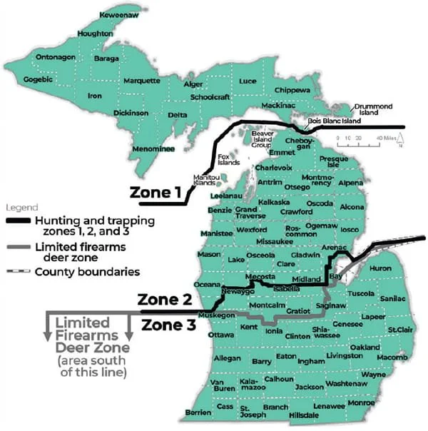
Michigan Has Three Deer Herds, Not One
That's where the whole debate goes off the rails, because Michigan keeps trying to apply statewide rules to a state that clearly has three different deer herds.
The southern Lower (Zone 3) is overabundant. The northern Lower (Zone 2) is mixed country with moderate densities and a strong local appetite for better buck age structure in some areas. The UP (Zone 1) is a northern-edge herd facing harsh winters, predation, aging habitat, and declining hunter participation. These are three different management problems, and they deserve three different management answers. Treating them like one herd is how we've ended up with regulations that satisfy nobody and deer management that drifts further from biological reality every year.
What Michigan Should Actually Do
Southern Lower Peninsula: One-Buck Rule, Tied to the Real Problem
In the southern Lower, adopt a one-buck rule. Tie it to the real problem: too many deer, chronic EHD outbreaks, and a herd that's outgrown its country. Pair it with generous antlerless tag allocations and a firearm opener moved to the last Saturday in November, which extends the effective hunting season into December, when deer concentrate on food sources. Let hunters focus their effort when it matters most. Possibly even work in Earn a Buck.
Northern Lower Peninsula: Combination Tag with Antler Restriction Criteria
In the northern Lower, keep the combination tag, one tag, valid for a legal buck meeting regional antler restriction criteria or an antlerless deer. Make the hunter choose at the moment of truth. This is the region where local support for buck age structure management is strongest, and a combo tag restructures the decision without forcing anyone into a rule they didn't ask for. Move the firearm opener to the third Saturday in November to align it with the end of peak rut.
Upper Peninsula: Combo Tag, No Antler Restrictions
In the UP, they would also run a combination tag, but without antler restrictions. UP deer have smaller antlers at given ages due to nutritional and winter constraints, and a point-count rule that works downstate would cut too deeply into available harvest up north. Move the firearm opener to the first Saturday in November. It catches the rut closer to peak, beats the worst of the weather, and respects deer camp culture that's built on a weekend anchor.
Fund It Through Region-Specific Licensing
And fund it properly through region-specific licensing. A hunter who hunts one region buys one regional license at a fair price. A hunter who wants two regions buys two. A hunter who wants all three pays for the privilege. License dollars follow the herd they support. Data follows the hunter to the region they actually use. Enforcement gets clearer because the license itself tells the DNR officer which rules apply.

The Real Conversation Michigan Isn't Having
This isn't a small change. It's a structural rethink of how Michigan manages its deer herd, and it asks more from hunters than the current system does. But it also gives back something the current system can't, management that actually matches the deer you're hunting. The UP hunter gets rules built for the UP. The southern Lower Hunter gets rules built to address the overabundance problem he sees every time he drives to work. The northern Lower Hunter gets the buck age structure its community has been asking for without forcing it on a state that doesn't uniformly want it.
The one-buck rule debate isn't wrong. It's just too small. Michigan has three herds, three hunting cultures, and three sets of problems, and we've been debating statewide regulations for twenty years while the real questions go unasked.
Time to ask them.
Michigan One-Buck Rule FAQ
Does Michigan have a one-buck rule?
No. Michigan currently allows licensed deer hunters to harvest two bucks per year under the combination license, with antler-point restrictions that vary by deer management unit. A statewide one-buck rule has been proposed multiple times but has not been adopted.
Would a one-buck rule grow bigger bucks in Michigan?
By itself, not much. Research from Wisconsin and the broader Midwest shows that single-regulation changes move harvest numbers in single-digit percentages. Buck age structure improves more from antler restrictions and habitat than from tag count alone.
Why does Michigan need different deer rules by region?
Michigan has three biologically distinct deer herds. The southern Lower Peninsula is overabundant and is dealing with chronic EHD outbreaks. The northern Lower has moderate densities and a local appetite for better buck age structure. The Upper Peninsula faces hard winters, predation, and aging habitat. One statewide rulebook can't serve all three.
When is the Michigan firearm deer opener?
Michigan's firearm deer season currently opens statewide on November 15th. Several proposals, including the regional approach outlined above, would shift the opener to better align with rut timing and weather patterns on each peninsula.
Get the Free Michigan Public Land Hunting Guide
Want practitioner-level breakdowns of Michigan's state game areas, national forests, and best public hunting by region? Subscribe below for free state-by-state public land hunting guides, including the full Michigan rundown.

Spring Turkey Hunting Tactics That Actually Work
The gobbler you chase opening morning isn't the same bird three weeks later. Here's how to hunt spring turkeys week by week on pressured land.
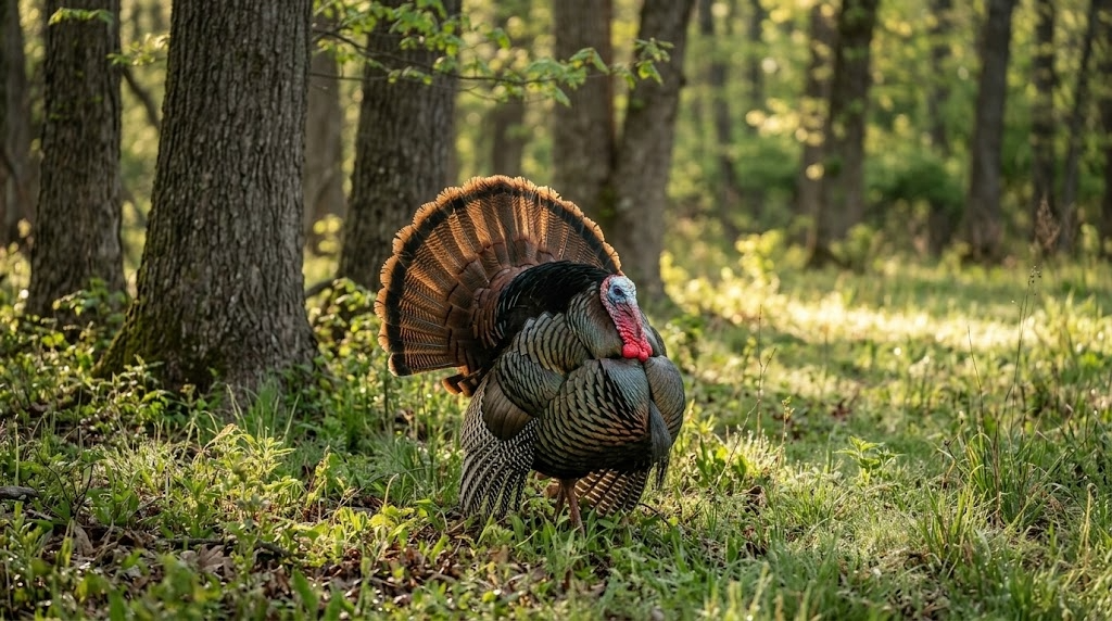
The tom that hammers from the limb on opening morning isn't the same bird you're chasing three weeks later. If you hunt him the same way in May that you did in April, you're going to eat tag soup. Spring turkey hunting tactics have to shift with the season, with the hens, and with the pressure stacking up on every piece of public dirt within driving distance.
Here's how I break down a spring season on public land, week by week, mood by mood.
Opening Week: Be the Loudmouth
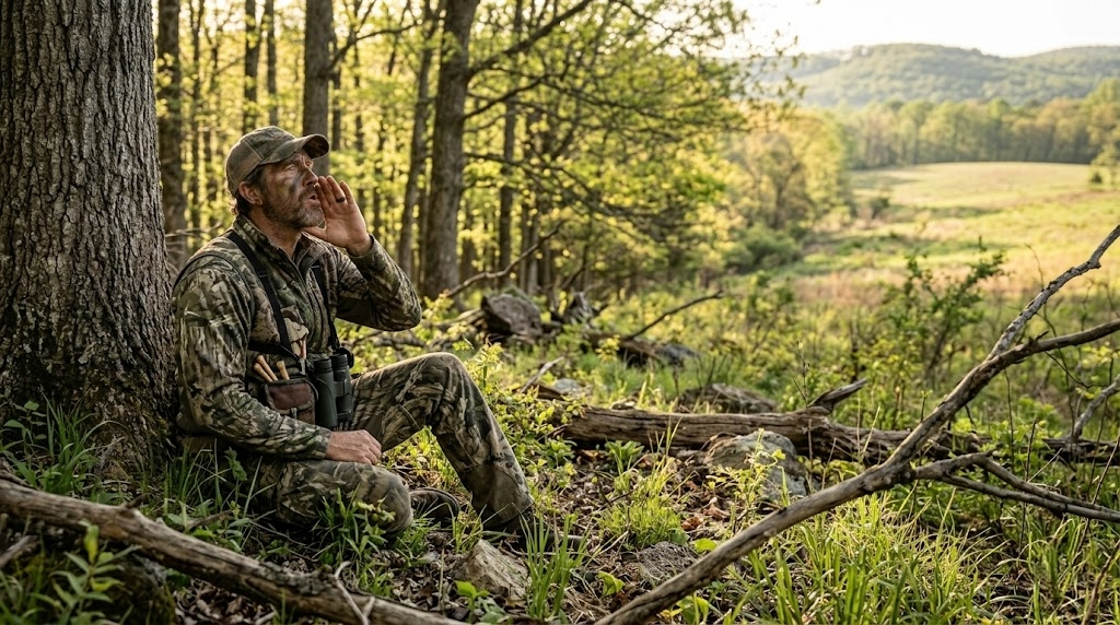
Opening week birds haven't been called to yet. They've been gobbling at owls, crows, and each other for two weeks, and they're fired up. This is the one stretch of the season where you can get away with being loud, aggressive, and a little sloppy.
Roost a bird the night before if you can. Slip in 45 minutes before legal light, set up 100 to 150 yards from the tree, and let him gobble first. When he hits the ground, hit him with a sharp cutting sequence on a mouth call, three to five sharp cuts followed by a string of excited yelps. If he cuts you off mid-call, shut up. He's coming.
Opening week setup that works on pressured ground: - Single hen decoy, no jake, no strutter - Back against a tree wider than your shoulders - Shooting lanes cleared to 40 yards in a half circle - Sun at your back if you can manage it.
Don't overthink the decoy spread. A lot of these birds have already seen a strutter and bailed. One soft hen looks honest.
Mid-Season: The Henned-Up Slump
Two weeks in, every gobbler worth shooting has hens on him at daylight. He'll gobble on the limb, fly down, and go silent for four hours while his harem feeds him through the woods. This is when most hunters quit. Don't.
You've got two ways to beat a henned-up gobbler. You can fight the boss hen, or you can wait her out.
Fighting the boss hen means getting close, really close, 75 yards if the cover lets you, and mimicking her exactly. She yelps, you yelp louder. She cuts, you cut over the top of her. You're not trying to call the tom. You're trying to make her so mad she marches over to whip you, and she drags him along behind her. It works maybe one time in four, but when it works it's the most exciting hunt of the spring.
Waiting her out is the patient play. Hens leave gobblers around 10 a.m. to go lay eggs. That lonesome tom is suddenly very interested in any soft yelp he hears. Set up on a known strut zone, a logging road bend, a field edge, an oak flat with a southern exposure, and call sparingly. Three soft yelps every 15 minutes. Let him come looking.
Late Season: Quiet, Slow, and Deadly
By the third and fourth weeks of the season, most toms have been called to, shot at, and spooked off every ridge they own. They're quiet. They might gobble once on the limb and not again all day. People assume the birds are gone. They're not. They're just done talking.
Late season is when you hunt like a bowhunter hunts whitetails. Set up on sign, not sound. Look for fresh strut marks in dusty two tracks, J shaped droppings under roost trees, dusting bowls, and feathers along field edges. Pick a spot where a bird wants to be and sit on it.
Calling late season is a whisper game. Soft tree yelps before fly down, a few clucks and purrs an hour later, and a lot of nothing in between. If you hear a gobble, don't run at it. Move once, set up tight, and make him think a hen is feeding away from him.
Running and Gunning the Right Way
Run and gun gets romanticized, and on public land it gets a lot of guys busted. You can cover ground without bumping every bird in the county if you do it right.
Walk the ridges, not the bottoms. Sound carries up. Stop every 200 yards and hit a loud locator call, a crow call early, an owl hooter at midday, a coyote howler if nothing else is working. Do not yelp to locate. You'll pull in silent toms you never knew were there and educate them when you stand up to leave.
When a bird answers, mark him on your onX Hunt app, drop a waypoint, and close the distance using terrain. Get a ridge or a creek bottom between you and him so you can move fast without being seen. Set up 100 to 150 yards out, never closer on the first sit unless the cover is thick. A mapping app like onX Hunt earns its keep on these moves because the topo lines tell you where you can sneak and where you'll skyline yourself.
Gear that matters for running and gunning: - Lightweight vest with a built-in seat, the TIDEWE Vest, or a Lucky Duck Predator Seat - Quality 10x42 binoculars for glassing fields and openings; the Vortex Diamondback HD does the job for the money. Check current price at Amazon. The downside is they're heavier than premium glass, so if you're walking eight miles a day, you'll feel it. - Two-month calls and a pot call, that's it. Leave the box call in the truck unless it's windy. - Quiet boots that drain. The LaCrosse Alphaburly Pro handles wet spring mornings and creek crossings. Check the current price. They run hot once the day warms up, so plan your walks for early.
Budget option for the guy just getting started: a Primos Hook Hunter mouth call and a slate pot call from any farm store will kill turkeys all day long.

Afternoon Hunting Tactics Most Guys Skip
Where it's legal, and check your state regulations because some states still have half-day seasons, afternoon turkey hunting is the most underused tactic in the spring woods. By 1 p.m., the morning crowd has gone home, the hens have left to nest, and gobblers are looking for one more date before flying up.
Find a known roost area and set up within 200 yards of it by 2 p.m. Call softly every 20 minutes. Yelps, clucks, soft purrs. Don't move. Birds drift back toward the roost slowly through the afternoon, and a lonesome gobbler will commit to a single hen call when he won't come to anything in the morning.
Afternoon birds also hit green fields and food plots hard between 4 and 6 p.m. for bugs and grit. If you've got access to a clover plot or a logging road with green up, that's your spot.
Calling Sequences for Three Common Scenarios
Bird gobbles hard on the limb, no hens visible. Soft tree yelps before flying down, three notes, barely audible. After flying down, a fly down cackle and some loud, excited yelps. Then shut up for 10 minutes. If he hangs up, scratch the leaves with your hand to mimic a feeding hen.
Bird is henned up and drifting away. Get aggressive. Cutting and excited yelping aimed at the boss hen. Match her cadence and step on her calls. If she responds, you're in business.
Bird gobbles once at midday and goes silent. Set up immediately, 100 yards toward where you think he is. Three soft yelps. Wait 20 minutes. Three more. Don't move for at least an hour. Silent toms kill more hunters' patience than they kill themselves.
Frequently Asked Questions
What's the best time of day to kill a public land gobbler?
First light gets the headlines, but the 10 a.m. to noon window is when mature public-land toms die. Hens have left them, hunter pressure has cleared out, and a soft calling setup on a strut zone is hard to beat.
Should you use a decoy on pressured public land?
A single hen decoy works most of the season. Skip the strutter and the jake on heavily pressured ground after week one. Mature toms have seen the trick and will hang up at 60 yards or fade out completely.
How far should you set up from a roosted gobbler?
100 to 150 yards is the sweet spot. Closer, and you risk getting busted at flydown. Farther and a hen can pull him the wrong way before he ever hears you.
Is it worth hunting turkeys in the rain?
Yes, especially light steady rain. Birds spend more time in fields and open areas where they can see, and they tend to be quieter but very killable over decoys.
How do you find turkeys on new public land?
Start with onX Hunt and look for a mix of mature hardwoods, open fields or food plots, and a water source within half a mile. Then go listen at dawn from a high point. Two mornings of scouting tell you more than two weeks of map study.
Want the full state-by-state breakdown of where to chase spring gobblers on public ground? Subscribe to our free state-by-state public land hunting guides, and we'll send the spring turkey edition straight to your inbox.
Subscribe for free state-by-state public land hunting guides and get the spring turkey edition delivered to your inbox before opening day.

Public Land Turkey Hunting: How to Kill Pressured Toms
How to Kill Pressured Toms on Public Land
A pressured gobbler doesn't act like the birds you see on TV. He doesn't sprint into your decoy spread at 40 yards. He doesn't hammer back at every yelp you throw at him. He gobbles once on the roost, pitches down the opposite direction, and disappears into a drainage you didn't know existed. If you've hunted public-land turkey for more than one season, you've met this bird, and he's probably still alive.
Killing educated toms on public land requires a fundamentally different approach than what works on private ground or early in the season before pressure sets in. The tactics below aren't theoretical. They come from years of chasing the same birds that every other truck at the parking lot is chasing, and consistently tagging out when the woods go quiet.
Why Standard Turkey Tactics Fail on Pressured Public Land
Most turkey hunting advice assumes a cooperative bird. Set up, call, wait. That sequence works on a gobbler that hasn't been bumped off his roost three mornings in a row or had six different hunters throw slate calls at him from the same field edge.
Public land toms, especially after the first week of season, learn a specific pattern: the sound of a call followed by a motionless setup equals danger. They've been educated by every hunter who parked at the main access, walked 200 yards in, set up on the first ridge, and started hammering a box call at flydown. These birds aren't stupid. They're conditioned.
Your job is to break the pattern they've learned to avoid.
Step-by-Step: A Pressured Tom System That Works
Scout Before Season With Purpose
Don't just listen for gobbles during your pre-season scouting. Map the terrain. You need to know where birds roost, where they go after flydown, and critically, where other hunters set up. Mark trailhead parking areas on your onX Hunt app. Note boot tracks, ground blind locations, and field edges that get the most attention. The spots every hunter gravitates toward are exactly the spots you're going to avoid.
Walk ridgelines and creek bottoms during mid-morning in March and early April. Locate dusting sites, strut zones (look for drag marks in the dirt), and travel corridors between roosting timber and open feeding areas. Log all of it on your mapping app with waypoints. You're building an intelligence file on the landscape, not just listening for noise.
Change Your Access
The single biggest edge you can give yourself on public land is entering from a direction no one else uses. Most hunters walk in from established trailheads and work inward. Pressured gobblers learn to avoid those approach corridors within days.
Study aerial imagery and topo lines on onX Hunt to find alternate entries. Maybe it's a power line right-of-way on the back side. Maybe it's a creek crossing 400 yards downstream from the bridge everyone else uses. Maybe it's a logging road that dead-ends a half mile from the main parking lot, but connects to the same ridge system from the opposite side. The harder the walk-in, the fewer hunters, and the less educated the birds.
Get in early. Forty-five minutes before first light, minimum. If you're walking in at shooting light, you're already behind. Pressured birds gobble less on the roost, and when they do, it's brief. You need to be in position before they make a sound.
Call Less, Listen More
This is where most hunters on public land fail completely. They overcall. A pressured gobbler has heard aggressive yelping, cutting, and purring from every setup in the area. He associates that volume and frequency with danger.
Your first sequence of the morning should be soft. Two or three tree yelps before flydown, nothing more. If a bird gobbles, resist the urge to hammer back. Give him one soft yelp and then shut up. Let silence do the work. A tom that won't commit to aggressive calling will often walk quietly toward a hen he thinks is just out of sight, precisely because she's not making a scene.
If you don't hear a gobble at all, sit tight for at least 30 minutes after flydown and scratch leaves with your hand or the back of your call. Subtle, intermittent feeding sounds, a few soft clucks, a gentle purr, mimic a real hen better than any aggressive sequence.
Set Up Off the Obvious Spots
Where most hunters set up: field edges, food plot borders, road intersections, and open hardwood flats with good visibility.
Where pressured gobblers go: inside the timber, along benches halfway up a ridge, through saddles between two ridge points, and down into creek bottoms where they can travel without skylining themselves.
Set up 80 to 150 yards off the main travel routes other hunters use. Get into the terrain features, the inside corners, the small benches on steep hillsides, and the pinch points between two drainages. Use your topo map to identify terrain funnels: places where the ridge narrows, where two hollows converge, or where a strip of mature timber connects two larger blocks. These are the travel lanes that pressured birds default to because they offer cover and escape routes.
Be Willing to Reposition
Static setups kill more unpressured birds than they kill educated ones. If you've been sitting for 90 minutes without hearing a sound, move. Not to another road or parking lot, deeper into the cover.
When you reposition, go slow. Take 50 to 75 steps, stop, scan, and listen for five minutes. If you hear drumming or spot movement, drop immediately and set up right there. Pressured gobblers often close distance silently, no gobbling, no drumming, you can hear beyond 75 yards. A slow creep through likely habitat lets you intercept birds that aren't announcing themselves.
The Afternoon Shift
Most public land turkey pressure is concentrated between 5:30 AM and 10:00 AM. By noon, the parking lots are empty. That's when pressured gobblers start to loosen up.
Afternoon hunting, where legal, is one of the most underutilized tactics on public land. Toms that were lockjaw all morning will start gobbling again between 2:00 PM and roosting time. Set up near known roost areas, strut zones, or field edges with fresh sign. Call softly every 20 to 30 minutes. Afternoon gobblers are often henned-up toms who've bred and are now looking for company again, and they're more responsive because they haven't been pressured for six hours straight.
Check your state regulations. Some states allow all-day hunting, while others restrict hours to morning only or close turkey hunting at noon or 1:00 PM.
A Real Scenario: Creek Bottom Tom in Southeast Ohio
Late April, second week of Ohio's spring season. The main parking lot at a Wayne National Forest tract had four trucks in it by 5:00 AM. I'd scouted the area two weeks earlier and marked a roost site 600 yards east of a creek, accessible from a township road a half mile south, a route no one was using because it required crossing a knee-deep creek in the dark.
I crossed the creek at 4:45 AM, worked up the east-facing slope, and set up on a small bench 80 yards below the ridgetop. At 5:50 AM, one gobble. Just one. Then silence. Three other hunters on the west side of the ridge started calling aggressively. I could hear at least two box calls and a slate working hard.
I did nothing. Sat against an oak with my Vortex Diamondback HD 10x42 binoculars in my lap, shotgun on my knee, and waited. At 6:20 AM, I caught movement below me, a tom walking the creek bottom, heading south, away from the calling. He was doing exactly what pressured birds do: going the opposite direction from the noise.
I gave one soft cluck. He stopped. I clucked once more and scratched the leaves. He turned and walked uphill toward me, completely silent. No gobble, no drum. At 30 yards, he hit a small opening. I could see his beard dragging the ground, and I took the shot. That bird had been bumped by the same hunters from the same side three mornings running. He'd learned the pattern. I just gave him a different one.
When to Use These Tactics
These approaches work best in specific conditions:
Season timing. After the first week of any public land turkey season. Early-season birds are often still responsive to standard tactics; save the pressure strategies for when the woods have been hammered.
Weather. Overcast, drizzly mornings are ideal for pressured birds. Rain keeps casual hunters home, which means less pressure. Gobblers are also more likely to move through open areas during low-light conditions.
Terrain. Hilly, timbered country with drainages and mixed cover gives you the most options for alternate access and unconventional setups. Flat, open public areas with limited cover are harder. Pressured birds on flat ground tend to hang up at extreme range because they can see so far.
Species. Eastern wild turkeys are the most susceptible to pressure conditioning because they inhabit the most heavily hunted regions. Merriam's and Rio Grande birds in western states face less concentrated pressure, though the same principles apply in walk-in areas near population centers.
Gear That Matters for Pressured Birds
You don't need a truck full of equipment. But a few specific items make a measurable difference.
Mapping app. onX Hunt is non-negotiable. The property boundary layers keep you legal on public parcels with confusing borders, and the satellite imagery lets you scout access routes from your couch. [Try onX Hunt free for 7 days]
Binoculars. A compact pair like the Vortex Diamondback HD 8x32 lets you glass timber edges and creek bottoms without moving. On pressured birds, spotting a tom at 200 yards before he sees you is the difference between a filled tag and a busted setup.
Calls. Keep it simple. A quality pot call with a wood peg for soft, raspy yelps. The Woodhaven Ninja is a go-to for quiet, realistic tones. A mouth call for hands-free work when a bird is closing. Skip the loud box call on pressured birds entirely.
Decoys. On pressured public land, decoys can hurt you more than help. Every other hunter is using them, and educated toms learn to hang up at the sight of a motionless fake hen at 60 yards. If you do use one, go with a single feeding hen, no jakes, no full-strut toms. Better yet, leave the decoys in the truck and rely on calling and position.
Seat or pad. You're going to sit longer than you think. A quality vest with an attached lightweight chair like the ALPS OutdoorZ NWTF Grand Slam keeps you comfortable and still during the long waits pressured hunts demand. Fidgeting and shifting kill more turkey hunts than bad calling.
What Most Hunters Get Wrong
Overcalling
This is the number one mistake. Pressured gobblers don't respond to volume; they respond to silence and subtlety. If a bird gobbles once and shuts up, your instinct says call louder and more aggressively. That instinct is wrong. He heard you the first time. He's either coming quietly or he's not coming at all. Adding more calling only confirms his suspicion that something isn't right.
Hunting the Same Spots Everyone Else Hunts
Walking 200 yards from the parking lot and setting up on the first good-looking ridge isn't a strategy; it's convenience. Every other hunter does the same thing. Pressured birds learn to avoid those setups within days. Put in the extra distance. Cross the creek. Climb the steep side. If you're comfortable, you're probably not far enough from the truck.
Not Staying Long Enough
Most hunters move on after 30 to 45 minutes of silence. Pressured gobblers can take two hours to commit. They circle downwind, approach from unexpected directions, and close the last 100 yards in absolute silence. If you picked a good spot based on solid scouting, trust it. Sit there until at least 1000 AM before repositioning.
Advanced Tactics for Experienced Hunters
Run-and-Gun in the Timber Interior
Once you've identified where pressured birds travel mid-morning, typically through interior timber, along benches, and through saddles, use an aggressive mobile approach. Move through these corridors slowly, calling every 100 to 150 yards with a single series of soft yelps, then sitting for 10 to 15 minutes. You're not trying to pull a bird to you from a distance. You're trying to bump into one that's already moving through the same cover.
The Two-Day Setup
Hunt a specific bird's pattern over consecutive days without trying to kill him on day one. Day one is pure observation. Note what time he flies down, which direction he goes, where he ends up by 9:00 AM, and what terrain features he uses. Day two, set up directly on his travel route before he gets there. This is patience-intensive, but it's deadly on that one bird nobody else can figure out.
Roost Ambush at Last Light
The evening before your morning hunt, slip into the area and listen for birds flying up to roost. Don't call. Just note the tree, the direction the bird faces on the limb, and the terrain below. The next morning, set up 100 yards downhill of the roost tree in the direction you expect him to pitch, which is almost always downhill and into an opening. Be in position an hour before first light and do not make a sound until he's on the ground.
Frequently Asked Questions
How Do You Know if a Tom Is Pressured?
A pressured tom gobbles infrequently, often once or twice on the roost, then goes silent. He tends to move away from calling rather than toward it. He may hang up at 80 to 100 yards and refuse to close the distance. If birds in your area were responsive early in the season and have gone quiet, pressure is almost certainly the cause.
Should You Use a Gobble Call on Public Land?
Generally, no. Gobble calls on public land create two problems: they can pull other hunters toward your position, which is a safety concern, and pressured toms often retreat from gobble calls because they associate aggressive tom sounds with competition they've learned to avoid. Stick with hen sounds, and keep them quiet.
What Time of Day Are Pressured Toms Most Active?
Mid-morning (9:00 to 11:00 AM) and late afternoon (2:00 to 6:00 PM, where legal) tend to be the windows when pressured birds let their guard down. Most hunter activity is concentrated around flydown, so the later you're willing to hunt, the less competition you'll face.
How Far Should You Walk In on Public Land to Avoid Other Hunters?
There's no magic number, but data on GPS-tracked hunter movements suggests that most public-land hunters stay within a quarter mile of road access. Getting a half mile or more from a trailhead puts you past the majority of the competition. On flat terrain, that number drops; even 400 yards off the road can make a difference if you use terrain or water crossings to access areas others skip.
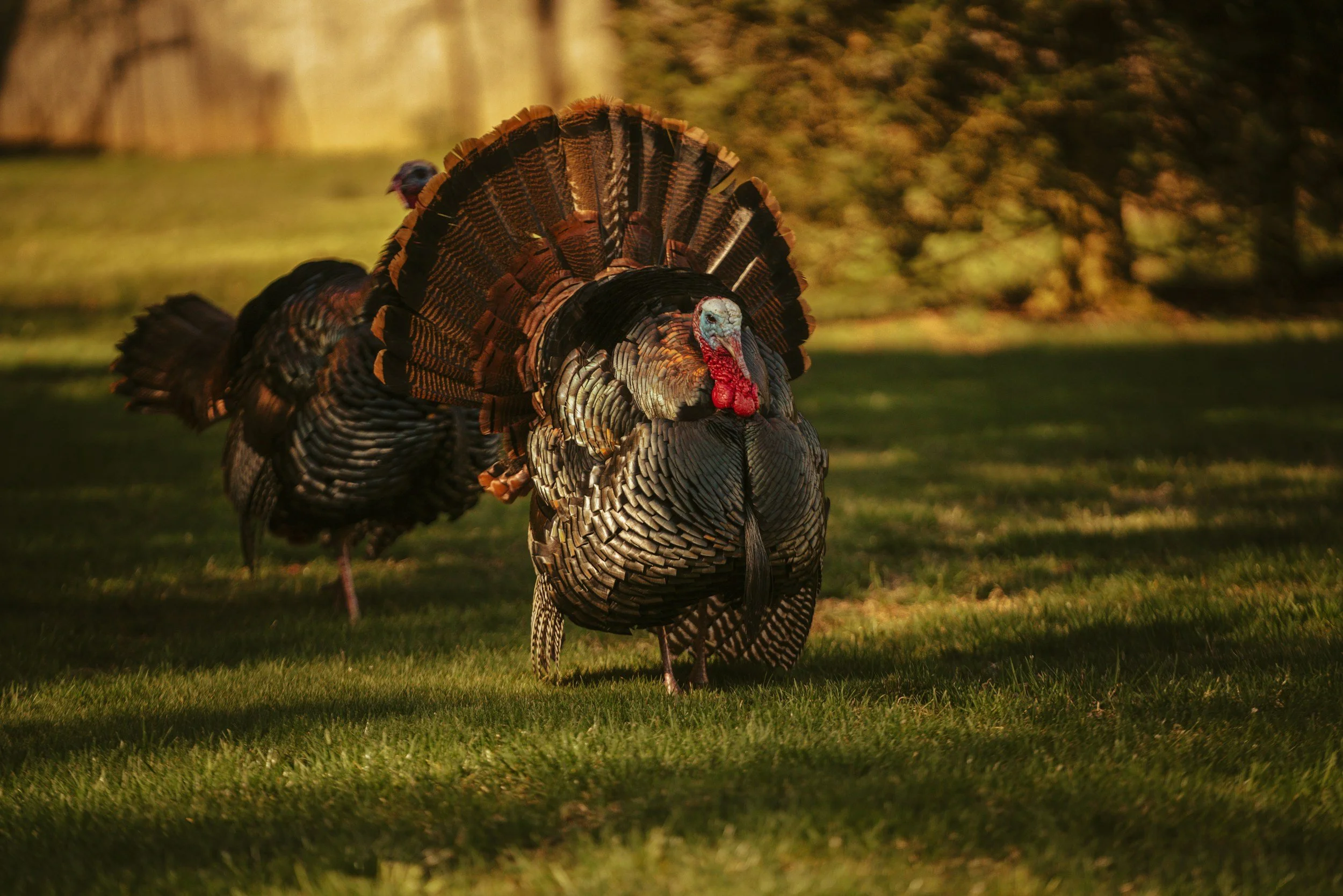

Solo Hunt, Solo Film: Mastering the Art of Self-Filmed Turkey Hunts on Public Land
How to Successfully Self-Film Your Public Land Turkey Hunt
Self-filming a turkey hunt on public land is an ambitious yet rewarding pursuit. Capturing your outdoor experiences on camera can enhance the hunt, help preserve memories, and offer learning opportunities through reviewing your footage. However, successfully filming your hunt while pursuing wary gobblers on public land presents unique challenges. Here's a practical guide to help you document your next spring turkey adventure effectively.
Why Self-Film Your Hunt?
Documenting your hunt provides lasting memories and valuable learning experiences. Reviewing a film can reveal subtle details like turkey behavior, calling effectiveness, and critical mistakes made during the hunt. Additionally, sharing your footage can inspire others, help preserve hunting traditions, and highlight opportunities on public lands. Groups like the National Wild Turkey Federation use hunter-produced footage to educate new spring hunters and preserve wild turkey habitat, and your film can contribute to that tradition.
Essential Filming Equipment
Quality filming requires the right gear. Here’s a rundown of essential equipment:
Camera Options:
Action Cameras (e.g., GoPro): Small, lightweight, and durable, perfect for POV shots or secondary angles.
Camcorders: Reliable and featuring excellent zoom capabilities, ideal for capturing clear footage at varying distances.
Mirrorless/DSLR Cameras: Excellent image quality, but require careful handling and more elaborate setups.
Tripods and Mounts:
Fluid Head Tripod: Offers smooth panning and tilting, crucial for capturing steady footage of moving turkeys.
Ground Stake Camera Mounts: Ideal for quick setups and versatile placement, especially when sitting against a tree or in brush blinds.
Tree or Limb Mounts: Useful for unique angles, overhead shots, or tight setups on public land.
Microphones:
External Shotgun Microphones: Critical for clear, directional audio, particularly when capturing gobbles and hen calls.
Lapel Microphone: Great for clear narration and capturing your live reactions quietly.
Extra Batteries and Storage:
Always bring multiple charged batteries and spare memory cards. Turkey hunts can extend longer than anticipated, and being prepared ensures you don't miss critical footage.
Best Camera Gear for Public Land Turkey Hunting
For capturing your turkey hunt, select gear that combines portability, durability, and quality. Consider using a compact camcorder or mirrorless camera with strong zoom capabilities for clear footage. A fluid head tripod is essential for achieving stable and smooth camera movements. Small action cameras, such as GoPros, are excellent for capturing secondary angles and point-of-view shots. Ensure you pack additional batteries, memory cards, and protective camo wraps to maintain stealth and preparedness in diverse conditions.
Planning and Pre-Scouting
Effective self-filming starts long before the hunt:
Scouting: Identify high-percentage areas on public land, roost sites, travel corridors, strut zones, and set camera positions ahead of time.
Visualize Camera Angles: Determine setup points where you can place your tripod or mounts discreetly without sacrificing hunting effectiveness.
Setting Up in the Field
Early Arrival: Arrive earlier than usual to set up filming gear quietly and without haste. Public land gobblers can be highly pressured, so a stealthy setup is critical.
Camera Positioning: Position your primary camera strategically to capture anticipated turkey movements and your calling sequences clearly. Place secondary action cameras for alternate angles, such as facing toward your blind or facing the anticipated turkey approach path.
Concealment: Ensure that your camera setups are concealed and minimally intrusive. Utilize natural cover, ghillie tape, or camouflage fabric to hide your gear from wary birds and other hunters.
Filming Techniques for Turkey Hunts
Capturing Authenticity: Film every aspect of your hunt, including hiking in, calling, setting decoys, and waiting periods. This provides an authentic storytelling element to your footage.
Steady Shots and Patience: Practice smooth camera movements to achieve steady shots. Use slow pans and deliberate zooms. Turkeys are notoriously observant; minimizing camera movement can mean the difference between success and failure.
Audio Capture: Clearly record calling sequences, gobbles, wingbeats, and natural ambient sounds. High-quality audio dramatically enhances the viewing experience.
Challenges and Solutions
Self-filming presents unique challenges. Here's how to manage them effectively:
Limited Mobility:
Solution: Use compact, lightweight setups that allow for rapid repositioning if turkeys move unexpectedly.Maintaining Stealth:
Solution: Use remote camera controls or smartphone apps to minimize movement during critical hunting moments.Managing Multiple Tasks:
Solution: Practice camera operation thoroughly beforehand to make filming second nature, allowing you to focus primarily on hunting.
Ethical Considerations on Public Land
Respect Other Hunters: Be mindful of other public land users. Avoid filming areas crowded by fellow hunters and respect their space and hunting experience. Organizations like Backcountry Hunters & Anglers exist specifically to preserve the DIY public land experience that self-filming helps document, and their code of ethics is worth reading before you post.
Minimal Impact: Follow the Leave No Trace 7 Principles. Public land ethics extend to filming equipment, so your setups should not negatively impact the environment or other users. Pack out every zip tie, every strip of ghillie tape, every battery.
Editing and Sharing Your Story
Authenticity: Edit your footage honestly and transparently, portraying both successful and unsuccessful moments to accurately reflect the hunting experience.
Storytelling: Construct a narrative—beginning with scouting and setup, progressing through anticipation and calling, and concluding with the climax of your encounter.
Educational Value: Share what you learned, including mistakes and successes, to help educate others and encourage responsible, ethical hunting practices.
Final Thoughts
Self-filming a public land turkey hunt demands extra preparation and patience, but offers immense satisfaction. With thoughtful gear selection, careful planning, stealthy setups, and responsible ethics, you’ll not only capture compelling footage but also create lasting memories and valuable educational content.
This spring, take on the rewarding challenge of self-filming your turkey hunt, it might become your new favorite way to enjoy the great outdoors.
How to Read Public Land Hunting Maps Like a Pro
It all begins with an idea.
If you're hunting public land, your map isn't just a tool; it's your secret weapon. Whether you're chasing bugling elk in the backcountry or patterning whitetails in Midwest woodlots, knowing how to read topographic and land ownership maps can make or break your hunt.
Here’s how to unlock what the map is really telling you and use it to gain an edge on pressured game.
1. Know Your Public Land Layers
Start with a reliable mapping app like OnX Hunt, HuntStand, or Gaia GPS. Enable these essential layers:
Land Ownership- Know where public land starts and ends. Federal agencies like the Bureau of Land Management, U.S. Forest Service, and state DNRs each maintain their own boundaries. Your map should show them all.
Access Points – Trails, gates, roads, parking lots
Game Units – Helps match your tag to the right hunt area
Private-In-Public (Inholdings) – Avoid trespassing and use edges to your advantage
Tip: Cross-check with state agency maps for walk-in access programs and specific regulations.
2. Read Topo Lines Like a Wildlife Biologist
Contour lines = elevation. The tighter they are, the steeper the terrain. The USGS National Map is the foundation every hunting app builds on. Understanding the basic map symbology transfers to every mapping tool you'll use in the field.
Benches & Saddles: Prime travel corridors for deer and elk
Drainages & Creek Bottoms: Water, bedding, and thermal cover
Ridges: Great for glassing and mid-day travel
North vs. South Facing Slopes: South slopes = sun = warmth. North slopes = cool = bedding.
Pro Move: Mark a spot where two habitat edges meet — like a bench near a water source — and watch the patterns unfold.
3. Use Aerial & Satellite Layers to Your Advantage
Sometimes topo isn’t enough — that’s where satellite views shine:
Look for browse edges: Transitions between fields, cuts, and forests
Identify feeding vs. bedding zones
Find hidden meadows, water holes, or burns
Combine this with trail cam data or e-scouting pins to form a real hunt plan.
4. Understand Access & Pressure
Public hunting success often depends on how far you’re willing to go. Use maps to:
Pin trailheads and lesser-known entry routes
Find landlocked parcels with legal walk-in access
Analyze where most hunters go — and go somewhere else
Rule of thumb: Most hunters stay within ½ mile of the road. Go a mile in, and you’re hunting different animals.
5. Build a Layered Strategy
Combine these map layers to hunt smarter:
Use public land overlays to find legal spots
Study terrain for travel routes
Analyze food, bedding, and cover transitions
Confirm access routes and backup plans
Then, save offline maps and mark up your spots like a general preparing for war.
Final Thoughts
Your map is your game plan, your scout, and your lifeline — all in one. Learn to read it like a biologist and move through it like a predator.
Need maps, agency links, or public access info by state?
Start with our State-by-State Directory and plan your next DIY hunt today.

Beginner’s Guide to Hunting Public Land
It all begins with an idea.
Thinking about hunting public land for the first time? You're not alone. Every year, more DIY hunters are heading into the woods, marshes, and mountains to chase game without needing private land access or expensive leases.
This guide breaks down everything you need to know to get started — with tips that work whether you're chasing whitetails in the Midwest or ducks in the Delta.
What Is Public Hunting Land?
Public hunting land is any property that’s legally open to hunting and owned or managed by government agencies. These can include:
WMAs (Wildlife Management Areas)
National Forests
BLM Land (Bureau of Land Management)
State Forests
Walk-in Areas (private lands enrolled in public access programs)
You don’t need a lease or permission. You need a valid license and to follow the rules.
Why Hunt Public Land?
Low cost: No need to pay to hunt
High challenge: Deer and elk here don’t come easy
Big opportunity: Millions of acres are legally huntable
If you’re willing to scout, hike, and hunt smart, public land can be more rewarding than any guided trip.
Tools for Scouting Public Land
Digital scouting is the new edge. Use these tools to find land, read terrain, and mark your access points:
OnX Hunt or HuntStand – Mobile maps with land ownership and layers
LandsToHunt.com – Directory of all 50 states with links to maps, regulations, and agencies
Google Earth – 3D satellite views to plan entry routes, glassing spots, and escape paths
Species to Start With
Some game animals are better suited for first-time public land hunters:
Whitetail Deer – Midwest & Southeast WMAs and state forests
Turkey – Nearly every state offers spring season on public land
Small Game (squirrel, rabbit) – Great for learning without pressure
Doves – Early season action on open fields
Licenses, Tags & Regulations
Every state is different, but these tips apply everywhere:
Buy the proper license (resident or nonresident)
Check season dates and game limits
Some areas require a WMA or public land access permit
Read the hunting digest for special rules (firearms, blaze orange, etc.)
You can find all this info linked from your state’s page in our Public Hunting Directory.
Final Tips for First-Time Public Land Hunters
Go early and scout before the season
Always have a Plan B spot (or C… or D)
Stay mobile: patterns change fast on pressured land
Follow wind, thermals, and access routes like a chess player
Pack light, hunt smart, and respect other hunters
🔗 Ready to hunt? Browse game-specific guides on what-do-want-to-hunt